Dreki–Dyngjufjöll–Víti Trail in Vatnajökull National Park

Vatnajökull National Park

Dreki–Dyngjufjöll–Víti Trail

A rugged mountain crossing to Víti and open views into Askja.

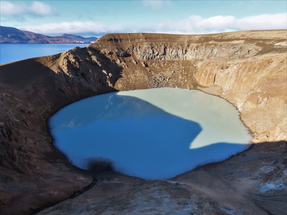
Photo: Rémih, CC BY-SA 4.0, via Wikimedia Commons

Length
8km
Time
4.5hr
Elev. change
509m
Difficulty
Challenging
  • Dogs allowed
  • High point 1,290 m
  • #21 of 92 in Vatnajökull

Hear the audio tour

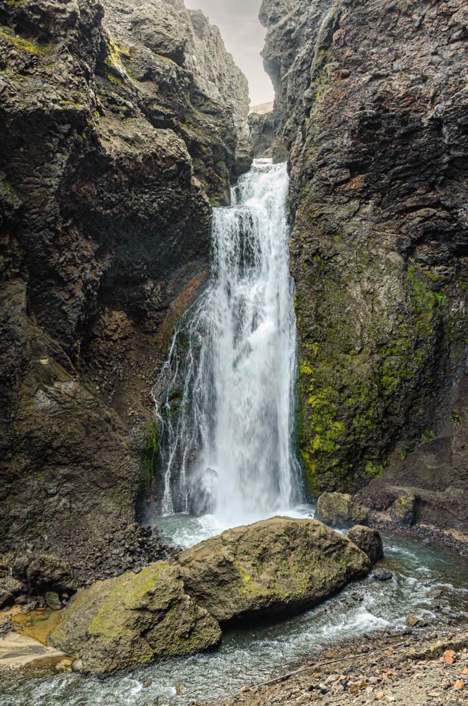
Dreki and Drekagil Gorge

Overview

About Dreki–Dyngjufjöll–Víti Trail

Why go

  • Direct mountain route to Víti with a wide view into Askja.
  • The volcanic terrain and crater make the full crossing feel distinct from the easier caldera approach.

Heads up

  • The 8 km is one way; returning to Dreki doubles the distance.
  • Rough lava, a 500 m climb and highland weather demand strong navigation and footing.

Map & elevation

The route

Loading the Vatnajökull map
Full map
Elevation781–1,290 m
TrailheadDreki65.04194, -16.59496
Keep this map with you offline in the Parkwolf app

Plan your hike

Before you go

Parking

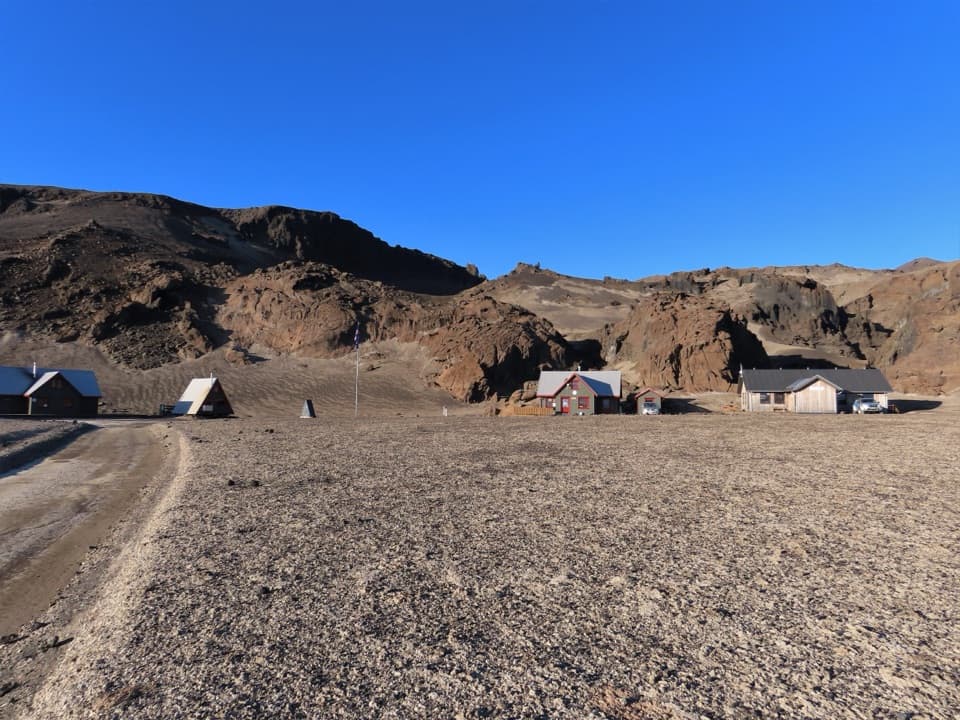
Start at Dreki by the Drekagil campground and cabins, the named A2 starting area. The campsite has toilets and showers; no parking-capacity detail was found. The parking area at Vikraborgir serves the separate A1 approach and is useful only if your planned finish and pickup use that side.

Safety

Snowstorms and very low visibility can occur in Dyngjufjöll even in high summer. Carry a map, compass, GPS, sturdy-soled boots and enough water; water is scarce along the wider Askja Trail outside cabins. At Víti the descent is slippery when wet, mud can be hot, especially on the east bank, and rockfall is possible from the rim. Highland roads to Dreki can be rough and unbridged; check current road and weather status.

A park ranger sits on a dash-mounted phone, talking, as Parkwolf’s Tour Guide plays “Army Cutworm Moths: A Grizzly Bear Buffet” on Grand Loop Road below Dunraven Pass in Yellowstone
Parkwolf Tour GuideThe highest, rockiest slopes around here are a summer buffet for grizzly bears.

Vatnajökull Tour Guide

Your drive to Dreki–Dyngjufjöll–Víti Trail, narrated.

Parkwolf is a GPS audio tour guide for Vatnajökull National Park. As you drive, it chimes in with what’s ahead: hidden gems, upcoming stops, history, geology, and wildlife, right through your car’s speakers.

Recorded for this trailhead

Dreki and Drekagil Gorge
0:00 / 0:32
“You're coming up on Dreki, the hut and camping base beside Drekagil gorge. The older hut dates to nineteen sixty-eight, and campers have indoor space to eat their own food and dry clothes.”

Plays as you drive up to this trailhead in the Parkwolf Vatnajökull Tour Guide.

More stories near here in the app

  • When Summer and Winter Freeze Together
  • Zipping a Feather Together
  • First Migration to Africa
  • A Nest Inside the Rocks
  • 298 audio storiesacross Vatnajökull’s roads, triggered by GPS as you drive
  • Wildlife heatmapsfor Grey Seal, Harbor Seal, Caribou, and 13 more
  • Works offlinemaps, 92 trails, 75 places, and audio download before you lose signal
  • CarPlay readysimple controls built for the drive
★★★★★
“Fantastic app with many points of information… It’s great to just turn on while you’re driving and it gives you an audio tour of the national Park. We love it!!!!”
JMJamesApp Store review
Download Parkwolf on the App StoreGet Parkwolf on Google Play

4.7 from 8,600+ ratings

Trail guide

Hiking Dreki–Dyngjufjöll–Víti Trail

The A2 to VítiDreki–Dyngjufjöll–Víti is an 8 km, one-way point-to-point route from Dreki over the mountains…

Dreki–Dyngjufjöll–Víti is an 8 km, one-way point-to-point route from Dreki over the mountains to Víti in Askja. The park calls it challenging and lists about 500 m of ascent. The mapped line from Dreki to Víti is about 8.1 km, so the park’s 8 km figure describes the crossing, not a return to Dreki. Allow four to five hours one way for the rough highland route. If you want to see the caldera by a shorter approach, the separate A1 starts at Vikraborgir; it is not the same hike.

Over DyngjufjöllFrom the Dreki area, the direct route goes west over the mountains north of Drekagil, climbs to…

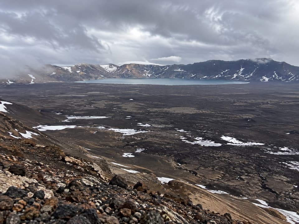
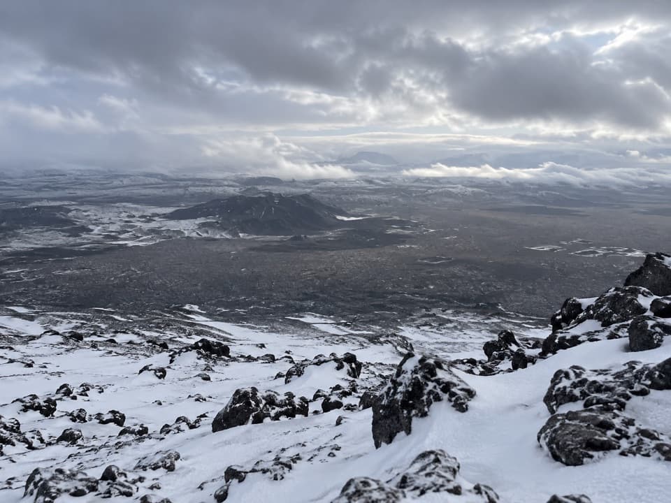
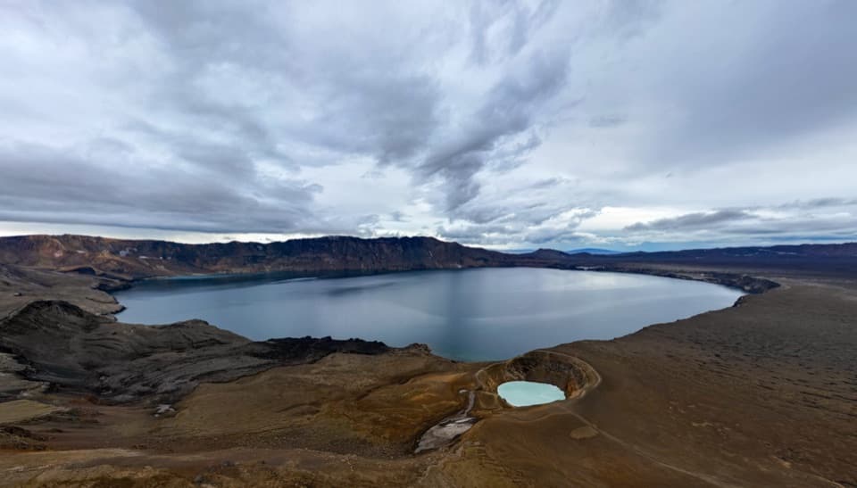
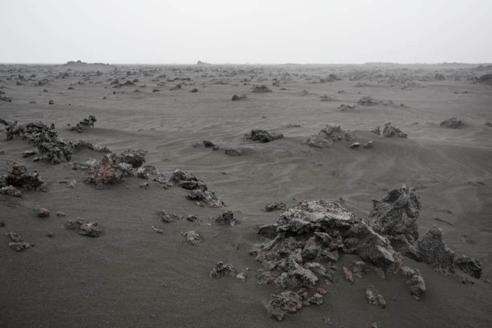
From the Dreki area, the direct route goes west over the mountains north of Drekagil, climbs to the eastern edge of Askja, then descends into the caldera east of Öskjuvatn toward Víti. Expect rough lava and tephra rather than a smooth, developed path. The climb and the empty volcanic terrain are the commitment; in clear weather, the reward is a broad view south and into Askja, with Öskjuvatn below the rim.

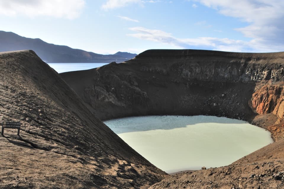
A crater born in 1875Víti is a water-filled maar formed near the end of Askja’s 1875 eruption.

Víti is a water-filled maar formed near the end of Askja’s 1875 eruption. The wider caldera formed when a major eruption emptied the magma chamber and its roof collapsed; the rough lava and ash around the route are part of that volcanic story. Ash and pumice from 1875 travelled far, damaged vegetation and helped drive people from settlements in East Iceland. Víti’s water temperature varies with spring meltwater and is usually above 20°C. The path down is slippery when wet, the mud at the bottom is hot—especially on the eastern bank—and rocks can fall from the crater edge.

Make the one-way logistics workA2 does not loop back to Dreki.

A2 does not loop back to Dreki. Arrange a pickup near Vikraborgir after using the established path from Víti, or retrace the A2; walking back makes the day about 16 km. A longer Öskjuvegur itinerary continues beyond Víti toward Dyngjufell, so do not use its 20 km stage figure for this A2 crossing. The Dreki campground and cabins sit by the named start, with toilets and showers. There are no shops, restaurants or fuel in Askja, so bring food and water. Dogs are allowed on the park’s normal rule and must be kept on a leash.

Weather and footingThis is exposed highland terrain, not a lowland walk.

This is exposed highland terrain, not a lowland walk. Snowstorms and very poor visibility can occur in Dyngjufjöll even in high summer; carry a map, compass and GPS, and use sturdy boots for the rough lava. In cloud, take the lower road approach to Vikraborgir and the clear path to Víti rather than crossing the mountains. The drive to Dreki is also on highland roads that may be rough, unbridged or impassable; check current road and weather information before setting out.

Wildlife

Wildlife in Vatnajökull

All Vatnajökull wildlife maps

Sighting maps show where each species has been reported across Vatnajökull. Wildlife moves, so no sighting is guaranteed.

Parkwolf’s Vatnajökull ranking

Top-rated trails in Vatnajökull

All 92 trails
  1. 1Svartifoss–Sjónarsker–Sel Loop (S2)Moderate · 5.8 km
  2. 2Dettifoss and Selfoss – West BankEasy · 2.5 km
  3. 3Svartifoss TrailModerate · 3 km
  4. 4Skaftafellsjökull Glacier TrailEasy · 4.1 km
  5. 5Múlagljúfur Canyon TrailModerate · 3.9 km
  6. 6Kristínartindar S4 Summit CircuitChallenging · 17.9 km

Take Parkwolf to Vatnajökull.

The audio tour guide for the drive, plus offline maps, trails, and wildlife heatmaps for when the signal drops.

4.7 from 8,600+ ratings

Download Parkwolf on the App StoreGet Parkwolf on Google Play