Great Divide Trail: Yoho Traverse in Yoho National Park

Yoho National Park, BC

Great Divide Trail: Yoho Traverse

Goodsir Pass to Amiskwi Pass through Yoho’s remote valleys

Length
72.4km
Time
1.5days
Elev. change
1,017m
Difficulty
Challenging
  • Dogs allowed
  • High point 2,209 m
Parkwolf audio tour35 stories across Yoho’s roads

Overview

About Great Divide Trail: Yoho Traverse

Why go

  • A continuous long-distance traverse through two remote valley systems.
  • Field offers a practical resupply stop between the sections.

Heads up

  • Highway and town walking separate the backcountry segments.
  • Rough, lightly used tread and three unbridged river fords.

Map & elevation

The route

Loading the Yoho map
Full map
Elevation1,192–2,209 m
TrailheadGoodsir Pass51.22109, -116.33016
Keep this map with you offline in the Parkwolf app

Plan your hike

Before you go

Parking

This point-to-point route begins at Goodsir Pass and ends at Amiskwi Pass; neither is a vehicle lot. Reach and leave the passes along the adjoining backcountry routes, and arrange transport for both ends. Ottertail, Field and Natural Bridge are access points along the route, not parking for the entire traverse.

Safety

The route includes 4.9 km of walking beside Highway 1. Beyond Field, expect frequent blowdowns, overgrowth and washouts, as well as three unbridged Amiskwi River fords. Water levels affect safe crossing; strong route-finding skills are essential.

5 active Yoho alerts

  • ClosureYoho Valley Road closed for avalanche seasonYoho Valley Road is closed to vehicles from mid-October to mid-June because of avalanche risk. - Parks Canada’s current trail report lists no vehicle access to trails in the Yoho Valley.Official details
  • CautionWatercraft and angling prohibited in YohoWatercraft use and angling are prohibited on all waterbodies in Yoho National Park until March 31, 2027, to reduce the spread of aquatic invasive species, including whirling disease.Official details
See all 5 alerts
A park ranger sits on a dash-mounted phone, talking, as Parkwolf’s Tour Guide plays “Army Cutworm Moths: A Grizzly Bear Buffet” on Grand Loop Road below Dunraven Pass in Yellowstone
Parkwolf Tour GuideThe highest, rockiest slopes around here are a summer buffet for grizzly bears.

Yoho Tour Guide

Your drive to Great Divide Trail: Yoho Traverse, narrated.

Parkwolf is a GPS audio tour guide for Yoho National Park. As you drive, it chimes in with what’s ahead: hidden gems, upcoming stops, history, geology, and wildlife, right through your car’s speakers.

See the Yoho audio tour
  • 35 audio storiesacross Yoho’s roads, triggered by GPS as you drive
  • Wildlife heatmapsfor Grizzly Bear, Mountain Goat, Black Bear, and 13 more
  • Works offlinemaps, 54 trails, 58 places, and audio download before you lose signal
  • CarPlay readysimple controls built for the drive
★★★★★
“Fantastic app with many points of information… It’s great to just turn on while you’re driving and it gives you an audio tour of the national Park. We love it!!!!”
JMJamesApp Store review
Download Parkwolf on the App StoreGet Parkwolf on Google Play

4.7 from 8,600+ ratings

Trail guide

Hiking Great Divide Trail: Yoho Traverse

Route and commitmentThis is a 45-mile (72 km), one-way section of the Great Divide Trail between Goodsir Pass and…

This is a 45-mile (72 km), one-way section of the Great Divide Trail between Goodsir Pass and Amiskwi Pass. It descends through Ottertail Valley to Highway 1, follows the highway and a backroad into Field, then crosses town to Tally-Ho Trail, Natural Bridge and the Amiskwi Valley. The line connects two GDT sections at Field; no published total describes exactly this combination. Treat it as a multi-day backcountry traverse, not a day hike or loop. Allow about 36 hours of walking, usually spread over four or five days, and arrange access and exit transport.

Goodsir Pass to FieldFrom Goodsir Pass the route descends through the McArthur Creek and Ottertail Valley corridor.

From Goodsir Pass the route descends through the McArthur Creek and Ottertail Valley corridor. At the Ottertail trailhead, the current GDT alignment walks beside Highway 1 for 4.9 km, then follows a 3.5 km backroad into Field. That road and town link are part of the mileage here. Field is the midway resupply stop.

Field to Amiskwi PassFrom Field, follow Tally-Ho Trail 4.

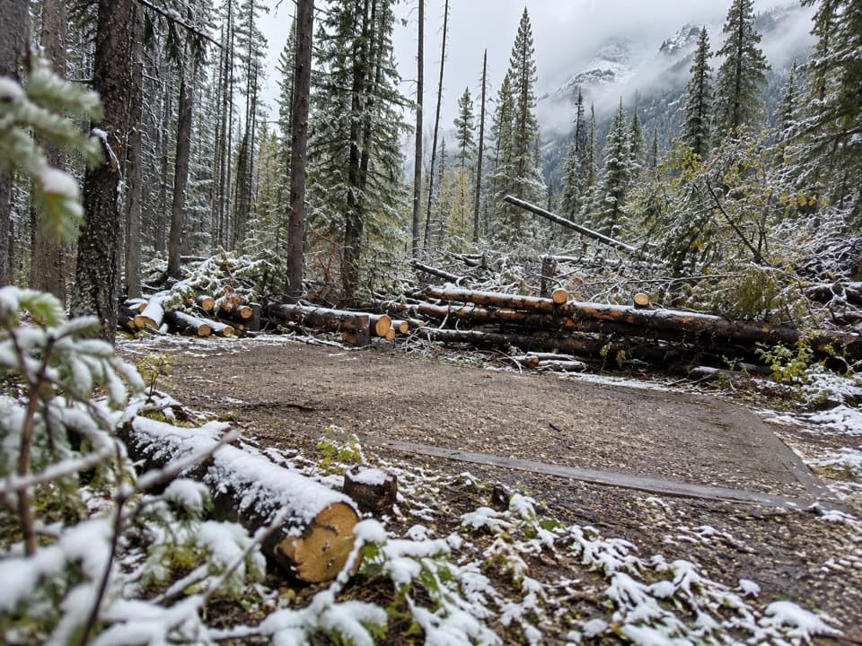
From Field, follow Tally-Ho Trail 4.5 km to Natural Bridge, then continue north through Amiskwi Valley to Amiskwi Pass. The Amiskwi Valley is the main route; the Kiwetinok alternate is a different line and is not included. The first part is maintained, but the tread soon becomes little used. Expect frequent blowdowns, overgrowth and washouts, plus three unbridged fords of the Amiskwi River. The section is remote and needs confident navigation and careful water-crossing decisions.

Camping and accessBackcountry camping in Yoho requires a permit.

Backcountry camping in Yoho requires a permit. Reserve designated sites, or obtain a random-camping permit for a designated area before relying on an overnight stop. Pets are allowed in the backcountry on leash. Neither pass is a vehicle trailhead, so plan the approach and pickup as a point-to-point trip. Check current access and route conditions before setting out.

Field’s railway pastField grew as a Canadian Pacific Railway switching point.

Field grew as a Canadian Pacific Railway switching point. Before the Spiral Tunnels opened in 1909, trains descended the steep Big Hill, where extra locomotives were needed to haul them back up the grade. Today, the hamlet is also a practical break for GDT hikers to resupply.

Wildlife

Wildlife in Yoho

All Yoho wildlife maps

Sighting maps show where each species has been reported across Yoho. Wildlife moves, so no sighting is guaranteed.

Keep exploring

Near Great Divide Trail: Yoho Traverse

See it all on the map

Trails that start nearby

Places near the trailhead

Parkwolf’s Yoho ranking

Top-rated trails in Yoho

All 54 trails
  1. 1Lake O’Hara Alpine CircuitChallenging · 11.1 km
  2. 2Iceline via Little YohoChallenging · 20.3 km
  3. 3Lake McArthur CircuitModerate · 8 km
  4. 4Opabin Plateau CircuitModerate · 6.7 km
  5. 5Emerald Lakeshore TrailEasy · 5.2 km
  6. 6Lake Oesa TrailModerate · 6.4 km

Take Parkwolf to Yoho.

The audio tour guide for the drive, plus offline maps, trails, and wildlife heatmaps for when the signal drops.

4.7 from 8,600+ ratings

Download Parkwolf on the App StoreGet Parkwolf on Google Play