Buttertubs Pass in Yorkshire Dales National Park

Sight · Yorkshire Dales National Park

Buttertubs Pass

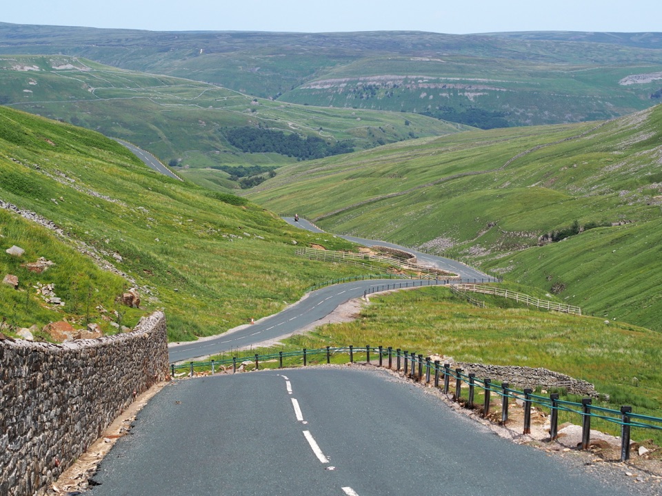
Buttertubs Pass climbs between two dales past deep limestone potholes

Photo: Wikimedia Commons
Type
Sight
Nearest trail
4.3 km
Audio stories
2 nearby
  • Parking
  • #11 of 53 sights

Hear the audio tour

Buttertubs Pass

Overview

About Buttertubs Pass

Why stop

  • Dramatic road-and-valley scenery between two classic Dales

Heads up

  • Narrow, steep and exposed, with very limited safe stopping space
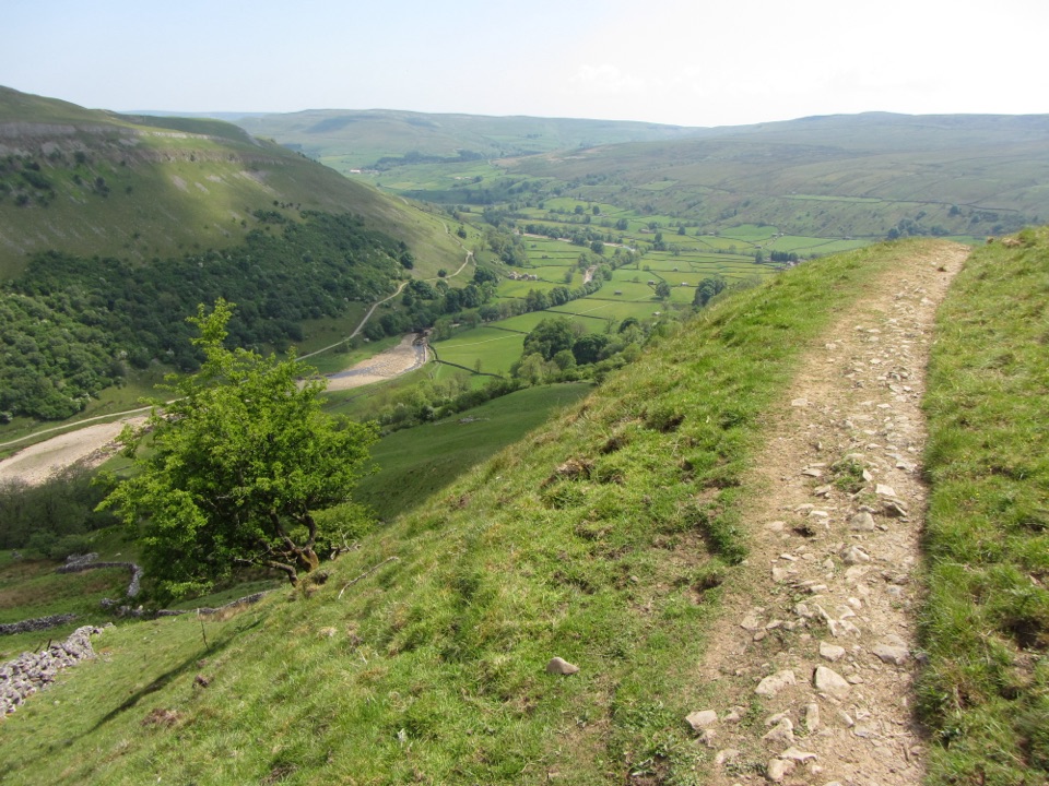
This is the high road between Hawes in Wensleydale and the hamlet of Thwaite in Swaledale, crossing open moorland at a saddle around 526m (roughly 1,690 feet at the highest part of the route). The reward is the crossing itself: a narrow ribbon of tarmac climbing through steep green limestone hills and dry-stone walls, with long views down Wensleydale on the Hawes side and into Swaledale on the Thwaite side. Unlike a car park overlook, the interest is spread along about two miles of climbing, cresting and descending, so the drive is the attraction and the stops are short punctuation marks.
Parkwolf’s verdictWhy stop

Map

Where it is

Loading the Yorkshire Dales map
Full map
SightButtertubs Pass54.35523, -2.20479
Keep this map with you offline in the Parkwolf app

Plan your stop

Before you go

Best time to go

Most people stop for ten to twenty minutes; adding a half-hour wander along the moorland edge near the summit gets you away from the parked cars and improves the views. Early morning and the hour or two before sunset give the best light across the two valleys and the quietest road. Midday on summer weekends and bank holidays is when the limited parking fills and the road is busiest with bikes. Wind at the top is often much stronger than in the dales below, and mist, rain or ice can make both the driving and the views a poor bet, so carry warm layers plus food and drink if you intend to linger.


Driving and parking

The route follows the B6270 and Cliff Gate Road. It is a public road with sharp bends, single-lane pinch points, steep gradients, cattle grids and patchy surfaces in places, and it is fully exposed near the top. Sheep and farm animals wander onto the carriageway, so slow speeds matter more than timing. There is a small area of free, compacted parking near the named saddle with room for roughly ten cars, plus further roadside space near the Buttertubs. That is the extent of what is reliably there. Do not plan around toilets, food or other facilities, and do not stop on blind bends or verges where you would narrow the road.

1 active Yorkshire Dales alert

  • ClosureTemporary closures on public rights of wayAvoid the listed sections of public rights of way while their temporary closures or pedestrian prohibition are in force. - Public Bridleway No. 52 (05.Official details
Yorkshire Dales alerts
A park ranger sits on a dash-mounted phone, talking, as Parkwolf’s Tour Guide plays “Army Cutworm Moths: A Grizzly Bear Buffet” on Grand Loop Road below Dunraven Pass in Yellowstone
Parkwolf Tour GuideThe highest, rockiest slopes around here are a summer buffet for grizzly bears.

Yorkshire Dales Tour Guide

Your drive to Buttertubs Pass, narrated.

Parkwolf is a GPS audio tour guide for Yorkshire Dales National Park. As you drive, it chimes in with what’s ahead: hidden gems, upcoming stops, history, geology, and wildlife, right through your car’s speakers.

Recorded for this place

Buttertubs Pass
0:00 / 0:40
“You're approaching Buttertubs Pass, the narrow high road between Wensleydale and Swaledale.”

Plays as you drive up to Buttertubs Pass in the Parkwolf Yorkshire Dales Tour Guide.

More stories near here in the app

  • The Buttertubs' Short Journey
  • Hardraw Force
  • The Long Carry to Grinton
  • Cotter Force
  • 298 audio storiesacross Yorkshire Dales’s roads, triggered by GPS as you drive
  • Wildlife heatmapsfor Eurasian Otter, Atlantic Salmon, Short-eared Owl, and 13 more
  • Works offlinemaps, 99 trails, 63 places, and audio download before you lose signal
  • CarPlay readysimple controls built for the drive
★★★★★
“Fantastic app with many points of information… It’s great to just turn on while you’re driving and it gives you an audio tour of the national Park. We love it!!!!”
JMJamesApp Store review
Download Parkwolf on the App StoreGet Parkwolf on Google Play

4.7 from 8,600+ ratings

Guide

More about Buttertubs Pass

The Buttertubs themselvesA little north of the summit, deep limestone fissures sit immediately beside the road, with an…

A little north of the summit, deep limestone fissures sit immediately beside the road, with an information board and cave entrances in the surrounding rock. They are commonly described as around 20m deep, and you can look into them from the roadside within a couple of minutes of parking. The traditional story told locally is that farmers heading to market in Hawes lowered butter into the cool shafts to keep it firm, which is where the name comes from. Treat that as the longstanding story rather than proven history.

Cycling and the Tour connectionThe pass featured in the 2014 Grand Depart as the second King of the Mountains climb, with Jens…

The pass featured in the 2014 Grand Depart as the second King of the Mountains climb, with Jens Voigt first over the top, and it has stayed popular with riders ever since. From either side it is roughly a 4km climb with about 250m of ascent; the Thwaite approach is the harder one, with the first stretch averaging close to 9%. Expect cyclists and motorbikes on most fine days, often on the bends where sightlines are shortest.

Honest drawbacksStopping space is genuinely tight, and on busy days you may have to drive over and come back.

Stopping space is genuinely tight, and on busy days you may have to drive over and come back. Nervous drivers, wide vehicles and anyone uneasy with steep drops and oncoming traffic on narrow sections will find this a demanding crossing rather than a relaxing one. In low cloud there is little to see. Wildlife is mostly sheep, cattle and moorland birds, and none of it is guaranteed.

Wildlife

Wildlife in Yorkshire Dales

All Yorkshire Dales wildlife maps

Sighting maps show where each species has been reported across Yorkshire Dales. Wildlife moves, so no sighting is guaranteed.

Keep exploring

Near Buttertubs Pass

See it all on the map

Trails nearby

More stops nearby

Parkwolf’s Yorkshire Dales ranking

Top sights in Yorkshire Dales

All 63 places
  1. 1Malham CoveSight
  2. 2Aysgarth FallsSight
  3. 3Ribblehead ViaductSight
  4. 4Gordale ScarSight
  5. 5Bolton CastleSight
  6. 6Janet's FossSight

Take Parkwolf to Yorkshire Dales.

The audio tour guide for the drive, plus offline maps, trails, and wildlife heatmaps for when the signal drops.

4.7 from 8,600+ ratings

Download Parkwolf on the App StoreGet Parkwolf on Google Play