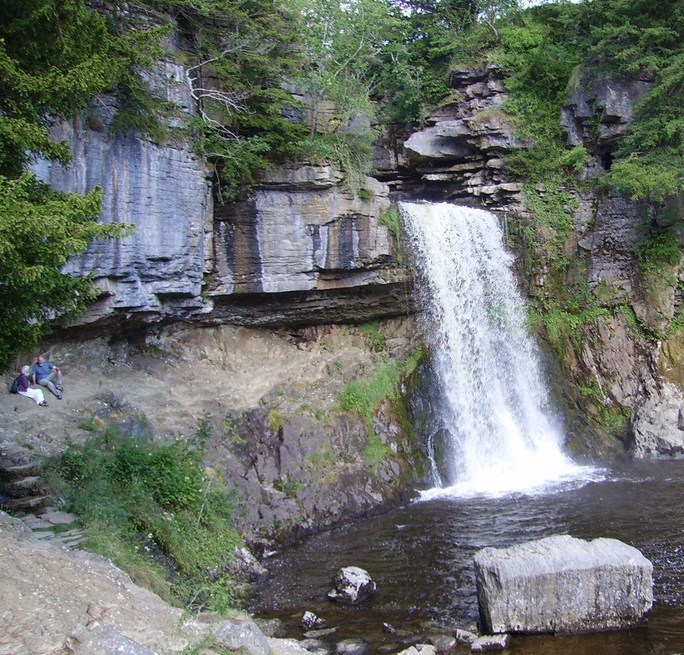
Thornton Force in Yorkshire Dales National Park

Sight · Yorkshire Dales National Park

Thornton Force

Water drops over 170 million years of missing geological time

Photo: Public Domain
Type
Sight
Nearest trail
2.1 km
Audio stories
9 nearby
  • Scenic viewpoint
  • #20 of 53 sights

Hear the audio tour

Ingleton Waterfalls Trail

Overview

About Thornton Force

Why stop

  • Dramatic limestone waterfall with a memorable plunge pool

Heads up

  • Ticketed walk with steep, uneven and slippery sections
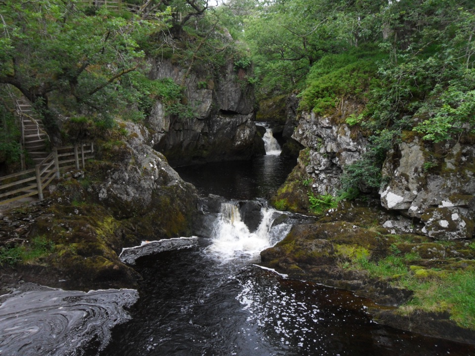
The Rivers Twiss and Doe throw down a whole series of falls on the Ingleton Waterfalls Trail, and Thornton Force is the most impressive of them. Water pours clear of a layered limestone lip into a rocky pool ringed by trees and open banking, which makes it the natural pause and photo point on the Twiss side of the loop. It is also the one place on the walk where the geology is laid out plainly enough to read from the ground.
Parkwolf’s verdictWhy this one is worth the climb

Map

Where it is

Loading the Yorkshire Dales map
Full map
SightThornton Force54.17284, -2.46887
Keep this map with you offline in the Parkwolf app

Plan your stop

Before you go

Best time to go

After a spell of rain the falls run fuller and louder, which is when Thornton Force looks its best. An early start tends to mean a quieter first stretch, with the car park busier later in the day. The trail runs year round but closes earlier in the darker months, so plan around available daylight rather than assuming a late afternoon start works in winter. Extreme weather can shut the route, so check before travelling.


1 active Yorkshire Dales alert

  • ClosureTemporary closures on public rights of wayAvoid the listed sections of public rights of way while their temporary closures or pedestrian prohibition are in force. - Public Bridleway No. 52 (05.Official details
Yorkshire Dales alerts
A park ranger sits on a dash-mounted phone, talking, as Parkwolf’s Tour Guide plays “Army Cutworm Moths: A Grizzly Bear Buffet” on Grand Loop Road below Dunraven Pass in Yellowstone
Parkwolf Tour GuideThe highest, rockiest slopes around here are a summer buffet for grizzly bears.

Yorkshire Dales Tour Guide

Your drive to Thornton Force, narrated.

Parkwolf is a GPS audio tour guide for Yorkshire Dales National Park. As you drive, it chimes in with what’s ahead: hidden gems, upcoming stops, history, geology, and wildlife, right through your car’s speakers.

Recorded for this place

Ingleton Waterfalls Trail
0:00 / 0:29
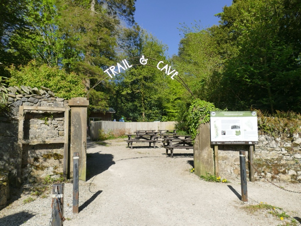
“You're approaching the Broadwood entrance for the Ingleton Waterfalls Trail, a ticketed loop through two wooded gorges. Its four-point-three miles take two to four hours, with many damp, uneven steps.”

Plays as you drive up to Thornton Force in the Parkwolf Yorkshire Dales Tour Guide.

More stories near here in the app

  • A Garden in the Cracks
  • When the Falls Became an Outing
  • The Rock Standing on Edge
  • White Scar Cave
  • 298 audio storiesacross Yorkshire Dales’s roads, triggered by GPS as you drive
  • Wildlife heatmapsfor Eurasian Otter, Atlantic Salmon, Short-eared Owl, and 13 more
  • Works offlinemaps, 99 trails, 63 places, and audio download before you lose signal
  • CarPlay readysimple controls built for the drive
★★★★★
“Fantastic app with many points of information… It’s great to just turn on while you’re driving and it gives you an audio tour of the national Park. We love it!!!!”
JMJamesApp Store review
Download Parkwolf on the App StoreGet Parkwolf on Google Play

4.7 from 8,600+ ratings

Guide

More about Thornton Force

The rock story, brieflyThe cliff shows a classic three-layer unconformity: folded basement slates at the bottom, a…
  • The cliff shows a classic three-layer unconformity: folded basement slates at the bottom, a thin conglomerate boulder bed above them, then Great Scar Limestone. The time gap across that junction is roughly 170 million years.
  • The fall exists because of ice-age drainage. At the end of the Devensian glaciation, meltwater ponded behind a moraine barrier at Raven Ray in southern Kingsdale; when the lake overtopped, the new channel cut through the moraine and into the limestone beneath.
  • Since that breach the fall has retreated about 60 metres into the hillside. Water also sinks into limestone fissures upstream, with some of it reappearing as Little Thornton Force to the west.
How you get hereThis is not a roadside stop.

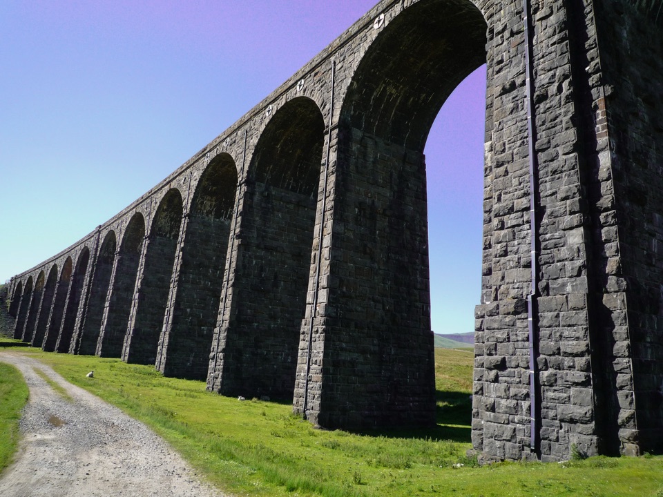
This is not a roadside stop. Thornton Force is reached on foot as part of the ticketed Ingleton Waterfalls Trail, entered at the ticket office at the Broadwood entrance by the viaduct in Ingleton, signposted from the A65. The trail is a 4.5 mile circular route walked clockwise as a one-way footpath, normally taking 2 to 4 hours with an average around two and a half. The path stays close to the two rivers and passes through Thornton and Twisleton Glens, so you get the fall as part of a longer walk rather than a quick detour.

Footing and effortThe operator describes the walk as strenuous, with a large number of steps.
  • The operator describes the walk as strenuous, with a large number of steps. Sections are uneven and can be slippery.
  • It is unsuitable for wheelchairs and pushchairs.
  • Strong footwear with good grip matters more than anything else you bring. Warm waterproof clothing is sensible.
  • Stay on the path. Swimming in the river, campfires and barbecues are not allowed. Dogs are welcome on a lead.
Woodland and wildlifeThe glens are a nature reserve, part of the Thornton and Twisleton Glen SSSI, with sections…

The glens are a nature reserve, part of the Thornton and Twisleton Glen SSSI, with sections cared for by the Woodland Trust and areas covered by a Limestone Pavement Order. It is one of the finest places in the national park to see gorge woodland, with ancient semi natural upland ash woodland growing on limestone. Keep an eye on the water: brown trout are commonly seen leaping the falls and dippers are often spotted at water level. Both are possibilities rather than guarantees.

Practical notes and honest drawbacksNo formal facilities have been verified at the waterfall itself.
  • No formal facilities have been verified at the waterfall itself. Parking, toilets, refreshments, WiFi hotspots, EV charging and picnic areas all belong to the trail infrastructure elsewhere on the route, including the Broadwood car park and the Falls Park area roughly halfway round.
  • Mobile data is not available around the trail. Download the operator's self guided geology and ecology guide before you set off if you want the background as you walk.
  • Parking at Broadwood is limited and reserved for ticket holders.
  • The route is popular and the steps and narrow, uneven sections make it a proper walk rather than a stroll. If steep steps are a problem, this fall will not be an easy target.

Wildlife

Wildlife in Yorkshire Dales

All Yorkshire Dales wildlife maps

Sighting maps show where each species has been reported across Yorkshire Dales. Wildlife moves, so no sighting is guaranteed.

Keep exploring

Near Thornton Force

See it all on the map

Trails nearby

More stops nearby

Parkwolf’s Yorkshire Dales ranking

Top sights in Yorkshire Dales

All 63 places
  1. 1Malham CoveSight
  2. 2Aysgarth FallsSight
  3. 3Ribblehead ViaductSight
  4. 4Gordale ScarSight
  5. 5Bolton CastleSight
  6. 6Janet's FossSight

Take Parkwolf to Yorkshire Dales.

The audio tour guide for the drive, plus offline maps, trails, and wildlife heatmaps for when the signal drops.

4.7 from 8,600+ ratings

Download Parkwolf on the App StoreGet Parkwolf on Google Play