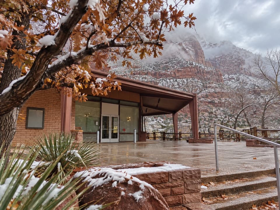
Canyon Overlook Trail in Zion National Park

#3 of 54 trails in Zion

Zion National Park, UT

Canyon Overlook Trail

A short, rocky climb to a big view over Pine Creek Canyon.

Photo: Wikimedia Commons
Length
1mi
Time
1hr
Elev. change
144ft
Difficulty
Moderate
  • No dogs
  • High point 5,276 ft

Hear the audio tour

Canyon Overlook

Overview

About Canyon Overlook Trail

Why go

  • Big Pine Creek and lower Zion Canyon views for a one-mile walk.
  • A shaded fern alcove, slickrock, and sandstone pillars add variety.

Heads up

  • Very limited parking by the tunnel.
  • Some narrow exposed edges are uncomfortable for hikers uneasy with heights.
Canyon Overlook Trail is a one-mile out-and-back from the east end of the Zion–Mount Carmel Tunnel to a broad view over Pine Creek Canyon and lower Zion Canyon. The short climb buys one of Zion’s best quick panoramas without taking half a day, but it isn’t a level viewpoint stroll: stone steps, uneven slickrock, and a few narrow exposed spots matter more than the mileage. If you want a short walk with a real canyon payoff, keep it in the plan. If heights make you freeze, take that seriously before setting out; a short trail can still feel uncomfortable when the canyon edge is beside you.
Parkwolf’s verdictIs this the hike for you?

Map & elevation

The route

Loading the Zion map
Full map
Elevation5,131–5,276 ft
TrailheadZion Canyon Overlook Parking Area37.21340, -112.94050
Keep this map with you offline in the Parkwolf app

Plan your hike

Before you go

Parking

Use the small Zion Canyon Overlook parking area east of the tunnel, then cross Highway 9 to the signed start. Parking is extremely limited; park only in designated spaces and do not count on roadside shoulders as overflow. Pit toilets are available along the highway; there is no water-filling station at the trailhead.

Safety

Most long drop-offs are fenced, but a few narrow edges remain exposed without a rail. The slickrock is uneven, and snow or ice can make the route treacherous.

3 active Zion alerts

  • CautionToxic cyanobacteria in Zion waterwaysDo not drink Zion in-stream water, submerge your head, or touch or ingest algae mats; cyanobacteria can produce harmful toxins.Official details
  • ClosureWatchman Trail closed for repairsWatchman Trail is closed pending repairs; do not enter the trail and choose another hike. Check current park conditions before setting out.Official details
See all 3 alerts
A park ranger sits on a dash-mounted phone, talking, as Parkwolf’s Tour Guide plays “Army Cutworm Moths: A Grizzly Bear Buffet” on Grand Loop Road below Dunraven Pass in Yellowstone
Parkwolf Tour GuideThe highest, rockiest slopes around here are a summer buffet for grizzly bears.

Zion Tour Guide

Your drive to Canyon Overlook Trail, narrated.

Parkwolf is a GPS audio tour guide for Zion National Park. As you drive, it chimes in with what’s ahead: hidden gems, upcoming stops, history, geology, and wildlife, right through your car’s speakers.

See the Zion audio tour

Recorded for this trailhead

Canyon Overlook
0:00 / 0:28
“Canyon Overlook trailhead is coming up, just east of the Zion-Mount Carmel Tunnel.”

Plays as you drive up to this trailhead in the Parkwolf Zion Tour Guide.

More stories near here in the app

  • Clear Creek Wash
  • Zion–Mount Carmel Tunnel and Great Arch
  • How the Canyon Gets Wider
  • Lower Pine Creek Falls
  • 45 audio storiesacross Zion’s roads, triggered by GPS as you drive
  • Wildlife heatmapsfor California Condor, Bighorn Sheep, Mountain Lion, and 13 more
  • Works offlinemaps, 54 trails, 36 places, and audio download before you lose signal
  • CarPlay readysimple controls built for the drive
★★★★★
“Fantastic app with many points of information… It’s great to just turn on while you’re driving and it gives you an audio tour of the national Park. We love it!!!!”
JMJamesApp Store review
Download Parkwolf on the App StoreGet Parkwolf on Google Play

4.7 from 8,600+ ratings

Trail guide

Hiking Canyon Overlook Trail

Getting to the startThe Zion Canyon Overlook parking area sits just east of the tunnel; the signed pedestrian start…

The Zion Canyon Overlook parking area sits just east of the tunnel; the signed pedestrian start is across Highway 9. The lot is small, and a full lot or slow tunnel traffic can turn this quick stop into a wait. Come early or later in the day if the timing works for you, and park only in designated spaces; don’t count on roadside shoulders as overflow. Pit toilets are available along the highway, but there’s no water-filling station at the trailhead. The park entrance fee applies.

Follow the rockThe opening stair climb is the most obvious uphill push.

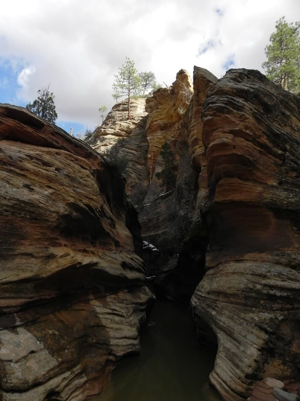
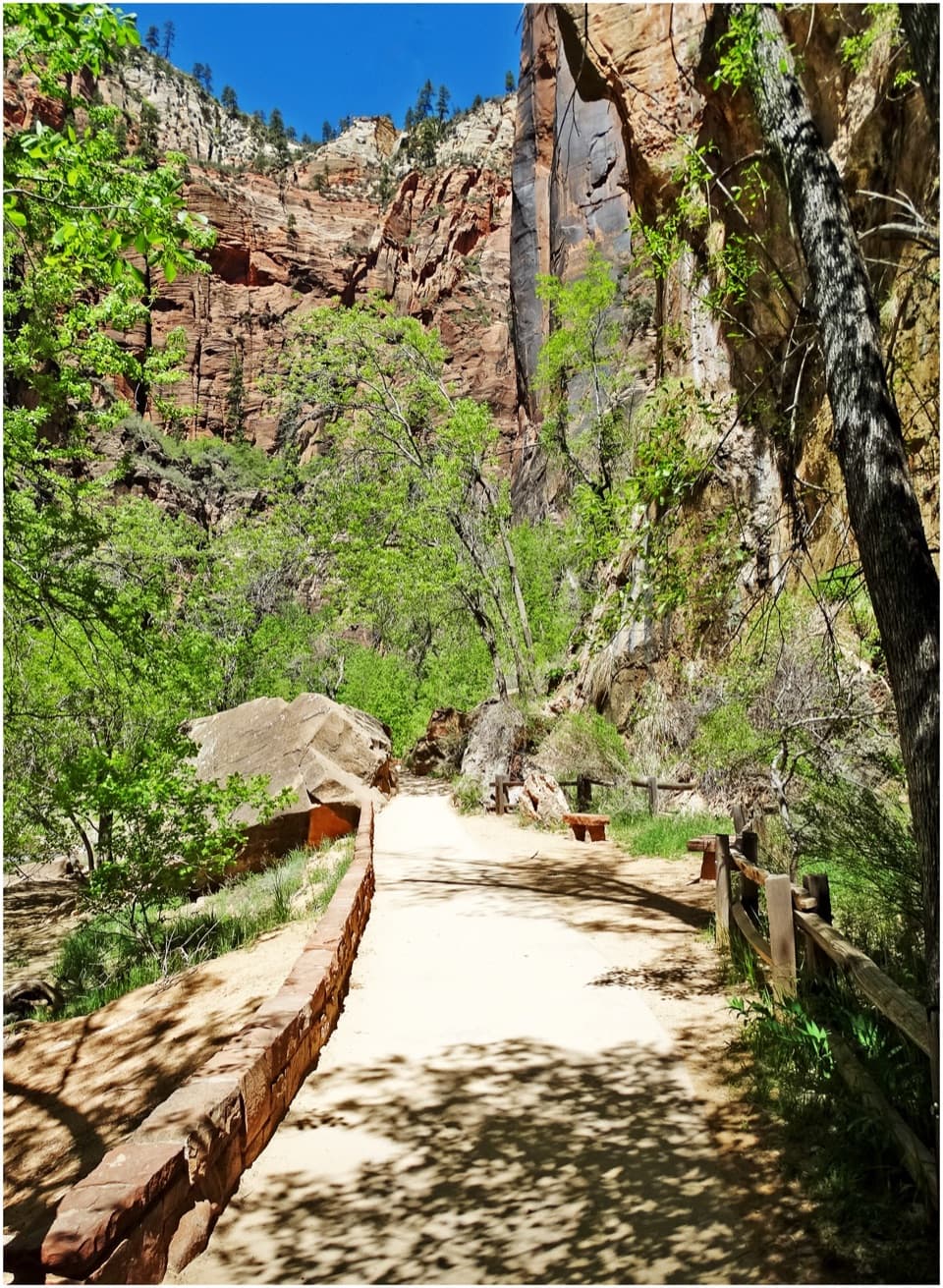
The opening stair climb is the most obvious uphill push. After it, the route crosses bare slickrock and rough stone above Pine Creek’s slot canyon. Around the middle, a shaded alcove holds a seep and ferns—a cool pause that’s easy to miss if you only watch your footing. Just beyond it, the path narrows along the rock with the drop close by. Most long drop-offs are fenced, but not every narrow edge is; keep children close through this section.

Near the end, the tread crosses eroded sandstone pillars and pinyon pines before reaching the signed overlook. The return follows the same line. There’s no loop or alternate descent to find, and the one-mile figure already includes the walk back.


Take time at the overlookThe view opens over lower Zion Canyon and Pine Creek Canyon, with Route 9’s switchbacks and the…

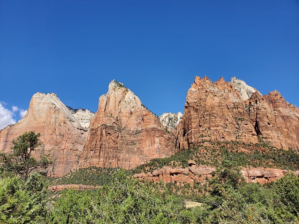
The view opens over lower Zion Canyon and Pine Creek Canyon, with Route 9’s switchbacks and the tunnel visible below. A plaque points out East Temple, Bridge Mountain, West Temple, the Towers of the Virgin, and Streaked Wall. Give yourself a minute to trace those shapes across the skyline. For a photo, include part of the switchback road; it gives the cliffs a sense of scale instead of turning the view into a wall of red rock.

Footing, weather, and petsThe distance is modest, but the uneven rock, steps, and exposed edges make this a moderate hike…

The distance is modest, but the uneven rock, steps, and exposed edges make this a moderate hike rather than an easy stroll. Rails protect many of the longer drops, not all of the narrow spots. Snow or ice can make the slickrock treacherous, so don’t treat winter footing like a dry-day walk. Pets aren’t allowed on this trail; service animals are the exception. There’s no water on the route, and you’ll want to arrive with what you need already filled.

The name above the archThe route was built in the 1930s and was reportedly called Great Arch Trail before its name…

The route was built in the 1930s and was reportedly called Great Arch Trail before its name changed in the 1940s. The new name makes sense once you reach the end: you stand above the Great Arch rather than looking straight at it. The payoff is the canyon panorama from the rock above it.

Is this the hike for you?Walk about half a mile to the viewpoint, then retrace the same path.

Walk about half a mile to the viewpoint, then retrace the same path. The Park Service estimates an hour and lists 163 feet of elevation change. The trail starts with a flight of stone steps, then gets less stair-heavy and more uneven as it climbs and crosses slickrock. Leave time to pause at the end and take the exposed sections at your own pace.

Wildlife

Wildlife in Zion

All Zion wildlife maps

Sighting maps show where each species has been reported across Zion. Wildlife moves, so no sighting is guaranteed.

Keep exploring

Near Canyon Overlook Trail

See it all on the map

Trails that start nearby

Places near the trailhead

Parkwolf’s Zion ranking

Top-rated trails in Zion

All 54 trails
  1. 1Angels Landing TrailChallenging · 4.2 mi
  2. 2The Narrows from the Bottom UpChallenging · 9.4 mi
  3. 4East Mesa Trail to Observation PointModerate · 6.8 mi
  4. 5Left Fork (Subway) Bottom-UpChallenging · 9 mi
  5. 6West Rim Trail (Top-Down)Challenging · 14.6 mi
  6. 7Riverside WalkEasy · 2 mi

Take Parkwolf to Zion.

The audio tour guide for the drive, plus offline maps, trails, and wildlife heatmaps for when the signal drops.

4.7 from 8,600+ ratings

Download Parkwolf on the App StoreGet Parkwolf on Google Play