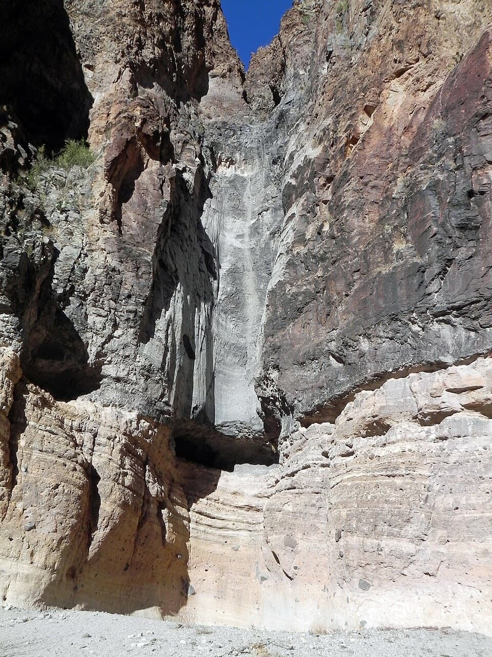
Lower Burro Mesa Pouroff in Big Bend National Park

Sight · Big Bend National Park

Lower Burro Mesa Pouroff

A short wash hike ends beneath a 100-foot rock pouroff.

Photo: Wikimedia Commons
Type
Sight
Nearest trail
0.4 mi
Audio stories
7 nearby
  • Trailhead
  • Parking

Hear the audio tour

Lower Burro Mesa Pouroff

Overview

About Lower Burro Mesa Pouroff

Why stop

  • The wash and rising canyon walls make the walk interesting before the end.

Heads up

  • The pouroff is usually dry, and the wash has loose footing.

Map

Where it is

Loading the Big Bend map
Full map
SightLower Burro Mesa Pouroff29.23559, -103.40109
Keep this map with you offline in the Parkwolf app

Plan your stop

Before you go

Getting there safely

Take the paved 1.5-mile Burro Mesa side road from Ross Maxwell Scenic Drive to the trailhead. The lot has 16 pull-in spaces, including one accessible space. This is a wash, so stay out of the canyon if storms threaten; flash floods can race through it. Pets are not allowed on park trails.

2 active Big Bend alerts

  • ClosureWeather-related road closuresDo not use these closed roads; NPS lists the closures as in effect until further notice.Official details
  • InfoBoquillas Crossing schedule changeBoquillas Crossing is open Friday through Monday, 9:00 a.m.–4:00 p.m.; NPS says it will not change to winter hours at this time. Check current park conditions before planning a crossing.Official details
Big Bend alerts
A park ranger sits on a dash-mounted phone, talking, as Parkwolf’s Tour Guide plays “Army Cutworm Moths: A Grizzly Bear Buffet” on Grand Loop Road below Dunraven Pass in Yellowstone
Parkwolf Tour GuideThe highest, rockiest slopes around here are a summer buffet for grizzly bears.

Big Bend Tour Guide

Your drive to Lower Burro Mesa Pouroff, narrated.

Parkwolf is a GPS audio tour guide for Big Bend National Park. As you drive, it chimes in with what’s ahead: hidden gems, upcoming stops, history, geology, and wildlife, right through your car’s speakers.

See the Big Bend audio tour

Recorded for this place

Lower Burro Mesa Pouroff
0:00 / 0:22
“You're coming up on the Lower Burro Mesa Pouroff trailhead, where a short hike leads beneath a hundred-foot rock chute. Come for the canyon walls and the shape water has carved; the pour-off is dry most of the year.”

Plays as you drive up to Lower Burro Mesa Pouroff in the Parkwolf Big Bend Tour Guide.

More stories near here in the app

  • Why Adobe Needs More Mud
  • Burro Spring Trail
  • The Mistletoe Bird
  • Upper Burro Mesa Pouroff
  • 110 audio storiesacross Big Bend’s roads, triggered by GPS as you drive
  • Wildlife heatmapsfor Black Bear, Collared Peccary, White-tailed Deer, and 13 more
  • Works offlinemaps, 45 trails, 64 places, and audio download before you lose signal
  • CarPlay readysimple controls built for the drive
★★★★★
“Fantastic app with many points of information… It’s great to just turn on while you’re driving and it gives you an audio tour of the national Park. We love it!!!!”
JMJamesApp Store review
Download Parkwolf on the App StoreGet Parkwolf on Google Play

4.7 from 8,600+ ratings

Guide

More about Lower Burro Mesa Pouroff

A dry fall at the end of a short walkThis is a 100-foot vertical channel cut into the volcanic rock at the end of a wash hike off…

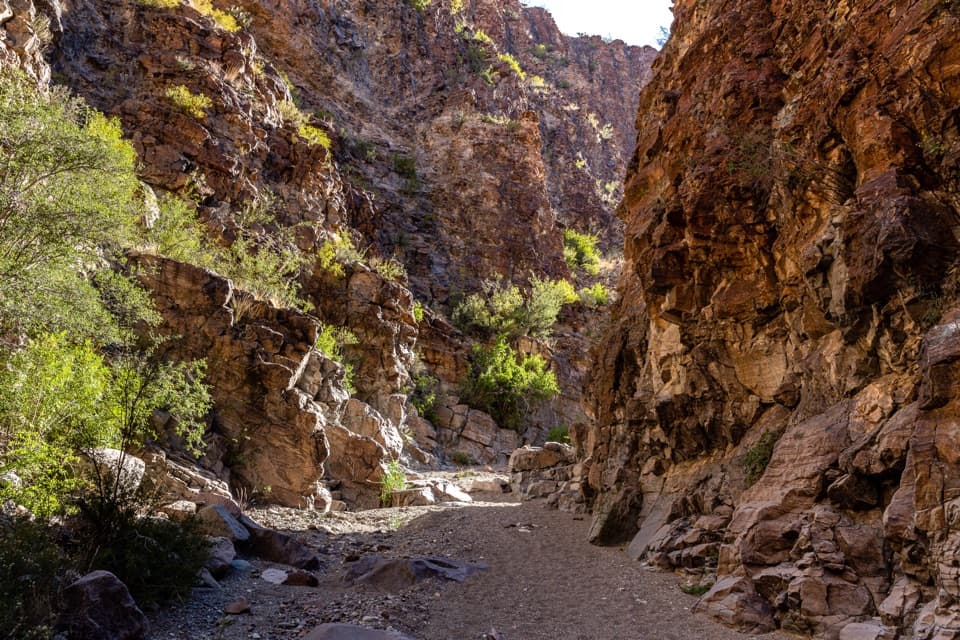
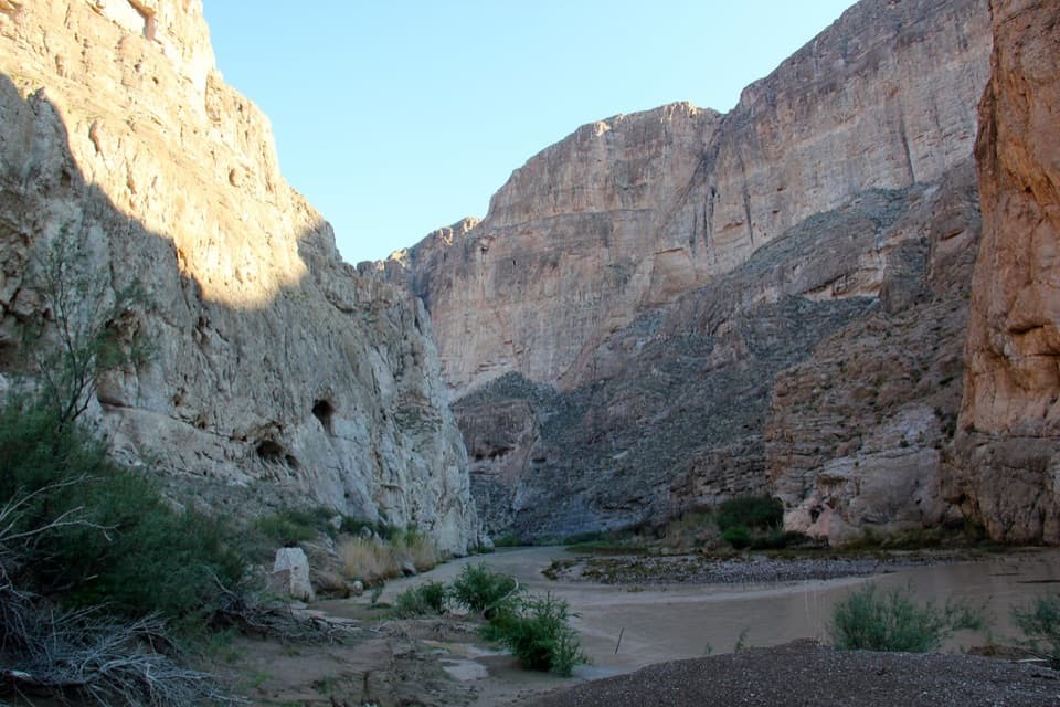
This is a 100-foot vertical channel cut into the volcanic rock at the end of a wash hike off Ross Maxwell Scenic Drive. The wash narrows into a box canyon, and most of the year the pouroff is dry. Come for the scale of the chute and the rock around it, rather than expecting flowing water.

The walk into the canyonThe hike is 1 mile round trip with 120 feet of elevation change.

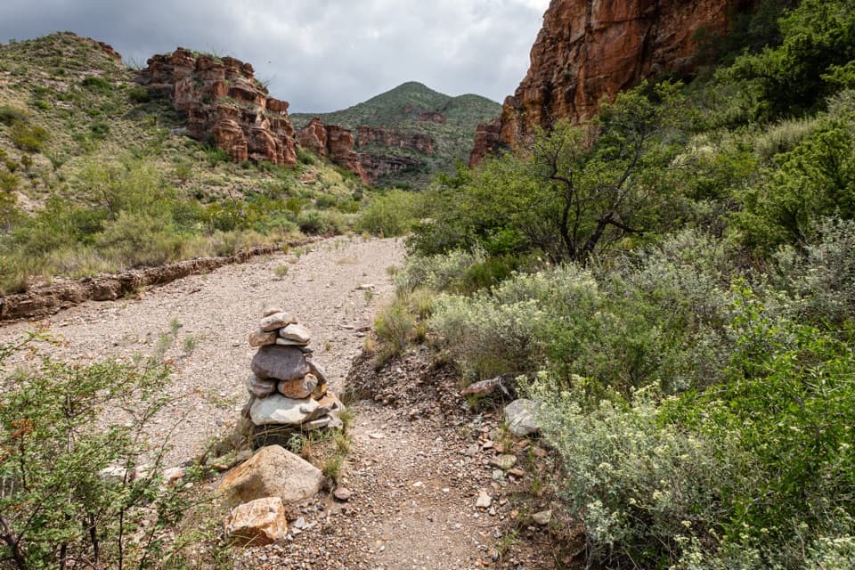
The hike is 1 mile round trip with 120 feet of elevation change. It stays fairly gentle until about a quarter mile in, where uneven steps drop into coarse sand and gravel. Allow at least half an hour, and longer if you want to explore the wash; loose footing can slow the short walk.

Look at the rockThe pouroff funnels water from the mesa above through a 100-foot channel.

The pouroff funnels water from the mesa above through a 100-foot channel. Nearby hills show yellow and orange ash-flow tuff, while conglomerate boulders lie across the valley floor. Even when the fall is dry, you can trace the route water takes through this volcanic landscape. For a photo, frame the full chute from the wash and include a boulder near the bottom for scale.

Plants along the washThe gravel wash is lined with Mexican persimmon, Mexican buckeye and desert hackberry.

The gravel wash is lined with Mexican persimmon, Mexican buckeye and desert hackberry. It is a chance to look closely at the plants growing in the drainage, as well as the cliffs that enclose it.

Wildlife

Wildlife in Big Bend

All Big Bend wildlife maps

Sighting maps show where each species has been reported across Big Bend. Wildlife moves, so no sighting is guaranteed.

Keep exploring

Near Lower Burro Mesa Pouroff

See it all on the map

Trails nearby

More stops nearby

Parkwolf’s Big Bend ranking

Top sights in Big Bend

All 64 places
  1. 1Santa Elena CanyonSight
  2. 2Sotol VistaSight
  3. 3Fossil Discovery ExhibitSight
  4. 4Window ViewSight
  5. 5Boquillas CanyonSight
  6. 6Langford Hot SpringsSight

Take Parkwolf to Big Bend.

The audio tour guide for the drive, plus offline maps, trails, and wildlife heatmaps for when the signal drops.

4.7 from 8,600+ ratings

Download Parkwolf on the App StoreGet Parkwolf on Google Play