Mossy Cave Trail in Bryce Canyon National Park

Bryce Canyon National Park, UT

Mossy Cave Trail

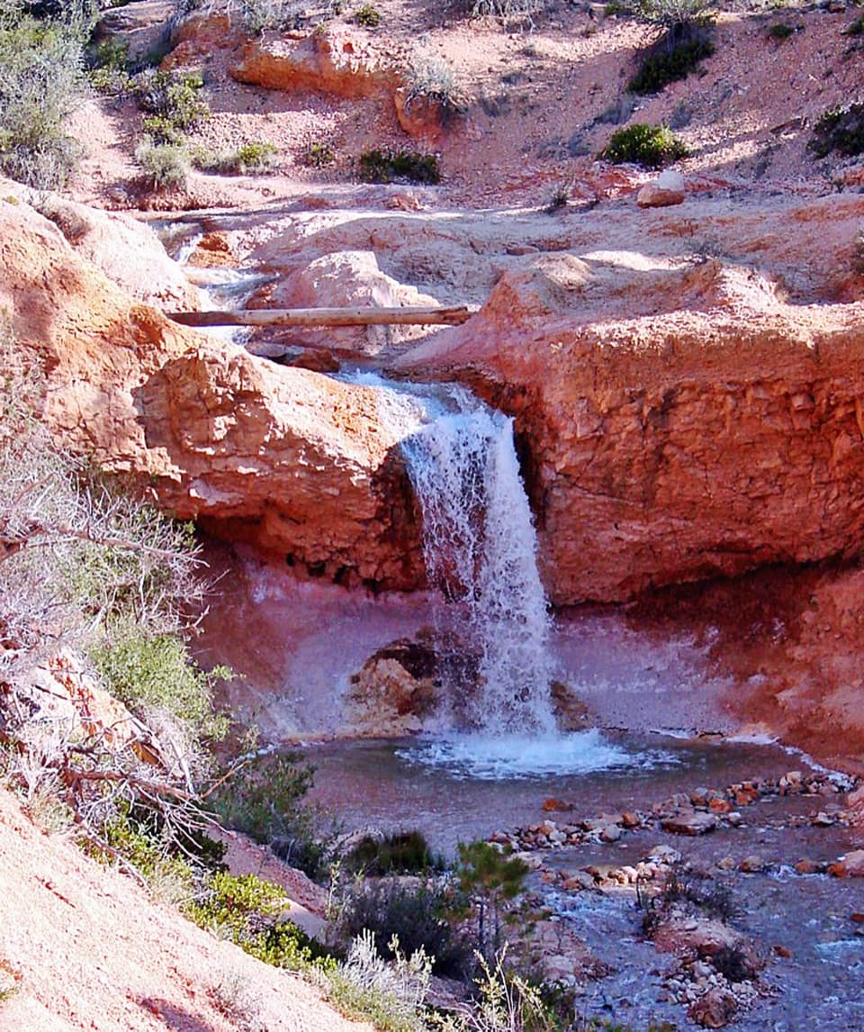
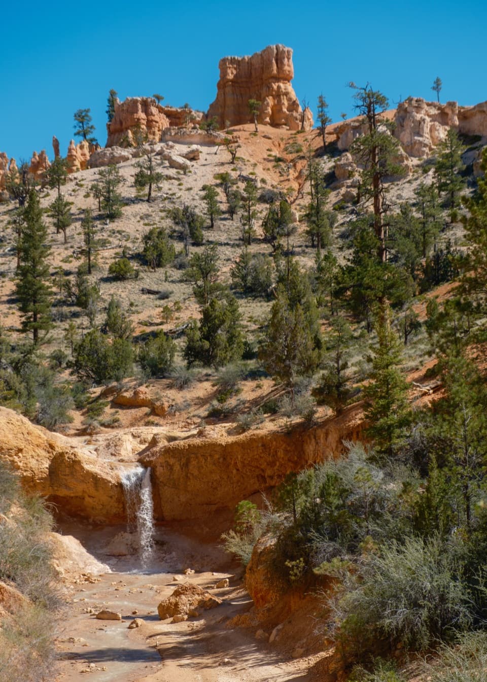
A short creekside hike to a mossy overhang and waterfall.

Photo: Wikimedia Commons
Length
0.8mi
Time
1hr
Elev. change
167ft
Difficulty
Easy
  • Loop
  • No dogs
  • High point 7,001 ft
  • #11 of 24 in Bryce Canyon

Hear the audio tour

Mossy Cave and the Irrigation Waterfall

Overview

About Mossy Cave Trail

Why go

  • Two signed destinations make a short walk feel varied.
  • The Tropic Ditch adds an unusual local history.

Heads up

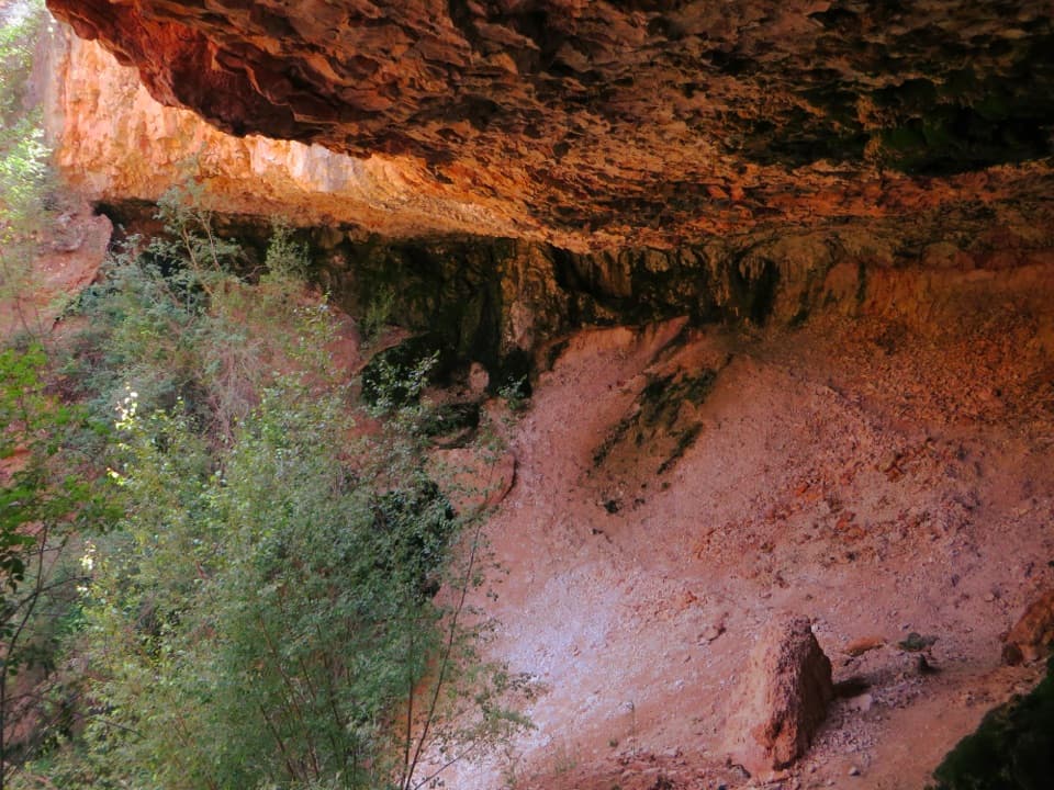
  • Mossy Cave is a shallow overhang, not an interior cavern.
  • Waterfall flow can be slight or absent.
Mossy Cave Trail is an easy, 0.8-mile round-trip walk in Bryce Canyon’s northern corner. It follows Water Canyon beside the Tropic Ditch, then branches to a small waterfall and a sheltered overhang called Mossy Cave. The park allows about an hour. Both stops fit into a quick outing, and they feel different enough to take both branches if you have the time. The waterfall’s flow varies, so think of it as a walk to the waterfall area rather than a guaranteed big cascade.
Parkwolf’s verdictIs this the hike for you?

Map & elevation

The route

Loading the Bryce Canyon map
Full map
Elevation6,834–7,001 ft
TrailheadMossy Cave Trailhead37.66572, -112.11035
Keep this map with you offline in the Parkwolf app

Plan your hike

Before you go

Parking

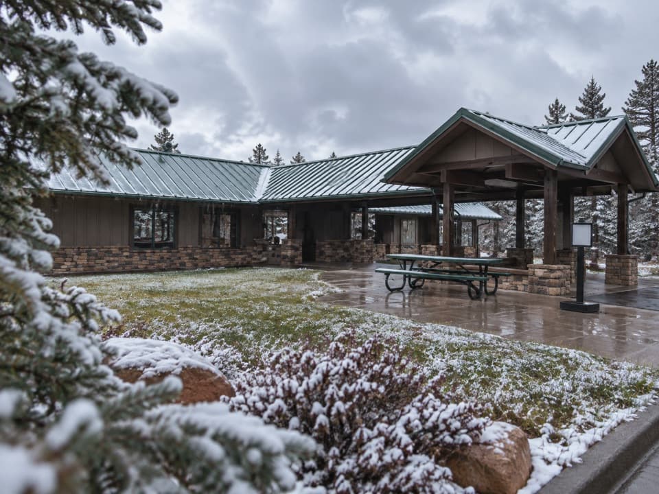
Mossy Cave Trailhead is just off UT-12 at the park’s north end, about four miles east of UT-63. Park in the trailhead lot; if it is full, return later rather than parking on the shoulder. Accessible restrooms are at the trailhead; there is no shuttle.

Safety

Stay on the signed main trail and use bridge crossings to enter or leave the stream, protecting fragile rocks and plants. The natural-terrain trail is not considered accessible. Pets are prohibited except service animals.

3 active Bryce Canyon alerts

  • ClosureWall Street closed after recent rainsWall Street is closed until further notice because of recent rains. - Other park trails are open, but hikers are urged to use caution. Check current park conditions before hiking.Official details
  • CautionUnder-the-Rim Trail damage and hiker advisoryUnder-the-Rim Trail conditions are deteriorated in many places; hike at your own risk. - Use a map and be able to navigate in the backcountry; strong wayfinding skills are essential.Official details
See all 3 alerts
A park ranger sits on a dash-mounted phone, talking, as Parkwolf’s Tour Guide plays “Army Cutworm Moths: A Grizzly Bear Buffet” on Grand Loop Road below Dunraven Pass in Yellowstone
Parkwolf Tour GuideThe highest, rockiest slopes around here are a summer buffet for grizzly bears.

Bryce Canyon Tour Guide

Your drive to Mossy Cave Trail, narrated.

Parkwolf is a GPS audio tour guide for Bryce Canyon National Park. As you drive, it chimes in with what’s ahead: hidden gems, upcoming stops, history, geology, and wildlife, right through your car’s speakers.

See the Bryce Canyon audio tour

Recorded for this trailhead

Mossy Cave and the Irrigation Waterfall
0:00 / 0:27
“You're approaching the Mossy Cave trailhead, for a short walk to a damp overhang and Tropic Ditch Falls.”

Plays as you drive up to this trailhead in the Parkwolf Bryce Canyon Tour Guide.

More stories near here in the app

  • Give the Stars Half an Hour
  • Before the Towers, a Lake
  • Fairyland Point: Look for Sinking Ship
  • Bryce Canyon Shuttle Station: Leave the Car Here
  • 30 audio storiesacross Bryce Canyon’s roads, triggered by GPS as you drive
  • Wildlife heatmapsfor Wapiti, Utah Prairie Dog, Mule Deer, and 13 more
  • Works offlinemaps, 24 trails, 41 places, and audio download before you lose signal
  • CarPlay readysimple controls built for the drive
★★★★★
“Super fun and useful app! We especially enjoyed the guide as we drove through Bryce Canyon National Park.”
Rae607App Store review
Download Parkwolf on the App StoreGet Parkwolf on Google Play

4.7 from 8,600+ ratings

Trail guide

Hiking Mossy Cave Trail

Follow both signed branchesThe trail starts with a climb and ends with a descent, an unusual profile for such a short walk.

The trail starts with a climb and ends with a descent, an unusual profile for such a short walk. The firm natural-sediment path crosses the stream on two bridges; it gets steeper after the second bridge and reaches a fork. Follow the signs to each destination and backtrack to the fork for the other. The short branch walk is a better fit for a break from Bryce’s rim overlooks than for a long hike. Stay on the signed path and use the bridges if you enter or leave the water; cutting across the banks creates damaging social trails.

Mossy Cave is an overhangDespite the name, this is a sheltered, damp rock overhang, not a deep cave you can walk into.

Despite the name, this is a sheltered, damp rock overhang, not a deep cave you can walk into. Moss grows here in summer, and icicles form in winter. It is a modest stop; the streamside walk and waterfall branch are just as much of the outing as the cave itself.

A ditch that changed the canyonThe water beside the trail is tied to the Tropic Ditch, a hand-dug irrigation canal built from…

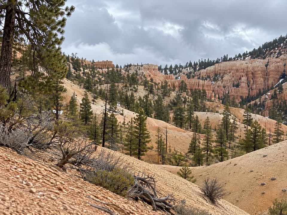
The water beside the trail is tied to the Tropic Ditch, a hand-dug irrigation canal built from 1890 to 1892 to carry water from the East Fork of the Sevier River to Tropic and Cannonville. It still serves those communities. Constant water has also shaped the lower canyon into smoother, V-shaped slopes, while higher ground keeps Bryce’s broken hoodoo texture. The unusually wet canyon supports Mountain Death Camas and Watson Bog Orchid.

Access and rulesThe trailhead is just off UT-12 at the park’s northern end, about four miles east of UT-63.

The trailhead is just off UT-12 at the park’s northern end, about four miles east of UT-63. You need a park pass even though you can reach this area without driving through the main fee booths. Parking and accessible restrooms are at the trailhead; if the lot is full, return later rather than parking on the highway shoulder. No shuttle serves the trail. Pets aren’t allowed, though service animals are. The natural-terrain trail itself is not considered accessible.

Wildlife

Wildlife in Bryce Canyon

All Bryce Canyon wildlife maps

Sighting maps show where each species has been reported across Bryce Canyon. Wildlife moves, so no sighting is guaranteed.

Keep exploring

Near Mossy Cave Trail

See it all on the map

Trails that start nearby

Places near the trailhead

Parkwolf’s Bryce Canyon ranking

Top-rated trails in Bryce Canyon

All 24 trails
  1. 1Queen’s Garden / Navajo Combination LoopModerate · 2.9 mi
  2. 2Navajo Loop TrailModerate · 1.3 mi
  3. 3Fairyland Loop TrailChallenging · 8 mi
  4. 4Peekaboo Loop TrailChallenging · 5.5 mi
  5. 5Figure-8 CombinationChallenging · 6.4 mi
  6. 6Queen's Garden TrailModerate · 1.8 mi

Take Parkwolf to Bryce Canyon.

The audio tour guide for the drive, plus offline maps, trails, and wildlife heatmaps for when the signal drops.

4.7 from 8,600+ ratings

Download Parkwolf on the App StoreGet Parkwolf on Google Play