Queen's Garden Trail in Bryce Canyon National Park

#6 of 24 trails in Bryce Canyon

Bryce Canyon National Park, UT

Queen's Garden Trail

Drop below the rim to meet Queen Victoria, then climb back out.

Photo: Wikimedia Commons
Length
1.8mi
Time
1.5hr
Elev. change
354ft
Difficulty
Moderate
  • Loop
  • No dogs
  • High point 7,976 ft

Hear the audio tour

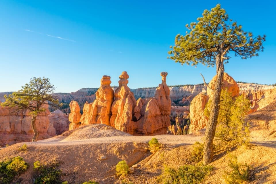
Sunrise Point: Pines Above the Hoodoos

Overview

About Queen's Garden Trail

Why go

  • Walks you among Bryce’s hoodoos instead of viewing them only from above.
  • Short, direct route with a clear destination at Queen Victoria.

Heads up

  • The return climb is steep at high elevation.
  • The approach from Sunrise Point parking adds walking beyond the trail mileage.

Map & elevation

The route

Loading the Bryce Canyon map
Full map
Elevation7,621–7,976 ft
TrailheadSunrise Point trailhead37.62844, -112.16296
Keep this map with you offline in the Parkwolf app

Plan your hike

Before you go

Parking

Use Sunrise Point parking or the shuttle stop. Follow the well-worn rim path about 0.2 mile to the descent; allow that approach in addition to the trail mileage. The lot can fill, and oversized vehicles are restricted while the shuttle operates.

Safety

The trail has a steep return climb at high altitude, with a listed maximum grade of 25%. The natural terrain is not considered accessible.

3 active Bryce Canyon alerts

  • ClosureWall Street closed after recent rainsWall Street is closed until further notice because of recent rains. - Other park trails are open, but hikers are urged to use caution. Check current park conditions before hiking.Official details
  • CautionUnder-the-Rim Trail damage and hiker advisoryUnder-the-Rim Trail conditions are deteriorated in many places; hike at your own risk. - Use a map and be able to navigate in the backcountry; strong wayfinding skills are essential.Official details
See all 3 alerts
A park ranger sits on a dash-mounted phone, talking, as Parkwolf’s Tour Guide plays “Army Cutworm Moths: A Grizzly Bear Buffet” on Grand Loop Road below Dunraven Pass in Yellowstone
Parkwolf Tour GuideThe highest, rockiest slopes around here are a summer buffet for grizzly bears.

Bryce Canyon Tour Guide

Your drive to Queen's Garden Trail, narrated.

Parkwolf is a GPS audio tour guide for Bryce Canyon National Park. As you drive, it chimes in with what’s ahead: hidden gems, upcoming stops, history, geology, and wildlife, right through your car’s speakers.

See the Bryce Canyon audio tour

Recorded for this trailhead

Sunrise Point: Pines Above the Hoodoos
0:00 / 0:33
“You're coming up on Sunrise Point, overlooking the northern end of the amphitheater. After the big view, look for Stilts, a limber pine with roots exposed where the rim has eroded beneath it.”

Plays as you drive up to this trailhead in the Parkwolf Bryce Canyon Tour Guide.

More stories near here in the app

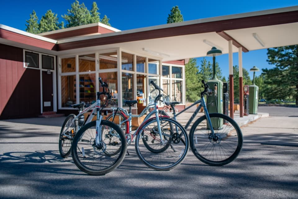
  • Bryce Canyon General Store and the Old Service Station
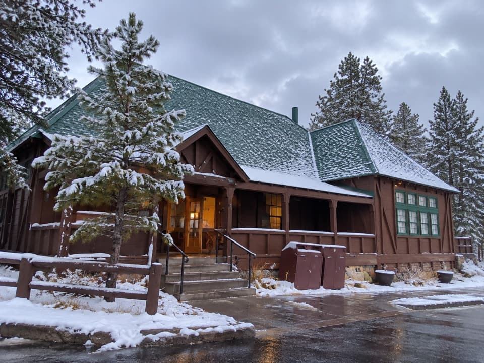
  • Bryce Canyon Lodge: History and a Meal
  • Sunset Point and Thor's Hammer
  • North Campground and the Outdoor Theater
  • 30 audio storiesacross Bryce Canyon’s roads, triggered by GPS as you drive
  • Wildlife heatmapsfor Wapiti, Utah Prairie Dog, Mule Deer, and 13 more
  • Works offlinemaps, 24 trails, 41 places, and audio download before you lose signal
  • CarPlay readysimple controls built for the drive
★★★★★
“Super fun and useful app! We especially enjoyed the guide as we drove through Bryce Canyon National Park.”
Rae607App Store review
Download Parkwolf on the App StoreGet Parkwolf on Google Play

4.7 from 8,600+ ratings

Trail guide

Hiking Queen's Garden Trail

The short route below the rimQueen’s Garden Trail is a 1.

Queen’s Garden Trail is a 1.8-mile out-and-back from Sunrise Point to the Queen Victoria hoodoo, with about 450 feet of climbing on the return. Allow one to two hours on the trail. It’s the easiest of Bryce’s named routes below the rim, and a good pick if you want to walk among hoodoos without taking on the longer Queen’s Garden/Navajo combination. The moderate rating is fair: the trail is short and easy to follow, but the first descent is steep and every step down comes back uphill at altitude.

Follow the Queen’s Garden branchThe trail drops from the rim on a series of switchbacks, then winds through orange and pale…

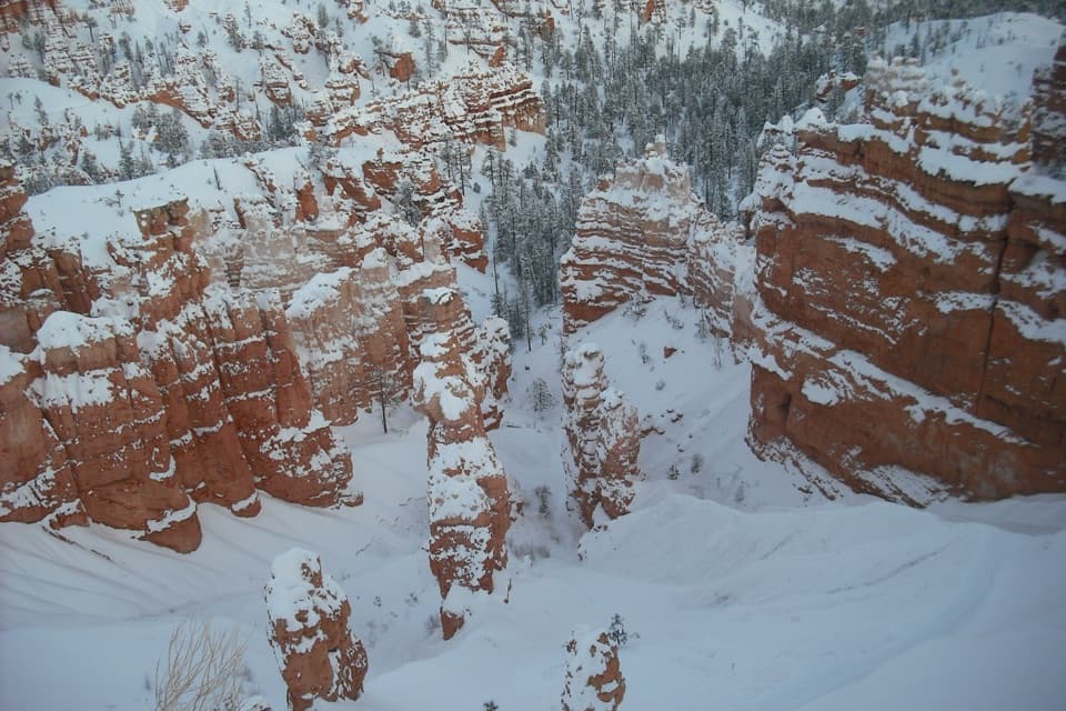
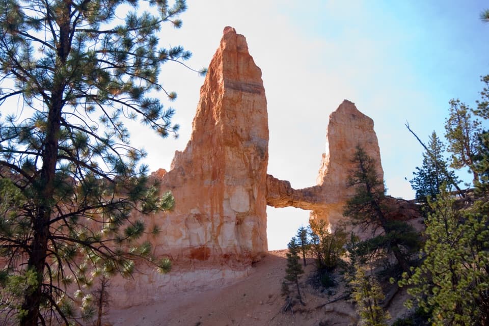
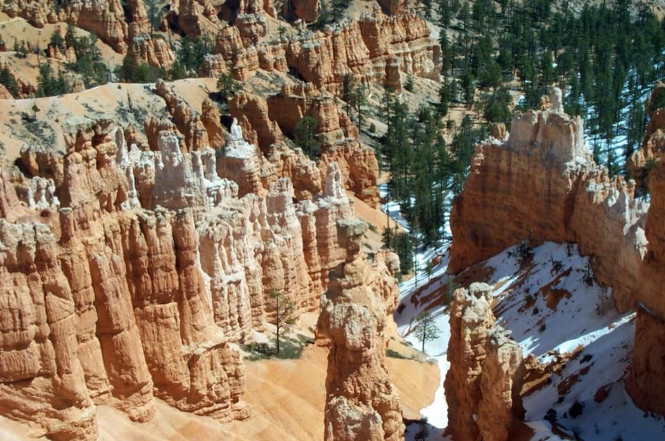
The trail drops from the rim on a series of switchbacks, then winds through orange and pale rock spires on firm native sediment. About halfway down, stay on Queen’s Garden at the junction with the Horse Trail. Farther in, the path passes three rock tunnels; after the third, you’ll reach the Navajo Loop connector. Keep straight for roughly another tenth of a mile to the Queen’s Garden end, rather than turning onto the loop. That last short spur leads to Queen Victoria, the hoodoo that gives the garden its name.

What the return asks of youThe descent feels forgiving because you’re walking down into the amphitheater.

The descent feels forgiving because you’re walking down into the amphitheater. Save some energy for the way back: NPS lists 450 feet of total ascent, an 11% typical grade and a 25% maximum grade. The lower trail has a gentler stretch among the formations, but the final climb out is still work, especially above 8,000 feet. Hikers often mention sun and heat on the exposed route; an early start can make the uphill return more comfortable.

The Queen Victoria hoodooAt the end, look for the tall formation said to resemble Queen Victoria.

At the end, look for the tall formation said to resemble Queen Victoria. Nearby rock shapes have names like Queen’s Castle and Gulliver’s Castle, so the walk has a clear destination even though it is not a summit hike. The rock openings also make a strong frame: from a tunnel, include the hoodoos beyond it; at Queen Victoria, leave room around the spire to show the garden of formations that surrounds it.

A walk through Bryce’s erosion storyFrom the rim, the trail carries you through stages of hoodoo formation.

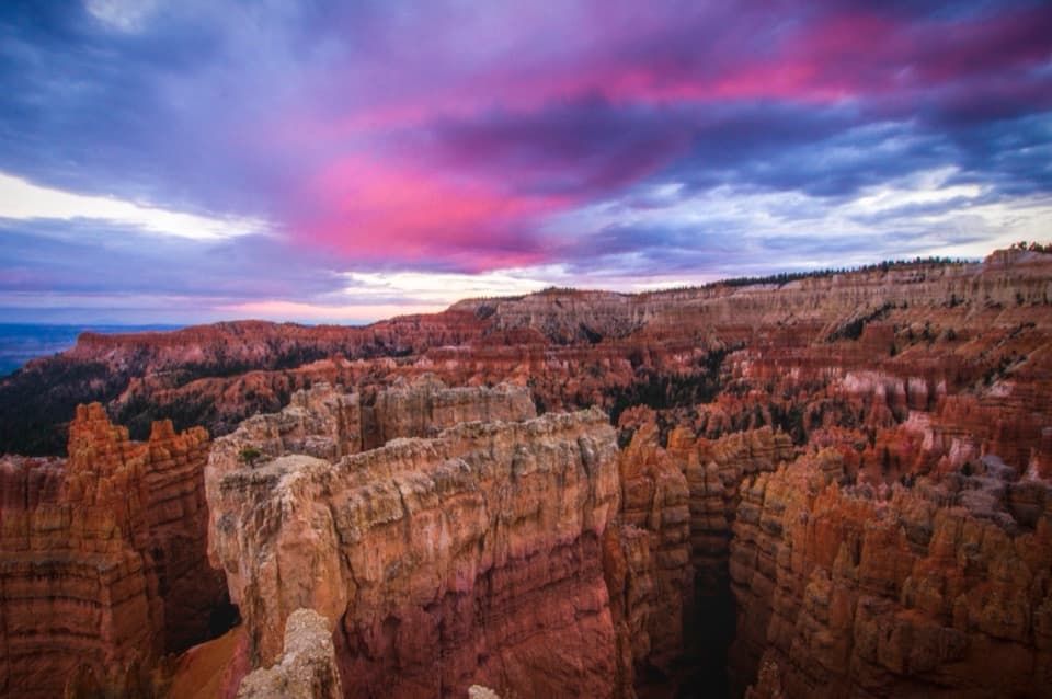
From the rim, the trail carries you through stages of hoodoo formation. Erosion cuts back the plateau into layered walls and fins; frost wedges open windows in the rock, and those openings widen until columns stand apart as hoodoos. The shape of the amphitheater is a live cross-section of that process, and the close views from the trail make the fragile columns easier to read than they are from an overlook. Stay on the tread and don’t climb the formations; the rock and slopes are crumbly.

Parking, water and rulesUse Sunrise Point parking or the shuttle stop.

Use Sunrise Point parking or the shuttle stop. The trailhead is reached by a well-worn path from the parking area; allow about 0.2 mile each way for that approach if you’re counting from your car. The lot can fill, and oversized vehicles are restricted there while the shuttle operates. The General Store near Sunrise Point has accessible restrooms and a water-fill station seasonally. There’s no separate trail fee, though park entrance fees may apply. Pets are not allowed on this unpaved trail; service animals are permitted. The natural terrain is not considered accessible.

Wildlife

Wildlife in Bryce Canyon

All Bryce Canyon wildlife maps

Sighting maps show where each species has been reported across Bryce Canyon. Wildlife moves, so no sighting is guaranteed.

Keep exploring

Near Queen's Garden Trail

See it all on the map

Trails that start nearby

Places near the trailhead

Parkwolf’s Bryce Canyon ranking

Top-rated trails in Bryce Canyon

All 24 trails
  1. 1Queen’s Garden / Navajo Combination LoopModerate · 2.9 mi
  2. 2Navajo Loop TrailModerate · 1.3 mi
  3. 3Fairyland Loop TrailChallenging · 8 mi
  4. 4Peekaboo Loop TrailChallenging · 5.5 mi
  5. 5Figure-8 CombinationChallenging · 6.4 mi
  6. 7The Rim TrailModerate · 5.5 mi

Take Parkwolf to Bryce Canyon.

The audio tour guide for the drive, plus offline maps, trails, and wildlife heatmaps for when the signal drops.

4.7 from 8,600+ ratings

Download Parkwolf on the App StoreGet Parkwolf on Google Play