Dava Way in Cairngorms National Park

Cairngorms National Park, SC

Dava Way

Walk the old railway across open moor to a seven-arch viaduct.

Length
38.2km
Time
11hr
Elev. change
299m
Difficulty
Moderate
  • Dogs allowed
  • High point 320 m
  • #119 of 260 in Cairngorms

Hear the audio tour

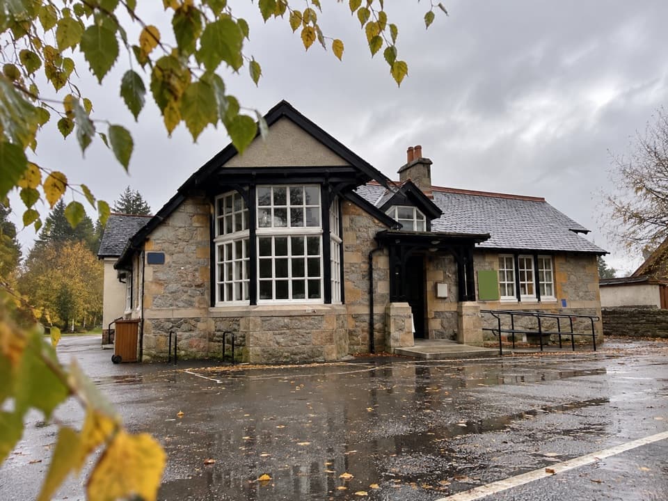
Grantown Square and Museum

Overview

About Dava Way

Why go

  • A long cross-country walk with very little steep climbing
  • Divie Viaduct and the changing moor, woods and farmland give the route real variety

Heads up

  • The 23.7-mile point-to-point distance needs a full day or staged planning
  • Some ballast and cuttings are rough or muddy, and the moor offers little shelter
The Dava Way is a 23.7-mile one-way walk from Grantown-on-Spey to Forres, mostly on the old Highland Railway trackbed with signed deviations. It climbs gradually from Grantown to about 320 m on Dava Moor, then descends through farmland and woods to Forres. The route gains only about 146 m, so steep climbing is not the challenge; it is the full-day distance, rough or muddy footing, and an exposed stretch of moor. Allow about 10–12 hours on foot, or split it into two or three stages. This suits walkers who want a long cross-country journey more than a summit day. Plan both ends before setting out; it is not a loop.
Parkwolf’s verdictIs this the walk for you?

Map & elevation

The route

Loading the Cairngorms map
Full map
Elevation21–320 m
TrailheadDava Way south endpoint, Grantown-on-Spey57.33087, -3.60814
Keep this map with you offline in the Parkwolf app

Plan your hike

Before you go

Parking

The signed south endpoint is in Grantown-on-Spey. No dedicated trail car park was confirmed at the endpoint; check town parking. The route finishes in Forres, so arrange transport between the ends before starting. Marked intermediate access points do not automatically mean parking is permitted.

Safety

Dava Moor is open and exposed with little shelter; old ballast and wet cuttings can be rough or muddy. The route crosses sporting estates, so heed shooting notices and keep dogs under control or on a short lead.

3 active Cairngorms alerts

  • CautionStorm Boelo high windsStorm Boelo will bring extremely windy weather to the Cairngorms; take extra care and limit time outdoors. - The Park Authority expects the very windy weather to last until Monday 26 October.Official details
  • ClosureGlenmore wildfire closures and dangerous treesWildfire damage has closed Allt Mor car park and the path to Sugarbowl/Utsi’s Bridge; keep out of the closed area.Official details
See all 3 alerts
A park ranger sits on a dash-mounted phone, talking, as Parkwolf’s Tour Guide plays “Army Cutworm Moths: A Grizzly Bear Buffet” on Grand Loop Road below Dunraven Pass in Yellowstone
Parkwolf Tour GuideThe highest, rockiest slopes around here are a summer buffet for grizzly bears.

Cairngorms Tour Guide

Your drive to Dava Way, narrated.

Parkwolf is a GPS audio tour guide for Cairngorms National Park. As you drive, it chimes in with what’s ahead: hidden gems, upcoming stops, history, geology, and wildlife, right through your car’s speakers.

See the Cairngorms audio tour

Recorded for this trailhead

Grantown Square and Museum
0:00 / 0:33
“You're coming up on Grantown's town square, with Grantown Museum tucked behind the Town House. I'd stop if you enjoy small local-history museums; this is a compact, seasonal visit rather than a large collection.”

Plays as you drive up to this trailhead in the Parkwolf Cairngorms Tour Guide.

More stories near here in the app

  • Anagach Woods' All Abilities Trail
  • When the Main Line Crossed Dava
  • A Twelve O’Clock Caber
  • Two Sides of a River Bend
  • 298 audio storiesacross Cairngorms’s roads, triggered by GPS as you drive
  • Wildlife heatmapsfor Red Deer, Reindeer, Osprey, and 13 more
  • Works offlinemaps, 260 trails, 90 places, and audio download before you lose signal
  • CarPlay readysimple controls built for the drive
★★★★★
“Fantastic app with many points of information… It’s great to just turn on while you’re driving and it gives you an audio tour of the national Park. We love it!!!!”
JMJamesApp Store review
Download Parkwolf on the App StoreGet Parkwolf on Google Play

4.7 from 8,600+ ratings

Trail guide

Hiking Dava Way

From Grantown to the open moorThe route leaves Grantown through a mix of town edge, farmland and pine woods, following much…

The route leaves Grantown through a mix of town edge, farmland and pine woods, following much of the old rail line. There are damp patches and narrower wooded paths, plus a short optional waterfall detour. Huntly’s Cave is another short side trip in the woods. The climb is gradual, but the surface changes between firm track, stones and wet ground.

Dava MoorThe high point is about 320 m on open Dava Moor.

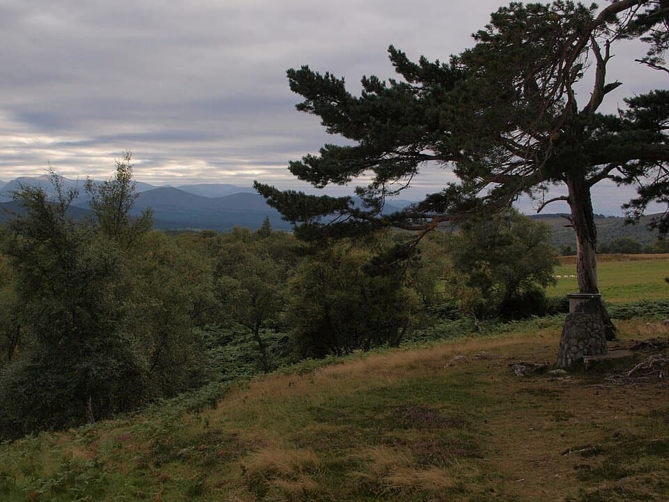
The high point is about 320 m on open Dava Moor. Heather and wide sky replace the woodland, with little shade or shelter when the weather turns. Look for Loch Mhic Leoìd and the grouse butts on the moor. A wooden Red Coat figure recalls a soldier travelling to the 1690 Battle of Cromdale. Keep an eye out for pine martens in the Grantown-side pine woods; sightings have been reported there, though they are never guaranteed.

The railway and the viaductThe old line threads through rough, sometimes muddy cuttings and softer woodland near Bogeny…

The old line threads through rough, sometimes muddy cuttings and softer woodland near Bogeny and Bantrach Wood. The standout landmark is Divie Viaduct, a seven-arch stone bridge 145 m long and 52 m above the River Divie. It was completed in 1863, the year the railway opened. Pause beyond the bridge for the view back across the arches and down to the river.

The last stretch to ForresPast Dunphail, the path crosses grazing land with many gates and fewer markers, then uses a…

Past Dunphail, the path crosses grazing land with many gates and fewer markers, then uses a signed diversion around a waterlogged cutting. Steps at Squirrel Neuk bridge make that short section less smooth-going. Farther on, an iron bridge crosses Altyre Burn and a high embankment opens views over farmland and the Burn of Mosset. Dallas Dhu distillery appears in the distance before the route reaches Forres.

Making a full traverse workThere are no refreshment stops along the route, so carry food and water.

There are no refreshment stops along the route, so carry food and water. Grantown and Forres have shops and places to eat; the café at Logie Steading requires leaving the trail near Peathillock Bridge. The route crosses sporting estates, so heed any shooting notices and keep dogs controlled or on a short lead. The marked access points do not guarantee permission to park, and intermediate parking is limited; check access and transport before choosing a shorter stage.

Wildlife

Wildlife in Cairngorms

All Cairngorms wildlife maps

Sighting maps show where each species has been reported across Cairngorms. Wildlife moves, so no sighting is guaranteed.

Keep exploring

Near Dava Way

See it all on the map

Trails that start nearby

Places near the trailhead

Parkwolf’s Cairngorms ranking

Top-rated trails in Cairngorms

All 260 trails
  1. 1Loch an Eilein CircuitEasy · 5 km
  2. 2Lairig GhruChallenging · 30.6 km
  3. 3Ben Macdui and Cairn Gorm CircuitChallenging · 19.8 km
  4. 4Loch Morlich TrailModerate · 5.6 km
  5. 5Meall a’ Bhuachaille CircuitChallenging · 8 km
  6. 6Loch Muick CircuitModerate · 12.5 km

Take Parkwolf to Cairngorms.

The audio tour guide for the drive, plus offline maps, trails, and wildlife heatmaps for when the signal drops.

4.7 from 8,600+ ratings

Download Parkwolf on the App StoreGet Parkwolf on Google Play