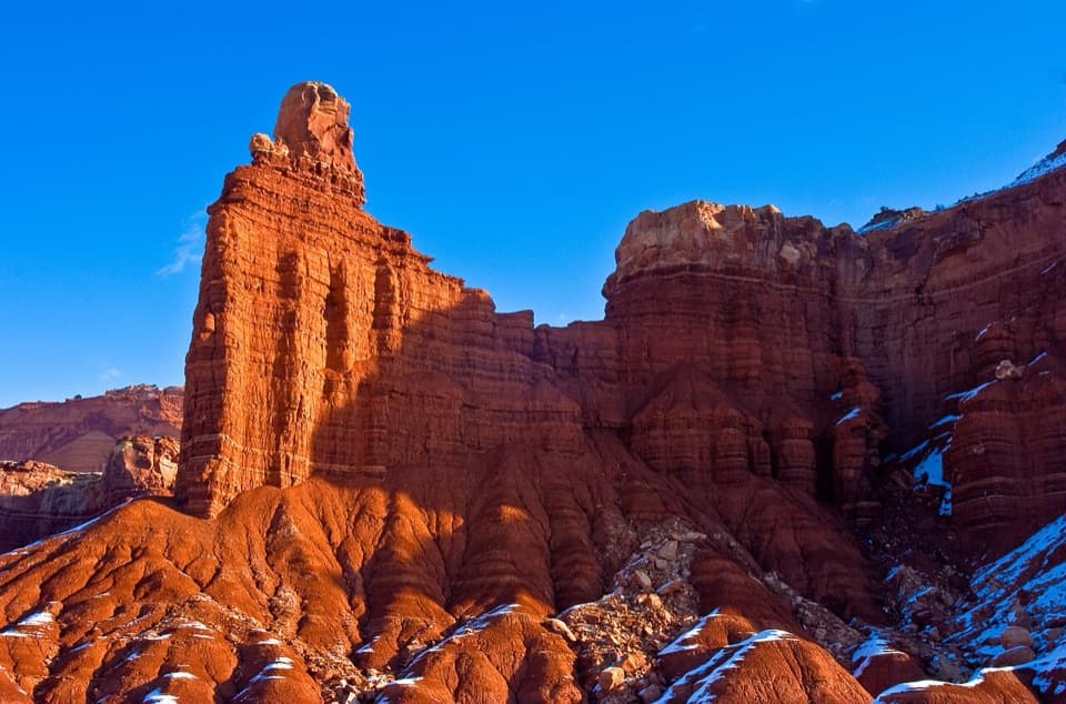
Sunset Point in Capitol Reef National Park

#7 of 45 sights in Capitol Reef

Sight · Capitol Reef National Park

Sunset Point

A short walk to sunset color on the Waterpocket Fold.

Photo: Wikimedia Commons
Type
Sight
Nearest trail
0.2 mi
Audio stories
7 nearby
  • Scenic viewpoint
  • Parking
  • Trailhead

Hear the audio tour

Sunset Point and Goosenecks

Overview

About Sunset Point

Why stop

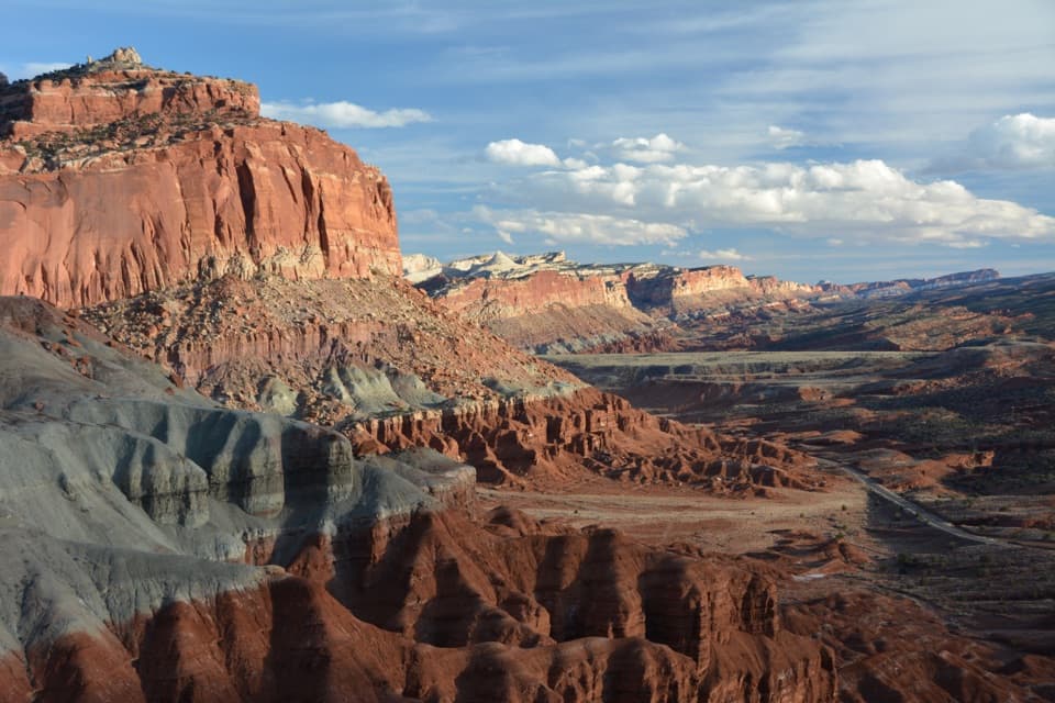
  • Wide east-facing panorama over the Waterpocket Fold.

Heads up

  • The shared lot can be busy around sunset.

Map

Where it is

Loading the Capitol Reef map
Full map
SightSunset Point38.29696, -111.29427
Keep this map with you offline in the Parkwolf app

Plan your stop

Before you go

2 active Capitol Reef alerts

  • CautionFlash-flood hazard in canyons and washesHeavy rains can cause sudden flooding in Capitol Reef’s canyons and washes; do not hike or drive through floodwater.Official details
  • CautionE. coli advisory for Fremont River and Sulphur CreekDo not swim in the Fremont River or Sulphur Creek or get water in your mouth: NPS reports elevated E. coli in both waterways, and Utah DEQ has issued a warning advisory. - DEQ reports Sulphur Creek E.Official details
Capitol Reef alerts
A park ranger sits on a dash-mounted phone, talking, as Parkwolf’s Tour Guide plays “Army Cutworm Moths: A Grizzly Bear Buffet” on Grand Loop Road below Dunraven Pass in Yellowstone
Parkwolf Tour GuideThe highest, rockiest slopes around here are a summer buffet for grizzly bears.

Capitol Reef Tour Guide

Your drive to Sunset Point, narrated.

Parkwolf is a GPS audio tour guide for Capitol Reef National Park. As you drive, it chimes in with what’s ahead: hidden gems, upcoming stops, history, geology, and wildlife, right through your car’s speakers.

See the Capitol Reef audio tour

Recorded for this place

Sunset Point and Goosenecks
0:00 / 0:27
“Sunset Point and Goosenecks are coming up, with two quite different views from the same parking area.”

Plays as you drive up to Sunset Point in the Parkwolf Capitol Reef Tour Guide.

More stories near here in the app

  • Panorama Point
  • Fluted Wall Viewpoint
  • The Castle Viewpoint
  • Chimney Rock
  • 116 audio storiesacross Capitol Reef’s roads, triggered by GPS as you drive
  • Wildlife heatmapsfor Bighorn Sheep, Mule Deer, Marmot, and 13 more
  • Works offlinemaps, 48 trails, 52 places, and audio download before you lose signal
  • CarPlay readysimple controls built for the drive
★★★★★
“Fantastic app with many points of information… It’s great to just turn on while you’re driving and it gives you an audio tour of the national Park. We love it!!!!”
JMJamesApp Store review
Download Parkwolf on the App StoreGet Parkwolf on Google Play

4.7 from 8,600+ ratings

Guide

More about Sunset Point

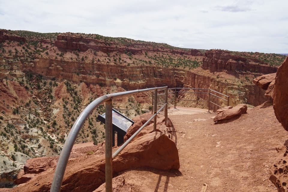
Why make the walkSunset Point is an exposed overlook above the Waterpocket Fold, reached by a short trail from a…

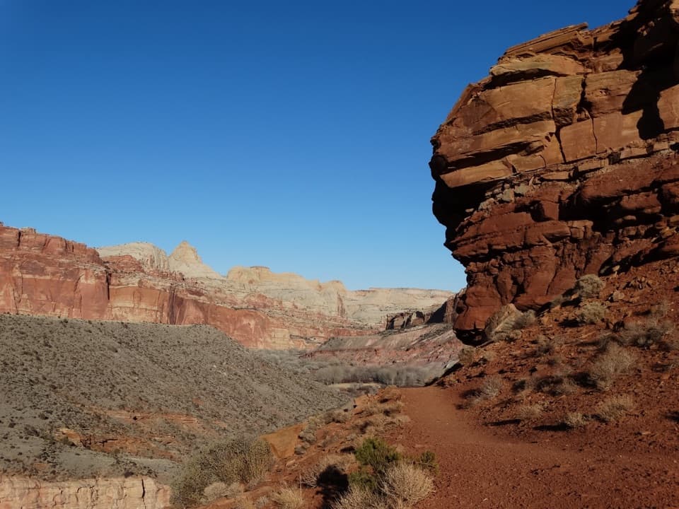
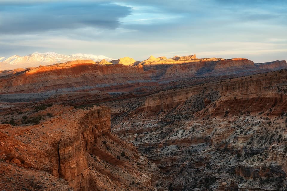
Sunset Point is an exposed overlook above the Waterpocket Fold, reached by a short trail from a dirt parking area at the end of Panorama Point Road. It gives you a wide look across the Fold’s east-facing cliffs and ridges. The walk is easy, so I’d keep it on the list if you have time to watch the light change across the landscape.

Getting out to the pointFrom UT 24, follow Panorama Point Road for about a mile on dirt to the shared parking area for…

From UT 24, follow Panorama Point Road for about a mile on dirt to the shared parking area for Sunset Point and Goosenecks Overlook. The Sunset Point trail is 0.4 mile one way, with less than 50 feet of elevation gain. That’s the National Park Service distance; some visitor accounts round it shorter. The path has some uneven, rocky footing, and the overlook is exposed. Pets aren’t allowed on the hiking trail.

Give the light time to changeSunset is the draw, but arrive with enough time to walk out and settle in before the last light.

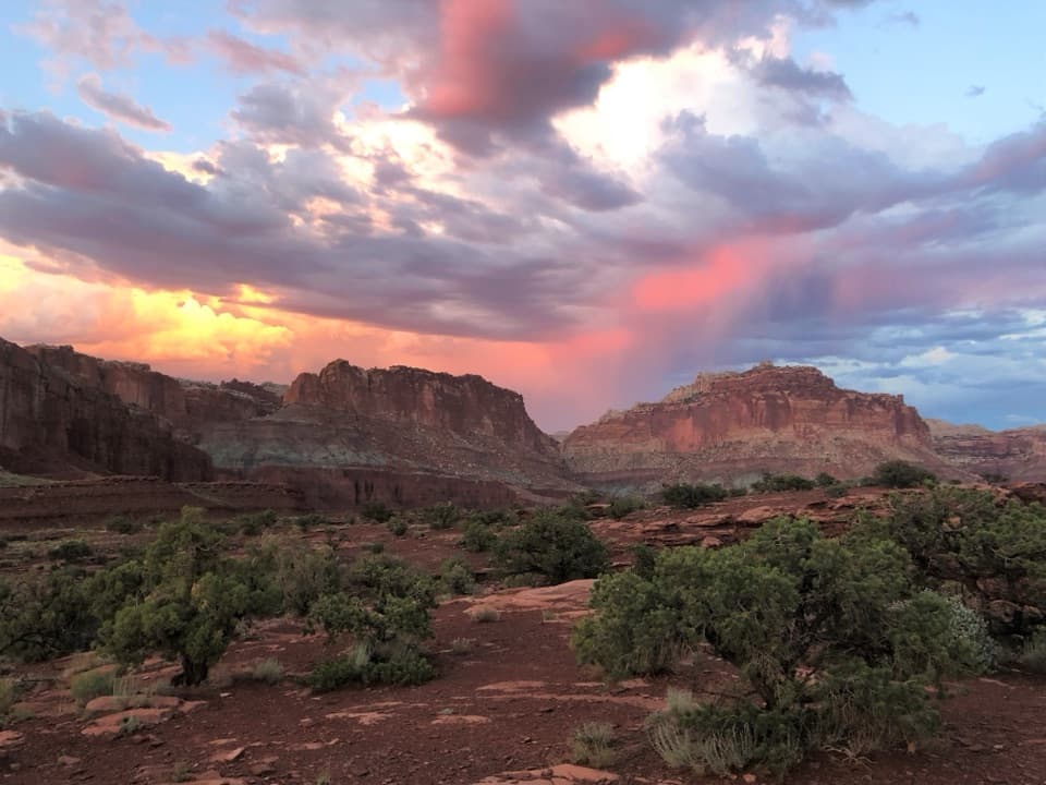
Sunset is the draw, but arrive with enough time to walk out and settle in before the last light. The east-facing cliffs of the Fold pick up warm color as the sun goes down. The shared dirt lot can be busy around sunset. Bring a headlamp if you stay until dark, since the return walk is after the light has gone.

What you can seeLook across the Fold for Chimney Rock and Ferns Nipple, with Boulder Mountain and Mount Ellen…

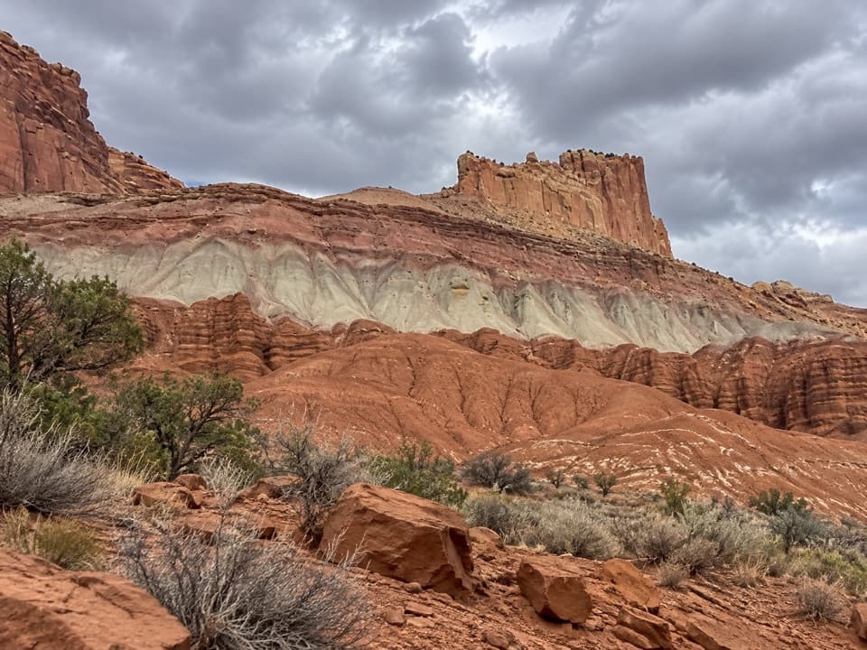
Look across the Fold for Chimney Rock and Ferns Nipple, with Boulder Mountain and Mount Ellen farther out. Mount Ellen is the high point of the Henry Mountains. A wide frame that holds the ridged Fold and the distant mountains gives the view its scale; zooming in on one cliff brings out the bands of color.

How the Fold got its shapeThe Waterpocket Fold is a nearly 100-mile bend in the rock layers.

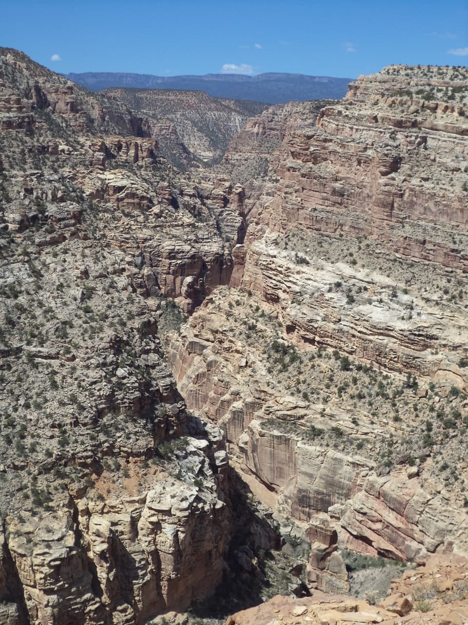
The Waterpocket Fold is a nearly 100-mile bend in the rock layers. It formed about 50 to 70 million years ago, when movement along a buried fault tilted and lifted the layers, raising the western side by more than 7,000 feet relative to the east. Erosion has since cut cliffs, domes, and canyons through the uplift.

Water also wears shallow pockets into the sandstone. Those waterpockets are the reason for the Fold’s name, and they’re part of the same slow process still shaping the ridges you see from the point.

Wildlife

Wildlife in Capitol Reef

All Capitol Reef wildlife maps

Sighting maps show where each species has been reported across Capitol Reef. Wildlife moves, so no sighting is guaranteed.

Keep exploring

Near Sunset Point

See it all on the map

Trails nearby

More stops nearby

Parkwolf’s Capitol Reef ranking

Top sights in Capitol Reef

All 52 places
  1. 1Hickman BridgeSight
  2. 2Gifford HomesteadSight
  3. 3Fremont PetroglyphsSight
  4. 4Cassidy ArchSight
  5. 5Temples of the Sun and MoonSight
  6. 6Fruita OrchardsSight

Take Parkwolf to Capitol Reef.

The audio tour guide for the drive, plus offline maps, trails, and wildlife heatmaps for when the signal drops.

4.7 from 8,600+ ratings

Download Parkwolf on the App StoreGet Parkwolf on Google Play