Hamburger Rocks and Muley Tanks in Capitol Reef National Park

Capitol Reef National Park, UT

Hamburger Rocks and Muley Tanks

Long, unmarked Halls Creek walk to red hoodoos and Muley Tanks.

Photo: National Park Service
Length
11.7mi
Time
6hr
Elev. change
262ft
Difficulty
Moderate
  • No dogs
  • High point 4,865 ft

Hear the audio tour

Headquarters Canyon

Overview

About Hamburger Rocks and Muley Tanks

Why go

  • Distinctive red hoodoos on a pale slickrock slope
  • Muley Tanks adds a short, memorable detour

Heads up

  • 11.7 miles in mostly exposed desert with little shade
  • Unmarked backcountry route and unreliable water require careful planning

Map & elevation

The route

Loading the Capitol Reef map
Full map
Elevation4,603–4,865 ft
TrailheadThe Post Corral / Lower Muley Twist Trailhead37.82678, -110.97870
Keep this map with you offline in the Parkwolf app

Plan your hike

Before you go

Parking

The Post Corral / Lower Muley Twist Trailhead, reached by a short dirt spur from Burr Trail Road. Road access can require high clearance and the spur may be rough after precipitation; the park advises checking access conditions before driving in.

Safety

This unmaintained backcountry route is unmarked in places; do not rely on cairns alone. The long walk is exposed to desert heat, water is unreliable, and the final climb crosses open slickrock. Flash floods are possible in the regional canyon drainages during the July–September monsoon season. Treat any natural water. Pets are prohibited in the backcountry; overnight camping requires a permit.

2 active Capitol Reef alerts

  • CautionFlash-flood hazard in canyons and washesHeavy rains can cause sudden flooding in Capitol Reef’s canyons and washes; do not hike or drive through floodwater.Official details
  • CautionE. coli advisory for Fremont River and Sulphur CreekDo not swim in the Fremont River or Sulphur Creek or get water in your mouth: NPS reports elevated E. coli in both waterways, and Utah DEQ has issued a warning advisory. - DEQ reports Sulphur Creek E.Official details
Capitol Reef alerts
A park ranger sits on a dash-mounted phone, talking, as Parkwolf’s Tour Guide plays “Army Cutworm Moths: A Grizzly Bear Buffet” on Grand Loop Road below Dunraven Pass in Yellowstone
Parkwolf Tour GuideThe highest, rockiest slopes around here are a summer buffet for grizzly bears.

Capitol Reef Tour Guide

Your drive to Hamburger Rocks and Muley Tanks, narrated.

Parkwolf is a GPS audio tour guide for Capitol Reef National Park. As you drive, it chimes in with what’s ahead: hidden gems, upcoming stops, history, geology, and wildlife, right through your car’s speakers.

See the Capitol Reef audio tour

Recorded for this trailhead

Headquarters Canyon
0:00 / 0:26
“Headquarters Canyon's trailhead is coming up, for a walk through a short slot into a greener canyon with tall, color-streaked walls. Allow two to three hours for the roughly two-point-six-mile round trip.”

Plays as you drive up to this trailhead in the Parkwolf Capitol Reef Tour Guide.

More stories near here in the app

  • Surprise Canyon
  • A Ranger Station Without Water
  • Lower Muley Twist Canyon
  • Strike Valley Overlook and Upper Muley Twist Access
  • 116 audio storiesacross Capitol Reef’s roads, triggered by GPS as you drive
  • Wildlife heatmapsfor Bighorn Sheep, Mule Deer, Marmot, and 13 more
  • Works offlinemaps, 48 trails, 52 places, and audio download before you lose signal
  • CarPlay readysimple controls built for the drive
★★★★★
“Fantastic app with many points of information… It’s great to just turn on while you’re driving and it gives you an audio tour of the national Park. We love it!!!!”
JMJamesApp Store review
Download Parkwolf on the App StoreGet Parkwolf on Google Play

4.7 from 8,600+ ratings

Trail guide

Hiking Hamburger Rocks and Muley Tanks

What this hike isHamburger Rocks and Muley Tanks is an 11.

Hamburger Rocks and Muley Tanks is an 11.7-mile out-and-back from The Post Corral, following Halls Creek to two short sandstone side trips. It is a long desert day on an unmaintained backcountry route, not a signed trail. Set aside about six hours, and longer if you need extra time to navigate or explore. The park says route-finding and map-reading skills are critical.

Follow Halls Creek carefullyA short walking access leads south from the corral to the open Halls Creek drainage.

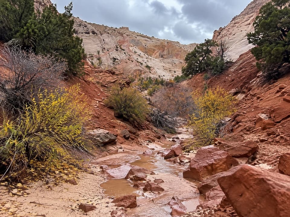
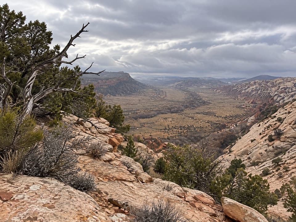
A short walking access leads south from the corral to the open Halls Creek drainage. From there, the route follows sandy ground, old road traces and worn footpaths with little shade. You reach the mouth of Lower Muley Twist Canyon about 4.7 miles in, then continue roughly another mile toward the rocks. The route is easy to lose in places: the Hamburger Rocks spur is unmarked, and cairns can be absent or misleading. Carry a current map and confirm the approach before leaving the main corridor.

The rocks and tanksA sign marks the short detour to Muley Tanks.

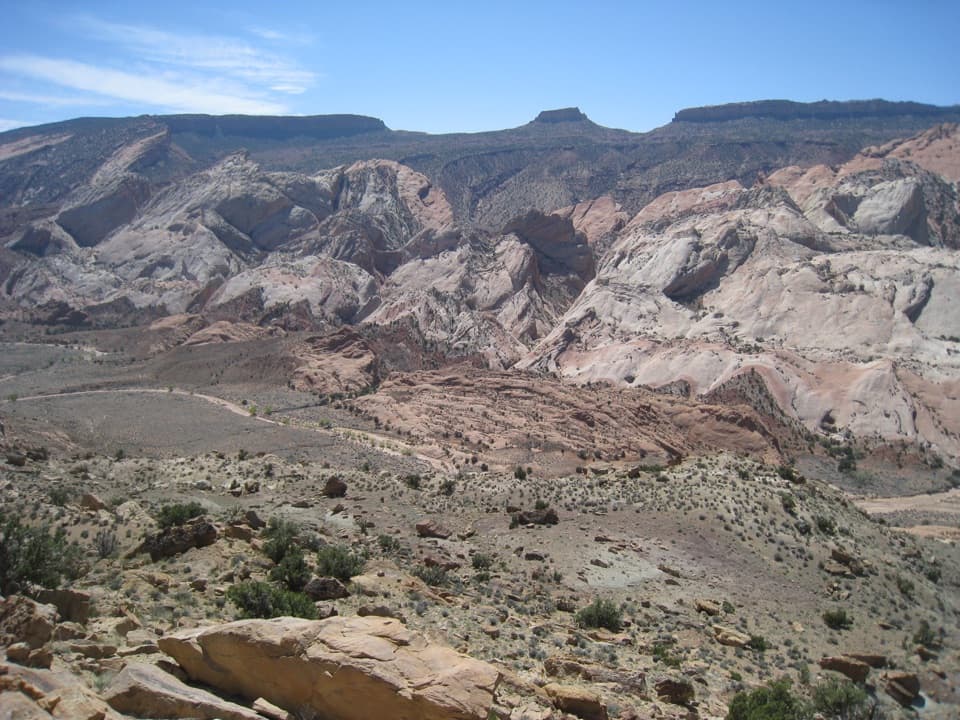
A sign marks the short detour to Muley Tanks. The slickrock potholes lie about 200 yards north of Hamburger Rocks. The rocks are low, dark-red hoodoos perched on a pale Navajo sandstone slope; the red caps stand out clearly against the light stone. The final climb leaves the main route, crosses a sandy wash and goes west up the open slope. Water may collect in the tanks, but it is unreliable and must be purified; do not plan on it as your supply.

Lower Muley's neighboring historyThe route passes the mouth of Lower Muley Twist Canyon but does not take its longer loop.

The route passes the mouth of Lower Muley Twist Canyon but does not take its longer loop. The park says Mormon pioneers used that canyon as a wagon route from 1881 to 1884 while traveling toward San Juan County. Its name comes from the old idea that the canyon was narrow enough to twist a mule through.

Access and desert conditionsReach The Post Corral / Lower Muley Twist Trailhead by the short dirt spur off Burr Trail Road.

Reach The Post Corral / Lower Muley Twist Trailhead by the short dirt spur off Burr Trail Road. The access roads are remote: the park describes Notom-Bullfrog Road as usually passable for passenger cars when dry, while Burr Trail may require high clearance at times; the spur can be rough after rain. There is no confirmed food, toilet or potable-water service at the trailhead. Summer heat can be extreme, and flash flooding is a concern in the region's canyons during the usual July–September monsoon season. Pets are not permitted on hiking trails or in the backcountry. An overnight backcountry permit is required for camping.

Wildlife

Wildlife in Capitol Reef

All Capitol Reef wildlife maps

Sighting maps show where each species has been reported across Capitol Reef. Wildlife moves, so no sighting is guaranteed.

Parkwolf’s Capitol Reef ranking

Top-rated trails in Capitol Reef

All 48 trails
  1. 1Hickman Bridge TrailModerate · 1.8 mi
  2. 2Cassidy Arch TrailChallenging · 3.4 mi
  3. 3Grand Wash TrailEasy · 4.4 mi
  4. 4Capitol Gorge TrailEasy · 2 mi
  5. 5Navajo Knobs TrailChallenging · 9.4 mi
  6. 6Rim Overlook TrailChallenging · 4.6 mi

Take Parkwolf to Capitol Reef.

The audio tour guide for the drive, plus offline maps, trails, and wildlife heatmaps for when the signal drops.

4.7 from 8,600+ ratings

Download Parkwolf on the App StoreGet Parkwolf on Google Play