Parking
Use the signed dirt pullout on the west side of Notom–Bullfrog Road, 34.3 road miles south of Highway 24. Continue straight at the Burr Trail junction; the pullout is about 1.8 miles farther south.
Capitol Reef National Park, UT
A short desert walk into a narrow canyon and spiraling pour-off.
Overview
Surprise Canyon Route is a 2-mile round-trip out-and-back from Notom–Bullfrog Road to the base of a spiraling pour-off in the Waterpocket Fold. Allow 1–2 hours. It's a short, visually rewarding backcountry walk, but don't expect a maintained path: the open approach is cairned, then the route drops steeply into a rocky ravine. If you want a quick canyon outing and are comfortable keeping your bearings, this is a good one. The usual turnaround is the pour-off; the much rougher climb above it is a separate option and isn't part of this route.
 Parkwolf’s verdictIs this the hike for you?
Map & elevation
Plan your hike

The highest, rockiest slopes around here are a summer buffet for grizzly bears.
Capitol Reef Tour Guide
Parkwolf is a GPS audio tour guide for Capitol Reef National Park. As you drive, it chimes in with what’s ahead: hidden gems, upcoming stops, history, geology, and wildlife, right through your car’s speakers.
See the Capitol Reef audio tourRecorded for this trailhead
Surprise Canyon“You're coming up on the Surprise Canyon trailhead, where a short backcountry hike leads between colorful sandstone walls to a spiraling pour-off. Allow one to two hours for the two-mile round trip.”
Plays as you drive up to this trailhead in the Parkwolf Capitol Reef Tour Guide.
More stories near here in the app
“Fantastic app with many points of information… It’s great to just turn on while you’re driving and it gives you an audio tour of the national Park. We love it!!!!”


Trail guide
From the signed pullout, cross a broad grassy drainage and the dry wash of Halls Creek. Bear slightly left over a small grassy hill, then continue west among colorful sandstone outcrops. Cattle tracks branch near the hill and the cairns can be sparse, so keep an eye on the route as you go and remember the line back to the road.
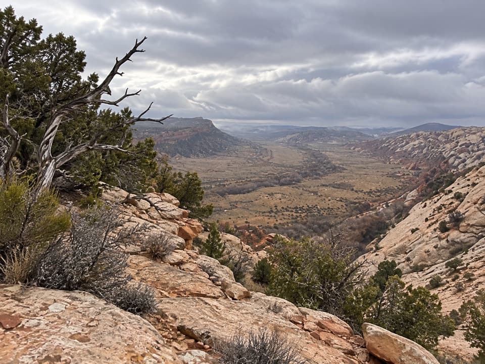
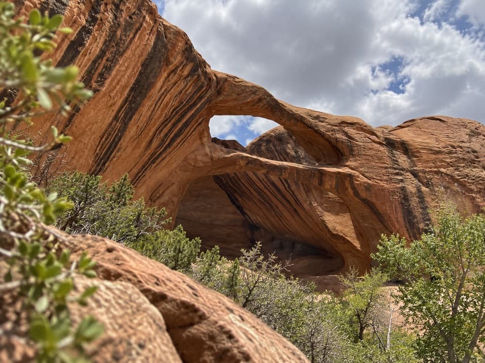
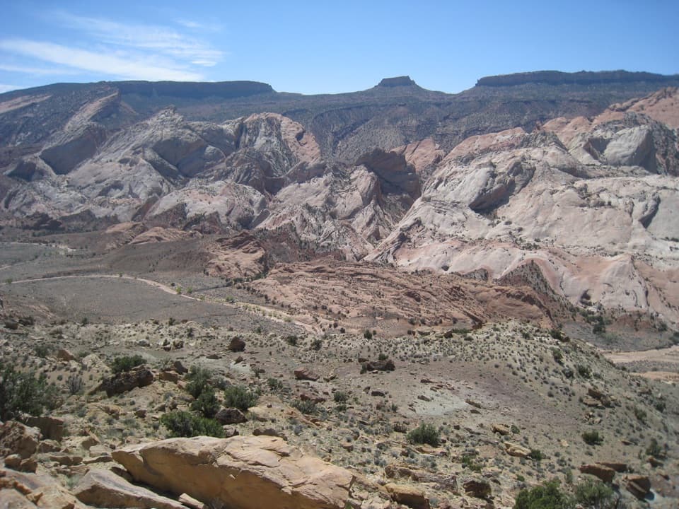
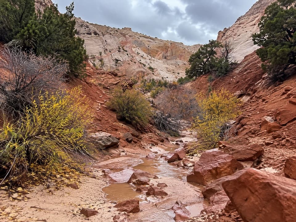
The trail drops from the outcrops into a rocky ravine. From there, follow the wash bottom into a deep, narrowing canyon. Expect sandy stretches, slickrock and loose rock rather than an even path. The canyon cuts through the Waterpocket Fold's stacked sedimentary layers; pale walls and pink and orange bands make the colors change as the route turns.
The standard hike ends below a spiraling pour-off about a mile from the road. Stop there: the left-side bypass enters the upper canyon, but boulder jams and steep, crumbling slopes make it a much harder continuation. For a photo, include some of the wash below the walls so the image shows the tight canyon as well as its colors.
The signed dirt pullout is on the west side of Notom–Bullfrog Road, 34.3 road miles south of Highway 24; continue straight at the Burr Trail junction, then go about 1.8 miles farther. The road becomes maintained dirt south of its first 15 miles, so check current park road conditions before driving it. Spring and fall are the best seasons listed for this district. Flash floods are most common July through September, and a narrow canyon is no place to be when storms threaten. There is no water on the route, and cell service in the area is unreliable or absent; bring your water from the start.
Wildlife
 50 sightingsBighorn SheepMost seen around 6 PMSighting map
 322 sightingsMule DeerMost seen around 6 PMSighting map
 70 sightingsMarmotMost seen around 7 AMSighting map
 13 sightingsCottontail RabbitMost seen around 7 PMSighting map
 33 sightingsTurkeyMost seen around 6 AMSighting map
 14 sightingsRavenMost seen around 9 AMSighting map
Sighting maps show where each species has been reported across Capitol Reef. Wildlife moves, so no sighting is guaranteed.
Keep exploring
 EasyHeadquarters Canyon Route2.6 mi · 2.5 hr · 0.5 mi awayA sandy approach opens into a short, striped slot canyon.
 ModerateHamburger Rocks and Muley Tanks11.7 mi · 6 hr · 1 mi awayLong, unmarked Halls Creek walk to red hoodoos and Muley Tanks.
 ChallengingLower Muley Twist Canyon — Post Loop15.4 mi · 10 hr · 1 mi awayA remote 15.4-mile loop of soaring alcoves and a severe exposed climb.
 EasyCottonwood Tanks3.3 mi · 1.5 hr · 1 mi awayAn old wagon track winds to pools below pale sandstone cliffs.ChallengingLower Muley Twist Canyon5.9 mi · 5 hr · 2.2 mi awayA remote canyon crossing with a steep exposed climb over the Fold.
 ChallengingUpper Muley Twist Canyon9 mi · 7 hr · 4.4 mi awayA 9-mile canyon approach to a steep, exposed rim loop.
 ModerateStrike Valley Overlook0.9 mi · 45 min · 4.4 mi awayA short slickrock climb to 150 million years of geology.
 ChallengingHalls Creek Narrows22.4 mi · 3.5 days · 8.9 mi awayA remote 22.4-mile backpack through a water-filled sandstone canyon.
Parkwolf’s Capitol Reef ranking
The audio tour guide for the drive, plus offline maps, trails, and wildlife heatmaps for when the signal drops.