Parking
Use the Hickman Bridge-Rim Overlook-Navajo Knobs Trailhead off UT-24. Its lot serves several popular hikes and can fill during busy hours; roadside parking can be unsafe. Pit toilets are available at the trailhead.

#6 of 48 trails in Capitol Reef
Capitol Reef National Park, UT
Fruita and the Waterpocket Fold spread below this steep rim climb.
Overview
Rim Overlook Trail is a 4.6-mile out-and-back from the shared Hickman Bridge trailhead to a sandstone rim high above Fruita. Expect about 1,100 feet of climbing, steep steps and switchbacks, then repeated drops into washes and climbs back out. Allow 3 to 4 hours. I’d pick this for the long view over Fruita, the Fremont River valley, the Waterpocket Fold and the Henry Mountains; the payoff is broad, but you earn it all the way there.
 Parkwolf’s verdictIs it worth the climb?
Map & elevation
Plan your hike

The highest, rockiest slopes around here are a summer buffet for grizzly bears.
Capitol Reef Tour Guide
Parkwolf is a GPS audio tour guide for Capitol Reef National Park. As you drive, it chimes in with what’s ahead: hidden gems, upcoming stops, history, geology, and wildlife, right through your car’s speakers.
See the Capitol Reef audio tourRecorded for this trailhead
Hickman Bridge“You're approaching the Hickman Bridge trailhead, where a rocky hike leads to a 133-foot sandstone span.”
Plays as you drive up to this trailhead in the Parkwolf Capitol Reef Tour Guide.
More stories near here in the app
“Fantastic app with many points of information… It’s great to just turn on while you’re driving and it gives you an audio tour of the national Park. We love it!!!!”


Trail guide
Start by following the Fremont River east. After about a tenth of a mile, the path climbs on steps and switchbacks before easing near a junction roughly a quarter-mile from the trailhead. Turn right for Rim Overlook; the left branch goes to Hickman Bridge. The trails share the approach, then split into separate hikes.
Beyond the junction, the route skirts pale drainages and crosses four washes, with repeated climbs of roughly 100 to 200 feet between them. Expect sand and slickrock, with scattered pinyon and juniper. Cairns mark the way where bare rock makes the tread harder to see. The last climb to the rim is the toughest. Turn around at Rim Overlook; Navajo Knobs continues past it and makes a much longer, more exposed hike.
From the cliff-edge shelf, Fruita’s orchards, historic buildings and campground sit below, with Cohab Canyon, the Henry Mountains and the Waterpocket Fold beyond. There’s a steep drop off the rim, so give the edge room. For a photo, include a bit of the near rim with Fruita and the tilted rock layers behind it; that keeps the depth in the frame.
The Waterpocket Fold is a nearly 100-mile bend in the rock layers. A buried fault moved again 50 to 70 million years ago as the Rocky Mountains were forming, lifting the west side by more than 7,000 feet; later erosion exposed the folded layers. “Reef” refers to the steep ridges that once made travel across this country difficult.
On the shared lower trail, look up to a Fremont granary built into the Kayenta cliffs. Fremont people stored corn, beans, squash and gathered foods there between about 300 and 1300 CE. Don’t leave the trail to get closer; the site and surrounding ground are fragile.
Spring and fall are the mildest seasons for hiking here. There’s little shade on this route and no drinking water at the trailhead; summer temperatures can approach 100°F. Pit toilets are at the shared trailhead. The parking area serves Hickman Bridge, Rim Overlook and Navajo Knobs, and can fill during busy hours. Arrive early and don’t use unsafe roadside parking. Pets aren’t allowed on the trail.
Hickman Bridge is a separate branch from the same trailhead and reaches the natural bridge after 0.9 mile one way. It’s the better pick if you want a shorter walk with a clear destination; Rim Overlook is the bigger climb and the broader valley view.
Wildlife
 50 sightingsBighorn SheepMost seen around 6 PMSighting map
 322 sightingsMule DeerMost seen around 6 PMSighting map
 70 sightingsMarmotMost seen around 7 AMSighting map
 13 sightingsCottontail RabbitMost seen around 7 PMSighting map
 33 sightingsTurkeyMost seen around 6 AMSighting map
 14 sightingsRavenMost seen around 9 AMSighting map
Sighting maps show where each species has been reported across Capitol Reef. Wildlife moves, so no sighting is guaranteed.
Keep exploring
 ChallengingNavajo Knobs Trail9.4 mi · 7 hr · At the trailheadA strenuous rim hike to a tiny summit and a huge panorama.
 ModerateHickman Bridge Trail1.8 mi · 1.5 hr · At the trailheadA moderate climb to a 133-foot bridge and a loop beneath it.
 ChallengingFrying Pan Trail4.4 mi · 4 hr · At the trailheadA tough mesa crossing with its best views behind you.
 EasyFremont Petroglyph Boardwalks0.4 mi · 20 min · 0.8 mi awayTwo wooden boardwalks reveal Fremont rock art.
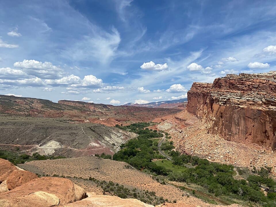 ModerateCohab Canyon Trail1.7 mi · 1.5 hr · 1.1 mi awayA steep Fruita climb opens into a sculpted sandstone canyon.
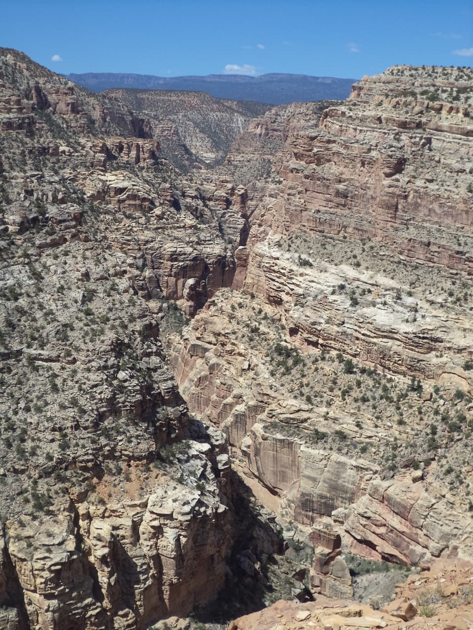 ChallengingFremont Gorge Overlook Trail4.6 mi · 3 hr · 1.1 mi awayA mesa climb ends above the Fremont River, 800 feet below.
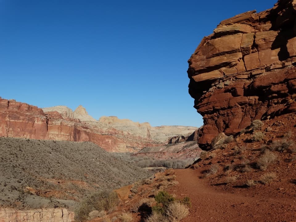 ModerateFremont River Trail2 mi · 1.5 hr · 1.3 mi awayRiver walk, a steep climb, and broad views over Fruita.
 ChallengingCassidy Arch Trail3.4 mi · 3.5 hr · 1.8 mi awayA steep climb to a walkable arch above Grand Wash.
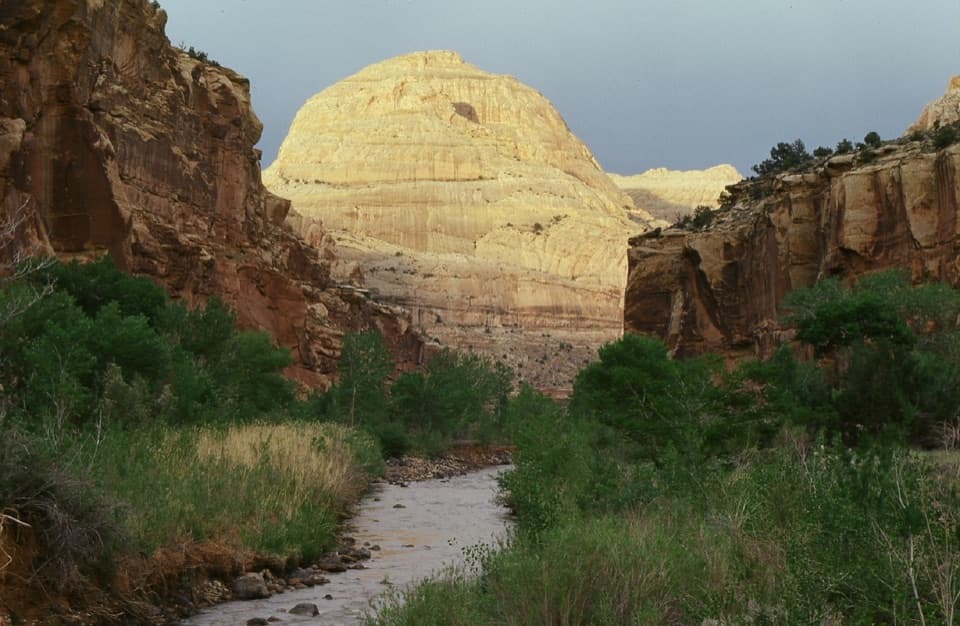 Sight · At the trailheadCapitol DomeSee the sandstone formation that helped give Capitol Reef its name.
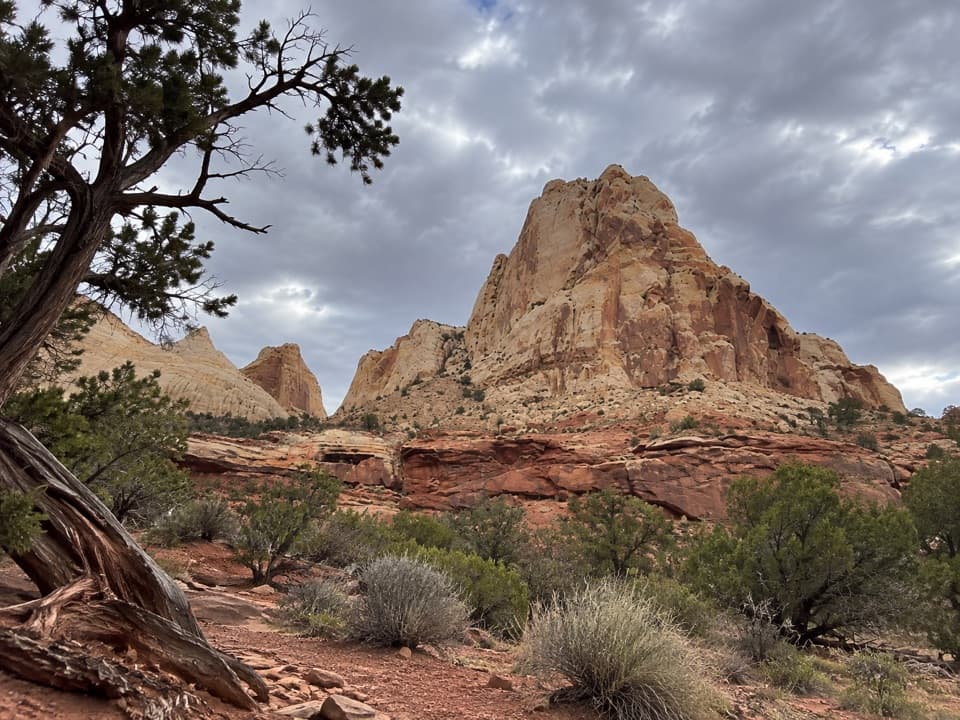 Sight · 0.3 mi awayNavajo Dome ViewpointA roadside look at Navajo Dome above the Waterpocket Fold.Sight · 0.4 mi awayHickman BridgeA 133-foot bridge rewards a rocky climb past Fremont remains.
 Sight · 0.5 mi awayNorth Fruita OverlookA steep climb pays off in a sweeping canyon view.Sight · 0.7 mi awaySouth Fruita OverlookThe layers of the Waterpocket Fold make sense from above Fruita.Sight · 0.8 mi awayFremont PetroglyphsFind tall human figures and geometric bighorns across the red wall.
 Picnic area · 1.1 mi awayFruita Picnic AreaA shaded lawn makes a welcome pause in Fruita's red-rock valley.
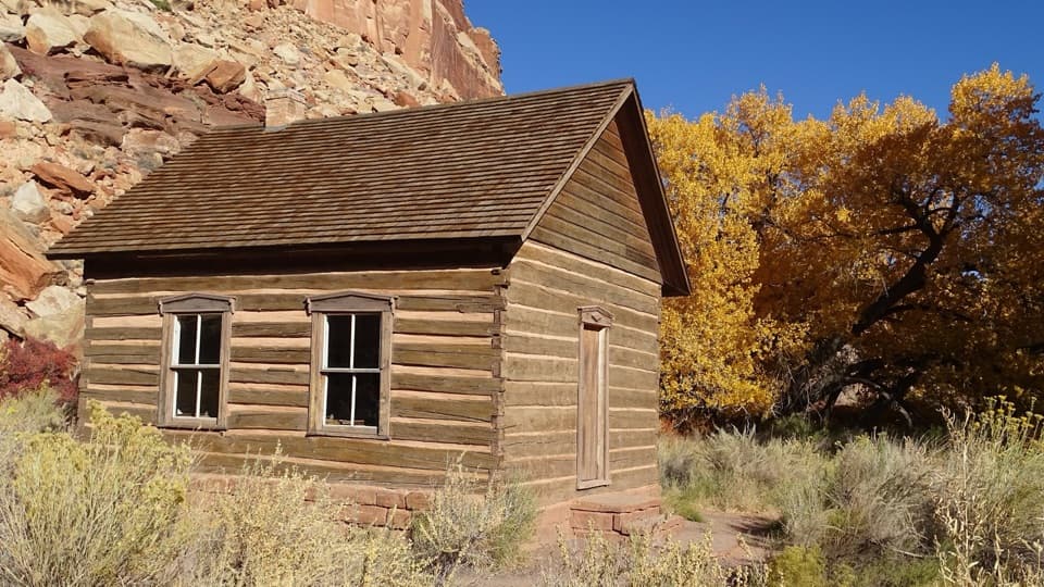 Sight · 1.1 mi awayFruita SchoolhouseA restored classroom, seen through its windows, tells a small-town story.
Parkwolf’s Capitol Reef ranking
The audio tour guide for the drive, plus offline maps, trails, and wildlife heatmaps for when the signal drops.

