Parking
Follow Notom-Bullfrog Road south from UT-24 for about 34.8 miles to the signed sandy pullout just north of The Post side road. The roadside parking area is small; the southern approach is unpaved and weather-sensitive.

Capitol Reef National Park, UT
A sandy approach opens into a short, striped slot canyon.
Overview
Map & elevation
Plan your hike

The highest, rockiest slopes around here are a summer buffet for grizzly bears.
Capitol Reef Tour Guide
Parkwolf is a GPS audio tour guide for Capitol Reef National Park. As you drive, it chimes in with what’s ahead: hidden gems, upcoming stops, history, geology, and wildlife, right through your car’s speakers.
See the Capitol Reef audio tourRecorded for this trailhead
Headquarters Canyon“Headquarters Canyon's trailhead is coming up, for a walk through a short slot into a greener canyon with tall, color-streaked walls. Allow two to three hours for the roughly two-point-six-mile round trip.”
Plays as you drive up to this trailhead in the Parkwolf Capitol Reef Tour Guide.
More stories near here in the app
“Fantastic app with many points of information… It’s great to just turn on while you’re driving and it gives you an audio tour of the national Park. We love it!!!!”


Trail guide
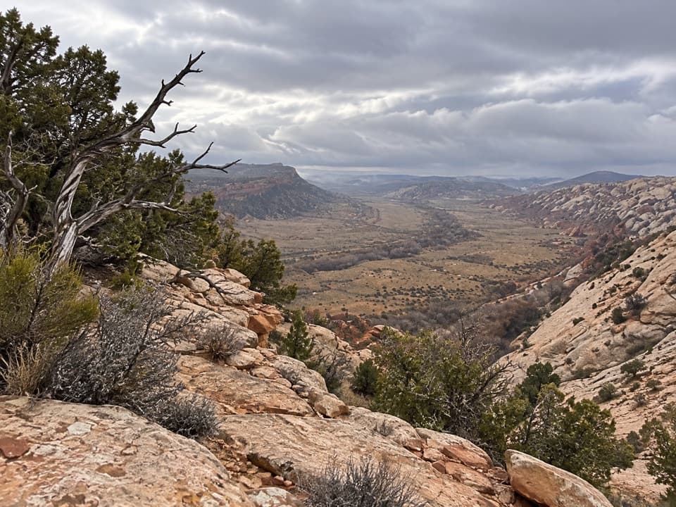
Headquarters Canyon is a sandy 2.6-mile out-and-back from the signed Waterpocket District trailhead to a sandstone ramp at the back of the canyon. Allow 2–3 hours. You cross open sagebrush and dry washes, then enter a short slot that opens into a greener canyon below tall, color-streaked walls. Published totals for the same walk range from 2.25 to 3.2 miles round trip. The mapped path measures about 1.29 miles from the start to the ramp; walking it back makes about 2.6 miles. The sandy washes can make the tread less obvious than a built trail.
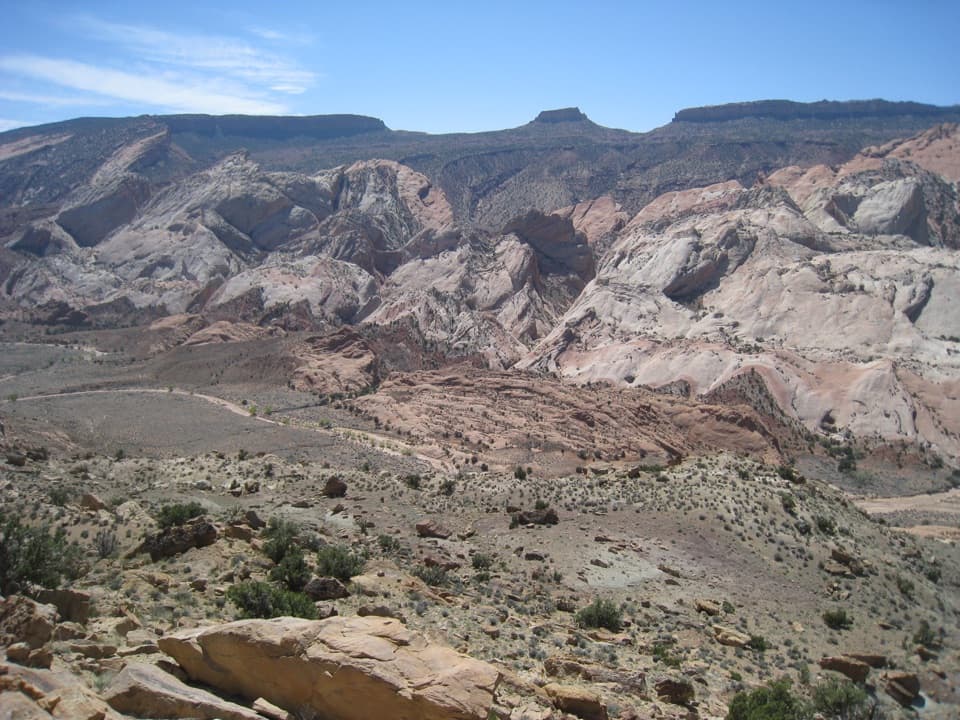
From the roadside start, head west across the sagebrush toward a pink-striped sandstone dome. The route crosses the dry Halls Creek drainage, skirts orange Entrada sandstone outcrops, then crosses more washes before reaching a wide, stony gulch. When you enter the wash, turn right and follow it north into the canyon. A missed cairn can send you onto the reef instead of into the wash; markers aren't maintained, so don't rely on them as your only way to navigate.
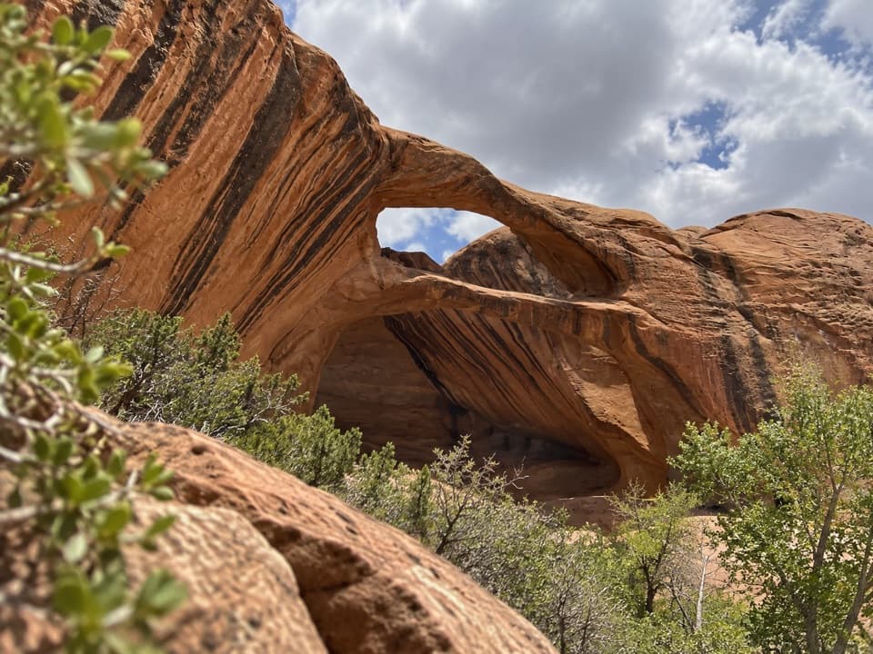
Less than a mile from the start, the gorge tightens into a short slot that usually has no major obstacles. It opens into a greener stretch with high Navajo sandstone walls streaked in color, then narrows again at the steep sandstone ramp in the Kayenta formation. That's the turnaround. A six-foot dryfall above the ramp is passable to agile climbers, but climbing it isn't needed to finish this hike; a much higher dryfall soon stops further progress.
The approach crosses orange Entrada sandstone, the canyon walls are Navajo sandstone, and the final sloping ramp is Kayenta. The route packs several sedimentary layers of the Waterpocket Fold into a short walk. In the slot, look back toward the opening for the striped walls framing a slice of sky.
The signed sandy pullout is just north of The Post side road, about 34.8 miles south of UT-24 on Notom-Bullfrog Road. Parking is small, and the southern approach is unpaved and weather-sensitive. Spring and fall are the preferred seasons for this district. These routes are unmaintained and route markers may be absent or misleading. Pets aren't allowed on trails or in the park backcountry; an overnight backcountry permit is required for camping, not for this day hike.
Wildlife
 50 sightingsBighorn SheepMost seen around 6 PMSighting map
 322 sightingsMule DeerMost seen around 6 PMSighting map
 70 sightingsMarmotMost seen around 7 AMSighting map
 13 sightingsCottontail RabbitMost seen around 7 PMSighting map
 33 sightingsTurkeyMost seen around 6 AMSighting map
 14 sightingsRavenMost seen around 9 AMSighting map
Sighting maps show where each species has been reported across Capitol Reef. Wildlife moves, so no sighting is guaranteed.
Keep exploring
 ModerateHamburger Rocks and Muley Tanks11.7 mi · 6 hr · 0.5 mi awayLong, unmarked Halls Creek walk to red hoodoos and Muley Tanks.
 ChallengingLower Muley Twist Canyon — Post Loop15.4 mi · 10 hr · 0.5 mi awayA remote 15.4-mile loop of soaring alcoves and a severe exposed climb.
 EasyCottonwood Tanks3.3 mi · 1.5 hr · 0.5 mi awayAn old wagon track winds to pools below pale sandstone cliffs.
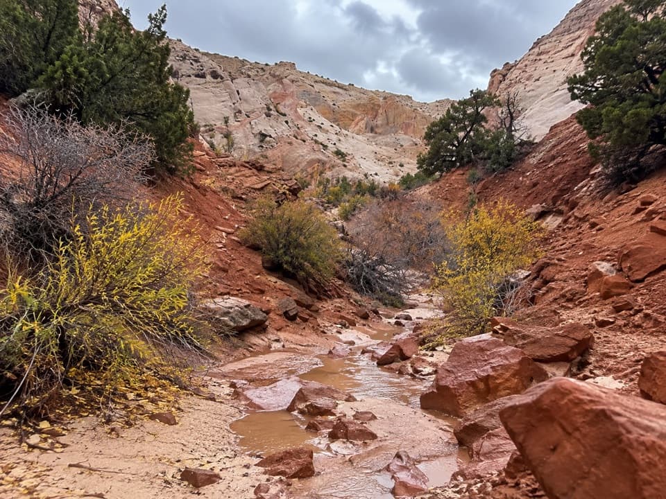 EasySurprise Canyon Route2 mi · 1.5 hr · 0.5 mi awayA short desert walk into a narrow canyon and spiraling pour-off.ChallengingLower Muley Twist Canyon5.9 mi · 5 hr · 2.7 mi awayA remote canyon crossing with a steep exposed climb over the Fold.
 ChallengingUpper Muley Twist Canyon9 mi · 7 hr · 4.9 mi awayA 9-mile canyon approach to a steep, exposed rim loop.
 ModerateStrike Valley Overlook0.9 mi · 45 min · 4.9 mi awayA short slickrock climb to 150 million years of geology.
 ChallengingHalls Creek Narrows22.4 mi · 3.5 days · 8.4 mi awayA remote 22.4-mile backpack through a water-filled sandstone canyon.
Parkwolf’s Capitol Reef ranking

The audio tour guide for the drive, plus offline maps, trails, and wildlife heatmaps for when the signal drops.