Strike Valley Overlook in Capitol Reef National Park

Capitol Reef National Park, UT

Strike Valley Overlook

A short slickrock climb to 150 million years of geology.

Photo: Wikimedia Commons
Length
0.9mi
Time
45min
Elev. change
108ft
Difficulty
Moderate
  • No dogs
  • High point 5,984 ft
  • #20 of 48 in Capitol Reef

Hear the audio tour

Strike Valley Overlook and Upper Muley Twist Access

Overview

About Strike Valley Overlook

Why go

  • A short climb opens onto a wide view of the Waterpocket Fold.
  • The tilted rock layers make the area’s geology unusually easy to see.

Heads up

  • The high-clearance access road is a much bigger commitment than the hike.
  • Cairned slickrock and no dependable water make it feel remote despite the short mileage.

Map & elevation

The route

Loading the Capitol Reef map
Full map
Elevation5,876–5,984 ft
TrailheadStrike Valley Overlook / Upper Muley Twist 4WD parking area37.88167, -111.04667
Keep this map with you offline in the Parkwolf app

Plan your hike

Before you go

Parking

Strike Valley Overlook / Upper Muley Twist 4WD parking area, at the end of the 2.9-mile rough, sandy and rocky access road from Burr Trail. The National Park Service specifies high clearance. Starting at the earlier 2WD parking adds several miles of walking and is not included in this route distance.

Safety

The access road requires high clearance. The cairned route has two moderate slickrock climbs and no dependable water. Avoid it when storms threaten because of flash-flood risk, especially July through September. Pets are prohibited on park trails and in off-trail or backcountry areas.

2 active Capitol Reef alerts

  • CautionFlash-flood hazard in canyons and washesHeavy rains can cause sudden flooding in Capitol Reef’s canyons and washes; do not hike or drive through floodwater.Official details
  • CautionE. coli advisory for Fremont River and Sulphur CreekDo not swim in the Fremont River or Sulphur Creek or get water in your mouth: NPS reports elevated E. coli in both waterways, and Utah DEQ has issued a warning advisory. - DEQ reports Sulphur Creek E.Official details
Capitol Reef alerts
A park ranger sits on a dash-mounted phone, talking, as Parkwolf’s Tour Guide plays “Army Cutworm Moths: A Grizzly Bear Buffet” on Grand Loop Road below Dunraven Pass in Yellowstone
Parkwolf Tour GuideThe highest, rockiest slopes around here are a summer buffet for grizzly bears.

Capitol Reef Tour Guide

Your drive to Strike Valley Overlook, narrated.

Parkwolf is a GPS audio tour guide for Capitol Reef National Park. As you drive, it chimes in with what’s ahead: hidden gems, upcoming stops, history, geology, and wildlife, right through your car’s speakers.

See the Capitol Reef audio tour

Recorded for this trailhead

Strike Valley Overlook and Upper Muley Twist Access
0:00 / 0:35
“You're nearing the access road for Strike Valley Overlook and Upper Muley Twist Canyon. The overlook is still almost three miles up a rough, sandy road requiring high clearance.”

Plays as you drive up to this trailhead in the Parkwolf Capitol Reef Tour Guide.

More stories near here in the app

  • The Bluebird’s Hovering Hunt
  • Honeycombs in the Sandstone
  • Stones Built by Groundwater
  • The Cattle Route Behind the Drive
  • 116 audio storiesacross Capitol Reef’s roads, triggered by GPS as you drive
  • Wildlife heatmapsfor Bighorn Sheep, Mule Deer, Marmot, and 13 more
  • Works offlinemaps, 48 trails, 52 places, and audio download before you lose signal
  • CarPlay readysimple controls built for the drive
★★★★★
“Fantastic app with many points of information… It’s great to just turn on while you’re driving and it gives you an audio tour of the national Park. We love it!!!!”
JMJamesApp Store review
Download Parkwolf on the App StoreGet Parkwolf on Google Play

4.7 from 8,600+ ratings

Trail guide

Hiking Strike Valley Overlook

A short climb to a wide viewStrike Valley Overlook is a cairn-marked out-and-back to a low saddle above Strike Valley,…

Strike Valley Overlook is a cairn-marked out-and-back to a low saddle above Strike Valley, where the Waterpocket Fold fills the horizon. Count on about 0.9 mile round trip and 30 minutes to an hour. The mapped tread is just under 0.4 mile each way; total figures vary slightly with the exact viewpoint reached. I’d save this for a day when you’re already headed down Burr Trail: the walk is quick, but reaching its start is the real commitment.

The path to the saddleThe route starts in packed sand among pinyon and juniper, drops briefly into a shallow wash,…

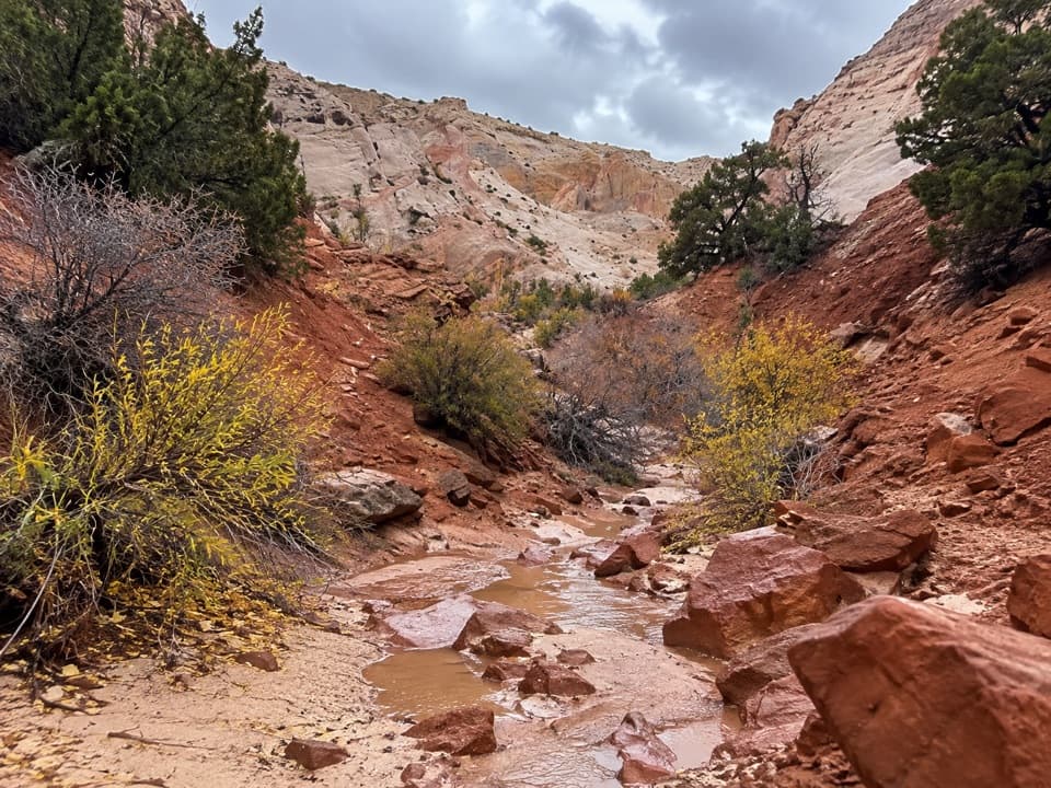
The route starts in packed sand among pinyon and juniper, drops briefly into a shallow wash, then climbs beside it. Cairns lead onto slickrock for two moderate-grade rises; a large cairn marks the low saddle and the overlook. Expect uneven rock rather than a built trail surface. Spring and fall are the more comfortable seasons for this exposed desert walk.

Read the layersFrom the saddle, Strike Valley opens between the Waterpocket Fold and the cliffs and badlands…

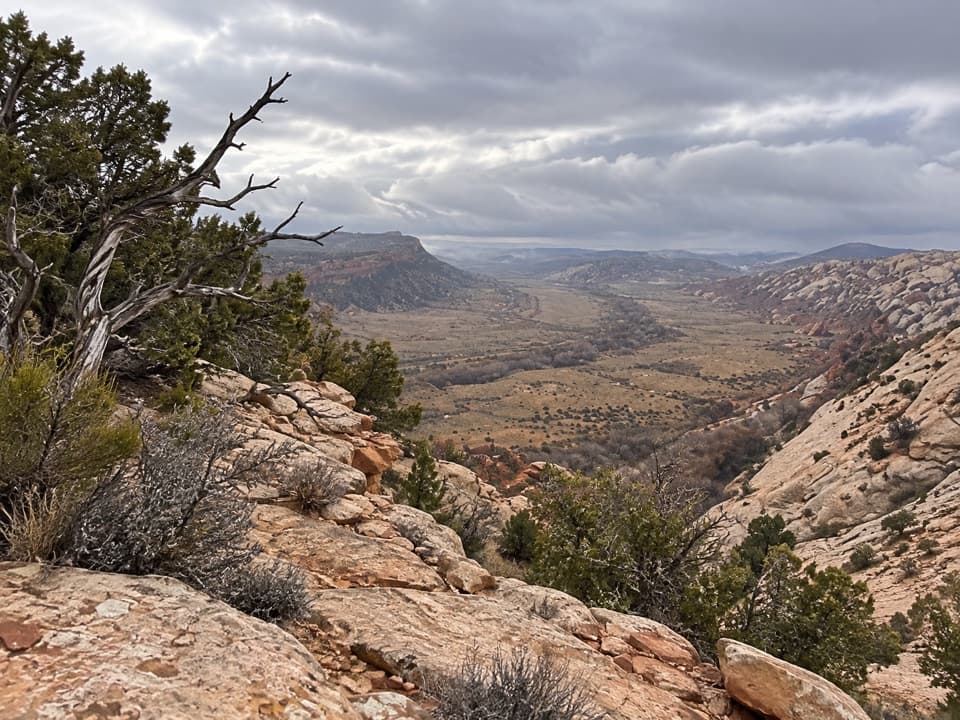
From the saddle, Strike Valley opens between the Waterpocket Fold and the cliffs and badlands to the east. Tarantula and Swap mesas sit in front of the Henry Mountains, with Capitol Reef’s domes to the north. The view makes the geology easy to read: nearly a dozen sedimentary layers here record about 150 million years. “Strike” describes the direction the rock layers run; the valley follows that line. For a photo that shows the landscape’s shape, keep some of the tilted foreground ledges in the frame with the valley behind them.

Getting to the trailheadStart at the Strike Valley Overlook / Upper Muley Twist 4WD parking area, at the end of a 2.

Start at the Strike Valley Overlook / Upper Muley Twist 4WD parking area, at the end of a 2.9-mile rough, sandy and rocky road from Burr Trail. The National Park Service specifies a high-clearance vehicle. Starting from the earlier 2WD parking or Burr Trail junction adds several miles of road walking and is a different outing, not part of the short hike described here. There’s no dependable water on the route. Avoid it when storms threaten; flash floods are most common in July through September. Dogs aren’t allowed on park trails or in off-trail and backcountry areas.

Wildlife

Wildlife in Capitol Reef

All Capitol Reef wildlife maps

Sighting maps show where each species has been reported across Capitol Reef. Wildlife moves, so no sighting is guaranteed.

Parkwolf’s Capitol Reef ranking

Top-rated trails in Capitol Reef

All 48 trails
  1. 1Hickman Bridge TrailModerate · 1.8 mi
  2. 2Cassidy Arch TrailChallenging · 3.4 mi
  3. 3Grand Wash TrailEasy · 4.4 mi
  4. 4Capitol Gorge TrailEasy · 2 mi
  5. 5Navajo Knobs TrailChallenging · 9.4 mi
  6. 6Rim Overlook TrailChallenging · 4.6 mi

Take Parkwolf to Capitol Reef.

The audio tour guide for the drive, plus offline maps, trails, and wildlife heatmaps for when the signal drops.

4.7 from 8,600+ ratings

Download Parkwolf on the App StoreGet Parkwolf on Google Play