Upper Muley Twist Canyon in Capitol Reef National Park

#10 of 48 trails in Capitol Reef

Capitol Reef National Park, UT

Upper Muley Twist Canyon

A 9-mile canyon approach to a steep, exposed rim loop.

Photo: National Park Service
Length
9mi
Time
7hr
Elev. change
745ft
Difficulty
Challenging
  • Loop
  • No dogs
  • High point 6,634 ft

Hear the audio tour

Strike Valley Overlook and Upper Muley Twist Access

Overview

About Upper Muley Twist Canyon

Why go

  • Canyon arches lead to broad views across the Waterpocket Fold
  • The wash-to-rim route gives the hike a clear change of character

Heads up

  • Unmaintained route with easy-to-miss cairns
  • Rough high-clearance access road and exposed scrambling

Map & elevation

The route

Loading the Capitol Reef map
Full map
Elevation5,889–6,634 ft
TrailheadStrike Valley Overlook parking area (Upper Muley Twist trailhead)37.88152, -111.04677
Keep this map with you offline in the Parkwolf app

Plan your hike

Before you go

Parking

From Burr Trail Road, Upper Muley Twist Canyon Road reaches a passenger-car trailhead after about 0.3 mile. Strike Valley Overlook parking, the start for the 9-mile route, is 2.9 miles up the rough road and generally requires high clearance and 4WD. Check current access with the park before driving. Starting from the lower trailhead makes the round trip 14.8 miles.

Safety

This is an unmaintained backcountry route; cairns and signs may be absent or misleading, so map-reading and route-finding are essential. The narrows bypass and rim involve steep, exposed slickrock and scrambling, and wet or icy rock is harder to cross. Summer heat can be extreme, water sources are unreliable, and narrow canyons carry flash-flood risk.

2 active Capitol Reef alerts

  • CautionFlash-flood hazard in canyons and washesHeavy rains can cause sudden flooding in Capitol Reef’s canyons and washes; do not hike or drive through floodwater.Official details
  • CautionE. coli advisory for Fremont River and Sulphur CreekDo not swim in the Fremont River or Sulphur Creek or get water in your mouth: NPS reports elevated E. coli in both waterways, and Utah DEQ has issued a warning advisory. - DEQ reports Sulphur Creek E.Official details
Capitol Reef alerts
A park ranger sits on a dash-mounted phone, talking, as Parkwolf’s Tour Guide plays “Army Cutworm Moths: A Grizzly Bear Buffet” on Grand Loop Road below Dunraven Pass in Yellowstone
Parkwolf Tour GuideThe highest, rockiest slopes around here are a summer buffet for grizzly bears.

Capitol Reef Tour Guide

Your drive to Upper Muley Twist Canyon, narrated.

Parkwolf is a GPS audio tour guide for Capitol Reef National Park. As you drive, it chimes in with what’s ahead: hidden gems, upcoming stops, history, geology, and wildlife, right through your car’s speakers.

See the Capitol Reef audio tour

Recorded for this trailhead

Strike Valley Overlook and Upper Muley Twist Access
0:00 / 0:35
“You're nearing the access road for Strike Valley Overlook and Upper Muley Twist Canyon. The overlook is still almost three miles up a rough, sandy road requiring high clearance.”

Plays as you drive up to this trailhead in the Parkwolf Capitol Reef Tour Guide.

More stories near here in the app

  • The Bluebird’s Hovering Hunt
  • Honeycombs in the Sandstone
  • Stones Built by Groundwater
  • The Cattle Route Behind the Drive
  • 116 audio storiesacross Capitol Reef’s roads, triggered by GPS as you drive
  • Wildlife heatmapsfor Bighorn Sheep, Mule Deer, Marmot, and 13 more
  • Works offlinemaps, 48 trails, 52 places, and audio download before you lose signal
  • CarPlay readysimple controls built for the drive
★★★★★
“Fantastic app with many points of information… It’s great to just turn on while you’re driving and it gives you an audio tour of the national Park. We love it!!!!”
JMJamesApp Store review
Download Parkwolf on the App StoreGet Parkwolf on Google Play

4.7 from 8,600+ ratings

Trail guide

Hiking Upper Muley Twist Canyon

What the route commits you toUpper Muley Twist Canyon is a 9-mile round trip from Strike Valley Overlook parking: walk 1.

Upper Muley Twist Canyon is a 9-mile round trip from Strike Valley Overlook parking: walk 1.7 miles up the wash to Saddle Arch, complete the 5.6-mile canyon-and-rim loop, then return down the same wash. Set aside about seven hours. This is an unmaintained backcountry route, not a built path. It rewards hikers who can read terrain and are comfortable with exposed slickrock; the cairns can be easy to miss. Start clockwise by continuing up the canyon from Saddle Arch. That puts the more gradual climb first.

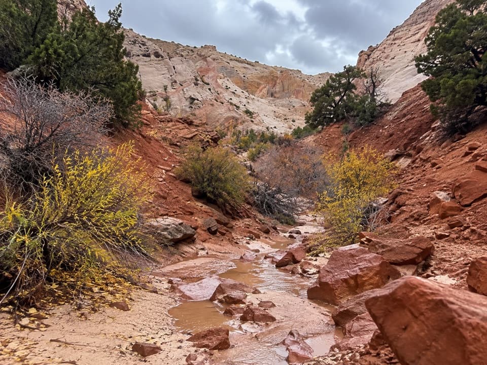
Up the wash to Saddle ArchThe approach follows an easy wash, mostly a steady walk between canyon walls.

The approach follows an easy wash, mostly a steady walk between canyon walls. Peekaboo Arch is visible near the trailhead; Saddle Arch marks the loop junction 1.7 miles in. The short Strike Valley Overlook spur starts at the parking area and is separate; its 0.4 miles one way are not included here. At Saddle Arch, follow the route sign and choose your direction around the canyon-and-rim loop.

Through the canyonBeyond Saddle Arch, the wash narrows among slickrock walls and arches.

Beyond Saddle Arch, the wash narrows among slickrock walls and arches. The narrows begin about 2.3 miles farther up the canyon. Floods and rockfall can change obstacles, so the passage may not look exactly as it does on a map. Old painted letters on one wall mark the corner of a uranium-mining claim; no date or claimant is known.

Find the bypass and climbThe standard route bypasses a difficult pour-off by climbing the canyon’s east, or right-hand,…

The standard route bypasses a difficult pour-off by climbing the canyon’s east, or right-hand, wall. The cairned turn is easy to walk past. A difficult pour-off blocks the slot near its start, and an impassable drop stops it farther in; follow the east-side bypass instead of descending into the slot. After it rejoins the wash, a sign marks the steep climb out to the rim. Expect exposed slickrock and some scrambling; wet or icy rock makes the climb harder.

Follow the rim backThe rim route crosses open slickrock, a short steep notch, and ledges before a signed descent…

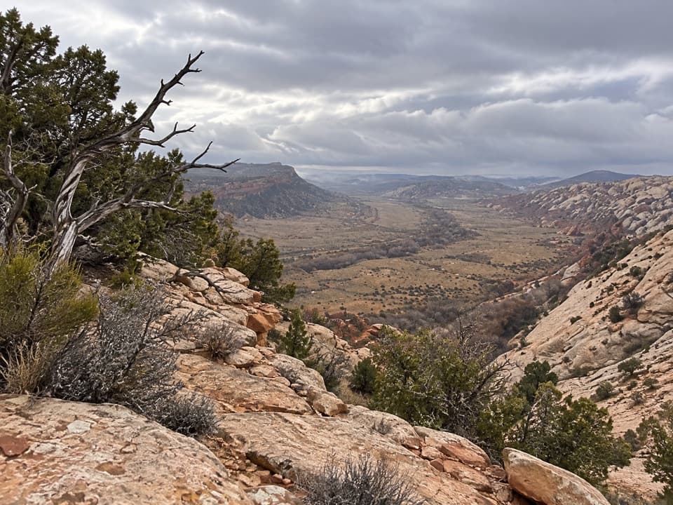
The rim route crosses open slickrock, a short steep notch, and ledges before a signed descent returns to the canyon floor. Cairns are subtle, and the sign for the descent is easy to miss. Keep checking the line as the terrain changes, especially where the route skirts edges or crosses a saddle. The rim section is the exposed part of the hike, with wide views across the Fold toward the Henry Mountains.

The rock and the archesThe trail follows the Waterpocket Fold, where Navajo and Wingate sandstone layers were tilted…

The trail follows the Waterpocket Fold, where Navajo and Wingate sandstone layers were tilted by the uplift that formed the long ridge. Erosion stripped protective Kayenta rock from parts of the Wingate, leaving the arches and unusual openings along the canyon. Saddle Arch is the route’s clearest landmark; the view from the rim makes the scale of the folded rock easier to read.

Start at the right accessThe 9-mile distance starts at Strike Valley Overlook parking, reached by a rough 2.

The 9-mile distance starts at Strike Valley Overlook parking, reached by a rough 2.9-mile canyon road that generally requires high clearance and 4WD. Passenger cars usually stop at the lower trailhead about 0.3 mile from Burr Trail Road; walking from there makes the round trip 14.8 miles. Check current road access with the park before driving. The road is not part of the mapped hike, and its condition changes.

Heat, water, and rulesSpring and fall are the best seasons.

Spring and fall are the best seasons. Summer heat can be extreme, water in the canyon is unreliable, and flash-flood season typically runs from mid-June to mid-October. Carry all the water you need and avoid entering narrow canyons when storms threaten. Pets are not allowed on trails or in backcountry areas. A free backcountry permit is required for overnight trips.

Wildlife

Wildlife in Capitol Reef

All Capitol Reef wildlife maps

Sighting maps show where each species has been reported across Capitol Reef. Wildlife moves, so no sighting is guaranteed.

Parkwolf’s Capitol Reef ranking

Top-rated trails in Capitol Reef

All 48 trails
  1. 1Hickman Bridge TrailModerate · 1.8 mi
  2. 2Cassidy Arch TrailChallenging · 3.4 mi
  3. 3Grand Wash TrailEasy · 4.4 mi
  4. 4Capitol Gorge TrailEasy · 2 mi
  5. 5Navajo Knobs TrailChallenging · 9.4 mi
  6. 6Rim Overlook TrailChallenging · 4.6 mi

Take Parkwolf to Capitol Reef.

The audio tour guide for the drive, plus offline maps, trails, and wildlife heatmaps for when the signal drops.

4.7 from 8,600+ ratings

Download Parkwolf on the App StoreGet Parkwolf on Google Play