Pros & cons
PROS
- Iconic cliff-top views of Arch Rock and Inspiration Point
- Closest island to the mainland with regular boat trips
CONS
- No potable water or shade—very exposed to sun and wind
- Landing requires a short ladder and 157 steep steps
Overview
Anacapa is a dramatic chain of three skinny volcanic islets—East, Middle, and West—about 12–14 miles offshore. You’ll land on East Anacapa and explore a compact cliff‑top plateau with outsized views, sea caves below, and the park’s postcard star, Arch Rock.
What You’ll See
Expect wave‑carved cliffs, natural arches, and wide‑open horizons. A short trail network (about two miles) links classic overlooks—Inspiration Point, lighthouse views, and vantages toward Middle and West Anacapa and Santa Cruz Island. It’s small enough to see the highlights in a few unrushed hours, but the scenery is big‑league.
Wildlife
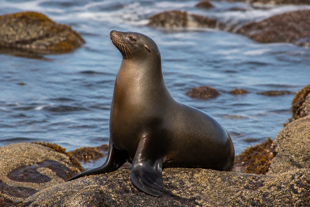
This is seabird central. West Anacapa hosts a major brown pelican rookery (closed to the public), and East Anacapa teems with western gulls—especially May through July—so plan for noise, close encounters, and plenty of guano. Cormorants are common, and from the cliffs you often spot seals, sea lions, and dolphins working the kelp and currents.
Logistics & Facilities
Boats land at East Anacapa’s Landing Cove; from the dock you climb a short ladder and then 157 steep steps to the top. Facilities are minimal: a small visitor center, vault toilets, a handful of picnic tables, and seven primitive campsites. There’s no water, no store, and virtually no shade. Bring everything you need and pack out all trash.
Landscape & Geology
Volcanic bedrock plus relentless surf equals the island’s signature sea cliffs, caves, and natural bridges. Arch Rock is the icon for a reason—its angles change with the light, the swell, and your vantage point along the rim.
Best Time to Visit
It’s a year‑round destination when seas allow. Mornings and late afternoons give the most flattering light and cooler temps on the exposed plateau. Spring (after winter rains) can bring bright bursts of coreopsis and other natives. If you want a quieter vibe, avoid peak gull nesting from late spring into midsummer.

Who It’s For
Hikers, photographers, and bird nerds who don’t mind wind, stairs, and primitive conditions. If you want shade, amenities, or a beach day, this isn’t your island.
Where it is
34.0044, -119.3996Tips for Anacapa Island
- 01Bring all the water you’ll need; there’s no potable water on the island.
- 02Expect wind and sun—pack hat, sunscreen, sunglasses, and a light shell.
- 03Gull season (May–July) is noisy and messy; visit outside that window for calmer vibes.
- 04Boats land only on East Anacapa; the three islets aren’t connected by trails.
- 05You’ll climb a short ladder and 157 steps from Landing Cove—pack light.
- 06Download the Anacapa hiking map before you go for on‑island wayfinding [nps.gov](https://www.nps.gov/chis/planyourvisit/maps.htm).
Amenities
Near Anacapa Island
All places →All trails →
0.7 mi awayFrenchy’s CoveRemote boat-in tidepools on West Anacapa's cobble beach
0.8 mi awaySS Winfield Scott (shipwreck)Shallow Gold Rush wreck amid Anacapa’s kelp forests
1.6 mi awayInspiration PointAnacapa’s classic cliff-edge panorama of islands and PacificScenic Viewpoint
2 mi awayCathedral CoveClifftop window onto kelp forests, sea caves, and marine lifeScenic Viewpoint
2.2 mi awayAnacapa Island Loop TrailShort, cliff-top loop to Inspiration Point with nonstop ocean viewsEasy · 1.5 mi · 1.5 hr
2.2 mi awayLighthouse Overlook TrailShort, easy walk to classic lighthouse views over sea cliffsEasy · 0.5 mi · 30 min
9.3 mi awayMontañon Ridge TrailBig ocean views on a rugged, exposed island ridgeline loopChallenging · 9 mi · 6.5 hr
9.3 mi awayNorth Bluff TrailBluff-top walk to Potato Harbor’s big ocean views from ScorpionEasy · 3.8 mi · 2 hr