Eagle Creek to High Bridge in Columbia River Gorge National Scenic Area

Columbia River Gorge National Scenic Area, OR · WA

Eagle Creek to High Bridge

Cabled cliff passages lead to waterfalls and a bridge over the gorge.

Length
6.6mi
Time
4hr
Elev. change
513ft
Difficulty
Moderate
  • Dogs allowed
  • High point 624 ft
  • #18 of 111 in Columbia River Gorge

Hear the audio tour

Eagle Creek Trailhead

Overview

About Eagle Creek to High Bridge

Why go

  • Punch Bowl Falls, Loowit Falls and High Bridge on one out-and-back.
  • The climb is modest for a waterfall-filled gorge route.

Heads up

  • Narrow, unguarded ledges make heights and passing other hikers a real factor.
  • The Lower Punch Bowl Falls spur adds a steep drop and climb.

Map & elevation

The route

Loading the Columbia River Gorge map
Full map
Elevation112–624 ft
TrailheadEagle Creek Trailhead45.63685, -121.91949
Keep this map with you offline in the Parkwolf app

Plan your hike

Before you go

Parking

Start at Eagle Creek Trailhead off Interstate 84, Exit 41. A Northwest Forest Pass or America the Beautiful pass is required. Parking at the road end is limited; if full, use the larger overflow area by the fish hatchery, which adds about one mile round trip.


Safety

Narrow cliffside tread has severe drops; some sections use fixed cables and can be slick. Not recommended for children or anyone afraid of heights. Dogs must remain leashed.

8 active Columbia River Gorge alerts

  • ClosureEagle Creek Fire area closureMentions Eagle Creek Fire, referenced in this guideDo not enter Oneonta Gorge or the specified trail sections because hazards remain following the Eagle Creek Fire.Official details
  • CautionAircraft and drone restrictions at developed recreation sitesAircraft and drone landings, drop-offs, and pickups are prohibited at six high-use developed recreation sites to protect visitor safety.Official details
See all 8 alerts
A park ranger sits on a dash-mounted phone, talking, as Parkwolf’s Tour Guide plays “Army Cutworm Moths: A Grizzly Bear Buffet” on Grand Loop Road below Dunraven Pass in Yellowstone
Parkwolf Tour GuideThe highest, rockiest slopes around here are a summer buffet for grizzly bears.

Columbia River Gorge Tour Guide

Your drive to Eagle Creek to High Bridge, narrated.

Parkwolf is a GPS audio tour guide for Columbia River Gorge National Scenic Area. As you drive, it chimes in with what’s ahead: hidden gems, upcoming stops, history, geology, and wildlife, right through your car’s speakers.

Recorded for this trailhead

Eagle Creek Trailhead
0:00 / 0:37
“You're approaching the access road for Eagle Creek's day-use area and trailhead; the waterfalls are farther in on foot.”

Plays as you drive up to this trailhead in the Parkwolf Columbia River Gorge Tour Guide.

More stories near here in the app

  • A Duck in the Whitewater
  • The Smell of Home
  • Washington Shore Visitor Center at Bonneville Dam
  • Bradford Island Visitor Center
  • 217 audio storiesacross Columbia River Gorge’s roads, triggered by GPS as you drive
  • Wildlife heatmapsfor Bald Eagle, Black Bear, American Pika, and 13 more
  • Works offlinemaps, 111 trails, 78 places, and audio download before you lose signal
  • CarPlay readysimple controls built for the drive
★★★★★
“Fantastic app with many points of information… It’s great to just turn on while you’re driving and it gives you an audio tour of the national Park. We love it!!!!”
JMJamesApp Store review
Download Parkwolf on the App StoreGet Parkwolf on Google Play

4.7 from 8,600+ ratings

Trail guide

Hiking Eagle Creek to High Bridge

A moderate hike with serious exposureEagle Creek to High Bridge is a 6.

Eagle Creek to High Bridge is a 6.6-mile round-trip out-and-back on Trail #440, ending at a footbridge across a narrow gorge. The trail follows the canyon above Eagle Creek, with a high view of Punch Bowl Falls, Loowit Falls on the approach, and a look through the gorge from the bridge. Allow about four hours with stops. Much of the climb is gradual, but the narrow cliff edges make this a serious choice for anyone uneasy with heights.

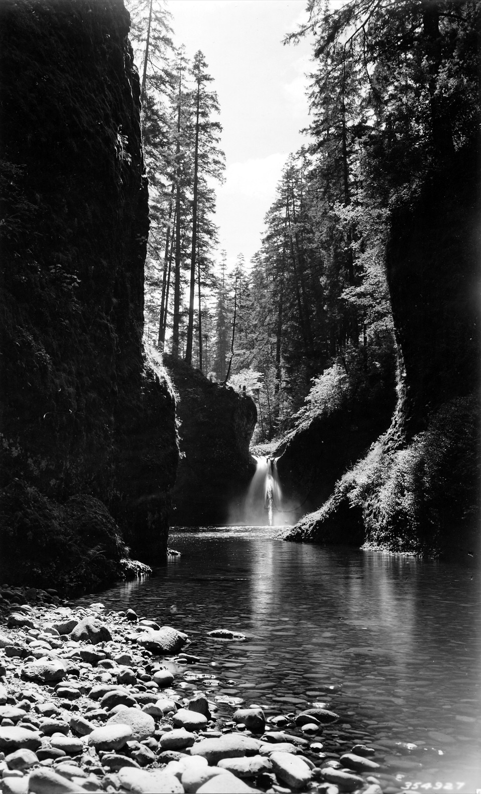
Punch Bowl, from aboveWithin the first half-mile, Trail 440 climbs high above the creek.

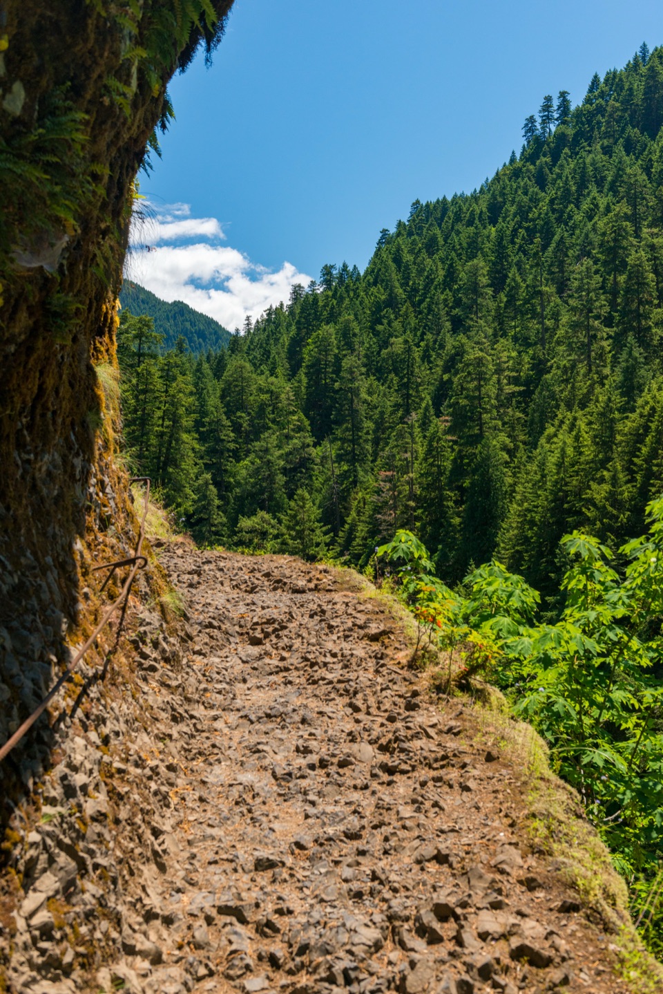
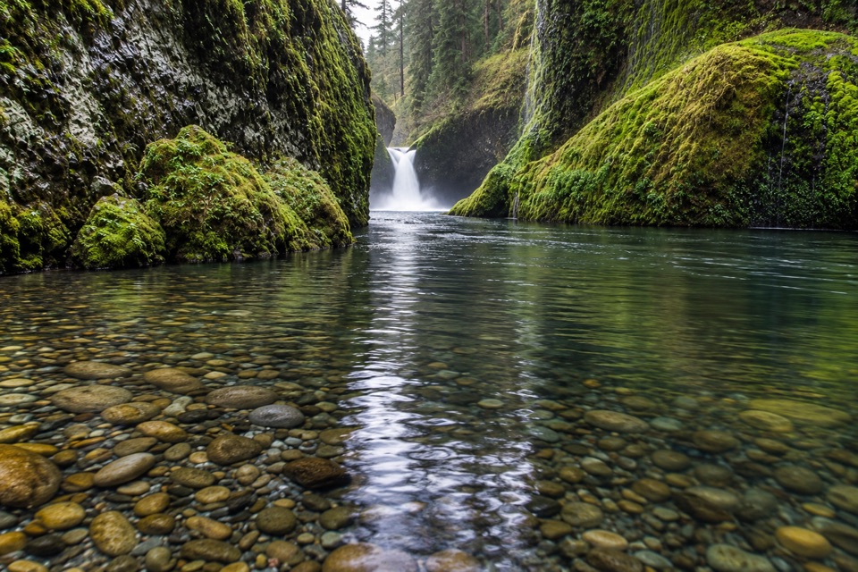
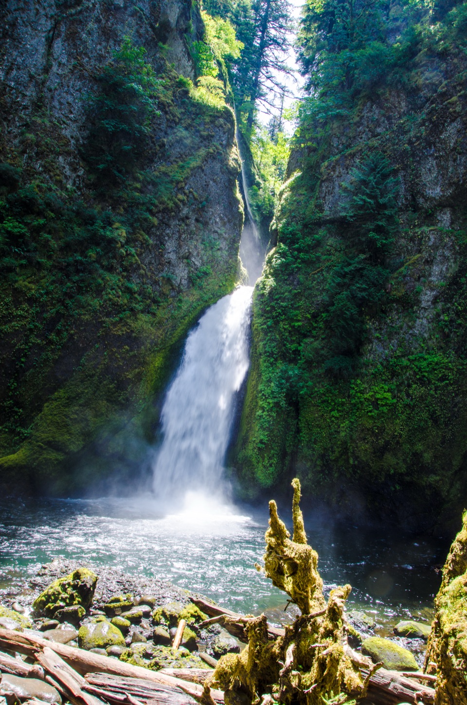
Within the first half-mile, Trail #440 climbs high above the creek. The tread pinches along exposed basalt cliffs; fixed cables give handholds in the narrowest sections, and seepage can make the rock slick. Around mile 1.9, a signed junction drops toward Lower Punch Bowl Falls. That spur adds a 300-foot descent and climb and is separate from the 6.6-mile High Bridge route. Stay on the main trail another quarter-mile for the overhead Punch Bowl Falls viewpoint, looking into its round basin and deep pool. The shorter out-and-back to Punch Bowl Falls is about 3.8 miles.

The bridge and the gorgePast the overlook, the trail leaves the creek briefly, then returns above it.

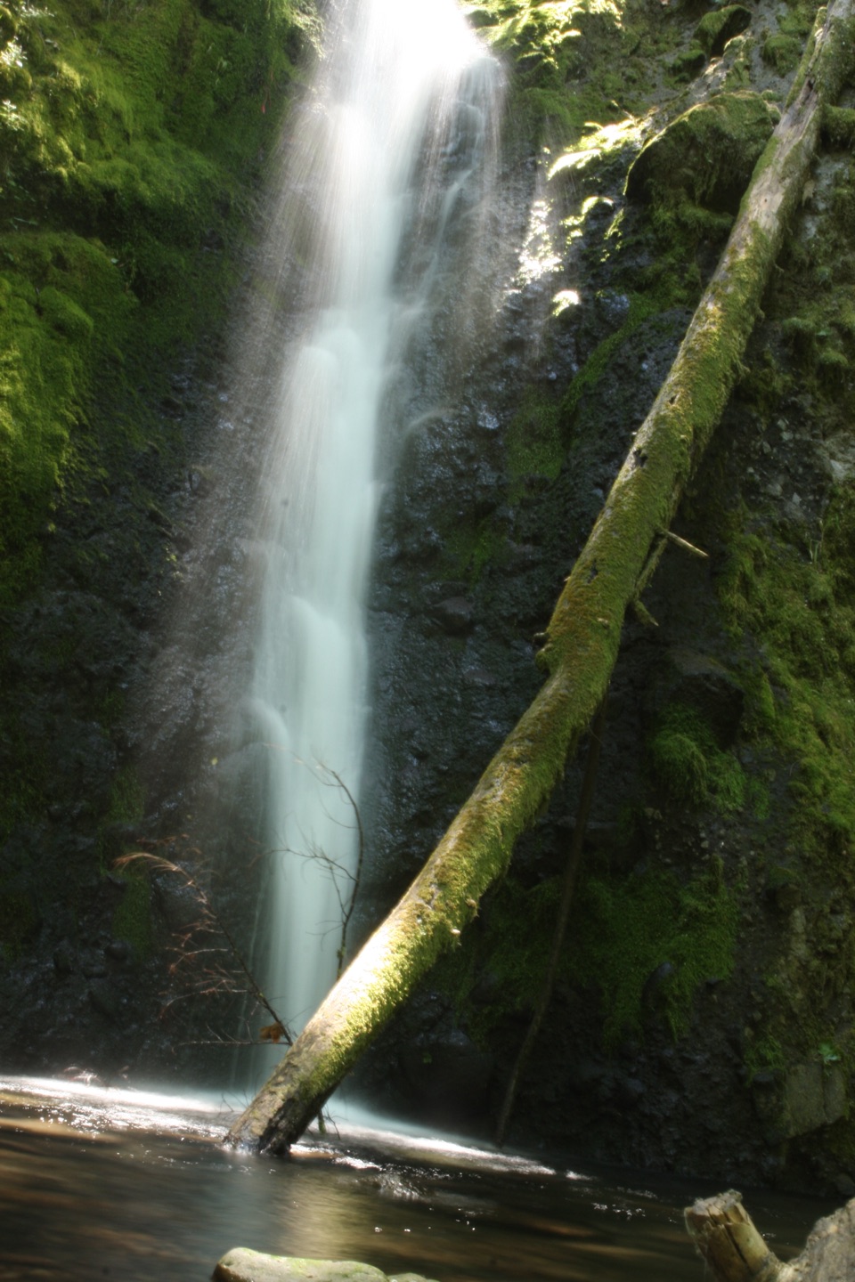
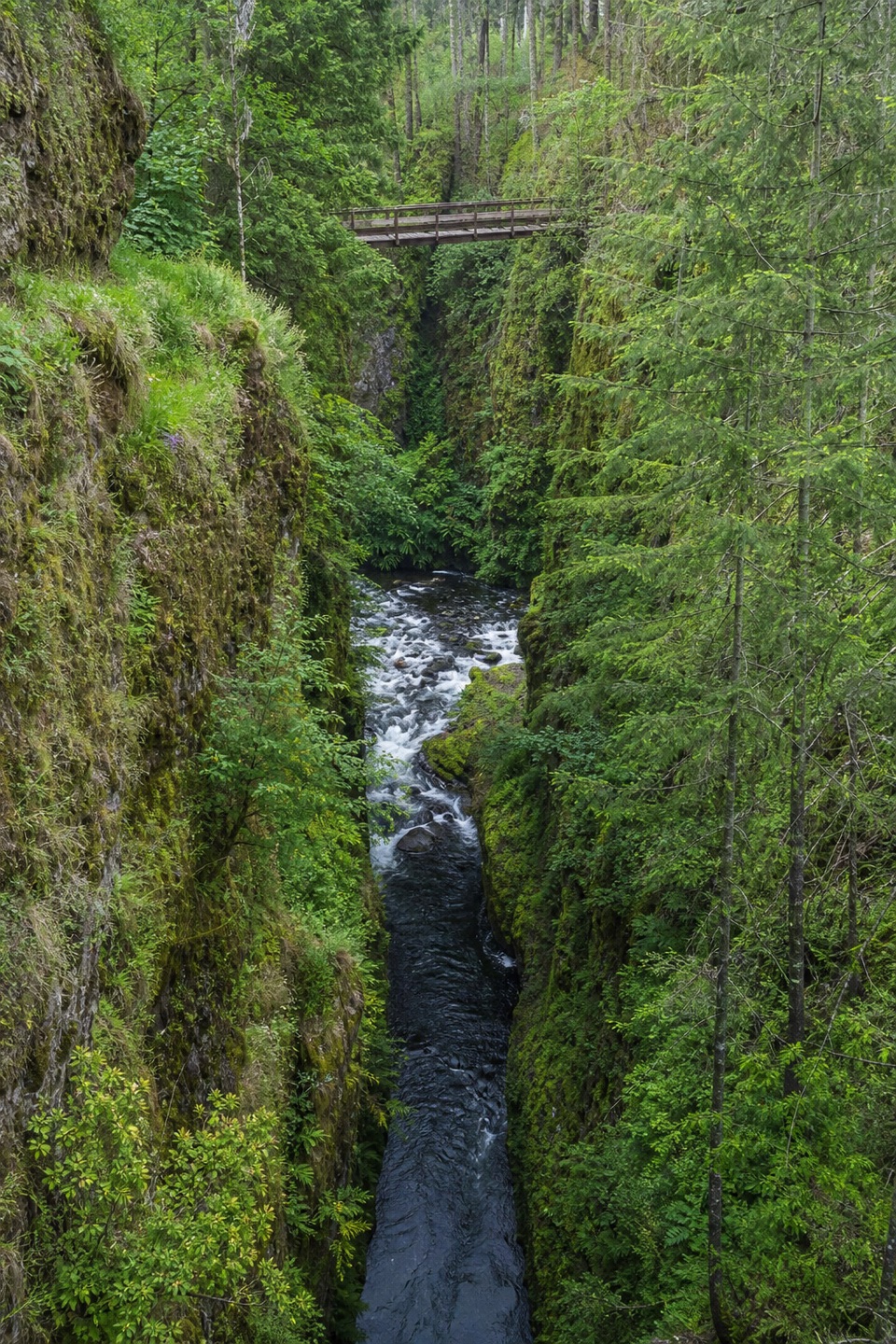
Past the overlook, the trail leaves the creek briefly, then returns above it. Look across the water for Loowit Falls, a thin cascade that drops into a pool before joining Eagle Creek. The final approach to High Bridge is rocky, with the cliff edge still close and cable fixed to the wall. The bridge spans the narrow channel; pause there to look down the gorge and upstream at cascades. It was replaced after damage in the 2017 Eagle Creek Fire. Tenas Camp, a quieter lunch stop, is about 100 yards beyond the mapped turnaround.

Getting there safelyStart at Eagle Creek Trailhead; a Northwest Forest Pass or America the Beautiful pass is…

Start at Eagle Creek Trailhead; a Northwest Forest Pass or America the Beautiful pass is required. Parking is limited. If the road-end lot is full, the larger area by the fish hatchery adds about one mile round trip. Dogs are allowed on leash; parts of the cliffside trail have no handrail, so keep them close. The free self-issued wilderness permit begins around mile five, beyond High Bridge, and is not needed for this turnaround. If exposed cliffs feel like too much, stopping at Punch Bowl Falls makes a shorter hike on the same corridor.

Wildlife

Wildlife in Columbia River Gorge

All Columbia River Gorge wildlife maps

Sighting maps show where each species has been reported across Columbia River Gorge. Wildlife moves, so no sighting is guaranteed.

Keep exploring

Near Eagle Creek to High Bridge

See it all on the map

Trails that start nearby

Places near the trailhead

Parkwolf’s Columbia River Gorge ranking

Top-rated trails in Columbia River Gorge

All 111 trails
  1. 1Eagle Creek Trail #440 to Tunnel FallsChallenging · 11.7 mi
  2. 2Multnomah Falls Trail to the TopModerate · 2.4 mi
  3. 3Multnomah–Wahkeena Falls LoopChallenging · 4.8 mi
  4. 4Dog Mountain LoopChallenging · 6.9 mi
  5. 5Angel's Rest TrailModerate · 4.8 mi
  6. 6Cape Horn Loop TrailChallenging · 6.5 mi

Take Parkwolf to Columbia River Gorge.

The audio tour guide for the drive, plus offline maps, trails, and wildlife heatmaps for when the signal drops.

4.7 from 8,600+ ratings

Download Parkwolf on the App StoreGet Parkwolf on Google Play