Eagle Creek Trail #440 to Tunnel Falls in Columbia River Gorge National Scenic Area

#1 of 111 trails in Columbia River Gorge

Columbia River Gorge National Scenic Area, OR · WA

Eagle Creek Trail #440 to Tunnel Falls

Follow Eagle Creek past cliffside falls to a tunnel behind the water.

Length
11.7mi
Time
7hr
Elev. change
1,106ft
Difficulty
Challenging
  • Dogs allowed
  • High point 1,257 ft

Hear the audio tour

Eagle Creek Trailhead

Overview

About Eagle Creek Trail #440 to Tunnel Falls

Why go

  • Waterfalls and gorge views keep changing beyond Punch Bowl Falls.
  • The route passes behind a 172-foot cascade at Tunnel Falls.
  • High Bridge crosses a narrow channel far above Eagle Creek.

Heads up

  • Narrow ledges have steep drops, with cables but no guardrail.
  • The rocky 11.7-mile return leaves little room for a quick visit.

Map & elevation

The route

Loading the Columbia River Gorge map
Full map
Elevation151–1,257 ft
TrailheadEagle Creek Trailhead45.63690, -121.91960
Keep this map with you offline in the Parkwolf app

Plan your hike

Before you go

Parking

From Portland, take eastbound I-84 Exit 41 just after the tunnel and follow signs to Eagle Creek Trailhead. From Cascade Locks, there is no westbound Exit 41: continue to Exit 40, then get back onto eastbound I-84 for Exit 41. The trail starts at the road’s end. Spaces there are limited; if the lot is full, the larger fish-hatchery lot on the access road adds about a mile round trip. A valid recreation pass or day-use fee is required.

Safety

Narrow cliffside tread has steep unguarded drops, rocky or slippery footing, and fixed cables; this is a poor choice for anyone uneasy with heights. A free, self-issued wilderness permit is required around mile five. Dogs must be leashed no longer than six feet. No potable water is available at the trailhead.

8 active Columbia River Gorge alerts

  • ClosureEagle Creek Fire area closureDo not enter Oneonta Gorge or the specified trail sections because hazards remain following the Eagle Creek Fire.Official details
  • CautionAircraft and drone restrictions at developed recreation sitesAircraft and drone landings, drop-offs, and pickups are prohibited at six high-use developed recreation sites to protect visitor safety.Official details
See all 8 alerts
A park ranger sits on a dash-mounted phone, talking, as Parkwolf’s Tour Guide plays “Army Cutworm Moths: A Grizzly Bear Buffet” on Grand Loop Road below Dunraven Pass in Yellowstone
Parkwolf Tour GuideThe highest, rockiest slopes around here are a summer buffet for grizzly bears.

Columbia River Gorge Tour Guide

Your drive to Eagle Creek Trail #440 to Tunnel Falls, narrated.

Parkwolf is a GPS audio tour guide for Columbia River Gorge National Scenic Area. As you drive, it chimes in with what’s ahead: hidden gems, upcoming stops, history, geology, and wildlife, right through your car’s speakers.

Recorded for this trailhead

Eagle Creek Trailhead
0:00 / 0:37
“You're approaching the access road for Eagle Creek's day-use area and trailhead; the waterfalls are farther in on foot.”

Plays as you drive up to this trailhead in the Parkwolf Columbia River Gorge Tour Guide.

More stories near here in the app

  • A Duck in the Whitewater
  • The Smell of Home
  • Washington Shore Visitor Center at Bonneville Dam
  • Bradford Island Visitor Center
  • 217 audio storiesacross Columbia River Gorge’s roads, triggered by GPS as you drive
  • Wildlife heatmapsfor Bald Eagle, Black Bear, American Pika, and 13 more
  • Works offlinemaps, 111 trails, 78 places, and audio download before you lose signal
  • CarPlay readysimple controls built for the drive
★★★★★
“Fantastic app with many points of information… It’s great to just turn on while you’re driving and it gives you an audio tour of the national Park. We love it!!!!”
JMJamesApp Store review
Download Parkwolf on the App StoreGet Parkwolf on Google Play

4.7 from 8,600+ ratings

Trail guide

Hiking Eagle Creek Trail #440 to Tunnel Falls

A full day in Eagle Creek’s canyonEagle Creek Trail 440 to Tunnel Falls is an 11.

Eagle Creek Trail #440 to Tunnel Falls is an 11.7-mile out-and-back from the road-end Eagle Creek Trailhead, climbing above the creek’s basalt gorge to a tunnel cut behind a 172-foot waterfall. The mapped line follows the 5.85-mile trail corridor once; the distance includes hiking it back to the start. Allow about seven hours, with roughly 1,600–1,900 feet of climbing and time for the falls. This is a great pick if you’re steady on exposed ground and want the gorge beyond the busy first stretch. Punch Bowl Falls, High Bridge, smaller cascades and the final waterfall make the miles feel different, but you repeat the cliffside sections on the return.

The first halfThe trail climbs above Eagle Creek within its first half mile.

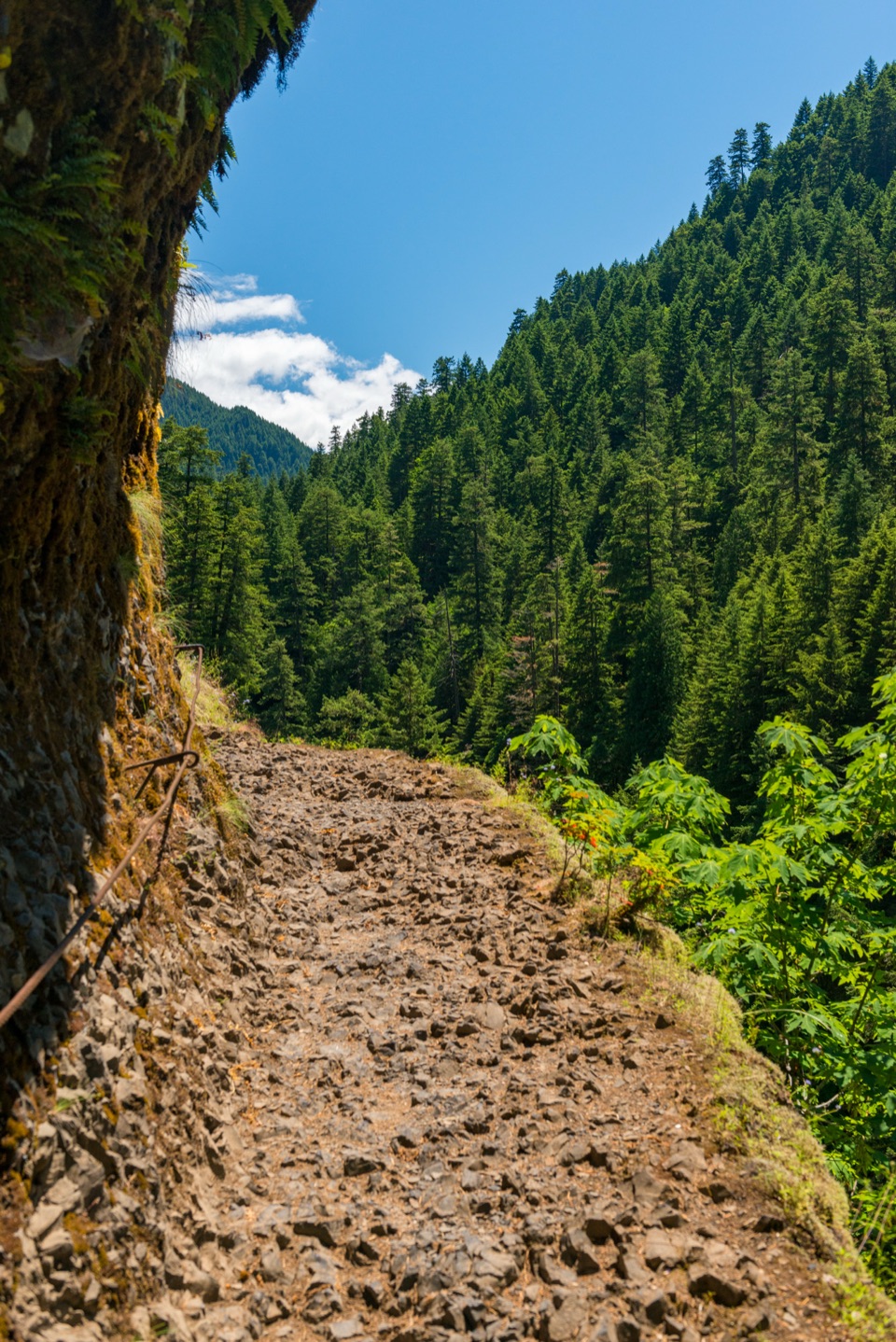
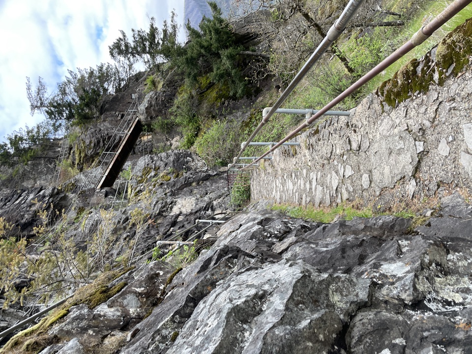
The trail climbs above Eagle Creek within its first half mile. In places the tread narrows beside steep drops, with cables fixed to the cliff for handholds. The path is rocky and can be slick, so this is a poor fit if heights make you freeze or you need a broad, forgiving trail.

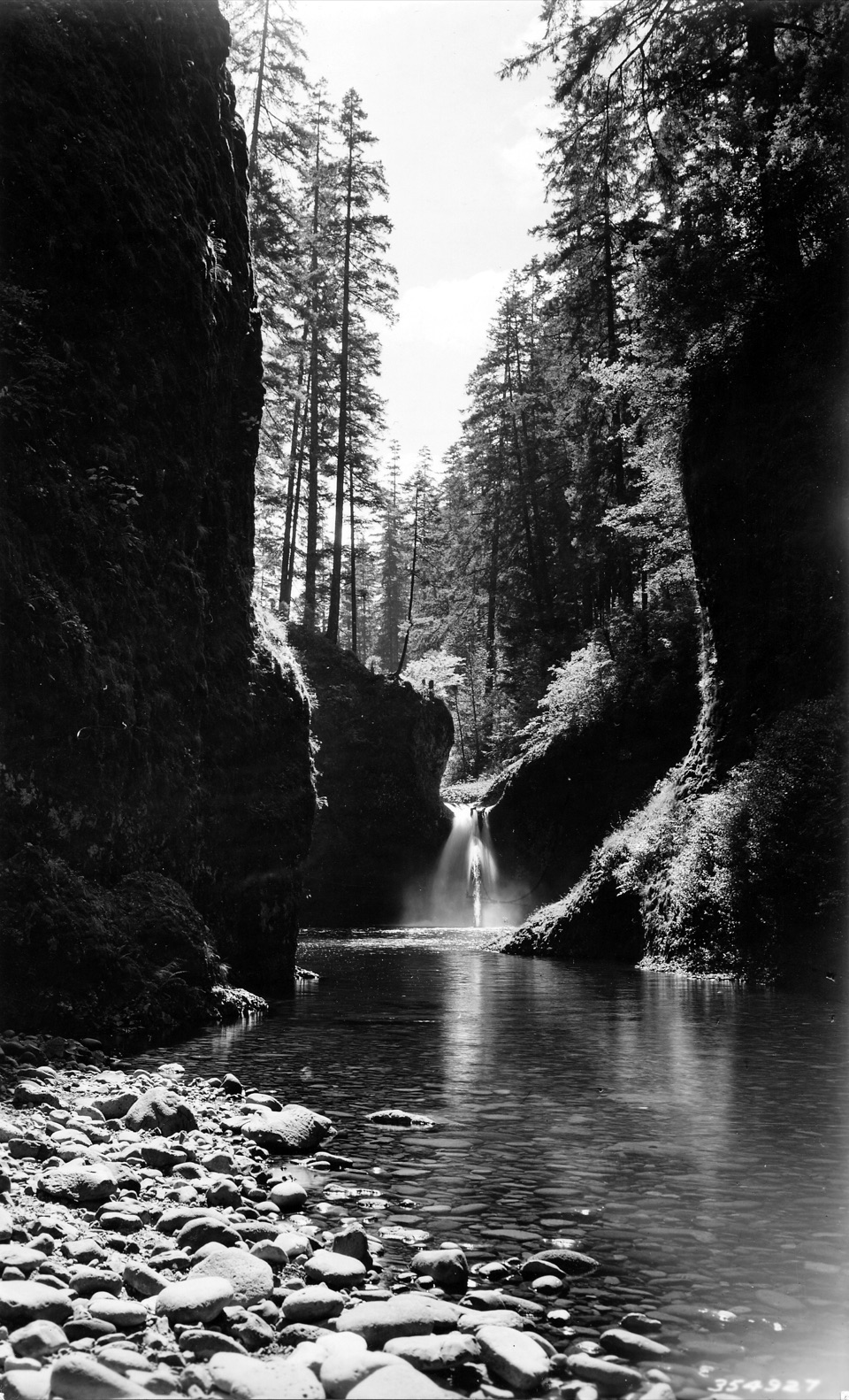
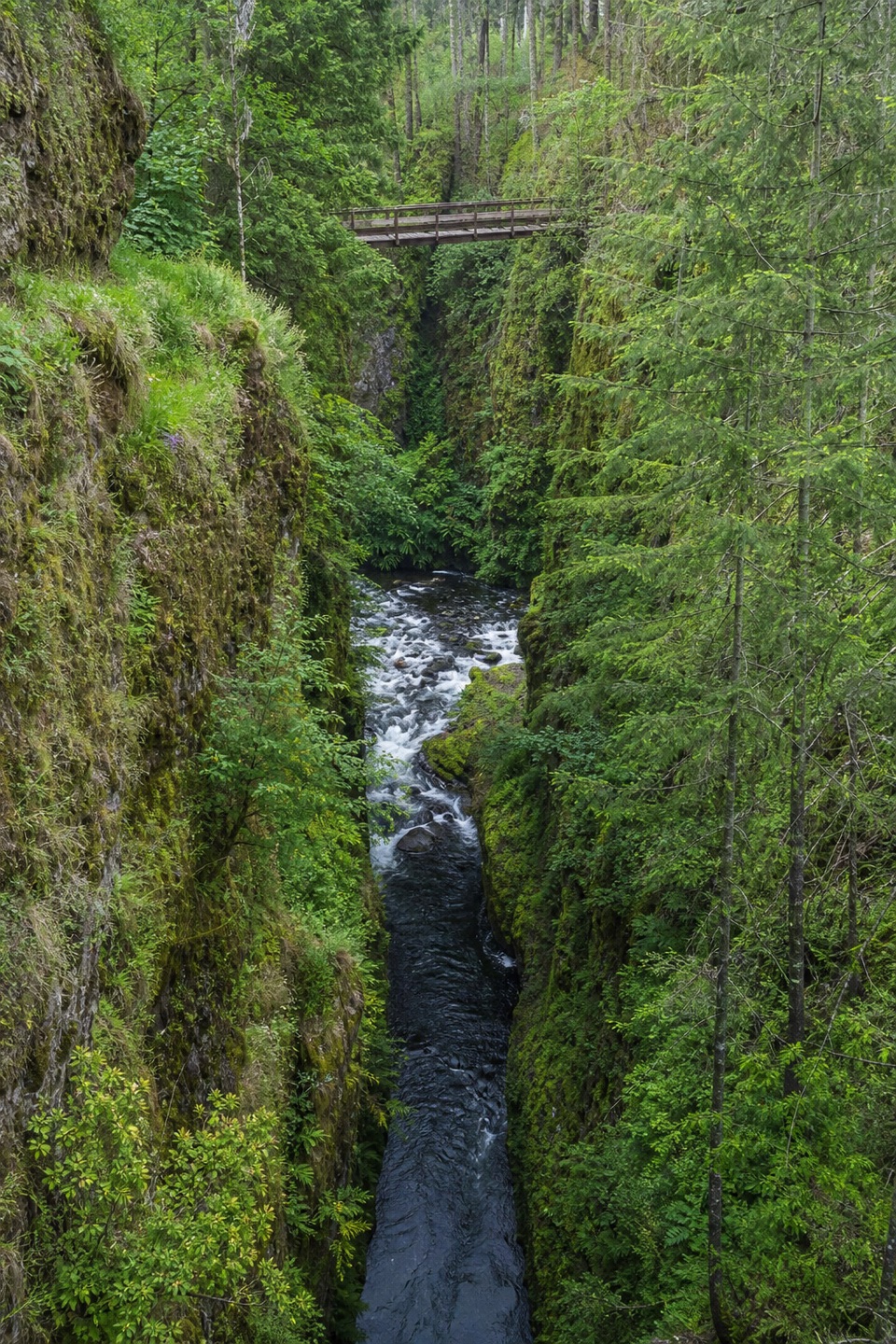
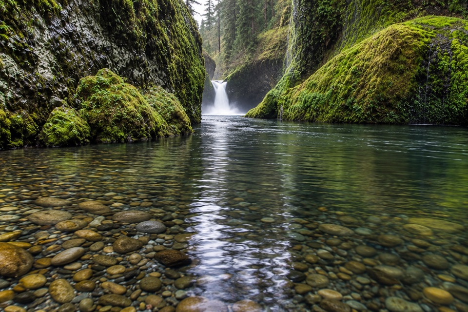
At about 1.9 miles, a signed spur drops roughly 300 feet to Lower Punch Bowl Falls. The main trail continues to an overlook about a quarter mile later, where you look down at the falls from above. Reaching the larger pool upstream means scrambling along the shore or swimming; that is a separate, much less controlled outing, not part of this route. Beyond the overlook, Eagle Creek slips out of view and then opens back into the gorge. Loowit Falls drops down the far bank. High Bridge crosses a narrow channel high above the water; the approach is rocky and exposed, with a wall cable alongside the ledge.

Beyond High BridgeAfter the bridge, the trail returns toward the creek. At about 4.

After the bridge, the trail returns toward the creek. At about 4.5 miles, Four and a Half Mile Bridge crosses Eagle Creek close to the water. A few miles of camps and tributary crossings follow; look across Wy’East Creek for its ribbon-like waterfall. Past the wilderness boundary, a free permit is required. Two broad talus slopes and the rocky section called the Potholes lead to Tunnel Falls.

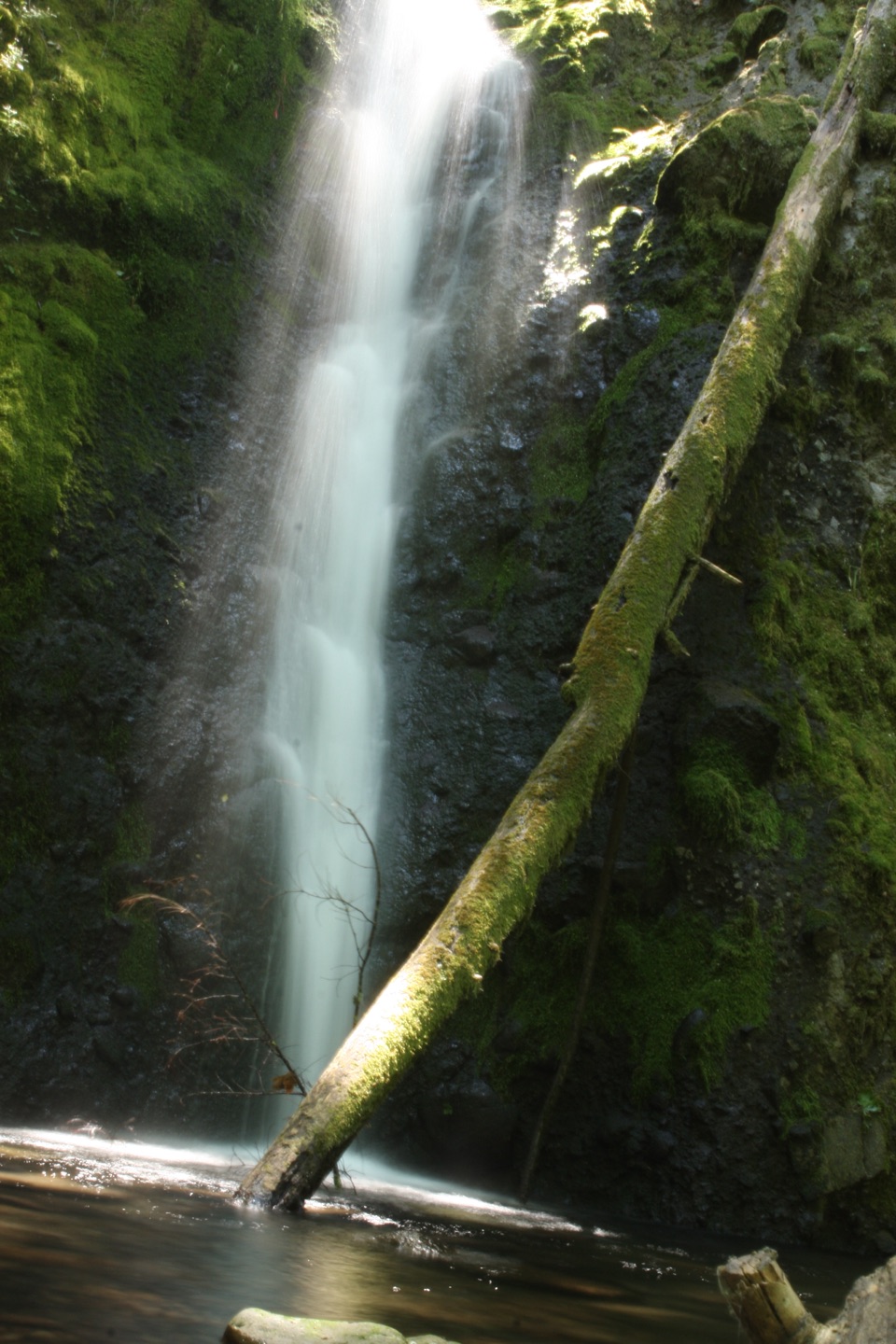
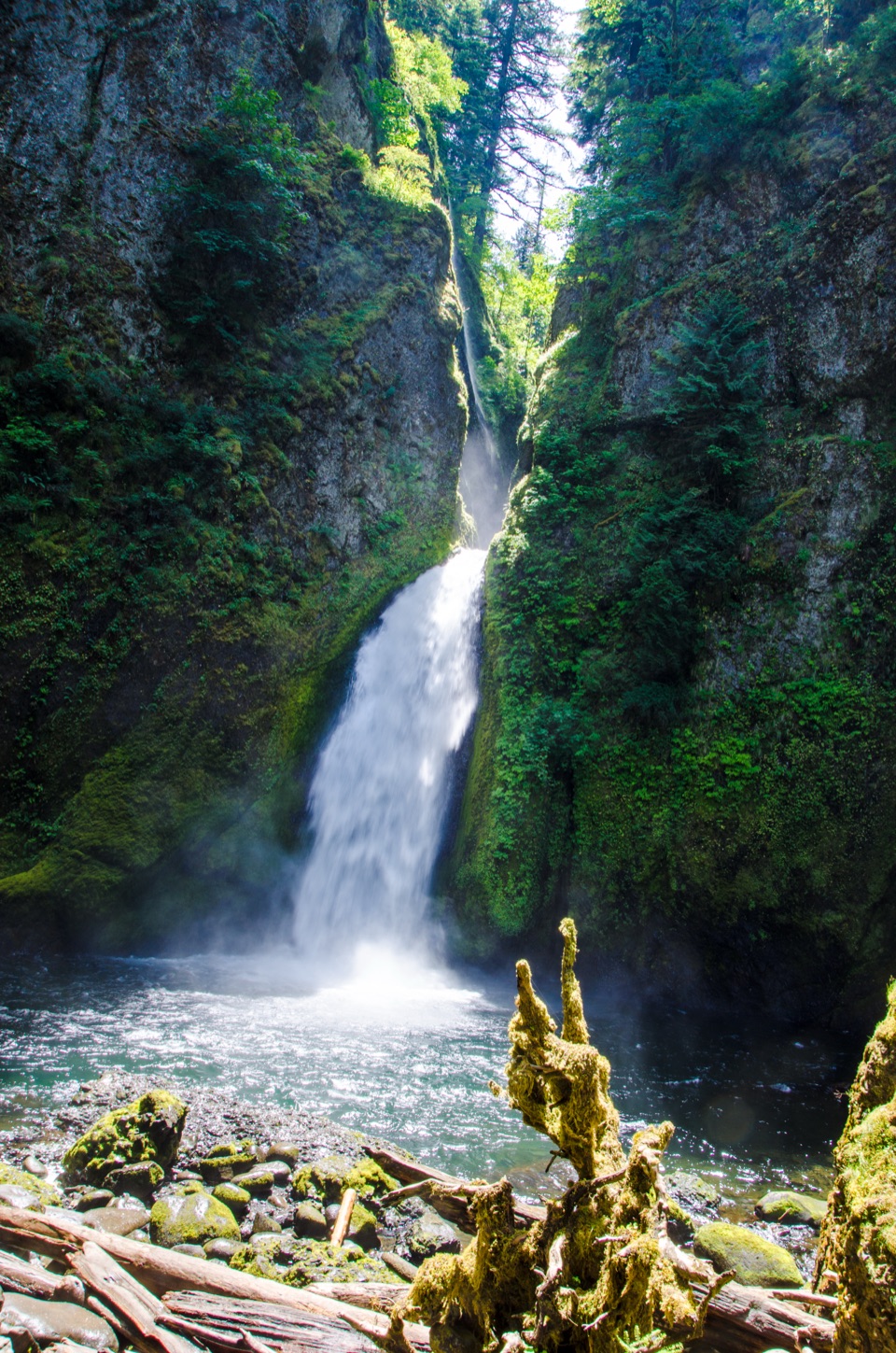
The 172-foot cascade drops into a bowl of columnar basalt. Trail builders cut a passage behind the water, and the path curves around the falls so you can see it from several angles. Keep to the tread and hold the cable through the tunnel. This is the turnaround; the return uses the same route, including the exposed ledges and bridge approaches. If the first narrow sections are already wearing on you, High Bridge is a sensible shorter destination instead.

Getting there and making it workFrom Portland, take eastbound I-84 Exit 41 just after the tunnel and follow signs to Eagle…

From Portland, take eastbound I-84 Exit 41 just after the tunnel and follow signs to Eagle Creek Trailhead. From Cascade Locks, there is no westbound Exit 41: continue to Exit 40, then get back onto eastbound I-84 for Exit 41. The trail starts at the road’s end. Spaces there are limited; if the lot is full, the larger fish-hatchery lot on the access road adds about a mile round trip. A recreation pass or day-use fee is required. No potable water is available at the trailhead, and the free wilderness permit is self-issued where the route enters Mark O. Hatfield Wilderness, around mile five.

Dogs are allowed but must stay on a leash no longer than six feet. The narrow drops make this a hard route for pets, even with cables. Cascade Locks has restaurants and brewpubs a few miles east for after the hike; there’s no food stop along the trail. At Tunnel Falls, take a moment on the curved path to see how the stream, basalt bowl and passage fit together; a tight crop of the water alone misses what makes this destination unusual.


Wildlife

Wildlife in Columbia River Gorge

All Columbia River Gorge wildlife maps

Sighting maps show where each species has been reported across Columbia River Gorge. Wildlife moves, so no sighting is guaranteed.

Keep exploring

Near Eagle Creek Trail #440 to Tunnel Falls

See it all on the map

Trails that start nearby

Places near the trailhead

Parkwolf’s Columbia River Gorge ranking

Top-rated trails in Columbia River Gorge

All 111 trails
  1. 2Multnomah Falls Trail to the TopModerate · 2.4 mi
  2. 3Multnomah–Wahkeena Falls LoopChallenging · 4.8 mi
  3. 4Dog Mountain LoopChallenging · 6.9 mi
  4. 5Angel's Rest TrailModerate · 4.8 mi
  5. 6Cape Horn Loop TrailChallenging · 6.5 mi
  6. 7Beacon Rock TrailModerate · 1.8 mi

Take Parkwolf to Columbia River Gorge.

The audio tour guide for the drive, plus offline maps, trails, and wildlife heatmaps for when the signal drops.

4.7 from 8,600+ ratings

Download Parkwolf on the App StoreGet Parkwolf on Google Play