Dog Mountain Loop in Columbia River Gorge National Scenic Area

#4 of 111 trails in Columbia River Gorge

Columbia River Gorge National Scenic Area, OR · WA

Dog Mountain Loop

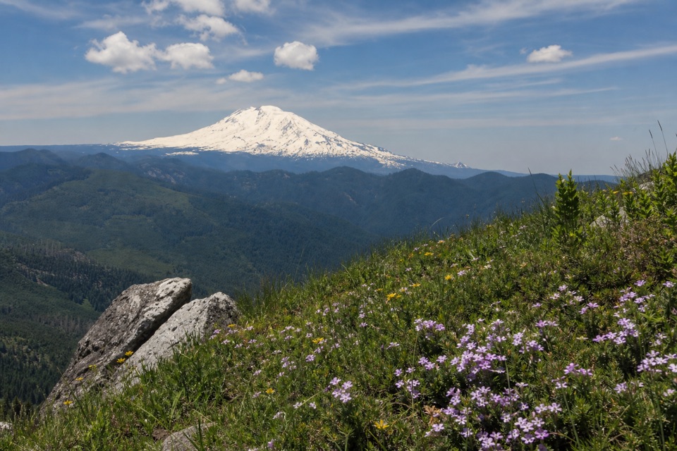
Spring balsamroot and a serious climb above the Columbia.

Photo: Wikimedia Commons
Length
6.9mi
Time
5hr
Elev. change
2,788ft
Difficulty
Challenging
  • Loop
  • Dogs allowed
  • High point 2,898 ft

Hear the audio tour

Dog Mountain Trailhead

Overview

About Dog Mountain Loop

Why go

  • Spring balsamroot brightens the upper meadows
  • Puppy Dog opens to Wind Mountain and the Columbia

Heads up

  • Nearly 2,800 feet of steep climbing
  • Wind and loose footing on the exposed upper slope

Map & elevation

The route

Loading the Columbia River Gorge map
Full map
Elevation110–2,898 ft
TrailheadDog Mountain Trailhead45.69917, -121.70806
Keep this map with you offline in the Parkwolf app

Plan your hike

Before you go

Parking

Dog Mountain Trailhead is off WA-14 at milepost 53.7. The lot holds about 70 vehicles and fills on busy spring weekends; do not park along the highway. A year-round recreation-site fee applies to private vehicles unless an accepted pass is used. Seasonal spring vehicle reservations may also apply; check the current rules and shuttle option before driving.

Safety

Steep sustained grades (about 10–25%), loose footing near the exposed upper meadow edge, and poison oak along the lower trail. No water is available at the trailhead. Follow the marked route and carry an offline map; peak-bloom weekends can have seasonal access rules.

8 active Columbia River Gorge alerts

  • ClosureEagle Creek Fire area closureDo not enter Oneonta Gorge or the specified trail sections because hazards remain following the Eagle Creek Fire.Official details
  • CautionAircraft and drone restrictions at developed recreation sitesAircraft and drone landings, drop-offs, and pickups are prohibited at six high-use developed recreation sites to protect visitor safety.Official details
See all 8 alerts
A park ranger sits on a dash-mounted phone, talking, as Parkwolf’s Tour Guide plays “Army Cutworm Moths: A Grizzly Bear Buffet” on Grand Loop Road below Dunraven Pass in Yellowstone
Parkwolf Tour GuideThe highest, rockiest slopes around here are a summer buffet for grizzly bears.

Columbia River Gorge Tour Guide

Your drive to Dog Mountain Loop, narrated.

Parkwolf is a GPS audio tour guide for Columbia River Gorge National Scenic Area. As you drive, it chimes in with what’s ahead: hidden gems, upcoming stops, history, geology, and wildlife, right through your car’s speakers.

Recorded for this trailhead

Dog Mountain Trailhead
0:00 / 0:26
“You're approaching Dog Mountain Trailhead, the start of a hard climb to spring wildflower meadows above the Columbia.”

Plays as you drive up to this trailhead in the Parkwolf Columbia River Gorge Tour Guide.

More stories near here in the app

  • What Mount Defiance Asks of You
  • Starvation Creek Falls
  • The Waterfall Through a Tunnel
  • A Slide Beside the Water
  • 217 audio storiesacross Columbia River Gorge’s roads, triggered by GPS as you drive
  • Wildlife heatmapsfor Bald Eagle, Black Bear, American Pika, and 13 more
  • Works offlinemaps, 111 trails, 78 places, and audio download before you lose signal
  • CarPlay readysimple controls built for the drive
★★★★★
“Fantastic app with many points of information… It’s great to just turn on while you’re driving and it gives you an audio tour of the national Park. We love it!!!!”
JMJamesApp Store review
Download Parkwolf on the App StoreGet Parkwolf on Google Play

4.7 from 8,600+ ratings

Trail guide

Hiking Dog Mountain Loop

What this loop includesDog Mountain Loop is a strenuous 6.

Dog Mountain Loop is a strenuous 6.9-mile loop from Dog Mountain Trailhead into the upper meadows and around the summit slope, returning by the wooded Summit Loop to the east approach. Expect about 2,820 feet of climbing and four to six hours on steep trail, with stops. This is the full summit hike for people who want a hard climb as much as the wildflower payoff; Puppy Dog, the lower river viewpoint, makes a natural shorter turnaround. The route here uses the newer, less difficult eastern approach, reaches the summit-area spur, and returns on Summit Loop into the woods before rejoining the main trail above Puppy Dog. It does not include the separate Dog–Augspurger descent, which is another loop.

The climb to Puppy DogThe trail gains quickly through forest for its first half mile or so.

The trail gains quickly through forest for its first half mile or so. At a fork, the older route to the left is steeper; the newer east-side path is the easier choice. Stay on the tread through this lower section because poison oak grows beside it. The east leg climbs to Puppy Dog, a small open meadow and viewpoint where the Columbia curves past Wind Mountain. Across the river, Mount Defiance and Starvation Creek Falls make useful landmarks. It is a good place to catch your breath or turn around if you came for a view without the summit push. Above it, the path climbs again through woods; the upper meadow starts showing through the trees, and an old fire-lookout site opens a view toward the Oregon side.

The upper meadows and returnThe trail crosses open hillside as the trees thin.

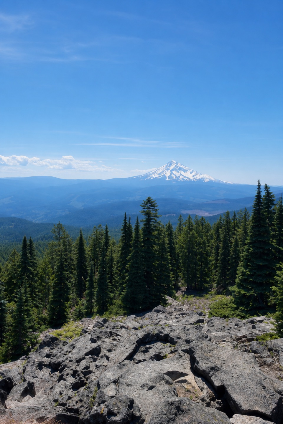
The trail crosses open hillside as the trees thin. In spring, the upper slope is bright with balsamroot and smaller flowers along the path; on a clear day the Columbia shows in both directions, with Mount Hood to the south and Mount St. Helens northwest. Wind can hit the open meadow hard, and loose footing beside the cliff edge deserves more attention than the view. Near the top, a short spur reaches a flat place beside a fire ring; the 2,948-foot high point is a short wooded spur, so the open meadow can have the better view. For a photo, include the flowers in the foreground with the river below; from Puppy Dog, frame the bend around Wind Mountain. Follow Summit Loop southeast into the woods for a more sheltered, steadier return, though you give up some of the open views. It rejoins the main route above Puppy Dog, which you pass again on the way down.


Getting there and planningThe signed trailhead and lot sit on WA-14 at milepost 53.7.

The signed trailhead and lot sit on WA-14 at milepost 53.7. The lot has about 70 spaces and fills on busy spring weekends; roadside parking is discouraged and can be ticketed or towed. It is a year-round Forest Service recreation-fee site for private vehicles, with accepted passes as an alternative. During peak wildflower season, some weekend drivers also need a separate vehicle reservation; the seasonal shuttle from Skamania County Fairgrounds is an alternative. Dates and access rules can change, so check before setting out. There is no water at the trailhead and no food service on the route; bring water and food. Dogs are allowed on leash. The steep 10–25% grades, exposed slope and occasional difficulty following the trail make an offline map useful. Allow the full half-day.

Wildlife

Wildlife in Columbia River Gorge

All Columbia River Gorge wildlife maps

Sighting maps show where each species has been reported across Columbia River Gorge. Wildlife moves, so no sighting is guaranteed.

Keep exploring

Near Dog Mountain Loop

See it all on the map

Trails that start nearby

Places near the trailhead

Parkwolf’s Columbia River Gorge ranking

Top-rated trails in Columbia River Gorge

All 111 trails
  1. 1Eagle Creek Trail #440 to Tunnel FallsChallenging · 11.7 mi
  2. 2Multnomah Falls Trail to the TopModerate · 2.4 mi
  3. 3Multnomah–Wahkeena Falls LoopChallenging · 4.8 mi
  4. 5Angel's Rest TrailModerate · 4.8 mi
  5. 6Cape Horn Loop TrailChallenging · 6.5 mi
  6. 7Beacon Rock TrailModerate · 1.8 mi

Take Parkwolf to Columbia River Gorge.

The audio tour guide for the drive, plus offline maps, trails, and wildlife heatmaps for when the signal drops.

4.7 from 8,600+ ratings

Download Parkwolf on the App StoreGet Parkwolf on Google Play