Cape Horn Loop Trail in Columbia River Gorge National Scenic Area

#6 of 111 trails in Columbia River Gorge

Columbia River Gorge National Scenic Area, OR · WA

Cape Horn Loop Trail

Waterfalls and river views reward a steep, varied Gorge loop.

Photo: Public Domain
Length
6.5mi
Time
4.5hr
Elev. change
1,060ft
Difficulty
Challenging
  • Loop
  • Dogs allowed
  • High point 1,286 ft

Hear the audio tour

Cape Horn Loop Trail

Overview

About Cape Horn Loop Trail

Why go

  • Several overlooks make the views a steady part of the hike.
  • Cape Horn Falls and basalt Cigar Rock add a rugged river-level section.
  • A complete loop avoids repeating the steep climb when the lower trail is open.

Heads up

  • The first mile gains about 800 feet.
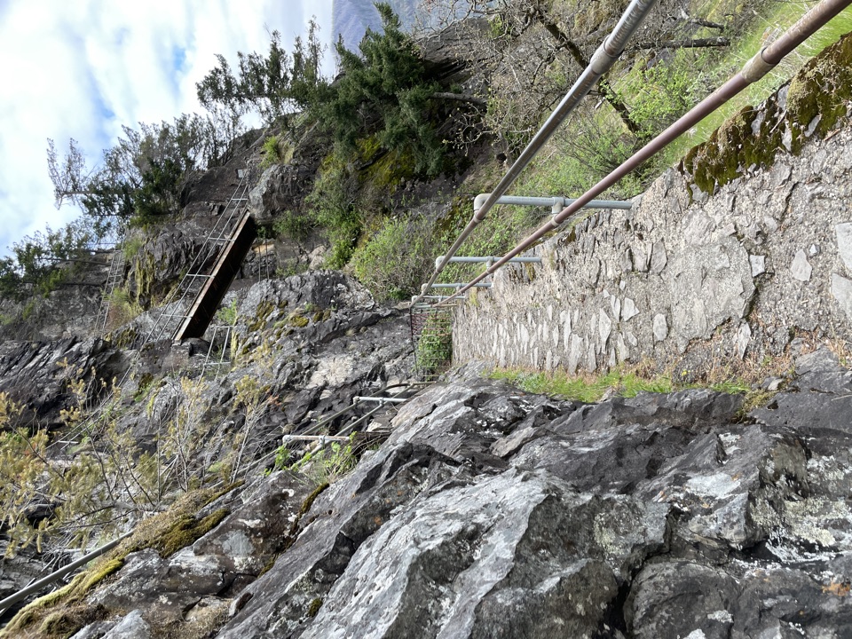
  • The rocky lower route has steep, narrow sections near cliffs.
  • The paved county-road return has blind corners.

Map & elevation

The route

Loading the Columbia River Gorge map
Full map
Elevation226–1,286 ft
TrailheadSalmon Falls Park & Ride45.58937, -122.17881
Keep this map with you offline in the Parkwolf app

Plan your hike

Before you go

Parking

Use the Skamania County Public Transit Park & Ride near the Salmon Falls Road and WA-14 junction. From WA-14, turn onto Salmon Falls Road, then right on Canyon Creek Road to the lot. The signed trail starts across Salmon Falls Road. Restrooms are at the lot; it can fill on weekends, and roadside parking is prohibited.

Safety

The lower loop is closed each year February 1–July 15 for peregrine nesting. Steep cliffs and narrow, rocky tread need care; dogs have died in falls, so a leash is strongly advised even though it is not required. The county-road return has blind corners; walk single-file and watch for vehicles.

8 active Columbia River Gorge alerts

  • CautionCape Horn area access restrictionsMentions Cape Horn, referenced in this guideCape Horn access is restricted: do not drive on National Forest System trails or off National Forest System roads, enter after sundown or before sunrise, camp, or have campfires.Official details
  • ClosureEagle Creek Fire area closureDo not enter Oneonta Gorge or the specified trail sections because hazards remain following the Eagle Creek Fire.Official details
See all 8 alerts
A park ranger sits on a dash-mounted phone, talking, as Parkwolf’s Tour Guide plays “Army Cutworm Moths: A Grizzly Bear Buffet” on Grand Loop Road below Dunraven Pass in Yellowstone
Parkwolf Tour GuideThe highest, rockiest slopes around here are a summer buffet for grizzly bears.

Columbia River Gorge Tour Guide

Your drive to Cape Horn Loop Trail, narrated.

Parkwolf is a GPS audio tour guide for Columbia River Gorge National Scenic Area. As you drive, it chimes in with what’s ahead: hidden gems, upcoming stops, history, geology, and wildlife, right through your car’s speakers.

Recorded for this trailhead

Cape Horn Loop Trail
0:00 / 0:29
“You're approaching the Cape Horn Loop trailhead, where a steep first mile leads to Gorge views before the trail drops toward river cliffs and Cape Horn Falls.”

Plays as you drive up to this trailhead in the Parkwolf Columbia River Gorge Tour Guide.

More stories near here in the app

  • What the Fire Left
  • Cape Horn's Cliff Nesters
  • The Lumberman Who Gave Away the Falls
  • The Salmon Staircase
  • 217 audio storiesacross Columbia River Gorge’s roads, triggered by GPS as you drive
  • Wildlife heatmapsfor Bald Eagle, Black Bear, American Pika, and 13 more
  • Works offlinemaps, 111 trails, 78 places, and audio download before you lose signal
  • CarPlay readysimple controls built for the drive
★★★★★
“Fantastic app with many points of information… It’s great to just turn on while you’re driving and it gives you an audio tour of the national Park. We love it!!!!”
JMJamesApp Store review
Download Parkwolf on the App StoreGet Parkwolf on Google Play

4.7 from 8,600+ ratings

Trail guide

Hiking Cape Horn Loop Trail

A full loop with several payoffsCape Horn Loop Trail is a roughly 6.

Cape Horn Loop Trail is a roughly 6.5-mile circuit from Salmon Falls Park & Ride, climbing through maple forest to a ridge of overlooks, dropping to Cape Horn Falls and the river cliffs, then returning on Cape Horn Road. The loop gains about 1,300 feet, with its hardest climbing packed into the first mile. Allow four to five hours if you want time at the viewpoints; this is a substantial hike, not a quick waterfall stop. What makes it worthwhile is the change of scene: shaded uphill tread, open Gorge views, a rocky lower trail, and one long road walk all come in the same outing.

The complete lower section is open July 16 through January 31. From February 1 through July 15, it closes to protect nesting peregrine falcons, leaving year-round out-and-back options to the upper overlooks.


Start with the climbFrom the Park & Ride, cross Salmon Falls Road to the signed trail and take the upper fork.

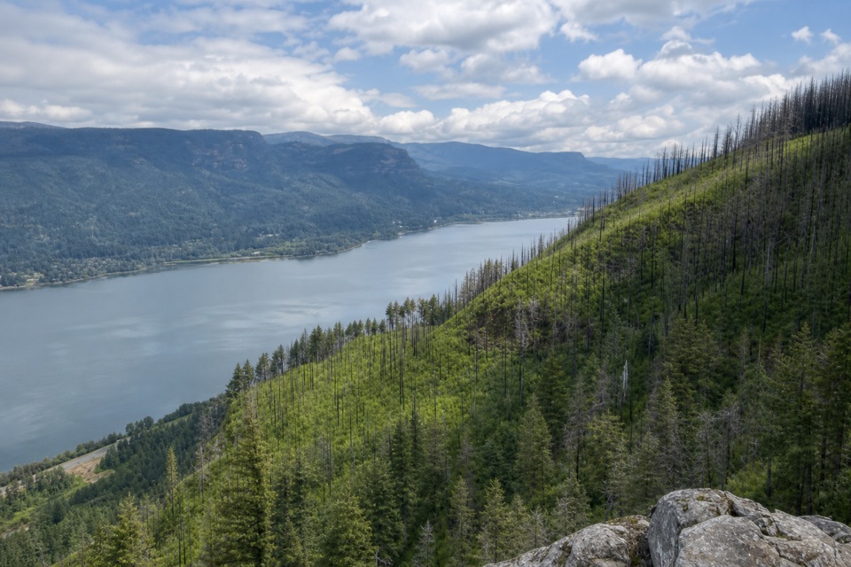
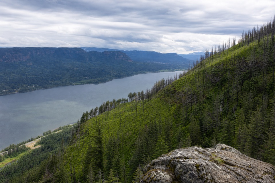
From the Park & Ride, cross Salmon Falls Road to the signed trail and take the upper fork. The path crosses a small creek on Twain Bridge, then climbs steeply under bigleaf maples, vine maples and sword ferns. The first overlook comes about 1.2 miles in, after roughly 800 feet of climbing, with east-facing views toward Hamilton Mountain, Beacon Rock and Multnomah Falls. A short spur reaches Pioneer Point and the Tipping Tree, where the view swings southwest toward Angel’s Rest and Devil’s Rest.

Return to the main path across a broad, wooded summit. It gradually descends to an abandoned forest road, then crosses Strunk Road and a gravel path to Nancy Russell Overlook. The handmade stone wall is a good place to pause and look east along the river. Russell helped protect this hillside from development, and the overlook was later named for her.

Down to the river and backFrom Nancy Russell Overlook, switchbacks descend through bigleaf maple and Oregon white oak to…

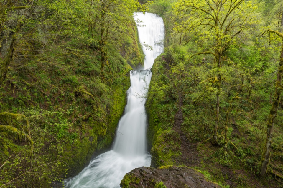
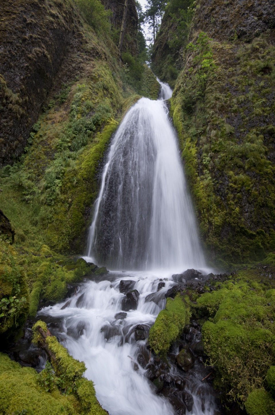
From Nancy Russell Overlook, switchbacks descend through bigleaf maple and Oregon white oak to a pedestrian underpass beneath Washington State Highway 14. Short spurs reach Cape Horn Falls Overlook and Oak View Overlook. Beyond Oak View, the full loop continues into the seasonal section, where intermittent river views lead to Cigar Rock, a basalt pillar at the water’s edge. The trail rises and drops through two moss-covered talus slopes before reaching Cape Horn Falls. Here the tread gets narrow, steep and rocky; take care near the cliff edges.

The return follows paved Cape Horn Road uphill through open pasture with views back to the cliffs, then uses another pedestrian underpass to reach the Park & Ride. That road stretch is the least trail-like part of the loop, but it completes the circuit without repeating the steep climb. For a shorter year-round outing, the out-and-back to Pioneer Point is about 2.5 miles; continuing to Nancy Russell Overlook makes it about five miles.

Practical detailsThe Skamania County Park & Ride has restrooms and is the right place to park; the lot can fill…

The Skamania County Park & Ride has restrooms and is the right place to park; the lot can fill on weekends, and roadside parking is prohibited. There is no fee or permit. No drinking water or food stop was found on the route, so don’t count on refilling or buying lunch along the way. The county-road return has blind corners; walk single-file and watch for vehicles. Dogs are permitted, but the Forest Service advises leaving them home because of the steep cliffs. If you bring one, keep it leashed; cliff falls have killed dogs here.

Wildlife

Wildlife in Columbia River Gorge

All Columbia River Gorge wildlife maps

Sighting maps show where each species has been reported across Columbia River Gorge. Wildlife moves, so no sighting is guaranteed.

Keep exploring

Near Cape Horn Loop Trail

See it all on the map

Trails that start nearby

Places near the trailhead

Parkwolf’s Columbia River Gorge ranking

Top-rated trails in Columbia River Gorge

All 111 trails
  1. 1Eagle Creek Trail #440 to Tunnel FallsChallenging · 11.7 mi
  2. 2Multnomah Falls Trail to the TopModerate · 2.4 mi
  3. 3Multnomah–Wahkeena Falls LoopChallenging · 4.8 mi
  4. 4Dog Mountain LoopChallenging · 6.9 mi
  5. 5Angel's Rest TrailModerate · 4.8 mi
  6. 7Beacon Rock TrailModerate · 1.8 mi

Take Parkwolf to Columbia River Gorge.

The audio tour guide for the drive, plus offline maps, trails, and wildlife heatmaps for when the signal drops.

4.7 from 8,600+ ratings

Download Parkwolf on the App StoreGet Parkwolf on Google Play