Discovery Point Trail in Crater Lake National Park

#8 of 34 trails in Crater Lake

Crater Lake National Park, OR

Discovery Point Trail

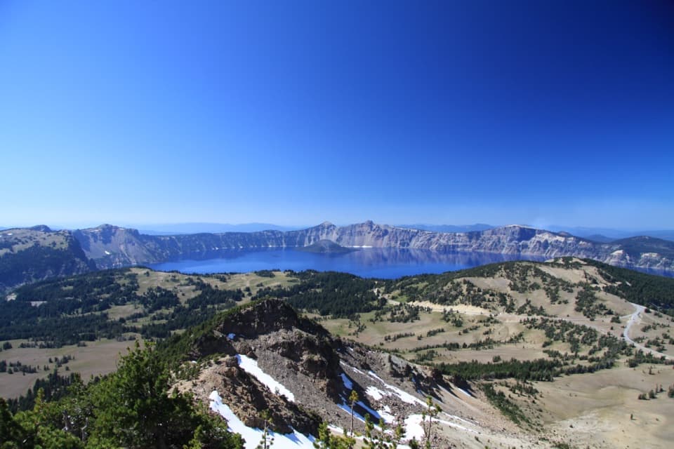
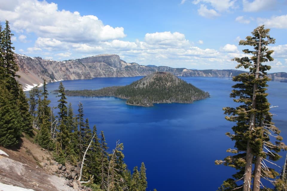
Wizard Island keeps appearing through the wind-shaped rim forest.

Photo: CC BY 2.0
Length
2mi
Time
1hr
Elev. change
131ft
Difficulty
Easy
  • No dogs
  • High point 7,175 ft

Hear the audio tour

Rim Village and Sinnott Memorial

Overview

About Discovery Point Trail

Why go

  • Repeated openings frame Wizard Island from the forested rim.
  • A short round trip reaches the Discovery Point panorama.

Heads up

  • Steep, unguarded caldera edges border some view openings.
  • Pets are prohibited on the trail.

Map & elevation

The route

Loading the Crater Lake map
Full map
Elevation7,044–7,175 ft
TrailheadRim Village west-end paved-to-dirt access42.91208, -122.14763
Keep this map with you offline in the Parkwolf app

Plan your hike

Before you go

Parking

Use Rim Village’s angle-in lots, with additional parking in the picnic area. Walk west along the paved promenade to where it becomes dirt at the village’s west end. The Discovery Point Overlook pullout is at the far end of the trail, not the primary starting access.

Best time to go

Rim Village has angle-in parking, with more spaces in its picnic area. Start at the west end of the paved walk, beyond the cafe and lodge area. The cafe is a separate stop at Rim Village and offers grab-and-go sandwiches, salads and snacks; restrooms are also available there. At this elevation, snow and ice commonly cover front-country trails from December into June, when the trails are unmarked and unavailable for winter or spring hiking. Pets are not allowed on Discovery Point Trail.

Safety

Some lake-view openings sit beside steep, unguarded caldera edges. Pets are prohibited on this trail.

2 active Crater Lake alerts

  • ClosureCleetwood Cove Trail closed for rehabilitationCleetwood Cove Trail is closed to the public during construction to rehabilitate the trail and marina.Official details
  • CautionPinnacles Road restricted to hikers and bicyclistsPinnacles Road is open only to hikers and bicyclists because of a road construction project; motor vehicles cannot use it.Official details
Crater Lake alerts
A park ranger sits on a dash-mounted phone, talking, as Parkwolf’s Tour Guide plays “Army Cutworm Moths: A Grizzly Bear Buffet” on Grand Loop Road below Dunraven Pass in Yellowstone
Parkwolf Tour GuideThe highest, rockiest slopes around here are a summer buffet for grizzly bears.

Crater Lake Tour Guide

Your drive to Discovery Point Trail, narrated.

Parkwolf is a GPS audio tour guide for Crater Lake National Park. As you drive, it chimes in with what’s ahead: hidden gems, upcoming stops, history, geology, and wildlife, right through your car’s speakers.

See the Crater Lake audio tour

Recorded for this trailhead

Rim Village and Sinnott Memorial
0:00 / 0:32
“Rim Village is coming up, a useful stop for a lake walk and a bite to eat. Make time for Sinnott Memorial if you want geology exhibits alongside a sheltered view of the water.”

Plays as you drive up to this trailhead in the Parkwolf Crater Lake Tour Guide.

More stories near here in the app

  • Crater Lake Lodge and Garfield Peak
  • Piano Wire to the Bottom
  • Discovery Point
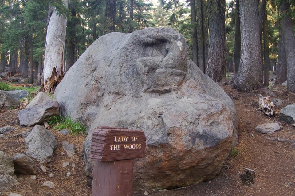
  • Steel Information Center and Lady of the Woods
  • 58 audio storiesacross Crater Lake’s roads, triggered by GPS as you drive
  • Wildlife heatmapsfor Black Bear, Mule Deer, Common Raven, and 13 more
  • Works offlinemaps, 34 trails, 49 places, and audio download before you lose signal
  • CarPlay readysimple controls built for the drive
★★★★★
“Fantastic app with many points of information… It’s great to just turn on while you’re driving and it gives you an audio tour of the national Park. We love it!!!!”
JMJamesApp Store review
Download Parkwolf on the App StoreGet Parkwolf on Google Play

4.7 from 8,600+ ratings

Trail guide

Hiking Discovery Point Trail

A short walk above the lakeDiscovery Point Trail is a 2-mile out-and-back along Crater Lake’s west rim from the west end…

Discovery Point Trail is a 2-mile out-and-back along Crater Lake’s west rim from the west end of Rim Village to Discovery Point and back. The Park Service lists about 100 feet of gain and a one-hour walking time. It is an easy, short route for many hikers, with the lake appearing between the trees and Wizard Island as the main view at the far end. The path sits around 7,100 feet, so take your time if you feel the altitude. Turn around at Discovery Point; the Rim Trail continues from the same pullout as a separate hike.

From the promenade to the pulloutWalk west from Rim Village along the paved promenade until it becomes a dirt path.

Walk west from Rim Village along the paved promenade until it becomes a dirt path. That change is the trail’s starting access. The path first follows near West Rim Drive, then slips into the forest and crosses a few gentle rises before flattening along the rim. A short split around a low rise rejoins. Near the end, the tread drops more steeply at a switchback to the Discovery Point pullout. At the last split, the right-hand approach is the easier way to the point.

Lake openings in the treesMost of the route passes through old-growth forest, especially mountain hemlock and whitebark…

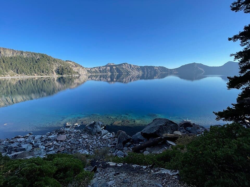
Most of the route passes through old-growth forest, especially mountain hemlock and whitebark pine. Openings in the trees bring back the lake, the caldera walls and Wizard Island, so the view builds in pieces rather than waiting for one final lookout. Some openings are close to steep, unguarded edges; stay on the established tread. For a photo, let the conifers frame Wizard Island instead of filling the whole shot with water. Calm early mornings can leave the lake glassy, though wind can change that quickly.

The name and the first reportDiscovery Point recalls John Wesley Hillman’s 1853 prospecting party, which reached Crater Lake…

Discovery Point recalls John Wesley Hillman’s 1853 prospecting party, which reached Crater Lake on June 12. A companion suggested “Deep Blue Lake” after seeing the water, but the name did not last. The historical account places the party at the lake without identifying today’s pullout as the exact point of its first view.

A caldera with an island inside itAbout 7,700 years ago, a massive eruption weakened Mount Mazama and its center collapsed,…

About 7,700 years ago, a massive eruption weakened Mount Mazama and its center collapsed, forming the caldera. Rain and snow gradually filled the basin. Later eruptions built Wizard Island, the volcanic cone you see across the water from the trail. The lake is roughly five to six miles across, and the caldera walls rise sharply around it, which is why even a short rim walk gives such a broad view.

Wildlife

Wildlife in Crater Lake

All Crater Lake wildlife maps

Sighting maps show where each species has been reported across Crater Lake. Wildlife moves, so no sighting is guaranteed.

Keep exploring

Near Discovery Point Trail

See it all on the map

Trails that start nearby

Places near the trailhead

Parkwolf’s Crater Lake ranking

Top-rated trails in Crater Lake

All 34 trails
  1. 1Garfield Peak TrailModerate · 3.6 mi
  2. 2Watchman Peak TrailModerate · 1.6 mi
  3. 3Mount Scott TrailChallenging · 4.4 mi
  4. 4Cleetwood Cove TrailChallenging · 2.2 mi
  5. 5Wizard Island Summit TrailModerate · 2.4 mi
  6. 6Sun Notch TrailEasy · 0.8 mi

Take Parkwolf to Crater Lake.

The audio tour guide for the drive, plus offline maps, trails, and wildlife heatmaps for when the signal drops.

4.7 from 8,600+ ratings

Download Parkwolf on the App StoreGet Parkwolf on Google Play