Wizard Island Summit Trail in Crater Lake National Park

#5 of 34 trails in Crater Lake

Crater Lake National Park, OR

Wizard Island Summit Trail

A steep volcanic climb to a crater above the lake.

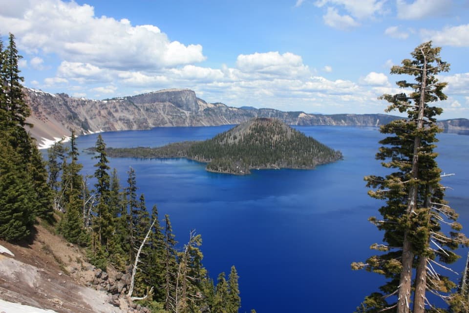
Photo: Wikimedia Commons
Length
2.4mi
Time
1.5hr
Elev. change
653ft
Difficulty
Moderate
  • No dogs
  • High point 6,893 ft

Hear the audio tour

Cleetwood Cove Trailhead

Overview

About Wizard Island Summit Trail

Why go

  • A summit-crater loop with changing views across Crater Lake
  • A volcanic climb with a clear geological payoff

Heads up

  • Steep, rough climbing at high elevation
  • Boat and shore-trail access make the outing a larger commitment

Map & elevation

The route

Loading the Crater Lake map
Full map
Elevation6,240–6,893 ft
TrailheadWizard Island boat dock42.93436, -122.15045
Keep this map with you offline in the Parkwolf app

Plan your hike

Before you go

Parking

Use the Cleetwood Cove Trailhead at the end of East Rim Drive for boat access to Wizard Island. The island has no road access; the boat trip reaches the dock where this 2.4-mile hike begins. Reaching the shore involves the separate Cleetwood Cove Trail.

Safety

Expect a sustained steep climb on rough, loose volcanic tread at roughly 6,200–6,900 feet. Use care near the crater rim. The optional Witches Cauldron descent is steep and loose and is not part of the measured route. Public access to the island trail requires boat tour service from Cleetwood Cove; it is not a roadside hike. Pets are prohibited on this trail.

2 active Crater Lake alerts

  • ClosureCleetwood Cove Trail closed for rehabilitationMentions Cleetwood Cove Trail, referenced in this guideCleetwood Cove Trail is closed to the public during construction to rehabilitate the trail and marina.Official details
  • CautionPinnacles Road restricted to hikers and bicyclistsPinnacles Road is open only to hikers and bicyclists because of a road construction project; motor vehicles cannot use it.Official details
Crater Lake alerts
A park ranger sits on a dash-mounted phone, talking, as Parkwolf’s Tour Guide plays “Army Cutworm Moths: A Grizzly Bear Buffet” on Grand Loop Road below Dunraven Pass in Yellowstone
Parkwolf Tour GuideThe highest, rockiest slopes around here are a summer buffet for grizzly bears.

Crater Lake Tour Guide

Your drive to Wizard Island Summit Trail, narrated.

Parkwolf is a GPS audio tour guide for Crater Lake National Park. As you drive, it chimes in with what’s ahead: hidden gems, upcoming stops, history, geology, and wildlife, right through your car’s speakers.

See the Crater Lake audio tour

Recorded for this trailhead

Cleetwood Cove Trailhead
0:00 / 0:23
“You're coming up on Cleetwood Cove Trailhead, the start of the only legal walking route down to the lake when the trail is open.”

Plays as you drive up to this trailhead in the Parkwolf Crater Lake Tour Guide.

More stories near here in the app

  • Lightning Spring Picnic Area
  • Discovery Point
  • Watchman Overlook and the Summit
  • Rim Village and Sinnott Memorial
  • 58 audio storiesacross Crater Lake’s roads, triggered by GPS as you drive
  • Wildlife heatmapsfor Black Bear, Mule Deer, Common Raven, and 13 more
  • Works offlinemaps, 34 trails, 49 places, and audio download before you lose signal
  • CarPlay readysimple controls built for the drive
★★★★★
“Fantastic app with many points of information… It’s great to just turn on while you’re driving and it gives you an audio tour of the national Park. We love it!!!!”
JMJamesApp Store review
Download Parkwolf on the App StoreGet Parkwolf on Google Play

4.7 from 8,600+ ratings

Trail guide

Hiking Wizard Island Summit Trail

A crater hike with an extra legWizard Island Summit Trail is a steep out-and-back from the island’s boat dock to its summit…

Wizard Island Summit Trail is a steep out-and-back from the island’s boat dock to its summit crater, with a short circuit around the rim. The standard hike is about 2.4 miles round trip, including the crater loop but not the optional descent into the crater. Allow one to two hours on the island. The boat crossing and the steep Cleetwood Cove shore trail are separate parts of the outing, so this is a bigger commitment than the mileage suggests. Go for a real volcanic climb and a perspective across Crater Lake from the middle of it; skip it if you want a quick overlook or an easy stroll. The path stays high, climbs steadily, and is rough underfoot in places.

From dock to rimThe route leaves the south-shore dock and soon reaches the split for Fumarole Bay; follow the…

The route leaves the south-shore dock and soon reaches the split for Fumarole Bay; follow the Summit Trail. The first quarter mile is the roughest, with loose, uneven volcanic rock. The tread becomes more even higher up, but the climb keeps coming. Several tight switchbacks carry you up the cinder cone. Trees shade the lower slope, then thin as you gain height and the lake begins to open behind you. The summit route is straightforward to follow at the junction, but the grade makes a short distance feel substantial. Snow can linger into early July in some years, so the start of the boat season is not always the easiest time to hike it.

Circle the Witches CauldronAt the top, the trail makes a roughly quarter-mile loop around the island’s summit crater,…

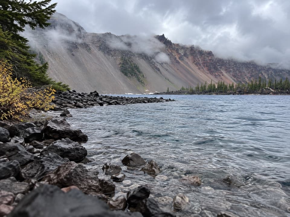
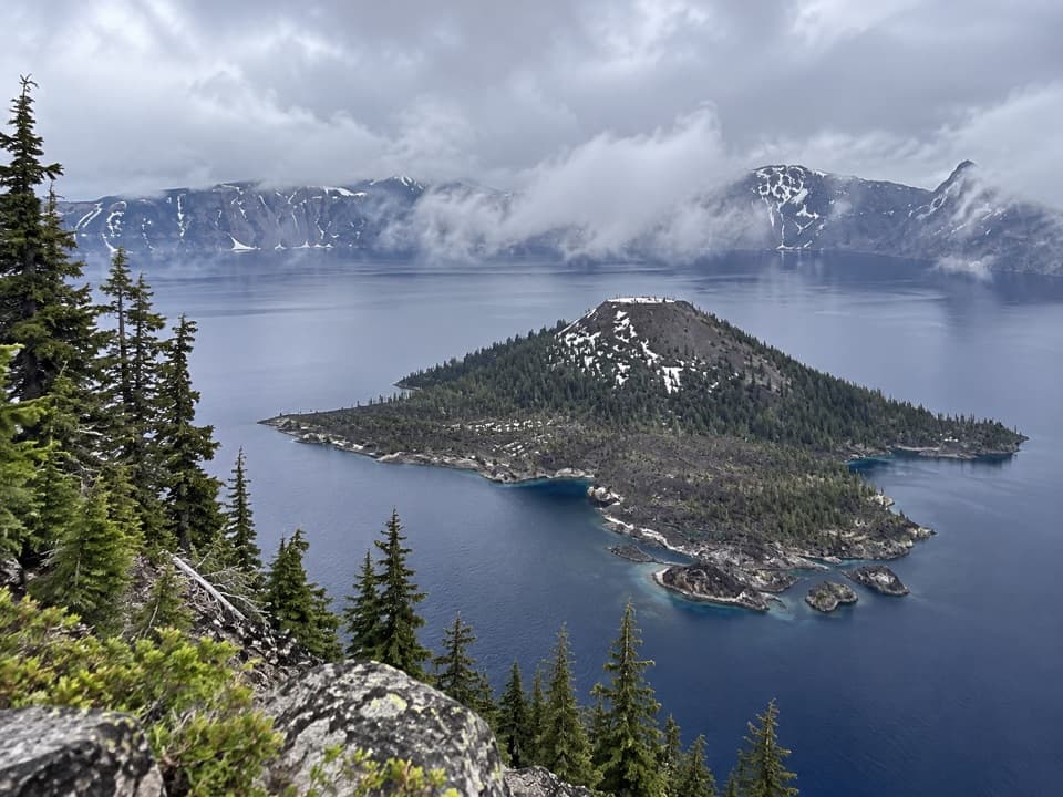
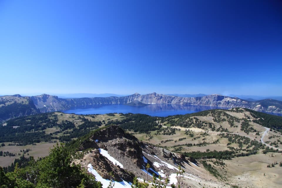
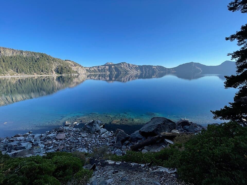
At the top, the trail makes a roughly quarter-mile loop around the island’s summit crater, locally called the Witches Cauldron. It is a smaller volcanic bowl inside Crater Lake’s much larger caldera: look over the rim into the island’s own crater, then turn back toward the blue water and the steep caldera walls. The views change as you circle, so give the loop time instead of stopping at its first opening. For a photo, keep a piece of the crater rim or a bleached tree trunk in the foreground with the lake beyond; a frame full of water loses the island’s scale.

A separate spur drops into the crater. It is short, but steep and loose, and can be slippery; it is not part of the measured 2.4-mile hike. The summit loop gives you the defining view without taking that descent.

A volcano inside a volcanoWizard Island formed after Mount Mazama’s caldera-forming eruption about 7,700 years ago.

Wizard Island formed after Mount Mazama’s caldera-forming eruption about 7,700 years ago. Its cinder cone rose within the collapsed caldera, and the crater at the top is another volcanic feature on the same island. The climb makes that layering unusually easy to read: you leave the lakeshore, cross the cone’s rocky slope, and finish above its smaller crater with the caldera all around.

Plan the accessThe public trailhead is the Wizard Island dock, reached by boat from Cleetwood Cove; the 2.

The public trailhead is the Wizard Island dock, reached by boat from Cleetwood Cove; the 2.4 miles start at the dock, not at the rim road or the shore parking lot. Reaching the boat also involves the separate, steep Cleetwood Cove Trail, and the boat trip runs on its own schedule. Lake access is seasonal, usually from late June or early July into late September or early October, and snow can affect the upper trail early in the season. A composting toilet is available near the dock; carry food and water for the boat trip and hike. Pets are not allowed on this trail.

Wildlife

Wildlife in Crater Lake

All Crater Lake wildlife maps

Sighting maps show where each species has been reported across Crater Lake. Wildlife moves, so no sighting is guaranteed.

Keep exploring

Near Wizard Island Summit Trail

See it all on the map

Trails that start nearby

Places near the trailhead

Parkwolf’s Crater Lake ranking

Top-rated trails in Crater Lake

All 34 trails
  1. 1Garfield Peak TrailModerate · 3.6 mi
  2. 2Watchman Peak TrailModerate · 1.6 mi
  3. 3Mount Scott TrailChallenging · 4.4 mi
  4. 4Cleetwood Cove TrailChallenging · 2.2 mi
  5. 6Sun Notch TrailEasy · 0.8 mi
  6. 7Plaikni Falls TrailEasy · 2 mi

Take Parkwolf to Crater Lake.

The audio tour guide for the drive, plus offline maps, trails, and wildlife heatmaps for when the signal drops.

4.7 from 8,600+ ratings

Download Parkwolf on the App StoreGet Parkwolf on Google Play