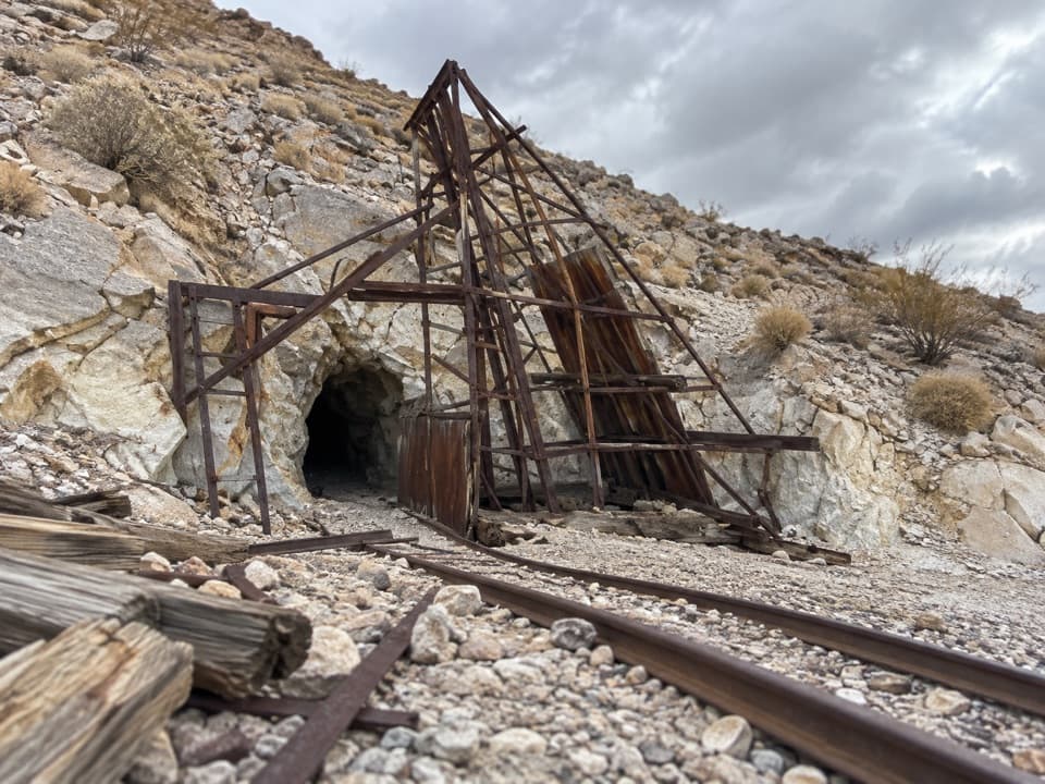
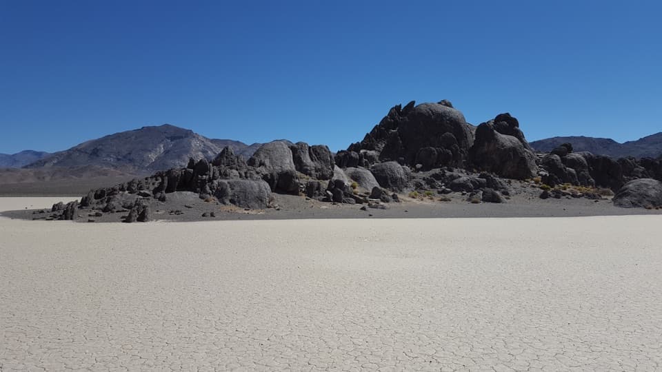
Lower Marble Canyon in Death Valley National Park

Death Valley National Park, CA · NV

Lower Marble Canyon

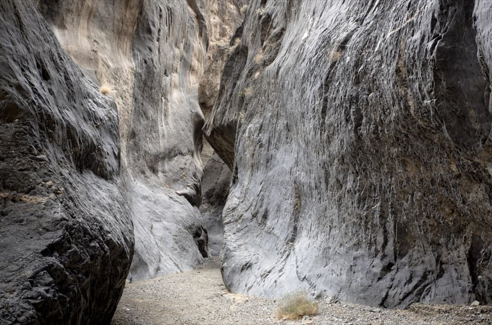
An 8.4-mile wash hike to polished narrows and dragon eggs.

Photo: Andrew Smith from Seattle, WA, USA, CC BY-SA 2.0, via Wikimedia Commons

Length
8.4mi
Time
6hr
Elev. change
1,388ft
Difficulty
Moderate
  • No dogs
  • High point 3,238 ft
  • #21 of 57 in Death Valley
Parkwolf audio tour228 stories across Death Valley’s roads

Overview

About Lower Marble Canyon

Why go

  • Dark, polished narrows and a distinctive boulder-filled side canyon.
  • The carved Goldbelt marker and “dragon egg” cluster give the route memorable waypoints.

Heads up

  • The 4WD trailhead is reached by a rough, remote road; 2WD access adds several miles.
  • Unmarked route, short scrambles, no dependable water, and serious flash-flood exposure.
Lower Marble Canyon is an unmarked out-and-back up a gravel wash, then northwest into a side canyon of polished narrows and rounded “dragon eggs.” From the 4WD trailhead, count about 4.2 miles each way, 8.4 miles total; the turnaround sits nearly 1,400 feet above the start. Allow about five to seven hours for the uneven wash, one bypass scramble and the short scrambles farther in. This is a remote route for hikers comfortable reading a canyon, not a signed trail. It’s separate from the 26–28-mile Cottonwood–Marble loop.
Parkwolf’s verdictIs this the hike for you?

Map & elevation

The route

Loading the Death Valley map
Full map
Elevation1,850–3,238 ft
TrailheadMarble Canyon 4WD Trailhead36.61880, -117.33054
Keep this map with you offline in the Parkwolf app

Plan your hike

Before you go

Parking

Marble Canyon 4WD Trailhead at the end of Marble Canyon Road; reaching it requires a high-clearance 4WD vehicle. The 2WD limit by Cottonwood Wash adds roughly 4–5 miles of road walking each way. The access is remote and rough; check current road conditions with the park.

Safety

This is an unmarked desert wash with route-finding, a faint bypass around a chockstone, and short scrambles in the side-canyon narrows. Flash floods can carry rocks and debris through the canyon; do not enter if storms threaten the drainage. No dependable water source is documented. Pets are prohibited on trails and in wilderness. Day-hike permit requirements were not established.

4 active Death Valley alerts

  • ClosureRoad closures and hazardous conditionsSeveral park roads are closed or hazardous; follow closures and vehicle restrictions.Official details
  • ClosureSaline Valley Lower Springs closed after wildfireLower Springs pools at Saline Valley Warm Springs remain closed because the September 15 wildfire left safety hazards, including potential hazardous chemicals; do not enter the closed area.Official details
See all 4 alerts
A park ranger sits on a dash-mounted phone, talking, as Parkwolf’s Tour Guide plays “Army Cutworm Moths: A Grizzly Bear Buffet” on Grand Loop Road below Dunraven Pass in Yellowstone
Parkwolf Tour GuideThe highest, rockiest slopes around here are a summer buffet for grizzly bears.

Death Valley Tour Guide

Your drive to Lower Marble Canyon, narrated.

Parkwolf is a GPS audio tour guide for Death Valley National Park. As you drive, it chimes in with what’s ahead: hidden gems, upcoming stops, history, geology, and wildlife, right through your car’s speakers.

See the Death Valley audio tour
  • 228 audio storiesacross Death Valley’s roads, triggered by GPS as you drive
  • Wildlife heatmapsfor Bighorn Sheep, Desert Tortoise, Coyote, and 13 more
  • Works offlinemaps, 57 trails, 81 places, and audio download before you lose signal
  • CarPlay readysimple controls built for the drive
★★★★★
“Fantastic app with many points of information… It’s great to just turn on while you’re driving and it gives you an audio tour of the national Park. We love it!!!!”
JMJamesApp Store review
Download Parkwolf on the App StoreGet Parkwolf on Google Play

4.7 from 8,600+ ratings

Trail guide

Hiking Lower Marble Canyon

Through the narrows to the forkFollow the wash south.

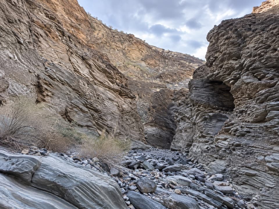
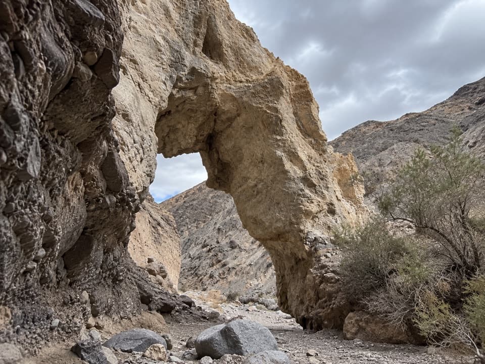
Follow the wash south. The First Narrows start almost at once, with polished walls, black chert nodules and pale calcite stripes. A large granite boulder blocks a pour-over at the end; use the faint bypass gully on the north side and go around the cliffs rather than trying to climb the boulder. Beyond it, the Second Narrows are longer and darker, with smooth walls that overhang the winding wash and hide much of the sky. Look for old petroglyphs on the walls and leave them untouched.

The canyon widens for a stretch. At about 2.4 miles from the 4WD start, a rounded boulder carved with “Goldbelt” and an arrow marks the side-canyon turn. Go northwest there. The main canyon continues toward other narrows, but that’s a different outing.

Dragon eggs and the last narrowsIn the side canyon, baseball-sized rounded rocks become common, then gather into a nest-like…

In the side canyon, baseball-sized rounded rocks become common, then gather into a nest-like cluster in the wash. Beyond it, the canyon tightens again into winding passages with a few short scramble-ups. It eventually opens into a broad, greener wash. The documented route ends about 4.2 miles from the car; turn around there. Between the GPS checkpoints, the map line is a guide through the drainage, not a marked tread.

What the rocks are telling youMost of these walls are ancient limestone and dolomite, deposited in an ocean and later tilted…

Most of these walls are ancient limestone and dolomite, deposited in an ocean and later tilted and folded. Black chert and calcite bands stand out against the pale, smoothly sculpted carbonate. The big boulder at the first narrows is different: it’s quartz monzonite carried down from Hunter Mountain by powerful floods. Floods still reshape the canyon and can push rocks and debris through its narrowest sections.

Plan the approachThe route begins at the end of Marble Canyon Road, a rough, high-clearance 4WD drive.

The route begins at the end of Marble Canyon Road, a rough, high-clearance 4WD drive. If you stop at the 2WD limit by Cottonwood Wash, add roughly 4–5 miles of road walking each way. Road measurements vary with the chosen start point, so plan on the longer side. There are no reliable water or food stops documented at the remote trailhead or along this route; carry what you need from the car.

This is a low-elevation desert hike, best kept for the cooler part of the year, roughly November through March. Heat can still be severe in spring and fall, and summer temperatures can be dangerous. Flash floods can sweep debris through the wash even when rain is upstream, so stay out of the canyon if storms threaten. Pets aren’t allowed on trails or in the wilderness. Permit instructions are clear for the separate overnight loop, but the day-hike rule for this route wasn’t clear; check with the park before heading in.

Wildlife

Wildlife in Death Valley

All Death Valley wildlife maps

Sighting maps show where each species has been reported across Death Valley. Wildlife moves, so no sighting is guaranteed.

Parkwolf’s Death Valley ranking

Top-rated trails in Death Valley

All 57 trails
  1. 1Badwater Salt FlatEasy · 1.9 mi
  2. 2Mosaic CanyonModerate · 4 mi
  3. 3Golden Canyon to Red CathedralModerate · 3 mi
  4. 4Telescope Peak TrailChallenging · 12.2 mi
  5. 5Golden Canyon Complete CircuitChallenging · 7.8 mi
  6. 6Gower Gulch LoopModerate · 4.3 mi

Take Parkwolf to Death Valley.

The audio tour guide for the drive, plus offline maps, trails, and wildlife heatmaps for when the signal drops.

4.7 from 8,600+ ratings

Download Parkwolf on the App StoreGet Parkwolf on Google Play