Cottonwood Marble Loop in Death Valley National Park

Death Valley National Park, CA · NV

Cottonwood Marble Loop

A hard, 26-mile wilderness loop through three remote desert canyons.

Photo: Andrew Smith from Seattle, WA, USA, CC BY-SA 2.0, via Wikimedia Commons

Length
26.3mi
Time
1day
Elev. change
3,333ft
Difficulty
Challenging
  • Loop
  • No dogs
  • High point 4,511 ft
  • #18 of 57 in Death Valley
Parkwolf audio tour228 stories across Death Valley’s roads

Overview

About Cottonwood Marble Loop

Why go

  • Three contrasting canyon systems, from cottonwood groves to striped narrows.
  • A rewarding remote route for experienced wilderness backpackers.

Heads up

  • Rough 4WD approach; 2WD adds about 4 miles of walking.
  • Sparse water and difficult route-finding through unmarked terrain.

Map & elevation

The route

Loading the Death Valley map
Full map
Elevation1,178–4,511 ft
TrailheadCottonwood & Marble Canyon Roads Intersection36.63104, -117.29628
Keep this map with you offline in the Parkwolf app

Plan your hike

Before you go

Parking

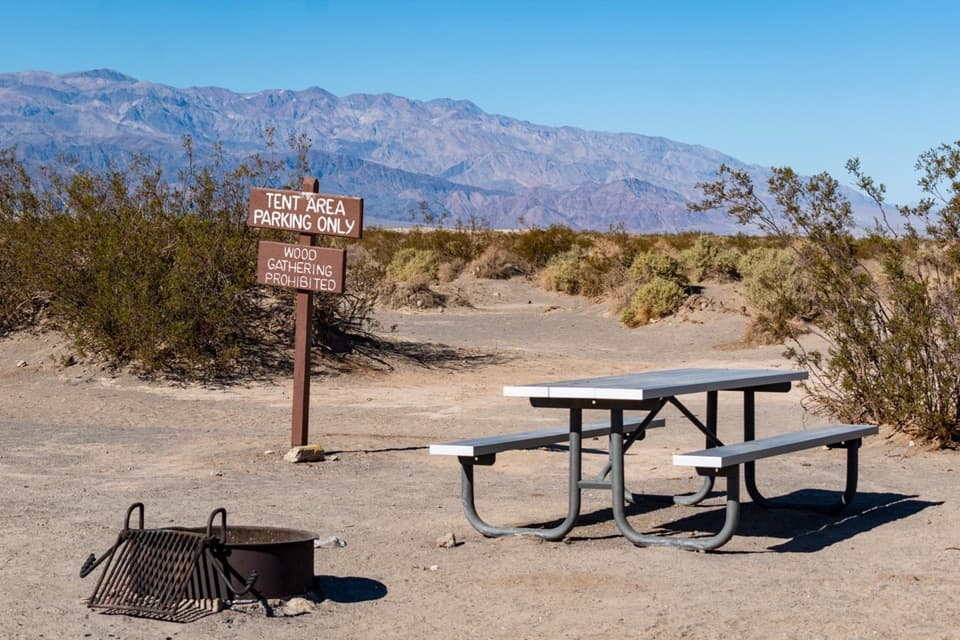
Start at the Cottonwood and Marble Canyon roads junction, reached via Cottonwood Marble Road from Stovepipe Wells. The last roughly 2 miles require 4WD; the 2WD parking area is about 2 miles short, adding roughly 2 miles each way on foot. The listed loop distance starts at the junction.

Safety

No maintained trail or signs; route-finding is difficult at Cottonwood Springs and the Deadhorse saddles. Carry a detailed map, compass, and GPS. A dry 8-foot drop in Deadhorse Canyon requires careful scrambling; footing on one side is loose. Springs are seasonal and unreliable; carry water and treat any source. The park advises against low-elevation hiking May through October. Narrow canyons carry flash-flood risk. Backcountry permits are required, and pets are prohibited on trails and in wilderness.

4 active Death Valley alerts

  • ClosureRoad closures and hazardous conditionsSeveral park roads are closed or hazardous; follow closures and vehicle restrictions.Official details
  • ClosureSaline Valley Lower Springs closed after wildfireLower Springs pools at Saline Valley Warm Springs remain closed because the September 15 wildfire left safety hazards, including potential hazardous chemicals; do not enter the closed area.Official details
See all 4 alerts
A park ranger sits on a dash-mounted phone, talking, as Parkwolf’s Tour Guide plays “Army Cutworm Moths: A Grizzly Bear Buffet” on Grand Loop Road below Dunraven Pass in Yellowstone
Parkwolf Tour GuideThe highest, rockiest slopes around here are a summer buffet for grizzly bears.

Death Valley Tour Guide

Your drive to Cottonwood Marble Loop, narrated.

Parkwolf is a GPS audio tour guide for Death Valley National Park. As you drive, it chimes in with what’s ahead: hidden gems, upcoming stops, history, geology, and wildlife, right through your car’s speakers.

See the Death Valley audio tour
  • 228 audio storiesacross Death Valley’s roads, triggered by GPS as you drive
  • Wildlife heatmapsfor Bighorn Sheep, Desert Tortoise, Coyote, and 13 more
  • Works offlinemaps, 57 trails, 81 places, and audio download before you lose signal
  • CarPlay readysimple controls built for the drive
★★★★★
“Fantastic app with many points of information… It’s great to just turn on while you’re driving and it gives you an audio tour of the national Park. We love it!!!!”
JMJamesApp Store review
Download Parkwolf on the App StoreGet Parkwolf on Google Play

4.7 from 8,600+ ratings

Trail guide

Hiking Cottonwood Marble Loop

The full loopThe Cottonwood Marble Loop is a 26.

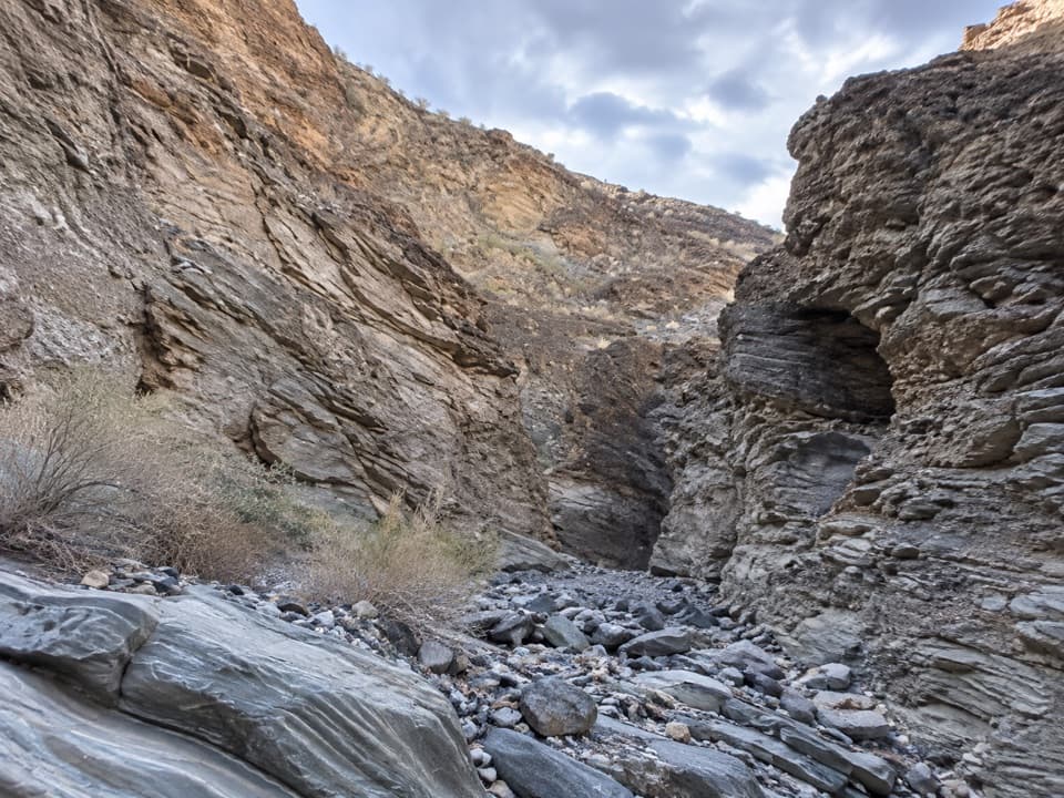
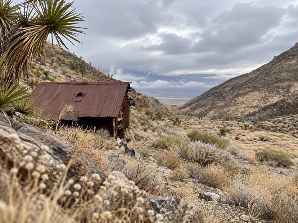
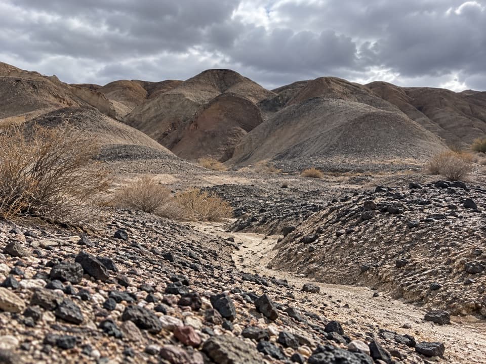
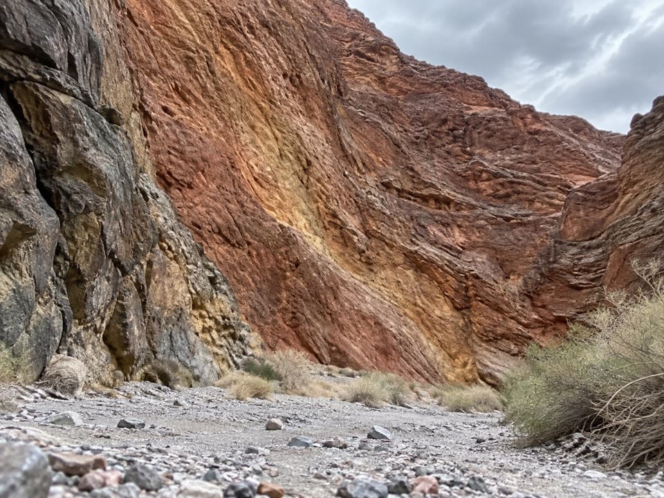
The Cottonwood Marble Loop is a 26.3-mile wilderness circuit from the Cottonwood and Marble Canyon roads junction. It follows a rough canyon road down Cottonwood Canyon, crosses open country to Deadhorse Canyon, then winds through Marble Canyon’s narrows and returns to the junction. Expect gravel washes, brush, bedrock, and faint cross-country paths rather than a maintained trail or signs. Most backpackers travel clockwise. Plan two to three nights; this is for experienced hikers comfortable navigating off trail and carrying a full desert backpacking load. An online backcountry permit is required.

Cottonwood Canyon and its springsThe first 8.

The first 8.5 miles follow a rough road that begins relatively flat before winding between canyon walls. At its end, continue about 3.5 miles through cottonwoods and several creek crossings to Cottonwood Springs. Near the spring, a steep, narrow path climbs over a rocky outcrop; when the drainage opens, look for the faint track heading north out of the shallow wash toward dense trees. If you reach a large cairn, you have gone too far. Old desert markers in the valley once guided miners toward Keeler and Goldbelt during the early twentieth-century mining boom. Burro and wild-horse sign may show near the springs, though sightings are never assured.

Finding the way to DeadhorseFrom Cottonwood Springs, cross a long valley and climb a moderately steep gully to a low saddle.

From Cottonwood Springs, cross a long valley and climb a moderately steep gully to a low saddle. The route-finding gets harder after that: descend into a vegetated canyon, climb to a smaller saddle overlooking Deadhorse, then take the left-hand traverse into the drainage and turn right downstream. An older GPX line sends hikers toward a steeper headwall here. Stop at the saddle and check your map before descending. Carry a detailed topographic map, compass, and GPS; footprints and faint tracks can lead into the wrong canyon. Deadhorse’s seasonal spring is about a quarter mile north of the large cottonwoods and is known to dry up first.

Through Deadhorse and MarbleThe route crosses the seasonal creek several times over exposed bedrock in Deadhorse Canyon.

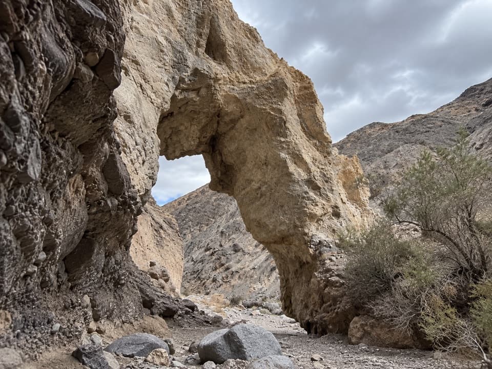
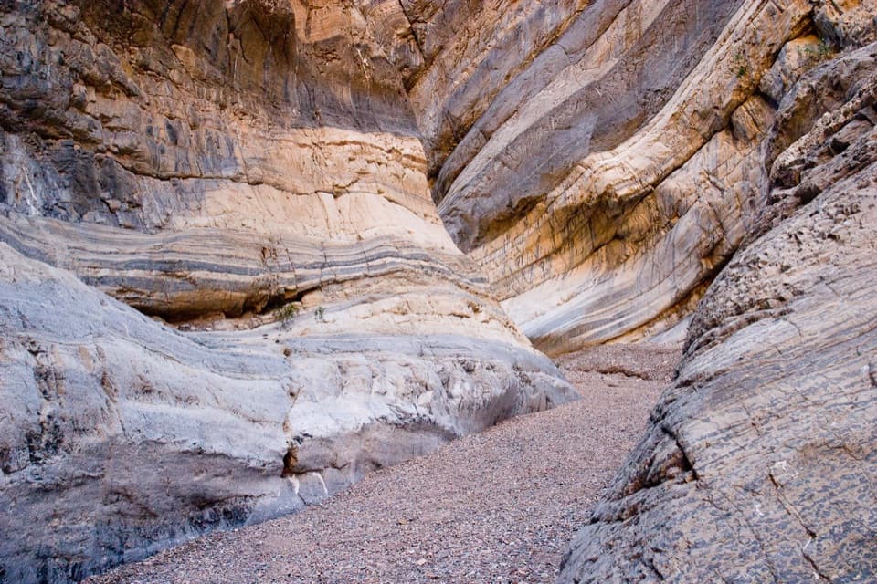
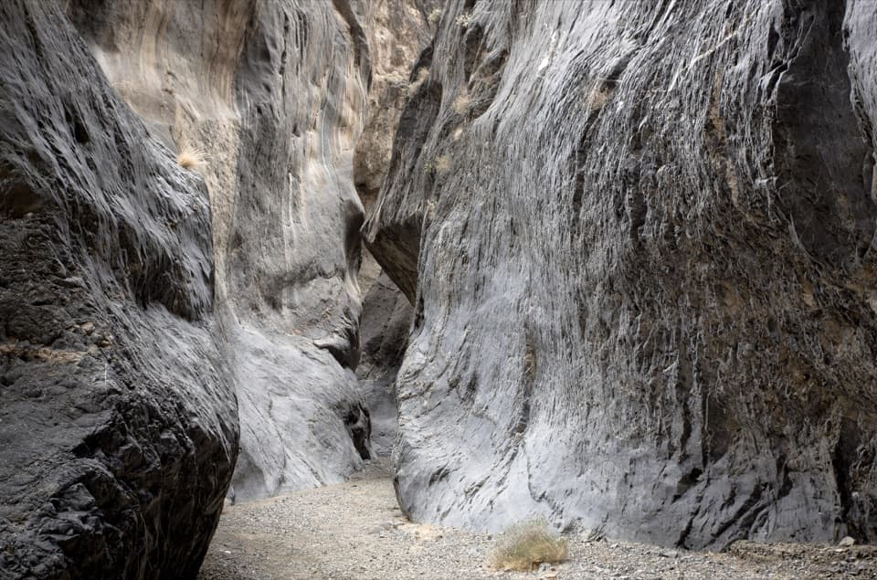
The route crosses the seasonal creek several times over exposed bedrock in Deadhorse Canyon. Within the first 800 feet, an 8-foot dryfall requires a careful descent; the left side has better handholds, while the right is looser. Marble Canyon joins from the northwest about 0.4 mile farther on. Three sets of narrows follow: black-and-white bands stripe the upper walls, while the middle passage runs beneath polished, overhanging limestone streaked tan and caramel. A huge chokestone blocks the passage between the middle and lower narrows; backtrack about 300 feet to the bypass. Quiet hikers may spot or hear owls in the middle narrows. This is a strong place to frame the curving walls around a person for scale. Flash floods move debris through these confined canyons, so keep storm risk in mind.

Getting there and planningReach the starting junction from CA-190 through Stovepipe Wells and Cottonwood Marble Road.

Reach the starting junction from CA-190 through Stovepipe Wells and Cottonwood Marble Road. The last roughly 2 miles to the junction require 4WD; the 2WD parking area is farther back, adding about 2 miles of walking each way. The final 1.8 miles of the loop crosses a sun-exposed wash with one more short narrows section. The park lists 3,882 feet of elevation gain and advises against low-elevation hiking from May through October. Springs are seasonal and may be dry; carry your own water and treat any backcountry source. Camp at least 100 feet from water and use a stove instead of an open fire. Pets are not allowed on trails or in wilderness.

Wildlife

Wildlife in Death Valley

All Death Valley wildlife maps

Sighting maps show where each species has been reported across Death Valley. Wildlife moves, so no sighting is guaranteed.

Keep exploring

Near Cottonwood Marble Loop

See it all on the map

Trails that start nearby

Places near the trailhead

Parkwolf’s Death Valley ranking

Top-rated trails in Death Valley

All 57 trails
  1. 1Badwater Salt FlatEasy · 1.9 mi
  2. 2Mosaic CanyonModerate · 4 mi
  3. 3Golden Canyon to Red CathedralModerate · 3 mi
  4. 4Telescope Peak TrailChallenging · 12.2 mi
  5. 5Golden Canyon Complete CircuitChallenging · 7.8 mi
  6. 6Gower Gulch LoopModerate · 4.3 mi

Take Parkwolf to Death Valley.

The audio tour guide for the drive, plus offline maps, trails, and wildlife heatmaps for when the signal drops.

4.7 from 8,600+ ratings

Download Parkwolf on the App StoreGet Parkwolf on Google Play