Willow Canyon in Death Valley National Park

Death Valley National Park, CA · NV

Willow Canyon

An unmarked cross-country walk to a seasonal waterfall

Photo: NPS

Length
4.2mi
Time
2.5hr
Elev. change
831ft
Difficulty
Moderate
  • No dogs
  • High point 597 ft
  • #23 of 57 in Death Valley

Hear the audio tour

Sidewinder and Willow Canyons: Choose Your Commitment

Overview

About Willow Canyon

Why go

  • A genuine canyon finish with a seasonal waterfall in a dramatic setting.
  • Polished, banded rock and changing alluvial deposits make the route varied.

Heads up

  • Unmarked navigation across a long, exposed rocky fan.
  • The falls may be dry, and the last section is slick and uneven.

Map & elevation

The route

Loading the Death Valley map
Full map
Elevation-234–597 ft
TrailheadWillow Canyon Trailhead Parking Area36.06564, -116.74490
Keep this map with you offline in the Parkwolf app

Plan your hike

Before you go

Parking

Use the unmarked gravel access road on Badwater Road 31.5 miles south of CA-190, between mile markers 31 and 32. The access road is less than half a mile and is typically passable to a sedan. It ends at an open gravel lot shared with Sidewinder Canyon; Willow starts from the north end. There are no nearby restrooms.

Safety

The route has no trail signage and crosses an exposed alluvial fan. The final quarter mile is over slick polished bedrock and may require scrambling. Do not enter the narrow upper canyon when rain threatens because of flash-flood risk. Park rules limit pets to developed areas, so pets cannot accompany this cross-country hike.

4 active Death Valley alerts

  • ClosureRoad closures and hazardous conditionsSeveral park roads are closed or hazardous; follow closures and vehicle restrictions.Official details
  • ClosureSaline Valley Lower Springs closed after wildfireLower Springs pools at Saline Valley Warm Springs remain closed because the September 15 wildfire left safety hazards, including potential hazardous chemicals; do not enter the closed area.Official details
See all 4 alerts
A park ranger sits on a dash-mounted phone, talking, as Parkwolf’s Tour Guide plays “Army Cutworm Moths: A Grizzly Bear Buffet” on Grand Loop Road below Dunraven Pass in Yellowstone
Parkwolf Tour GuideThe highest, rockiest slopes around here are a summer buffet for grizzly bears.

Death Valley Tour Guide

Your drive to Willow Canyon, narrated.

Parkwolf is a GPS audio tour guide for Death Valley National Park. As you drive, it chimes in with what’s ahead: hidden gems, upcoming stops, history, geology, and wildlife, right through your car’s speakers.

See the Death Valley audio tour

Recorded for this trailhead

Sidewinder and Willow Canyons: Choose Your Commitment
0:00 / 0:28
“You're approaching the access for Sidewinder and Willow Canyons. Choose Sidewinder for three tight slot canyons, with crawling, narrow squeezes and ledges up to eight feet high.”

Plays as you drive up to this trailhead in the Parkwolf Death Valley Tour Guide.

More stories near here in the app

  • A Toad's Desert Nursery
  • Practicing a Mars Landing
  • Salt Working Inside the Rock
  • The Jay’s Buried Pine Nuts
  • 228 audio storiesacross Death Valley’s roads, triggered by GPS as you drive
  • Wildlife heatmapsfor Bighorn Sheep, Desert Tortoise, Coyote, and 13 more
  • Works offlinemaps, 57 trails, 81 places, and audio download before you lose signal
  • CarPlay readysimple controls built for the drive
★★★★★
“Fantastic app with many points of information… It’s great to just turn on while you’re driving and it gives you an audio tour of the national Park. We love it!!!!”
JMJamesApp Store review
Download Parkwolf on the App StoreGet Parkwolf on Google Play

4.7 from 8,600+ ratings

Trail guide

Hiking Willow Canyon

A canyon walk with an uncertain waterfallWillow Canyon is a 4.

Willow Canyon is a 4.2-mile round-trip cross-country hike from the shared Badwater Road parking area to a 40 to 50 foot pour-over. The route crosses an open, rocky fan, then climbs a wash into a narrow canyon. Allow about 2.5 hours and roughly 800 feet of climbing. The canyon and polished rock are there on every visit; water is seasonal, so the falls may be dry.

This is an unmarked route, not a maintained path. Bring a map of the canyon approach and keep it handy from the lot. The main challenge is choosing the right wash across the fan and following it to the deep cleft, then picking your way over slick rock at the end.

Find the right washStart from the north end of the shared Willow and Sidewinder Canyon lot.

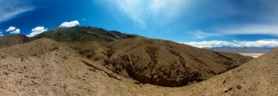
Start from the north end of the shared Willow and Sidewinder Canyon lot. Head north and northeast, wrapping around the low foothills toward the deep canyon. Several smaller gullies cut across the fan and can look tempting; the intended route is the broad wash leading into the high, dark canyon. Willow is north of Sidewinder, which leaves from the same parking area in the other direction.

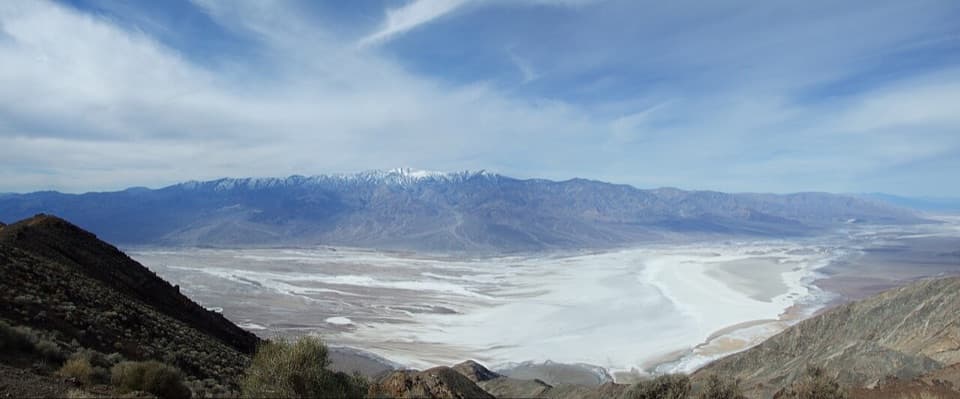
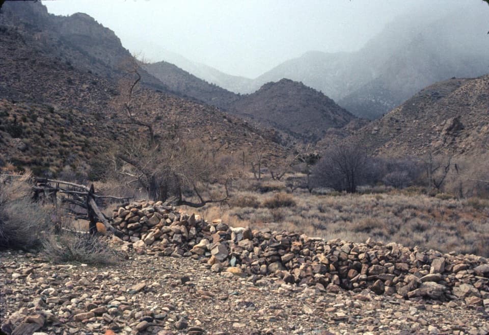
The first stretch is exposed, with cobbly, rocky footing and little shade. The fan gives broad views across the Badwater salt flats toward the Panamint Mountains. Take your time matching the landforms to your map before committing to a drainage.

Into the washThe route follows a moderately rising wash with low canyon walls at first.

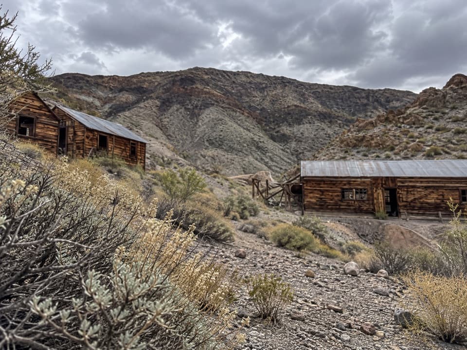
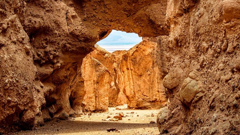
The route follows a moderately rising wash with low canyon walls at first. Farther in, the channel broadens beside a side wash where newer gray boulders and gravel sit against older, darker varnished rock. These deposits show how water and debris move out of the surrounding canyons during floods. Near the tighter bends, the rock changes to red conglomerate, with small honeycomb-like pockets and occasional low pour-overs.

The narrows and dryfallThe canyon closes in during the final stretch.

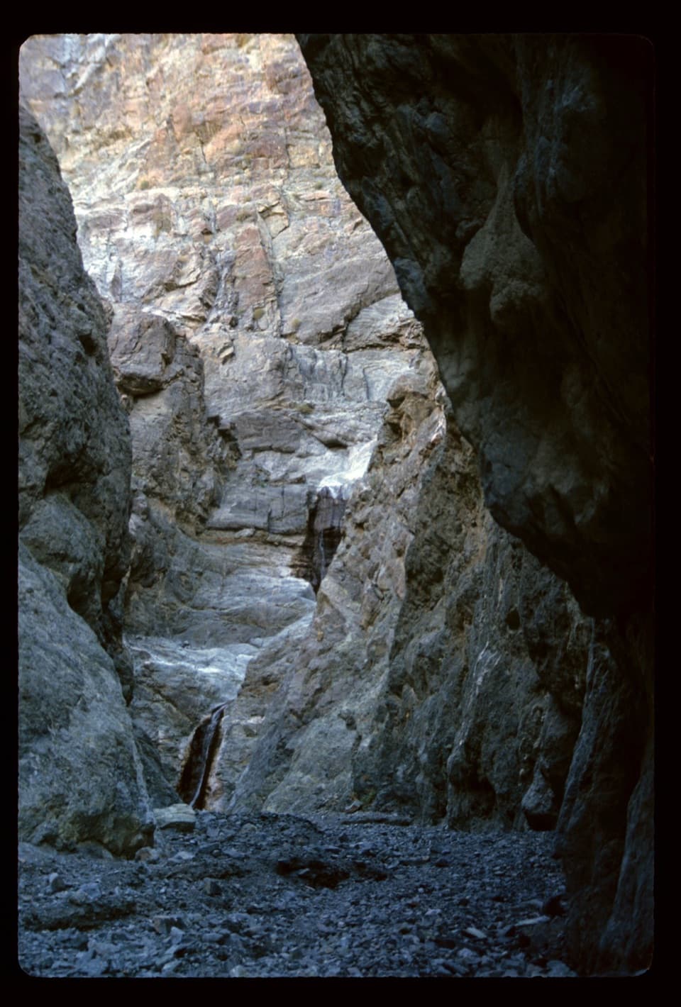
The canyon closes in during the final stretch. The upper wash becomes a deep, narrow slot, and the last quarter mile crosses smooth, water-polished bedrock. Expect some scrambling and watch your footing; the rock can be slick. The route ends at a 40 to 50 foot pour-over. When water is flowing it drops into a small pool, but reports vary by season and dry spells, and a stained dryfall is a normal outcome.

The polished walls carry bands of pale gray, white, red and green. If the falls are running, include some of the narrow canyon in a photo so the cascade has scale; the colored rock is still the main subject when it is dry.

Access and safetyThe approach is sun-exposed and there is no route signage.

The approach is sun-exposed and there is no route signage. Carry the water you need for a remote desert walk. Turn back if rain threatens: a narrow canyon wash can flood quickly, and the upper section offers little room to get out of the channel. Park rules limit pets to developed areas, so they cannot accompany this cross-country hike. There are no nearby restrooms at the parking area.

Wildlife

Wildlife in Death Valley

All Death Valley wildlife maps

Sighting maps show where each species has been reported across Death Valley. Wildlife moves, so no sighting is guaranteed.

Parkwolf’s Death Valley ranking

Top-rated trails in Death Valley

All 57 trails
  1. 1Badwater Salt FlatEasy · 1.9 mi
  2. 2Mosaic CanyonModerate · 4 mi
  3. 3Golden Canyon to Red CathedralModerate · 3 mi
  4. 4Telescope Peak TrailChallenging · 12.2 mi
  5. 5Golden Canyon Complete CircuitChallenging · 7.8 mi
  6. 6Gower Gulch LoopModerate · 4.3 mi

Take Parkwolf to Death Valley.

The audio tour guide for the drive, plus offline maps, trails, and wildlife heatmaps for when the signal drops.

4.7 from 8,600+ ratings

Download Parkwolf on the App StoreGet Parkwolf on Google Play