Parking
Park at Rarakau Car Park (Bluecliffs) near Tuatapere; no public transport—drive or hitchhike.

Fiordland National Park, SL
Rugged south coast, tramway viaducts, dolphins, and deep mud.
Overview
A true Fiordland backcountry classic, the South Coast Track serves up wild beaches, regenerating podocarp forest, dramatic headlands, and a heavy dose of history. Expect swing bridges, sections of beach walking, and an old timber tramway with four historic wooden viaducts. If you’re lucky, Hector’s dolphins cruise just offshore. It’s quieter than the park’s Great Walks, but also rougher and more remote—exactly the appeal for many.
 Parkwolf’s verdictWhy go
Map & elevation
Plan your hike

The highest, rockiest slopes around here are a summer buffet for grizzly bears.
Fiordland Tour Guide
Parkwolf is a GPS audio tour guide for Fiordland National Park. As you drive, it chimes in with what’s ahead: hidden gems, upcoming stops, history, geology, and wildlife, right through your car’s speakers.
See the Fiordland audio tour“Fantastic app with many points of information… It’s great to just turn on while you’re driving and it gives you an audio tour of the national Park. We love it!!!!”


Trail guide
The standard east–west traverse runs one way for about 38 miles (61 km) from Rarakau Car Park near Tuatapere to Big River. The first leg to Port Craig is the gentlest, with well-formed track that’s fine for less experienced trampers. Highlights early include Blowholes Beach and the Port Craig milling relics with interpretive panels. From Port Craig to the Wairaurahiri, the track follows the old tramline—mostly flat travel punctuated by those photogenic viaducts. West of the Wairaurahiri toward Waitutu, the going gets boggy for much of the way before improving; from Waitutu to Big River, it feels the most remote, with arguably the best forest and overall scenery.
Don’t be fooled by the low elevation—this is an advanced tramping route once you’re past Port Craig. Expect deep mud, uneven, rooty tread, tide-dependent beach sections, and unbridged stream/river crossings that can be impassable after rain. It’s slow going in places and navigation includes beach route-finding. Cell coverage is limited to nonexistent. Allow 4–6 days for the full traverse (roughly 21–29 hours on foot, depending on tides and conditions). A popular shorter option is the out-and-back to Port Craig (about 20 km, ~7 hours one way).
Huts are spaced sensibly along the route, including Port Craig, Wairaurahiri, Waitutu, and Big River. DOC huts here are first-come, first-served—carry hut tickets or a Backcountry Hut Pass. There’s also a private lodge at Port Craig if you want more comfort (book separately). There are no services along the track; you must be self-sufficient. Water from huts should be boiled before drinking. Campsites exist but can be scarce and damp; experienced trampers sometimes use unofficial camping near Big River.
Start at Rarakau Car Park (Bluecliffs). There’s no public transport to the trailhead—most people drive or hitchhike. Several sections are tide-affected; plan your day around the coast windows. Download offline topo maps/GPS data ahead of time and check current advisories on the Department of Conservation track page. If you want to extend your mission, this route can link with the Hump Ridge Track or the Teal Bay–South Coast Track.
Wildlife
 1,181 sightingsKeaMost seen around 10 AMSighting map
 199 sightingsFiordland PenguinMost seen around 7 PMSighting map
 228 sightingsBlue DuckMost seen around 5 PMSighting map
 32 sightingsBottlenose DolphinMost seen around 5 PMSighting map
 247 sightingsNew Zealand Fur SealMost seen around 6 PMSighting map
 58 sightingsKākāMost seen around 6 PMSighting map
Sighting maps show where each species has been reported across Fiordland. Wildlife moves, so no sighting is guaranteed.
Keep exploring
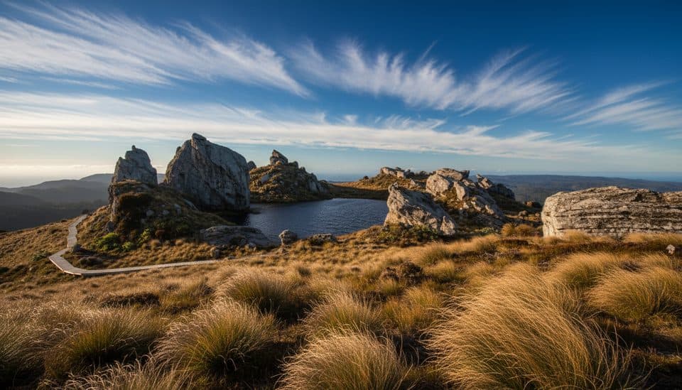 ChallengingTuatapere Hump Ridge Track61.5 km · 22.5 hr · At the trailheadCoast-to-alpine loop with big views, heritage viaducts, and comfy lodges.
 ChallengingHump Ridge Track61.5 km · 1 day · At the trailheadCoast-to-alpine Great Walk with big views and comfy lodges
 ChallengingWaitutu Track34.4 km · 16 hr · At the trailheadRemote viaduct-and-forest tramp into Fiordland's wild south coastChallengingLake Hauroko Lookout Track5.4 km · 3 hr · 18.8 km awayA steep, rough rainforest climb to a rugged panorama above Lake Hauroko
Parkwolf’s Fiordland ranking
The audio tour guide for the drive, plus offline maps, trails, and wildlife heatmaps for when the signal drops.


