Parking
Park at the signposted Rarakau Car Park near the Rarakau Station homestead at Bluecliffs Beach. From Tuatapere, the approach is about 28 km and includes roughly 7 km of unsealed road; cars are left at the owner’s risk.

Fiordland National Park, SL
Remote viaduct-and-forest tramp into Fiordland's wild south coast
Overview
The one-way route is about 21.4 miles (34.4 km) from Rarakau Car Park to the mapped access turnoff for Waitutu Forest Lodge. Allow around 16 hours of walking, usually split over two long days. This is a remote point-to-point backcountry tramp, not a short nature walk or a groomed Great Walk. The route combines beaches, forest, bridges and old timber-tramway sections; the lodge sits roughly 600 metres off the mapped track, so arrange access rather than assuming the line reaches its door.
 Parkwolf’s verdictIs this the right tramp for you?
Map & elevation
Plan your hike

The highest, rockiest slopes around here are a summer buffet for grizzly bears.
Fiordland Tour Guide
Parkwolf is a GPS audio tour guide for Fiordland National Park. As you drive, it chimes in with what’s ahead: hidden gems, upcoming stops, history, geology, and wildlife, right through your car’s speakers.
See the Fiordland audio tour“Fantastic app with many points of information… It’s great to just turn on while you’re driving and it gives you an audio tour of the national Park. We love it!!!!”


Trail guide
From the car park, the track crosses coastal streams and beaches before reaching the historic Port Craig milling settlement. Beyond it, the route follows an old logging tramline through regenerating native forest and over the Sand Hill, Percy Burn, Edwin Burn and Francis Burn viaducts. The final approach turns inland toward the Waitutu Forest Lodge access point. Store the route as the walking corridor once; the distance above is one way, not a return total.
The elevation is modest, but mud, wet forest, unbridged streams and exposed coastal sections can make progress slow. Tide timing matters on beach sections, and navigation and survival skills are important beyond Port Craig. Carry water-treatment supplies, warm waterproof layers and sandfly protection. There is no road connection at the lodge end; plan your return or jet-boat/other transport before setting out.
This is a good choice if you want a quiet, story-rich route rather than polished infrastructure. The viaducts and Port Craig relics reveal the area's timber-milling past, while the Waitutu Forest protects an exceptional tract of lowland podocarp bush. Watch the coast for Hector's dolphins and fur seals, and bring a camera for the timber structures, beach approaches and towering rimu and rata. Rarakau Car Park is reached by about 28 km of road from Tuatapere, including an unsealed section; leave the car at the signposted parking area at the owner's risk.
Wildlife
 1,181 sightingsKeaMost seen around 10 AMSighting map
 199 sightingsFiordland PenguinMost seen around 7 PMSighting map
 228 sightingsBlue DuckMost seen around 5 PMSighting map
 32 sightingsBottlenose DolphinMost seen around 5 PMSighting map
 247 sightingsNew Zealand Fur SealMost seen around 6 PMSighting map
 58 sightingsKākāMost seen around 6 PMSighting map
Sighting maps show where each species has been reported across Fiordland. Wildlife moves, so no sighting is guaranteed.
Keep exploring
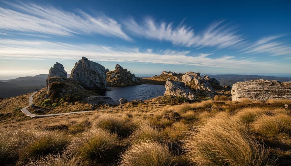 ChallengingTuatapere Hump Ridge Track61.5 km · 22.5 hr · At the trailheadCoast-to-alpine loop with big views, heritage viaducts, and comfy lodges.
 ChallengingHump Ridge Track61.5 km · 1 day · At the trailheadCoast-to-alpine Great Walk with big views and comfy lodges
 ChallengingSouth Coast Track61 km · 1 days · At the trailheadRugged south coast, tramway viaducts, dolphins, and deep mud.ChallengingLake Hauroko Lookout Track5.4 km · 3 hr · 18.8 km awayA steep, rough rainforest climb to a rugged panorama above Lake Hauroko
Parkwolf’s Fiordland ranking
The audio tour guide for the drive, plus offline maps, trails, and wildlife heatmaps for when the signal drops.


