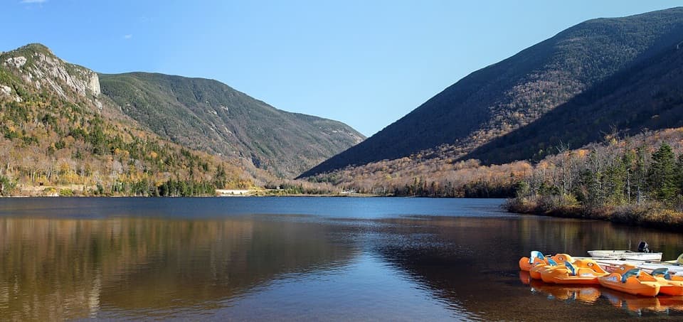
Mount Pemigewasset in Franconia Notch State Park

Sight · Franconia Notch State Park

Mount Pemigewasset

Broad ledges turn a steady climb into a Franconia Notch view.

Photo: Wikimedia Commons
Type
Sight
Nearest trail
0.9 mi
Audio stories
12 nearby
  • Parking
  • #12 of 26 sights

Hear the audio tour

Mount Pemigewasset and the Indian Head Profile

Overview

About Mount Pemigewasset

Why stop

  • Wide-open views across Franconia Notch
  • The distinctive Indian Head cliff profile

Heads up

  • A steady, rocky climb ends at exposed summit ledges

Map

Where it is

Loading the Franconia Notch map
Full map
SightMount Pemigewasset44.09763, -71.69968
Keep this map with you offline in the Parkwolf app

Plan your stop

Before you go

2 active Franconia Notch alerts

  • ClosureFlume Gorge Short Trail closed; seasonal closure Oct 26The Flume Gorge Short Trail/Rim Path is closed; before the seasonal closure, visitors must use the full 2-mile loop.Official details
  • ClosureCannon Mountain Aerial Tramway closed and retiredThe Cannon Mountain Aerial Tramway (Tram II) is closed and retired; do not plan on a tram ride.Official details
Franconia Notch alerts
A park ranger sits on a dash-mounted phone, talking, as Parkwolf’s Tour Guide plays “Army Cutworm Moths: A Grizzly Bear Buffet” on Grand Loop Road below Dunraven Pass in Yellowstone
Parkwolf Tour GuideThe highest, rockiest slopes around here are a summer buffet for grizzly bears.

Franconia Notch Tour Guide

Your drive to Mount Pemigewasset, narrated.

Parkwolf is a GPS audio tour guide for Franconia Notch State Park. As you drive, it chimes in with what’s ahead: hidden gems, upcoming stops, history, geology, and wildlife, right through your car’s speakers.

See the Franconia Notch audio tour

Recorded for this place

Mount Pemigewasset and the Indian Head Profile
0:00 / 0:23
“You're nearing the Flume parking area and the start of the Mount Pemigewasset hike.”

Plays as you drive up to Mount Pemigewasset in the Parkwolf Franconia Notch Tour Guide.

More stories near here in the app

  • The Frog That Freezes
  • The Storm That Changed the Flume
  • The Rock Missing from the Flume
  • Flume Gorge and the Full Loop
  • 32 audio storiesacross Franconia Notch’s roads, triggered by GPS as you drive
  • Wildlife heatmapsfor Black Bear, Moose, Wild Turkey, and 13 more
  • Works offlinemaps, 29 trails, 33 places, and audio download before you lose signal
  • CarPlay readysimple controls built for the drive
★★★★★
“Fantastic app with many points of information… It’s great to just turn on while you’re driving and it gives you an audio tour of the national Park. We love it!!!!”
JMJamesApp Store review
Download Parkwolf on the App StoreGet Parkwolf on Google Play

4.7 from 8,600+ ratings

Guide

More about Mount Pemigewasset

Make the climb for the ledgesMount Pemigewasset is a roughly 2,500-foot summit at the south end of Franconia Notch, known…

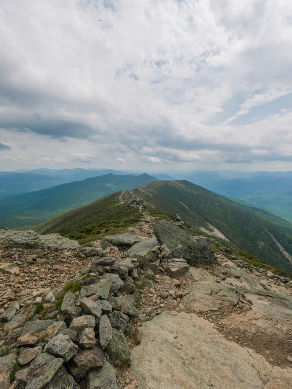
Mount Pemigewasset is a roughly 2,500-foot summit at the south end of Franconia Notch, known for its open ledges and the cliff profile called Indian Head. This is a proper uphill hike, not a roadside overlook. I’d choose it when you want a summit view and have time for a steady climb. From the Flume Gorge trailhead, the blue-blazed Mount Pemi Trail is just over 3 miles round trip with about 1,259 feet of gain.

Choose your trailhead firstThe Flume route starts at the Flume Gorge parking area near I-93 Exit 34A.

The Flume route starts at the Flume Gorge parking area near I-93 Exit 34A. Begin on the recreation path, then take the Mount Pemi sign and follow the blue blazes into the woods. The path gives way to rocky, rooty footing, with steeper climbing near the top. There’s a second approach on Indian Head Trail from a small lot on U.S. 3 south of Indian Head Resort. It uses a different trailhead, so use directions and mileage for the route you pick. Busy lots can fill early, and parking on I-93’s shoulder is illegal.

The Flume Visitor Center has a cafeteria and gift shop by the standard Flume approach. Those are trailhead stops, not summit facilities.

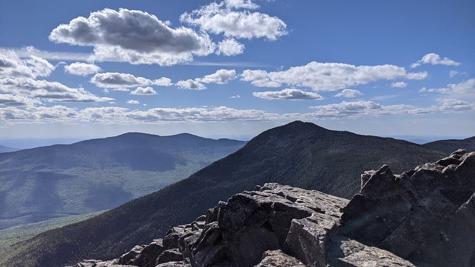
Walk the open ledges carefullyAt the top, the trail opens onto broad rock above steep drops.

At the top, the trail opens onto broad rock above steep drops. Wet rock can be slippery, so take care where the footing changes. From the ledges, look across Franconia Notch toward Franconia Ridge and Kinsman Ridge. Walk a little along the open rock before settling on a viewpoint; different ledges give you different angles. For a photo, keep some of the ledge along the bottom of the frame with the notch beyond it, so the view has a sense of scale.

The Indian Head profileThe pale cliff line on the mountain’s southern face reads like a head in profile, which gives…

The pale cliff line on the mountain’s southern face reads like a head in profile, which gives this summit its other familiar name. The rocky outline stands above the surrounding forest and is easiest to appreciate from below. At the summit, you’re on the exposed ledges themselves, looking out across the notch.

Wildlife

Wildlife in Franconia Notch

All Franconia Notch wildlife maps

Sighting maps show where each species has been reported across Franconia Notch. Wildlife moves, so no sighting is guaranteed.

Keep exploring

Near Mount Pemigewasset

See it all on the map

Trails nearby

More stops nearby

Parkwolf’s Franconia Notch ranking

Top sights in Franconia Notch

All 33 places
  1. 1Flume GorgeSight
  2. 2The BasinSight
  3. 3Old Man of the Mountain Profile PlazaSight
  4. 4Artists BluffSight
  5. 5Echo Lake BeachBeach
  6. 6Mount LafayetteSight

Take Parkwolf to Franconia Notch.

The audio tour guide for the drive, plus offline maps, trails, and wildlife heatmaps for when the signal drops.

4.7 from 8,600+ ratings

Download Parkwolf on the App StoreGet Parkwolf on Google Play