Rocky Glen Falls in Franconia Notch State Park

Sight · Franconia Notch State Park

Rocky Glen Falls

A stepped gorge waterfall worth the uphill finish.

Type
Sight
Nearest trail
0.5 mi
Audio stories
11 nearby
  • Trailhead
  • Parking

Hear the audio tour

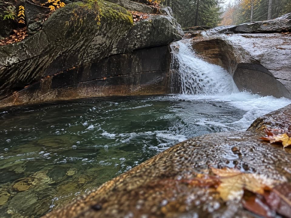
The Basin’s Water-Carved Bowl

Overview

About Rocky Glen Falls

Why stop

  • Several cascades make the brookside walk part of the payoff.

Heads up

  • A rocky crossing and steep final climb make it a rougher stop than The Basin.

Map

Where it is

Loading the Franconia Notch map
Full map
SightRocky Glen Falls44.12621, -71.69357
Keep this map with you offline in the Parkwolf app

Plan your stop

Before you go

2 active Franconia Notch alerts

  • ClosureFlume Gorge Short Trail closed; seasonal closure Oct 26The Flume Gorge Short Trail/Rim Path is closed; before the seasonal closure, visitors must use the full 2-mile loop.Official details
  • ClosureCannon Mountain Aerial Tramway closed and retiredThe Cannon Mountain Aerial Tramway (Tram II) is closed and retired; do not plan on a tram ride.Official details

Franconia Notch alerts
A park ranger sits on a dash-mounted phone, talking, as Parkwolf’s Tour Guide plays “Army Cutworm Moths: A Grizzly Bear Buffet” on Grand Loop Road below Dunraven Pass in Yellowstone
Parkwolf Tour GuideThe highest, rockiest slopes around here are a summer buffet for grizzly bears.

Franconia Notch Tour Guide

Your drive to Rocky Glen Falls, narrated.

Parkwolf is a GPS audio tour guide for Franconia Notch State Park. As you drive, it chimes in with what’s ahead: hidden gems, upcoming stops, history, geology, and wildlife, right through your car’s speakers.

See the Franconia Notch audio tour

Recorded for this place

The Basin’s Water-Carved Bowl
0:00 / 0:34
“The Basin is coming up, and it's a good choice for a short stop without a mountain hike. A paved path leads to a waterfall pouring into a smooth granite bowl in the Pemigewasset River.”

Plays as you drive up to Rocky Glen Falls in the Parkwolf Franconia Notch Tour Guide.

More stories near here in the app

  • A Chickadee’s Hidden Food
  • Lonesome Lake and Its Shoreline Loop
  • Mount Lafayette and Franconia Ridge
  • Where Autumn’s Colors Come From
  • 32 audio storiesacross Franconia Notch’s roads, triggered by GPS as you drive
  • Wildlife heatmapsfor Black Bear, Moose, Wild Turkey, and 13 more
  • Works offlinemaps, 29 trails, 33 places, and audio download before you lose signal
  • CarPlay readysimple controls built for the drive
★★★★★
“Fantastic app with many points of information… It’s great to just turn on while you’re driving and it gives you an audio tour of the national Park. We love it!!!!”
JMJamesApp Store review
Download Parkwolf on the App StoreGet Parkwolf on Google Play

4.7 from 8,600+ ratings

Guide

More about Rocky Glen Falls

The upper falls on Cascade BrookRocky Glen Falls is the last named waterfall on the Basin-Cascades Trail, above Kinsman Falls…

Rocky Glen Falls is the last named waterfall on the Basin-Cascades Trail, above Kinsman Falls in Franconia Notch. It’s the payoff for a longer brookside walk, not the quick look at The Basin near the parking area. Plan on roughly 2.2 miles round trip and 550 feet of climbing from the trailhead. If you want a string of cascades and a more tucked-away finish, keep going; if you only want an easy waterfall view, The Basin is the simpler stop.

The uphill finishStart from the Basin trailhead, where parking is available on both sides of I-93, and follow…

Start from the Basin trailhead, where parking is available on both sides of I-93, and follow the trail beside Cascade Brook. You pass smaller cascades and Kinsman Falls before crossing the brook on rocks and climbing steeply toward Rocky Glen. High water can make the crossing unsafe. This is not a wheelchair-accessible stop: the upper falls require an uneven trail and rocky crossing. The old bridge above Rocky Glen has been removed, so don’t count on continuing from here to Lonesome Lake.

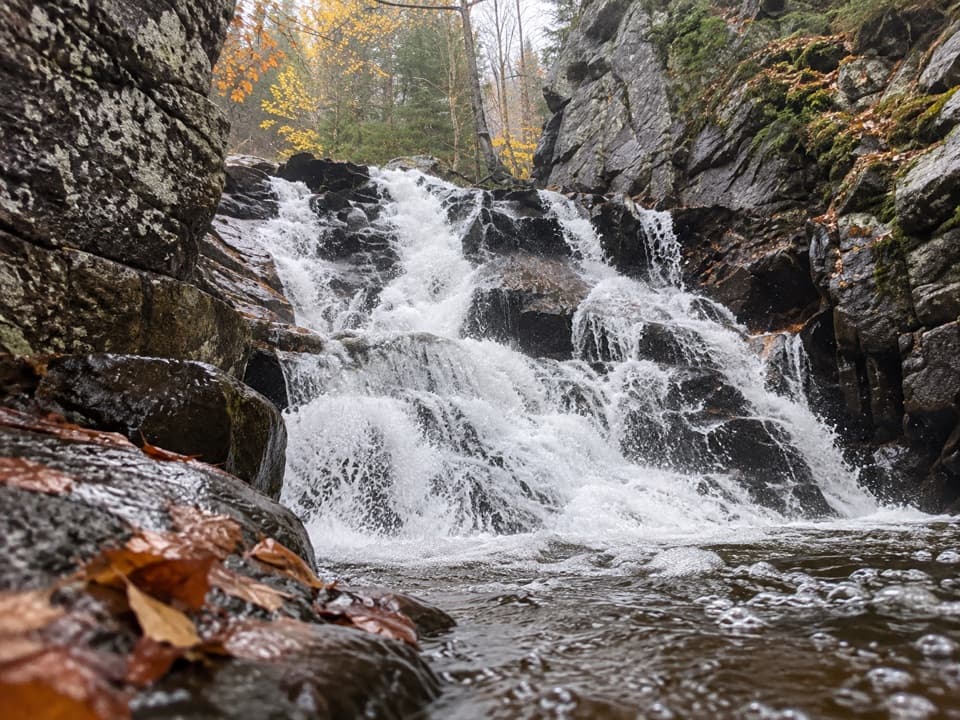
Look into the gorgeThe brook tumbles over jagged rock steps between narrow walls and gathers in deep, yellow-toned…

The brook tumbles over jagged rock steps between narrow walls and gathers in deep, yellow-toned pools. Sources disagree on the falls’ height and number of drops, so the useful thing to notice is the stepped shape and the color of the water below. A short step down from the trail viewpoint brings you closer to the gorge, but the footing is rocky. For a photo, frame both the stepped water and a little of the pool; the walls show how tightly the brook is squeezed in.

Part of a longer cascadeRocky Glen is one named fall in a roughly mile-long run where Cascade Brook drops about 600…

Rocky Glen is one named fall in a roughly mile-long run where Cascade Brook drops about 600 feet through waterfalls, slides and pools. The walk earns its length through that whole sequence, with Rocky Glen at the upper end rather than as a stand-alone roadside feature.

Wildlife

Wildlife in Franconia Notch

All Franconia Notch wildlife maps

Sighting maps show where each species has been reported across Franconia Notch. Wildlife moves, so no sighting is guaranteed.

Keep exploring

Near Rocky Glen Falls

See it all on the map

Trails nearby

More stops nearby

Parkwolf’s Franconia Notch ranking

Top sights in Franconia Notch

All 33 places
  1. 1Flume GorgeSight
  2. 2The BasinSight
  3. 3Old Man of the Mountain Profile PlazaSight
  4. 4Artists BluffSight
  5. 5Echo Lake BeachBeach
  6. 6Mount LafayetteSight

Take Parkwolf to Franconia Notch.

The audio tour guide for the drive, plus offline maps, trails, and wildlife heatmaps for when the signal drops.

4.7 from 8,600+ ratings

Download Parkwolf on the App StoreGet Parkwolf on Google Play