Gable Pass Trail in Glacier National Park

Glacier National Park, MT

Gable Pass Trail

A long Lee Ridge climb to a steep, rocky pass.

Length
13.6mi
Time
9hr
Elev. change
1,923ft
Difficulty
Challenging
  • No dogs
  • High point 7,425 ft
  • #56 of 157 in Glacier

Hear the audio tour

Lee Ridge Trailhead

Overview

About Gable Pass Trail

Why go

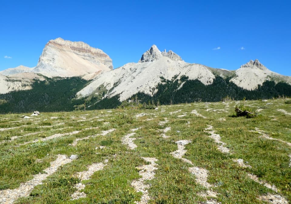
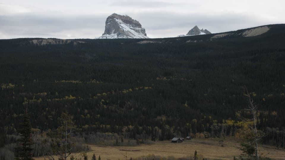
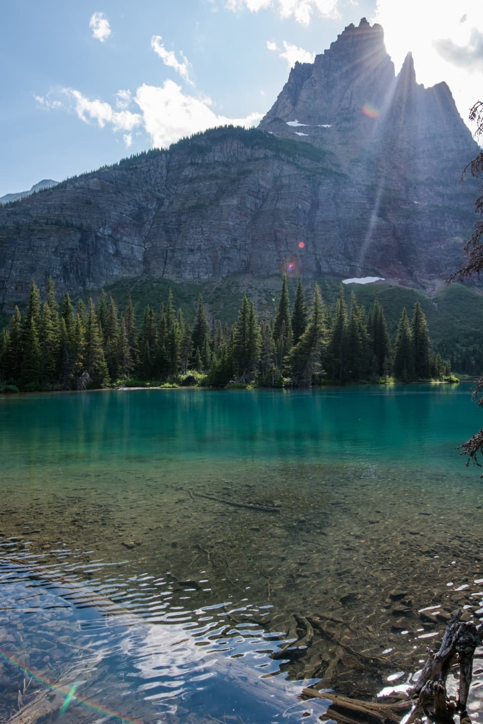
  • Open ridge views toward Chief Mountain and the surrounding peaks.
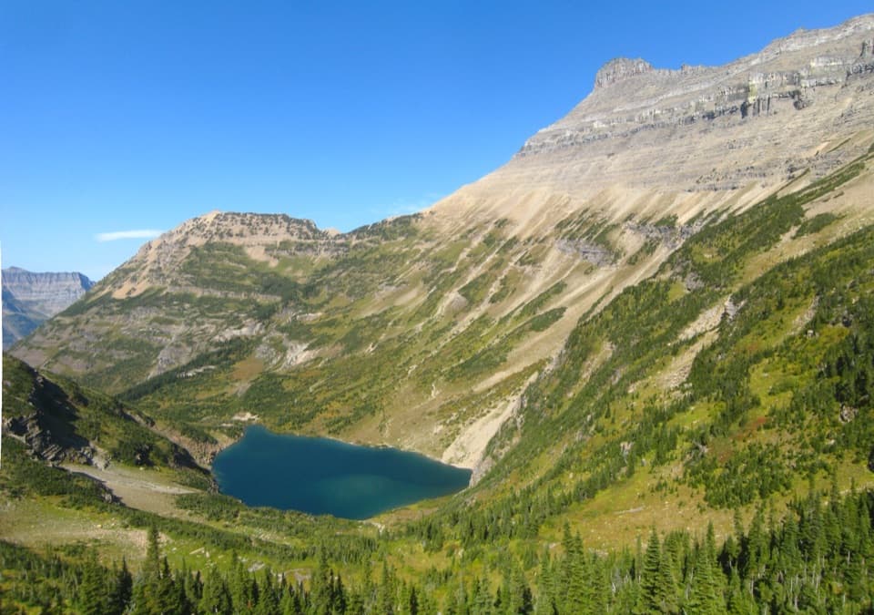
  • The rocky pass overlooks the head of Otatso Creek Valley.

Heads up

  • A long forest approach comes before the alpine ridge.
  • The final section is steep, rocky, and harder to follow than the lower trail.
Gable Pass Trail via Lee Ridge is a strenuous out-and-back from the Lee Ridge trailhead on Chief Mountain International Highway. Following the mapped trail about 6.8 miles to Gable Pass and returning the same way makes about 13.6 miles round trip. A detailed published route description gives 13.1 miles, so treat the total as approximate and plan on a full day; about 8–10 hours is a planning estimate. The open ridge and the pass are the payoff. If the rough final leg doesn't suit you, the Gable Pass junction makes a worthwhile shorter turnaround.
Parkwolf’s verdictIs this the hike for you?

Map & elevation

The route

Loading the Glacier map
Full map
Elevation5,502–7,425 ft
TrailheadLee Ridge Trailhead on Chief Mountain International Highway48.98977, -113.65199
Keep this map with you offline in the Parkwolf app

Plan your hike

Before you go

Parking

Lee Ridge Trailhead is on Chief Mountain International Highway near the Canadian border. There is no formal lot at the trailhead. A small roadside pullout about a tenth of a mile beyond it is reported to fit roughly ten cars; another roadside area is about a tenth of a mile before. Keep the highway clear and use the roadside spaces.

Safety

The tread fades above treeline, where cairns can be hard to spot. The final approach to Gable Pass drops steeply and crosses a large boulder field; footing and route-finding are much harder there than on the forest approach.

1 active Glacier alert

  • ClosureTwo Medicine Campground closed for 2026 constructionTwo Medicine Campground is closed throughout 2026 because of construction in the Two Medicine developed area.Official details
Glacier alerts
A park ranger sits on a dash-mounted phone, talking, as Parkwolf’s Tour Guide plays “Army Cutworm Moths: A Grizzly Bear Buffet” on Grand Loop Road below Dunraven Pass in Yellowstone
Parkwolf Tour GuideThe highest, rockiest slopes around here are a summer buffet for grizzly bears.

Glacier Tour Guide

Your drive to Gable Pass Trail, narrated.

Parkwolf is a GPS audio tour guide for Glacier National Park. As you drive, it chimes in with what’s ahead: hidden gems, upcoming stops, history, geology, and wildlife, right through your car’s speakers.

See the Glacier audio tour

Recorded for this trailhead

Lee Ridge Trailhead
0:00 / 0:28
“Lee Ridge Trailhead is coming up, an easily missed roadside start near the Canadian border. Choose this for a full hiking day: twelve miles round trip to the Gable Pass Trail junction, taking around eight hours.”

Plays as you drive up to this trailhead in the Parkwolf Glacier Tour Guide.

More stories near here in the app

  • Belly River Trailhead and Stoney Indian Pass
  • The Pass That Brought the Railway
  • Horns That Keep Growing
  • How a Cliff Becomes a Rock Pile
  • 204 audio storiesacross Glacier’s roads, triggered by GPS as you drive
  • Wildlife heatmapsfor Grizzly Bear, Wolverine, Mountain Goat, and 13 more
  • Works offlinemaps, 157 trails, 91 places, and audio download before you lose signal
  • CarPlay readysimple controls built for the drive
★★★★★
“Our first time to glacier and we used the audio portion for Going to the Sun Road. Wonderful information with perfect advice of what to see and do along the road.”
PaisleyParkFanApp Store review
Download Parkwolf on the App StoreGet Parkwolf on Google Play

4.7 from 8,600+ ratings

Trail guide

Hiking Gable Pass Trail

Climbing onto Lee RidgeThe first 2.

The first 2.6 miles are mostly level, with rolling ground under dense conifers and long thimbleberry patches. The climb builds after that. Around mile 4.4 the trees give way to views of Chief Mountain and peaks on both sides of the ridge; soon the route rises above treeline onto open tundra. The tread gets faint up here. Cairns mark the way, but they can be hard to pick out across the rocky ground.

The pass and the turnaroundAround six miles in, Lee Ridge meets Gable Pass Trail.

Around six miles in, Lee Ridge meets Gable Pass Trail. The junction itself has broad views and is a sensible turnaround if you want to avoid the roughest footing. Continue toward the pass and the route drops steeply into a basin, then crosses a large boulder field before reaching the pass cairn. From there, look across Otatso Creek Valley toward Yellow Mountain and Sherburne Peak. A rocky perch beside the cairn opens the view. The last stretch is short compared with the whole day, but it is the hardest part underfoot.

Trailhead and logisticsThe Lee Ridge trailhead is on Chief Mountain International Highway near the Canadian border.

The Lee Ridge trailhead is on Chief Mountain International Highway near the Canadian border. There is no formal lot at the trailhead. A small roadside pullout about a tenth of a mile beyond it is reported to fit roughly ten cars; another roadside area is about a tenth of a mile before. Leave the highway clear and use the roadside spaces. Pets are not allowed on Glacier trails or in the backcountry.

Wildlife

Wildlife in Glacier

All Glacier wildlife maps

Sighting maps show where each species has been reported across Glacier. Wildlife moves, so no sighting is guaranteed.

Parkwolf’s Glacier ranking

Top-rated trails in Glacier

All 157 trails
  1. 1Highline TrailChallenging · 11.8 mi
  2. 2Grinnell Glacier TrailChallenging · 10 mi
  3. 3Iceberg Lake TrailModerate · 9.6 mi
  4. 4Hidden Lake Overlook TrailModerate · 2.6 mi
  5. 5Avalanche Lake TrailModerate · 5 mi
  6. 6Trail of the CedarsEasy · 0.9 mi

Take Parkwolf to Glacier.

The audio tour guide for the drive, plus offline maps, trails, and wildlife heatmaps for when the signal drops.

4.7 from 8,600+ ratings

Download Parkwolf on the App StoreGet Parkwolf on Google Play