Lake Francis Trail in Glacier National Park

Glacier National Park, MT

Lake Francis Trail

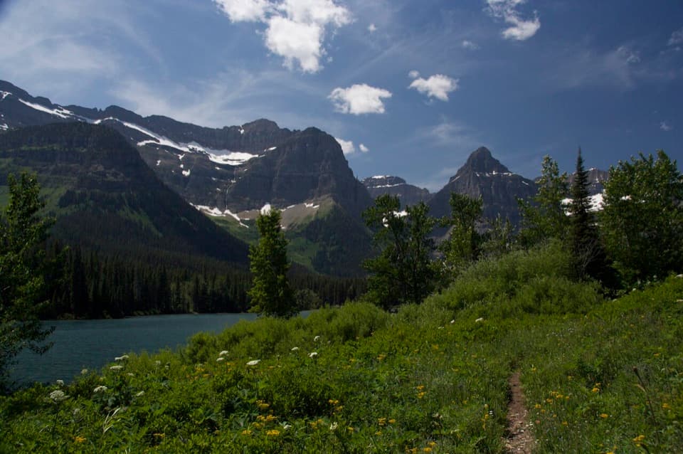
A long backcountry walk ends at a lake below The Sentinel.

Photo: CC BY 2.0
Length
12.6mi
Time
8hr
Elev. change
1,237ft
Difficulty
Challenging
  • No dogs
  • High point 5,440 ft
  • #73 of 157 in Glacier
Parkwolf audio tour204 stories across Glacier’s roads

Overview

About Lake Francis Trail

Why go

  • The gravel shore, waterfall, and The Sentinel make a memorable endpoint.

Heads up

  • Reaching the trailhead takes remote access and border planning.
  • The steep final spur can be hard to spot in brush.

Map & elevation

The route

Loading the Glacier map
Full map
Elevation4,203–5,440 ft
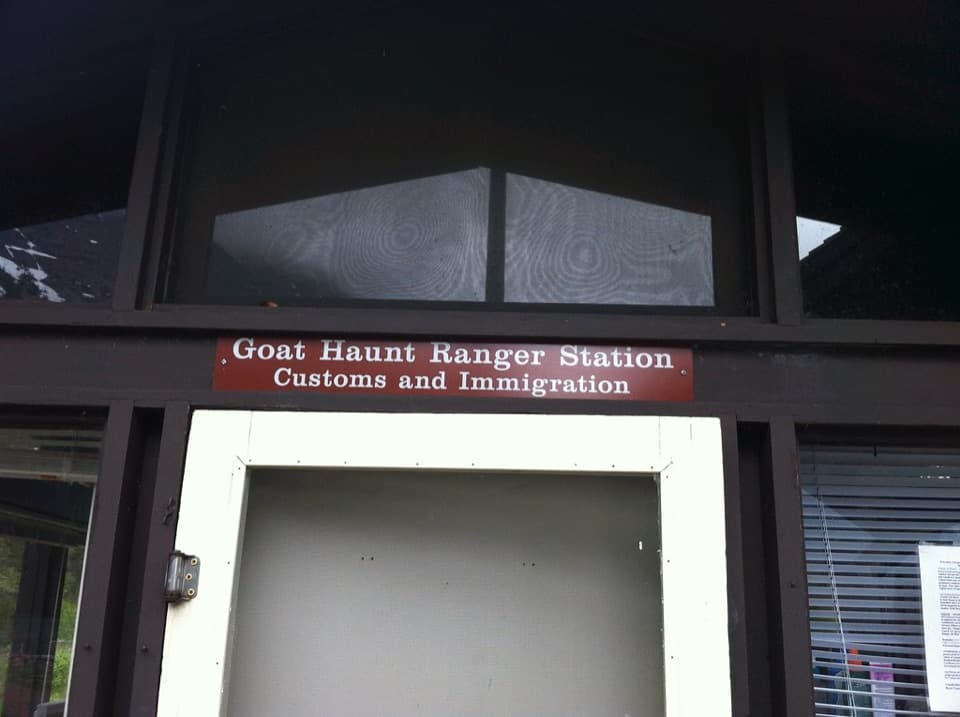
TrailheadGoat Haunt Ranger Station48.95758, -113.89249
Keep this map with you offline in the Parkwolf app

Plan your hike

Before you go

Parking

There is no road access or parking at Goat Haunt. Start at Goat Haunt Ranger Station, reached in summer by boat from Waterton or by an 8.5-mile hike from Waterton Townsite; that approach is outside this trail’s 12.6-mile distance. Hikers continuing beyond the station must report U.S. entry through CBP ROAM or an approved partner tablet. Confirm current access arrangements before traveling.

Safety

This is a remote, long backcountry day hike. The steep Lake Francis Camp spur can be obscured by tall vegetation, and the mapped line ends at camp beside the lake rather than tracing the last steps to the water. Hikers going beyond Goat Haunt Ranger Station must follow current U.S. entry reporting requirements; check live trail and boat status before setting out.

1 active Glacier alert

  • ClosureTwo Medicine Campground closed for 2026 constructionTwo Medicine Campground is closed throughout 2026 because of construction in the Two Medicine developed area.Official details
Glacier alerts
A park ranger sits on a dash-mounted phone, talking, as Parkwolf’s Tour Guide plays “Army Cutworm Moths: A Grizzly Bear Buffet” on Grand Loop Road below Dunraven Pass in Yellowstone
Parkwolf Tour GuideThe highest, rockiest slopes around here are a summer buffet for grizzly bears.

Glacier Tour Guide

Your drive to Lake Francis Trail, narrated.

Parkwolf is a GPS audio tour guide for Glacier National Park. As you drive, it chimes in with what’s ahead: hidden gems, upcoming stops, history, geology, and wildlife, right through your car’s speakers.

See the Glacier audio tour
  • 204 audio storiesacross Glacier’s roads, triggered by GPS as you drive
  • Wildlife heatmapsfor Grizzly Bear, Wolverine, Mountain Goat, and 13 more
  • Works offlinemaps, 157 trails, 91 places, and audio download before you lose signal
  • CarPlay readysimple controls built for the drive
★★★★★
“Our first time to glacier and we used the audio portion for Going to the Sun Road. Wonderful information with perfect advice of what to see and do along the road.”
PaisleyParkFanApp Store review
Download Parkwolf on the App StoreGet Parkwolf on Google Play

4.7 from 8,600+ ratings

Trail guide

Hiking Lake Francis Trail

A long walk to a remote lakeLake Francis Trail is a remote 12.

Lake Francis Trail is a remote 12.6-mile out-and-back from Goat Haunt Ranger Station to Lake Francis Camp beside the lake. It follows the Waterton Lake access trail, then Boulder Pass Trail, and finishes on a short campground spur. The park’s hiking list gives the main route as 6.2 miles one way with 1,050 feet of gain; the mapped spur brings the full route to about 6.3 miles each way. Allow about eight hours on foot, plus the separate trip to Goat Haunt. This is a long day for a prepared hiker, with a fine lake-and-cliff payoff at the end.

Take the right branchFrom the Ranger Station, follow the Waterton Lake trail connector to Boulder Pass Trail, then…

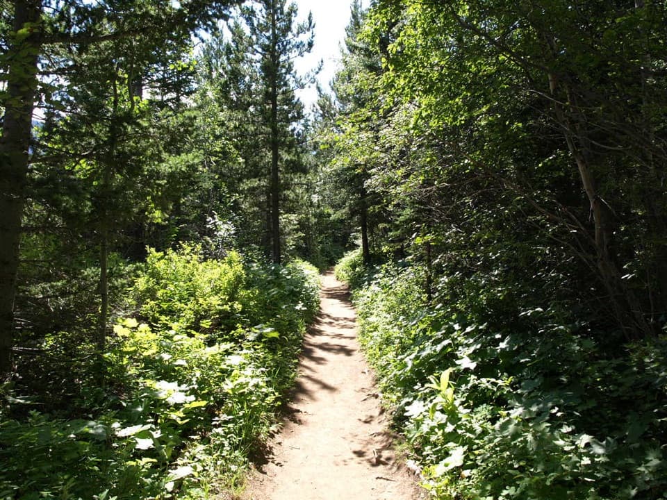
From the Ranger Station, follow the Waterton Lake trail connector to Boulder Pass Trail, then continue past Lake Janet toward the Lake Francis Camp junction. The main trail keeps going toward Boulder Pass; take the Lake Francis Camp spur for the lake. That last spur is steep and can be hard to pick out when tall plants crowd the tread, so watch the junction and leave time to find it on the return.

The lake under The SentinelLake Francis sits beneath the cliffs of The Sentinel.

Lake Francis sits beneath the cliffs of The Sentinel. A broad gravel bar gives you room to look across the water, and a waterfall drops into the lake from above. It is a good place to stop and stay awhile after the long approach. For a photo, include some of the gravel shore in the foreground and let the water lead toward the cliff face; the lake’s reflection can carry the view when the light is calm.

Getting to the startGoat Haunt has no road access. In summer, reach it from Waterton by boat or by an 8.

Goat Haunt has no road access. In summer, reach it from Waterton by boat or by an 8.5-mile hike from Waterton Townsite; that approach is not included in the trail mileage. Anyone hiking past the Ranger Station must report U.S. entry through CBP ROAM or an approved partner tablet. The round-trip ferry exception applies only to visits under 30 minutes that do not go beyond the station. Check current border, boat, and trail arrangements before setting out. Restrooms and drinking water are available at the station in summer, but no services are listed along the route. Pets are not allowed on park trails or in the backcountry. The mapped route ends at Lake Francis Camp beside the shore; the final steps to the water are not a separate mapped track.

Wildlife

Wildlife in Glacier

All Glacier wildlife maps

Sighting maps show where each species has been reported across Glacier. Wildlife moves, so no sighting is guaranteed.

Parkwolf’s Glacier ranking

Top-rated trails in Glacier

All 157 trails
  1. 1Highline TrailChallenging · 11.8 mi
  2. 2Grinnell Glacier TrailChallenging · 10 mi
  3. 3Iceberg Lake TrailModerate · 9.6 mi
  4. 4Hidden Lake Overlook TrailModerate · 2.6 mi
  5. 5Avalanche Lake TrailModerate · 5 mi
  6. 6Trail of the CedarsEasy · 0.9 mi

Take Parkwolf to Glacier.

The audio tour guide for the drive, plus offline maps, trails, and wildlife heatmaps for when the signal drops.

4.7 from 8,600+ ratings

Download Parkwolf on the App StoreGet Parkwolf on Google Play