Pacific Northwest National Scenic Trail: Glacier Section in Glacier National Park

Glacier National Park, MT

Pacific Northwest National Scenic Trail: Glacier Section

A rugged 55-mile crossing over the Continental Divide to Polebridge.

Photo: Public Domain Mark
Length
55mi
Time
1.7days
Elev. change
2,825ft
Difficulty
Challenging
  • No dogs
  • High point 6,352 ft

Hear the audio tour

Belly River Trailhead and Stoney Indian Pass

Overview

About Pacific Northwest National Scenic Trail: Glacier Section

Why go

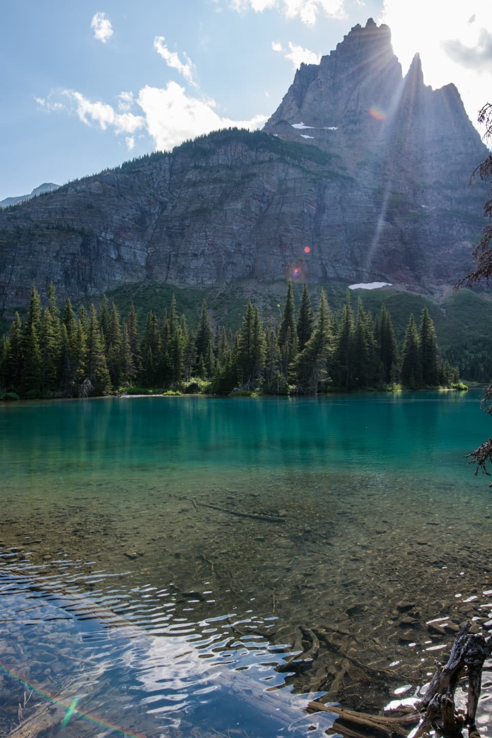
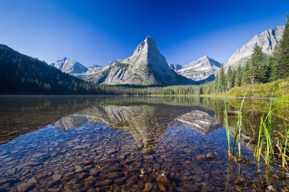
  • A continuous backcountry traverse links the Belly River, high passes, Waterton Valley and Bowman Lake side.
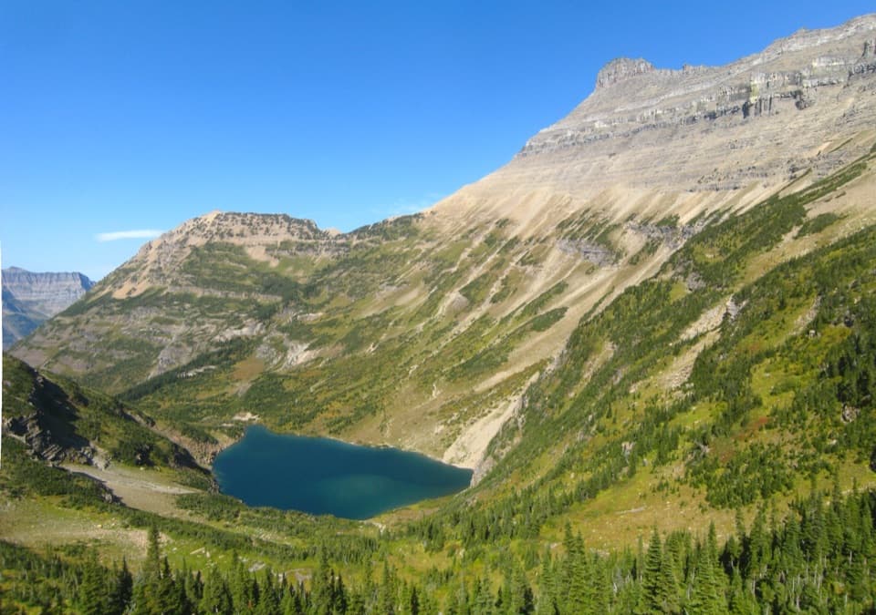
  • High meadows, glacial basins and wildflower slopes reward the demanding miles.

Heads up

  • The 55-mile one-way route needs a multi-day permit itinerary and end-to-end transport.
  • Much of the Glacier section is unmarked, and seasonal crossings can disrupt travel.

Map & elevation

The route

Loading the Glacier map
Full map
Elevation3,527–6,352 ft
TrailheadChief Mountain customs parking area48.99683, -113.66031
Keep this map with you offline in the Parkwolf app

Plan your hike

Before you go

Parking

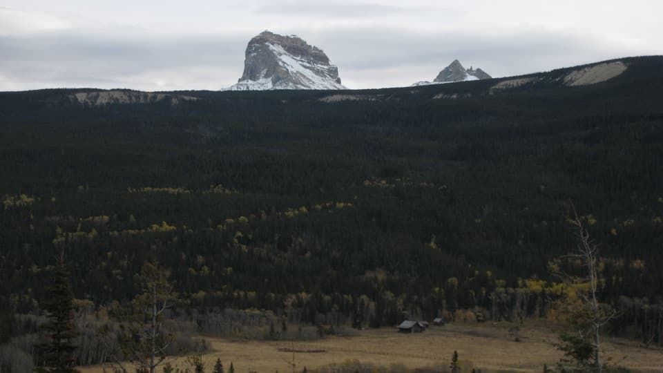
Start at the Chief Mountain customs parking area just north of the Chief Mountain Trailhead. The route ends in Polebridge, so arrange a vehicle or ride at the western end; this is not a loop. Confirm seasonal road and access conditions at both ends.

Best time to go

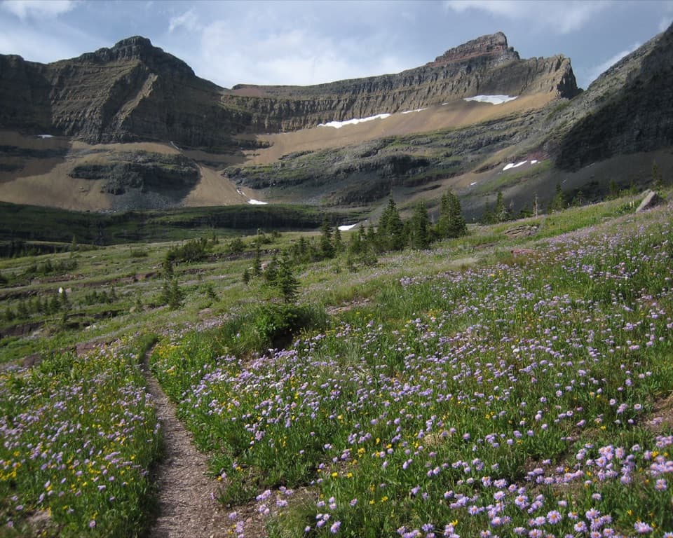
July through September is the usual high-country window, though snowfields and hazardous weather can persist in any month. Treat water from lakes and streams. Grizzlies, moose and mountain goats live in this backcountry; store food as required and give wildlife room. After snowmelt, high meadows may bloom with ivory beargrass and golden glacier lilies. In the flower meadows, include the trail tread in the foreground to lead the eye toward the rocky amphitheater and snow patches.

Safety

Remote backcountry travel crosses high passes and seasonal rivers; snowfields and hazardous weather can persist beyond midsummer. Most of the route is unmarked. Overnight trips require a Glacier wilderness permit, pets are prohibited on park trails, food-storage rules apply in grizzly habitat, bear spray is recommended, and seasonal bridges may be removed by late September.

1 active Glacier alert

  • ClosureTwo Medicine Campground closed for 2026 constructionTwo Medicine Campground is closed throughout 2026 because of construction in the Two Medicine developed area.Official details
Glacier alerts
A park ranger sits on a dash-mounted phone, talking, as Parkwolf’s Tour Guide plays “Army Cutworm Moths: A Grizzly Bear Buffet” on Grand Loop Road below Dunraven Pass in Yellowstone
Parkwolf Tour GuideThe highest, rockiest slopes around here are a summer buffet for grizzly bears.

Glacier Tour Guide

Your drive to Pacific Northwest National Scenic Trail: Glacier Section, narrated.

Parkwolf is a GPS audio tour guide for Glacier National Park. As you drive, it chimes in with what’s ahead: hidden gems, upcoming stops, history, geology, and wildlife, right through your car’s speakers.

See the Glacier audio tour

Recorded for this trailhead

Belly River Trailhead and Stoney Indian Pass
0:00 / 0:26
“You're approaching Belly River Trailhead near Chief Mountain Customs, where the Stoney Indian Pass route leads through lake basins to a waterfall-lined climb.”

Plays as you drive up to this trailhead in the Parkwolf Glacier Tour Guide.

More stories near here in the app

  • Lee Ridge Trailhead
  • The Pass That Brought the Railway
  • Horns That Keep Growing
  • How a Cliff Becomes a Rock Pile
  • 204 audio storiesacross Glacier’s roads, triggered by GPS as you drive
  • Wildlife heatmapsfor Grizzly Bear, Wolverine, Mountain Goat, and 13 more
  • Works offlinemaps, 157 trails, 91 places, and audio download before you lose signal
  • CarPlay readysimple controls built for the drive
★★★★★
“Our first time to glacier and we used the audio portion for Going to the Sun Road. Wonderful information with perfect advice of what to see and do along the road.”
PaisleyParkFanApp Store review
Download Parkwolf on the App StoreGet Parkwolf on Google Play

4.7 from 8,600+ ratings

Trail guide

Hiking Pacific Northwest National Scenic Trail: Glacier Section

The Glacier crossingGlacier's 55-mile section of the Pacific Northwest National Scenic Trail is a one-way,…

Glacier's 55-mile section of the Pacific Northwest National Scenic Trail is a one-way, point-to-point backcountry route from Chief Mountain customs parking area to Polebridge. It crosses the Continental Divide and links the Belly River, Waterton and Bowman Lake sides of the park. This record covers the Glacier section; the full trail continues more than 1,200 miles to the Pacific.

Plan a multi-day tripThis is a rugged backpacking route, not a day hike.

This is a rugged backpacking route, not a day hike. Expect roughly 40 hours of walking spread over several days; your overnight mileage depends on the backcountry campsites available to your permit. Most of the trail in Glacier is unmarked; bring the tools and skills to follow a route without regular blazes. Overnight trips require a Glacier wilderness permit, which sets where you can camp. Arrange transportation at Polebridge because this route does not return to the eastern start.

Belly River to Stoney Indian PassFrom Chief Mountain, the route follows the Belly River corridor and Cosley Lake Cutoff, then…

From Chief Mountain, the route follows the Belly River corridor and Cosley Lake Cutoff, then climbs over Stoney Indian Pass. The high pass and long approaches make this a serious undertaking; steep grades, lingering snowfields and rough high-country footing can slow progress. Beyond the divide, the trail descends toward Waterton Valley and Waterton Lake.

Waterton to the North Fork sideThe westbound line follows the Waterton Valley and Lake trail corridors, then uses the Boulder…

The westbound line follows the Waterton Valley and Lake trail corridors, then uses the Boulder Pass and Bowman Lake trails before road connections reach Polebridge. Seasonal bridges are not guaranteed year-round, so check the planned river crossings before setting daily stages. The western endpoint is Polebridge, separate from the starting access.

A long-distance trailCongress designated the Pacific Northwest Trail a National Scenic Trail in 2009.

Congress designated the Pacific Northwest Trail a National Scenic Trail in 2009. The route crosses Montana, Idaho and Washington before reaching the Pacific near Cape Alava; this Glacier crossing is its rugged eastern mountain segment.

Wildlife

Wildlife in Glacier

All Glacier wildlife maps

Sighting maps show where each species has been reported across Glacier. Wildlife moves, so no sighting is guaranteed.

Parkwolf’s Glacier ranking

Top-rated trails in Glacier

All 157 trails
  1. 1Highline TrailChallenging · 11.8 mi
  2. 2Grinnell Glacier TrailChallenging · 10 mi
  3. 3Iceberg Lake TrailModerate · 9.6 mi
  4. 4Hidden Lake Overlook TrailModerate · 2.6 mi
  5. 5Avalanche Lake TrailModerate · 5 mi
  6. 6Trail of the CedarsEasy · 0.9 mi

Take Parkwolf to Glacier.

The audio tour guide for the drive, plus offline maps, trails, and wildlife heatmaps for when the signal drops.

4.7 from 8,600+ ratings

Download Parkwolf on the App StoreGet Parkwolf on Google Play