Sherburne Boundary Trail in Glacier National Park

Glacier National Park, MT

Sherburne Boundary Trail

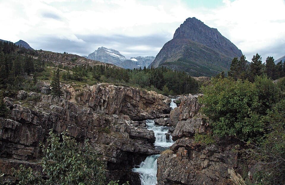
A steep climb to a small meadow on Boulder Ridge.

Length
3.1mi
Time
3hr
Elev. change
994ft
Difficulty
Challenging
  • No dogs
  • High point 5,784 ft

Hear the audio tour

Why the Drivers Are Jammers

Overview

About Sherburne Boundary Trail

Why go

  • A little-used route ends in a small Boulder Ridge meadow.

Heads up

  • Steep climb with limited views and an unsigned start.
  • Current public access to the dam-side approach is unconfirmed.

Map & elevation

The route

Loading the Glacier map
Full map
Elevation4,790–5,784 ft
TrailheadSherburne Dam outlet-side approach (unsigned)48.83015, -113.52161
Keep this map with you offline in the Parkwolf app

Plan your hike

Before you go

Parking

Reported access starts at the outlet side of Lake Sherburne Dam. Park at the dam and follow its outlet-side base to the far side, then take the road east and north to the unsigned trail. No specific parking capacity or facility details were found. The legality of this access route is not confirmed; verify it with Glacier National Park before you go.

Safety

Steep sustained climb (about 960 feet in 1.55 miles; reported grades reach 22%) and the same descent back. The route is unsigned. Legal public access to the dam-side approach remains unverified; confirm it with the park before setting out. Bear spray is advised.

1 active Glacier alert

  • ClosureTwo Medicine Campground closed for 2026 constructionTwo Medicine Campground is closed throughout 2026 because of construction in the Two Medicine developed area.Official details
Glacier alerts
A park ranger sits on a dash-mounted phone, talking, as Parkwolf’s Tour Guide plays “Army Cutworm Moths: A Grizzly Bear Buffet” on Grand Loop Road below Dunraven Pass in Yellowstone
Parkwolf Tour GuideThe highest, rockiest slopes around here are a summer buffet for grizzly bears.

Glacier Tour Guide

Your drive to Sherburne Boundary Trail, narrated.

Parkwolf is a GPS audio tour guide for Glacier National Park. As you drive, it chimes in with what’s ahead: hidden gems, upcoming stops, history, geology, and wildlife, right through your car’s speakers.

See the Glacier audio tour

Recorded for this area

Why the Drivers Are Jammers
0:00 / 0:30
“If you see one of Glacier's long red tour buses, you're looking at a design from the nineteen thirties. The historic fleet was built between nineteen thirty-six and nineteen thirty-nine.”

Plays on the road 0.3 mi from the trailhead in the Parkwolf Glacier Tour Guide.

More stories near here in the app

  • The Tiny Life Behind Pink Snow
  • Which Bear Is That?
  • A Moose’s Underwater Meal
  • The Scraps Beneath the Conifers
  • 204 audio storiesacross Glacier’s roads, triggered by GPS as you drive
  • Wildlife heatmapsfor Grizzly Bear, Wolverine, Mountain Goat, and 13 more
  • Works offlinemaps, 157 trails, 91 places, and audio download before you lose signal
  • CarPlay readysimple controls built for the drive
★★★★★
“Our first time to glacier and we used the audio portion for Going to the Sun Road. Wonderful information with perfect advice of what to see and do along the road.”
PaisleyParkFanApp Store review
Download Parkwolf on the App StoreGet Parkwolf on Google Play

4.7 from 8,600+ ratings

Trail guide

Hiking Sherburne Boundary Trail

A short, steep out-and-backSherburne Boundary Trail is a 3.

Sherburne Boundary Trail is a 3.1-mile round trip from the Lake Sherburne Dam outlet to a small meadow at the top of Boulder Ridge. The mapped path is about 1.55 miles each way and climbs roughly 960 feet; allow about three hours to go up and return. It suits hikers looking for a hard, steep climb more than a big-view destination: the forested climb has no views, and the ridge-top views are limited.

Finding the unsigned startThe approach begins at the outlet side of the dam.

The approach begins at the outlet side of the dam. Follow its base to the far side, then take the road east and north to the unsigned path heading southeast. Current legal access to this dam-side approach has not been confirmed; check with the park before setting out. This route’s actual start is unsigned, so do not expect a marked trailhead.

Climbing to Boulder RidgeThe path climbs through dense forest to the park boundary, follows it briefly, then continues…

The path climbs through dense forest to the park boundary, follows it briefly, then continues south to the ridge meadow. The small meadow is the endpoint; it is not a broad overlook. Turn around there and retrace the same route to the dam.

Pets and bear countryPets are not permitted on Glacier National Park trails.

Pets are not permitted on Glacier National Park trails. Bear spray is advised for this route; no trail-specific water or other facilities were confirmed, so plan to be self-sufficient.

Wildlife

Wildlife in Glacier

All Glacier wildlife maps

Sighting maps show where each species has been reported across Glacier. Wildlife moves, so no sighting is guaranteed.

Keep exploring

Near Sherburne Boundary Trail

See it all on the map

Trails that start nearby

Places near the trailhead

Parkwolf’s Glacier ranking

Top-rated trails in Glacier

All 157 trails
  1. 1Highline TrailChallenging · 11.8 mi
  2. 2Grinnell Glacier TrailChallenging · 10 mi
  3. 3Iceberg Lake TrailModerate · 9.6 mi
  4. 4Hidden Lake Overlook TrailModerate · 2.6 mi
  5. 5Avalanche Lake TrailModerate · 5 mi
  6. 6Trail of the CedarsEasy · 0.9 mi

Take Parkwolf to Glacier.

The audio tour guide for the drive, plus offline maps, trails, and wildlife heatmaps for when the signal drops.

4.7 from 8,600+ ratings

Download Parkwolf on the App StoreGet Parkwolf on Google Play