Mount Sterling Ridge Trail in Great Smoky Mountains National Park

Great Smoky Mountains National Park, TN · NC

Mount Sterling Ridge Trail

A remote 5.3-mile traverse from Mount Sterling to Balsam Mountain Trail.

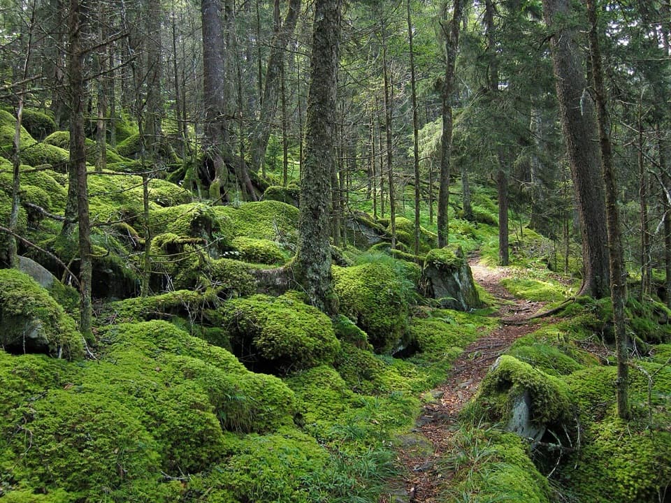
Photo: CC BY-SA 2.0
Length
5.3mi
Time
3.5hr
Elev. change
512ft
Difficulty
Moderate
  • No dogs
  • High point 5,709 ft

Hear the audio tour

Mount Sterling Gap Trailhead

Overview

About Mount Sterling Ridge Trail

Why go

  • A long, rolling high-ridge walk with an unusually level western stretch.
  • The historic fire tower is a signed half-mile side trip from the eastern junction.

Heads up

  • Remote point-to-point route with no road access at either end.
  • Reaching the eastern junction adds about 2.3 miles from Mount Sterling Gap.

Map & elevation

The route

Loading the Great Smoky Mountains map
Full map
Elevation5,197–5,709 ft
TrailheadMount Sterling Ridge junction with Mount Sterling and Baxter Creek trails35.69817, -83.12551
Keep this map with you offline in the Parkwolf app

Plan your hike

Before you go

Parking

The Ridge Trail has no road parking at either end. Mount Sterling Gap Trailhead on Mount Sterling Road is the nearest road access to the eastern junction; its roadside pull-off is very small, and the junction is about 2.3 hiking miles away on Mount Sterling Trail. A parking tag is required for vehicles left longer than 15 minutes. The western end meets Balsam Mountain Trail in the backcountry.

Safety

This is a remote, one-way corridor between backcountry trail junctions. Plan a longer route or a return along the same 5.3 miles; there is no direct road exit at the western end. The fire tower is another half-mile beyond the eastern junction on Baxter Creek Trail.

7 active Great Smoky Mountains alerts

  • ClosureHurricane Helene backcountry trail closures and hazardsHurricane Helene damage has closed backcountry trails and left hazardous crossings; avoid closed routes and heed trail-specific restrictions.Official details
  • CautionBear-related trail, road, shelter, and campsite restrictionsBear activity has closed trails, a shelter, and campsites and restricted pedestrian access on Cherokee Orchard Road; follow the vehicle restrictions and avoid closed areas.Official details
See all 7 alerts
A park ranger sits on a dash-mounted phone, talking, as Parkwolf’s Tour Guide plays “Army Cutworm Moths: A Grizzly Bear Buffet” on Grand Loop Road below Dunraven Pass in Yellowstone
Parkwolf Tour GuideThe highest, rockiest slopes around here are a summer buffet for grizzly bears.

Great Smoky Mountains Tour Guide

Your drive to Mount Sterling Ridge Trail, narrated.

Parkwolf is a GPS audio tour guide for Great Smoky Mountains National Park. As you drive, it chimes in with what’s ahead: hidden gems, upcoming stops, history, geology, and wildlife, right through your car’s speakers.

See the Great Smoky Mountains audio tour

Recorded for this area

Mount Sterling Gap Trailhead
0:00 / 0:27
“Mount Sterling Gap trailhead is ahead, the start of a steep forest hike to a historic fire tower. Allow around four hours for the five point four-mile round trip, with about two thousand feet of climbing.”

Plays on the road 1.6 mi from the trailhead in the Parkwolf Great Smoky Mountains Tour Guide.

More stories near here in the app

  • A Nest for Another Year
  • The Sycamore's Patchwork
  • How a Leaf Changes Color
  • Guests Before the Park
  • 188 audio storiesacross Great Smoky Mountains’s roads, triggered by GPS as you drive
  • Wildlife heatmapsfor Black Bear, Elk, Bald Eagle, and 13 more
  • Works offlinemaps, 197 trails, 100 places, and audio download before you lose signal
  • CarPlay readysimple controls built for the drive
★★★★★
“Fantastic app with many points of information… It’s great to just turn on while you’re driving and it gives you an audio tour of the national Park. We love it!!!!”
JMJamesApp Store review
Download Parkwolf on the App StoreGet Parkwolf on Google Play

4.7 from 8,600+ ratings

Trail guide

Hiking Mount Sterling Ridge Trail

What this trail isMount Sterling Ridge Trail is a remote, 5.

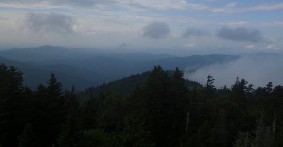
Mount Sterling Ridge Trail is a remote, 5.3-mile one-way walk from the Mount Sterling Trail and Baxter Creek Trail junction to Balsam Mountain Trail. The native-surface path crosses high-elevation forest, dropping about 500 feet from its eastern junction before rolling; the last three miles are unusually flat for this elevation. Allow about three and a half hours for the mapped traverse. This is a backcountry through-route, not a 5.3-mile round trip.

Plan the accessNeither end has road parking. The eastern junction is about 2.

Neither end has road parking. The eastern junction is about 2.3 hiking miles from Mount Sterling Gap via the separate Mount Sterling Trail; the pull-off at the Gap is very small. The western end joins Balsam Mountain Trail. To return to the east junction, retrace the full Ridge route, about 10.6 miles before the Gap approach. Horses share the trail, and pets are not allowed on park trails here. Treat this as part of a longer backcountry plan, not a quick add-on.

If you want the towerThe Mount Sterling fire tower is about half a mile beyond the eastern junction on Baxter Creek…

The Mount Sterling fire tower is about half a mile beyond the eastern junction on Baxter Creek Trail, so it is a side trip rather than the mapped Ridge Trail's endpoint. Count the extra walking both ways if you go. The 60-foot steel tower was built in 1935 by the Civilian Conservation Corps and now serves as a radio repeater. From the tower, forested ridges fall away in layers; that view is the payoff for the extra steps.

Wildlife

Wildlife in Great Smoky Mountains

All Great Smoky Mountains wildlife maps

Sighting maps show where each species has been reported across Great Smoky Mountains. Wildlife moves, so no sighting is guaranteed.

Keep exploring

Near Mount Sterling Ridge Trail

See it all on the map

Trails that start nearby

Places near the trailhead

Parkwolf’s Great Smoky Mountains ranking

Top-rated trails in Great Smoky Mountains

All 197 trails
  1. 1Mount Le Conte via Alum Cave TrailChallenging · 10 mi
  2. 2Charlies Bunion via Appalachian TrailModerate · 8 mi
  3. 3Alum Cave Trail to Alum Cave BluffsModerate · 4.6 mi
  4. 4Ramsey Cascades TrailChallenging · 8 mi
  5. 5Mount Cammerer TrailChallenging · 11.1 mi
  6. 6Gregory Ridge TrailChallenging · 11.4 mi

Take Parkwolf to Great Smoky Mountains.

The audio tour guide for the drive, plus offline maps, trails, and wildlife heatmaps for when the signal drops.

4.7 from 8,600+ ratings

Download Parkwolf on the App StoreGet Parkwolf on Google Play