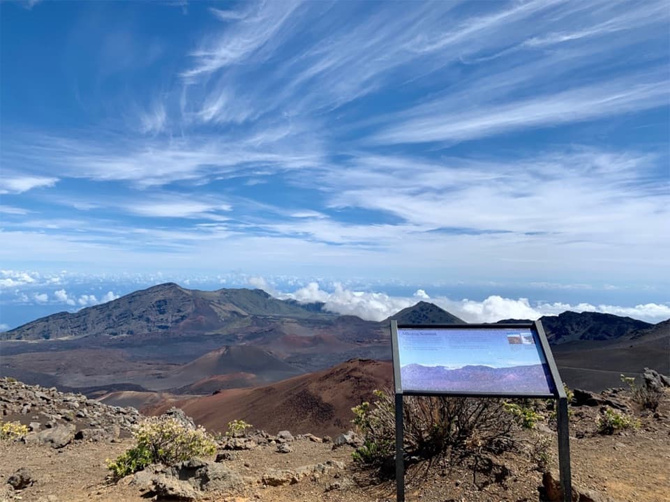
Keoneheʻeheʻe Overlook in Haleakalā National Park

Sight · Haleakalā National Park

Keoneheʻeheʻe Overlook

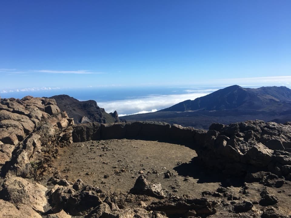
A half-mile walk reaches a signed wayside above Haleakalā’s crater.

Photo: National Park Service
Type
Sight
Nearest trail
0.2 mi
Audio stories
5 nearby
  • Scenic viewpoint
  • Exhibit
  • Parking

Hear the audio tour

Haleakalā Visitor Center

Overview

About Keoneheʻeheʻe Overlook

Why stop

  • A signed wayside and broad crater view on a half-mile round trip.

Heads up

  • Clouds can hide the crater view.

Map

Where it is

Loading the Haleakalā map
Full map
SightKeoneheʻeheʻe Overlook20.71203, -156.24997
Keep this map with you offline in the Parkwolf app

Plan your stop

Before you go

2 active Haleakalā alerts

  • ClosureSwimming prohibited at ʻOheʻo PoolsDo not enter or swim in the Pools of ʻOheʻo in the Kīpahulu District. - Entry is prohibited because of a number of safety concerns; view the pools safely from the Kūloa Point Trail instead.Official details
  • CautionCrater Road lane closures near Haleakalā National ParkExpect single-lane closures on Crater Road (Route 378) from Monday, October 12, through Friday, October 16.Official details

Haleakalā alerts
A park ranger sits on a dash-mounted phone, talking, as Parkwolf’s Tour Guide plays “Army Cutworm Moths: A Grizzly Bear Buffet” on Grand Loop Road below Dunraven Pass in Yellowstone
Parkwolf Tour GuideThe highest, rockiest slopes around here are a summer buffet for grizzly bears.

Haleakalā Tour Guide

Your drive to Keoneheʻeheʻe Overlook, narrated.

Parkwolf is a GPS audio tour guide for Haleakalā National Park. As you drive, it chimes in with what’s ahead: hidden gems, upcoming stops, history, geology, and wildlife, right through your car’s speakers.

Recorded for this place

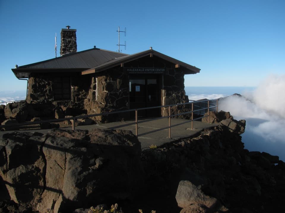
Haleakalā Visitor Center
0:00 / 0:32
“Up ahead is Haleakalā Visitor Center, with a crater view right beside the building. Go to the railing first, especially if time is short; you don't need a hike for this stop.”

Plays as you drive up to Keoneheʻeheʻe Overlook in the Parkwolf Haleakalā Tour Guide.

More stories near here in the app

  • Puʻuʻulaʻula Summit
  • The ʻIʻiwi's Curved Bill
  • Kalahaku Overlook
  • Why the Cinder Turns Red
  • 25 audio storiesacross Haleakalā’s roads, triggered by GPS as you drive
  • Wildlife heatmapsfor Hawaiian Goose, Hawaiian Short-eared Owl, Green Sea Turtle, and 12 more
  • Works offlinemaps, 17 trails, 32 places, and audio download before you lose signal
  • CarPlay readysimple controls built for the drive
★★★★★
“Fantastic app with many points of information… It’s great to just turn on while you’re driving and it gives you an audio tour of the national Park. We love it!!!!”
JMJamesApp Store review
Download Parkwolf on the App StoreGet Parkwolf on Google Play

4.7 from 8,600+ ratings

Guide

More about Keoneheʻeheʻe Overlook

A short walk to the craterKeoneheʻeheʻe Overlook is a signed wayside on the first stretch of the Sliding Sands Trail near…

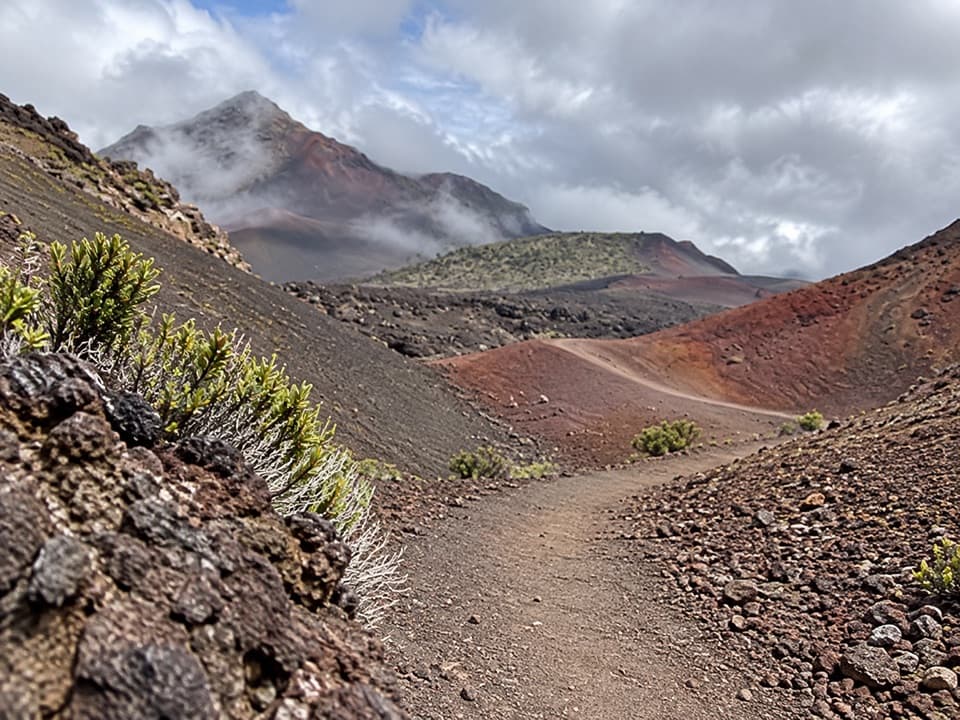
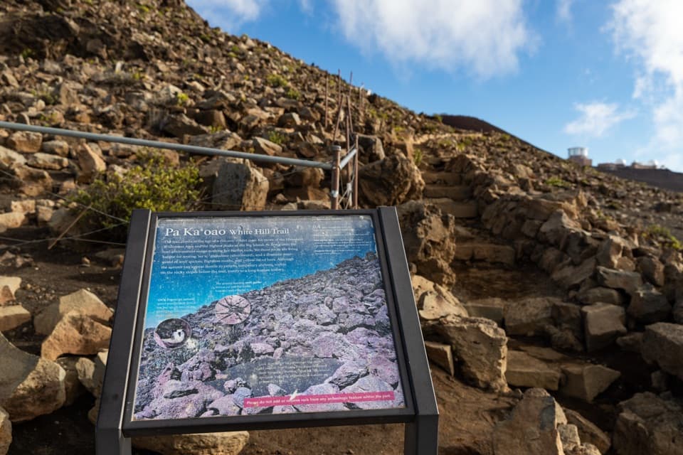
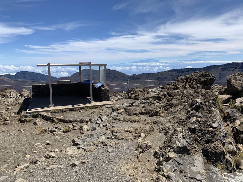
Keoneheʻeheʻe Overlook is a signed wayside on the first stretch of the Sliding Sands Trail near Haleakalā Visitor Center. The round trip is half a mile from the trailhead. I’d stop here for a first crater view without taking on the much longer route across the crater.

Go preparedEven this quick walk starts in the summit’s high, exposed country, where cold, wind, strong…

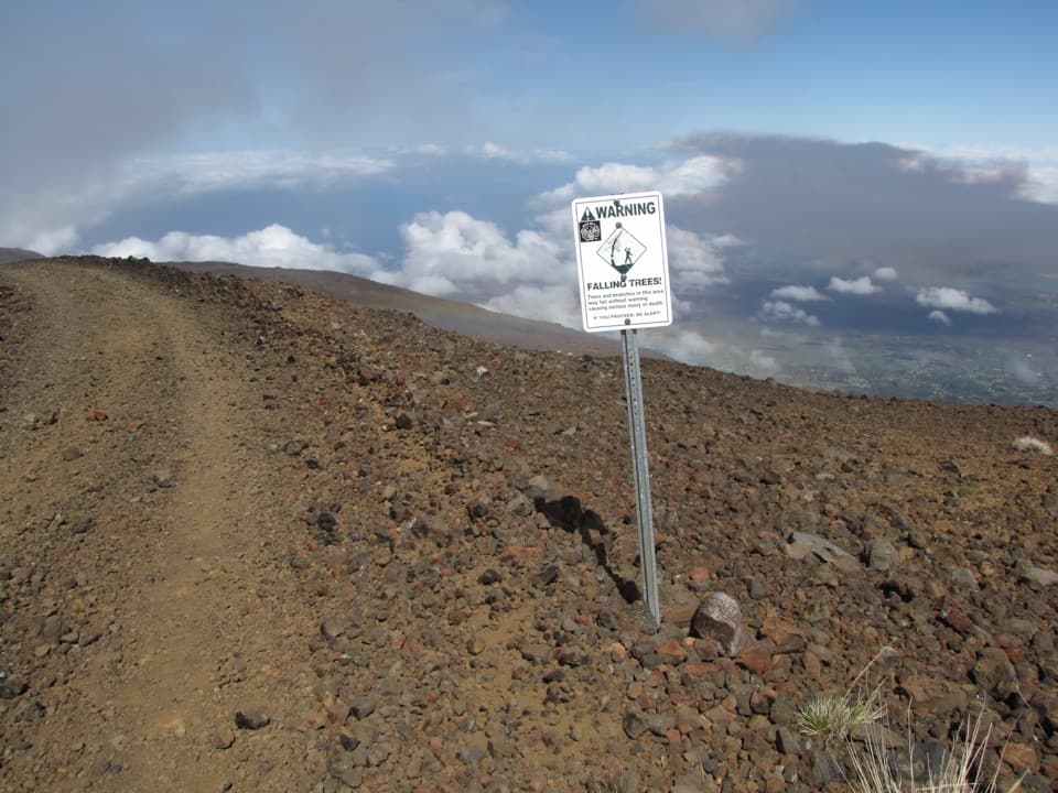
Even this quick walk starts in the summit’s high, exposed country, where cold, wind, strong sun, and fast weather changes come with the territory. Stay on marked trails; pets aren’t allowed on park trails. The park has no food, supplies, or gas. Drinking water is available at visitor centers.

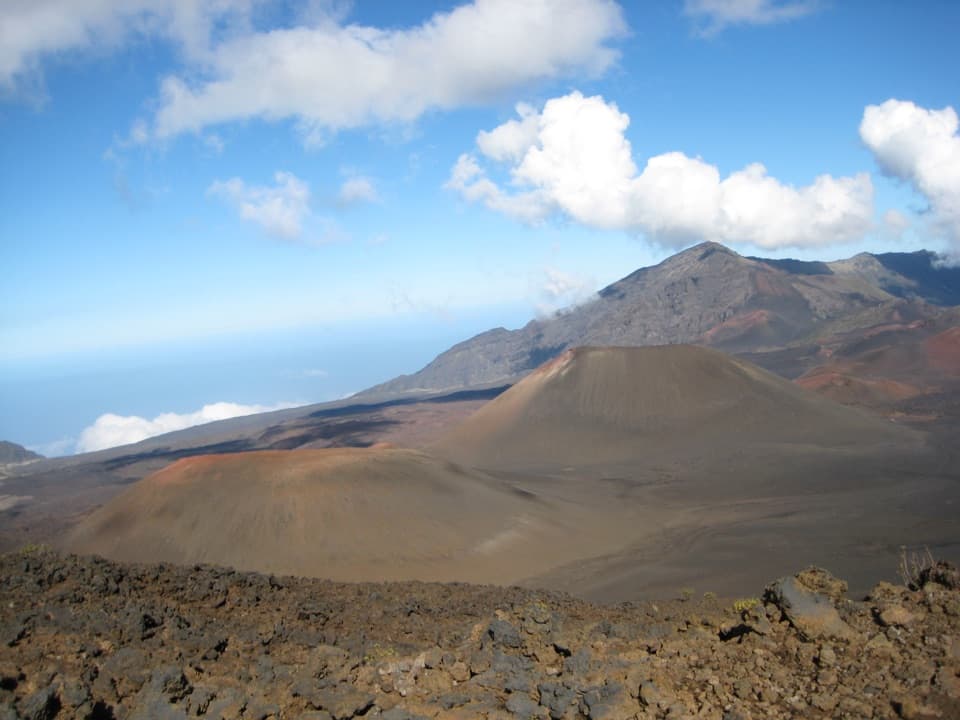
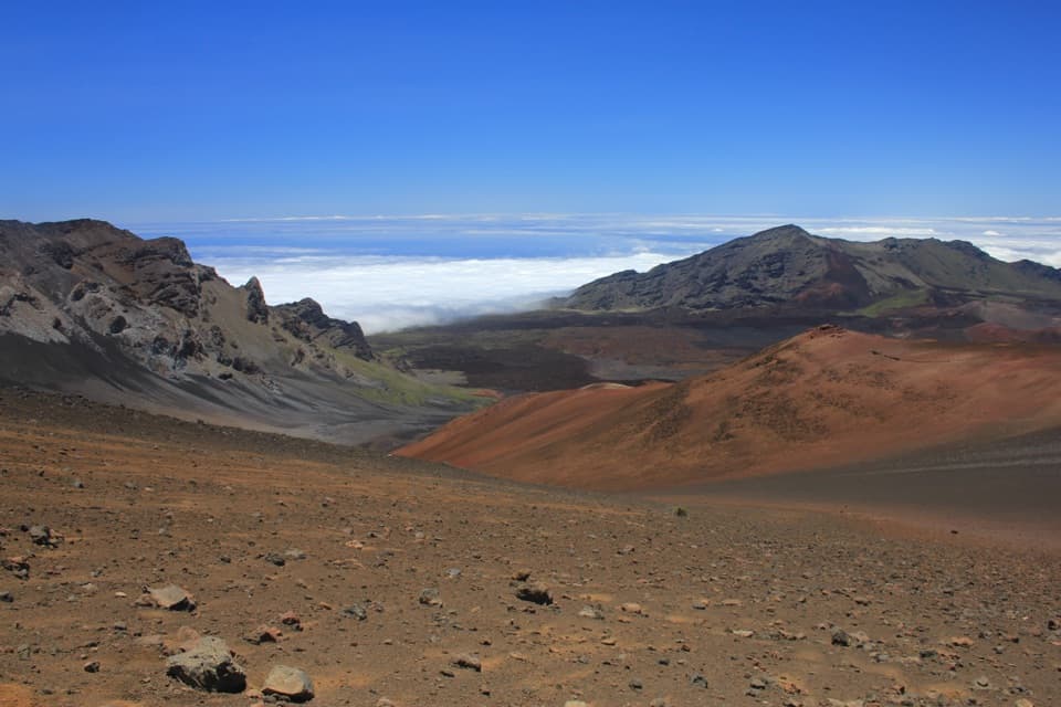
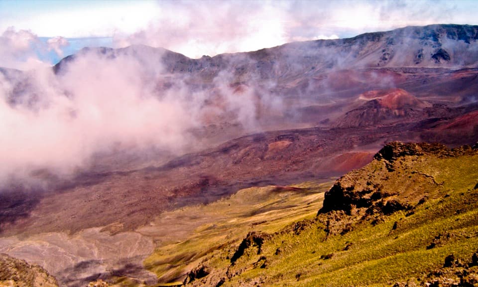
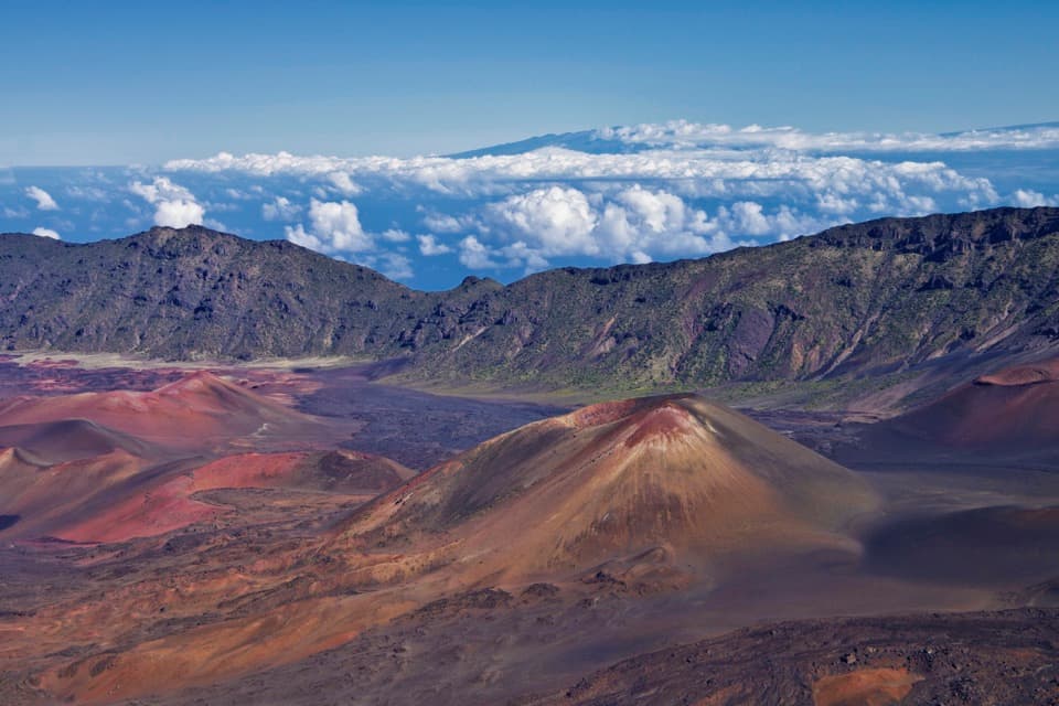
What you’re looking atThe summit crater is about 7.5 miles long and 2.5 miles wide, with 14 multicolored cinder cones.

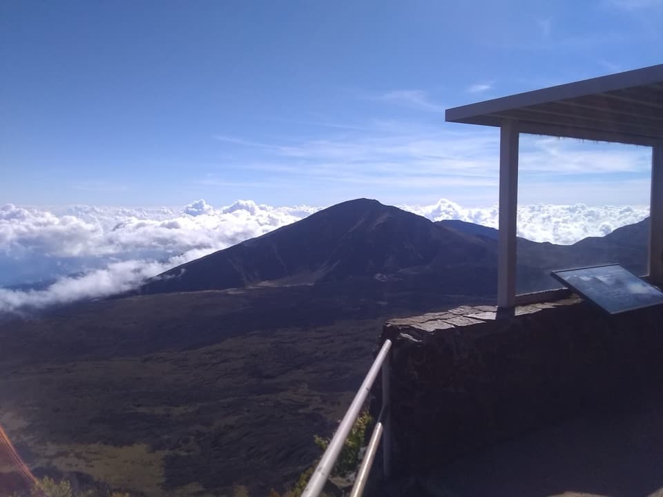
The summit crater is about 7.5 miles long and 2.5 miles wide, with 14 multicolored cinder cones. On a clear day, look for Koʻolau Gap on the left and Kaupō Gap on the right, the broad breaks where lava once flowed out. Clouds can hide the view, so a clear window makes this short walk pay off. The wayside sign also makes a good foreground for a photo of the cones.

A route through the craterNative Hawaiians crossed the crater for centuries as a route across the island.

Native Hawaiians crossed the crater for centuries as a route across the island. Ranchers later drove cattle through it toward pasture and summer water. The current trail dates to 1937, when Civilian Conservation Corps crews built it as part of a 20-mile network of crater trails.

Wildlife

Wildlife in Haleakalā

All Haleakalā wildlife maps

Sighting maps show where each species has been reported across Haleakalā. Wildlife moves, so no sighting is guaranteed.

Keep exploring

Near Keoneheʻeheʻe Overlook

See it all on the map

Trails nearby

More stops nearby

Parkwolf’s Haleakalā ranking

Top sights in Haleakalā

All 32 places
  1. 1Puʻuʻulaʻula SummitSight
  2. 2Waimoku FallsSight
  3. 3Pools of ʻOheʻoSight
  4. 4Kalahaku OverlookSight
  5. 5Leleiwi OverlookSight
  6. 6Pīpīwai Bamboo ForestSight

Take Parkwolf to Haleakalā.

The audio tour guide for the drive, plus offline maps, trails, and wildlife heatmaps for when the signal drops.

4.7 from 8,600+ ratings

Download Parkwolf on the App StoreGet Parkwolf on Google Play