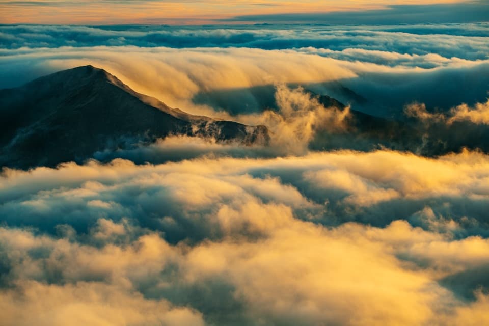
Puʻuʻulaʻula Summit in Haleakalā National Park

#1 of 19 sights in Haleakalā

Sight · Haleakalā National Park

Puʻuʻulaʻula Summit

A drive-up 10,023-foot view, if the clouds cooperate.

Photo: Public Domain
Type
Sight
Nearest trail
Right here
Audio stories
3 nearby
  • Parking
  • Scenic viewpoint
  • Exhibit
  • Restrooms

Hear the audio tour

Puʻuʻulaʻula Summit

Overview

About Puʻuʻulaʻula Summit

Why stop

  • A broad crater view without a summit hike.

Heads up

  • Clouds can hide the horizon, and the summit gets cold and windy.

Map

Where it is

Loading the Haleakalā map
Full map
SightPuʻuʻulaʻula Summit20.70988, -156.25255
Keep this map with you offline in the Parkwolf app

Plan your stop

Before you go

3 active Haleakalā alerts

  • CautionCrater Road lane closures near HaleakalāExpect single-lane closures on Crater Road (Route 378) between mile markers 0 and 10, on the approach to Haleakalā National Park, Monday, October 26–Friday, October 30.Official details
  • ClosureEntry and swimming prohibited at ʻOheʻo PoolsDo not enter or swim in the Pools of ʻOheʻo; view them from the Kūloa Point Trail.Official details

See all 3 alerts
A park ranger sits on a dash-mounted phone, talking, as Parkwolf’s Tour Guide plays “Army Cutworm Moths: A Grizzly Bear Buffet” on Grand Loop Road below Dunraven Pass in Yellowstone
Parkwolf Tour GuideThe highest, rockiest slopes around here are a summer buffet for grizzly bears.

Haleakalā Tour Guide

Your drive to Puʻuʻulaʻula Summit, narrated.

Parkwolf is a GPS audio tour guide for Haleakalā National Park. As you drive, it chimes in with what’s ahead: hidden gems, upcoming stops, history, geology, and wildlife, right through your car’s speakers.

Recorded for this place

Puʻuʻulaʻula Summit
0:00 / 0:34
“You're approaching Puʻuʻulaʻula, Maui's highest point at ten thousand and twenty-three feet. Keep this stop if you want the island's high point without a summit hike.”

Plays as you drive up to Puʻuʻulaʻula Summit in the Parkwolf Haleakalā Tour Guide.

More stories near here in the app

  • Haleakalā Visitor Center
  • The ʻIʻiwi's Curved Bill
  • Kalahaku Overlook
  • Why the Cinder Turns Red
  • 25 audio storiesacross Haleakalā’s roads, triggered by GPS as you drive
  • Wildlife heatmapsfor Hawaiian Goose, Hawaiian Short-eared Owl, Green Sea Turtle, and 12 more
  • Works offlinemaps, 17 trails, 32 places, and audio download before you lose signal
  • CarPlay readysimple controls built for the drive
★★★★★
“Fantastic app with many points of information… It’s great to just turn on while you’re driving and it gives you an audio tour of the national Park. We love it!!!!”
JMJamesApp Store review
Download Parkwolf on the App StoreGet Parkwolf on Google Play

4.7 from 8,600+ ratings

Guide

More about Puʻuʻulaʻula Summit

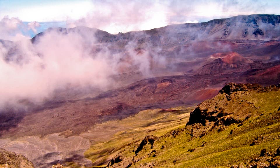
A drive-up trip to Maui’s high pointPuʻuʻulaʻula is the 10,023-foot summit of Haleakalā and the highest point on Maui.

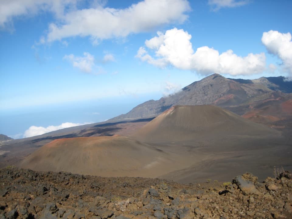
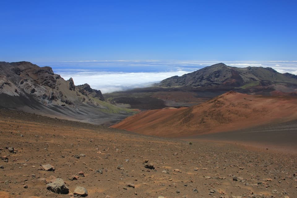
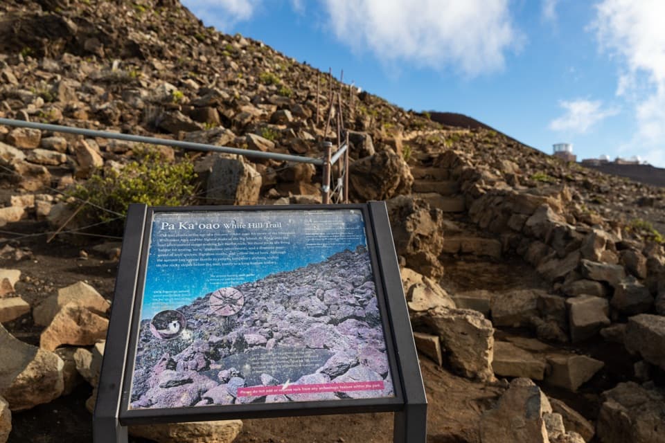
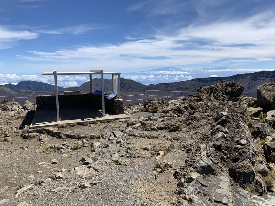
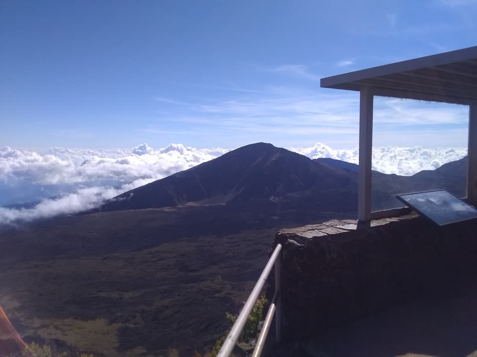
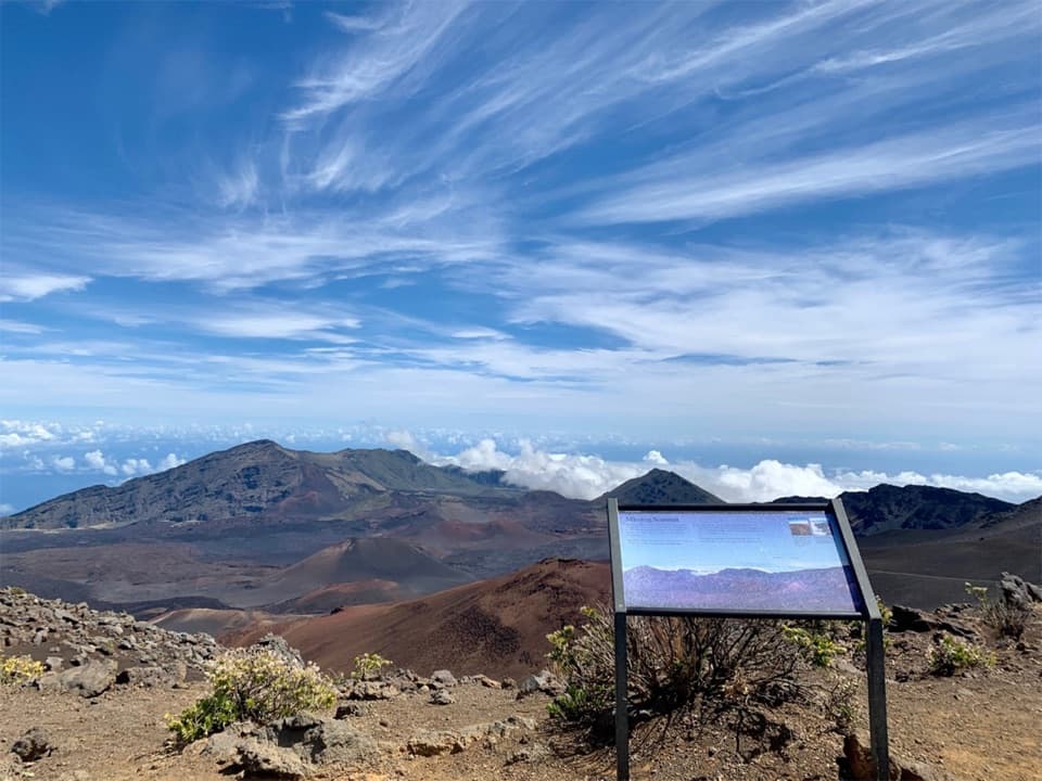
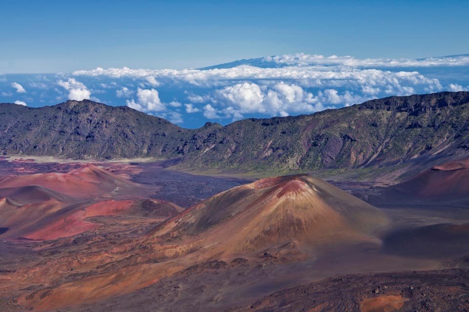
Puʻuʻulaʻula is the 10,023-foot summit of Haleakalā and the highest point on Maui. Its public observation building sits above the park’s enormous central crater, with short paved and unpaved paths around it. Keep this stop if you want the high point and a broad crater view without a hike. Clear weather opens views across Maui and out to sea; clouds can hide the far horizon.

Take in the whole viewA short path from the lot reaches the public observation building by stairs or an inclined path.

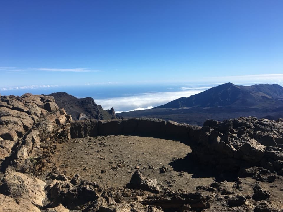
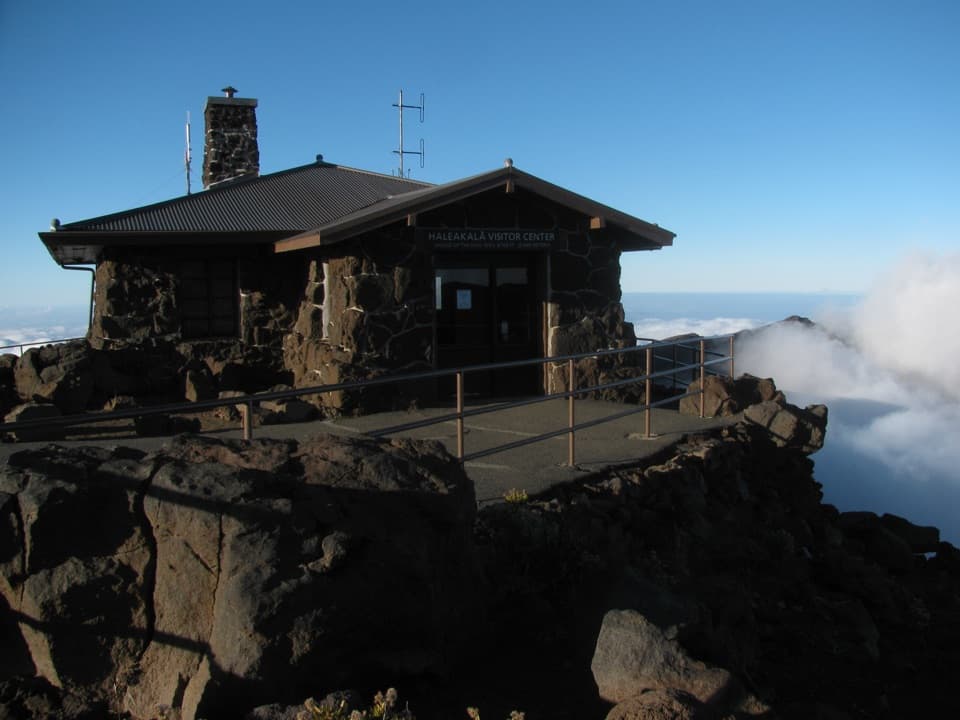
A short path from the lot reaches the public observation building by stairs or an inclined path. NPS identifies the site as wheelchair accessible but does not give the path’s grade or surface. From the summit, look across the crater, toward the West Maui Mountains and, on clear days, to neighboring islands and the Pacific. Mauna Kea and Mauna Loa on Hawaiʻi Island are sometimes visible across the water. For a sunrise photo, include the small summit building against the sky; it gives the cloud view a sense of scale. The nearby observatories are not open to visitors. The public viewing area is the summit building and its paths.

Plan the drive and entryThe summit is 10 miles beyond the entrance station, up a road with no lights or guardrails.

The summit is 10 miles beyond the entrance station, up a road with no lights or guardrails. Before a pre-dawn visit, check the current rules and reserve the separate sunrise entry. Parking is limited and can fill, especially near sunset, and the entrance may turn cars around when the lot is full. There’s no food, fuel or EV charging in the park, so arrive supplied. Restrooms and drinking fountains are available at the summit.

Give the altitude a momentAt 10,023 feet, the air is thin and the summit can be cold and windy even when the coast is…

At 10,023 feet, the air is thin and the summit can be cold and windy even when the coast is warm. Take the first walk slowly and bring a warm, wind-resistant layer. If you feel unwell from the altitude, head back down rather than pushing on.

The crater is an erosional valleyHaleakalā’s “crater” wasn’t made by the summit collapsing into a hollow.

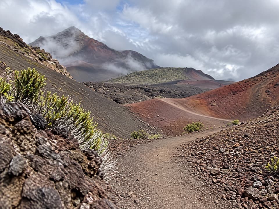
Haleakalā’s “crater” wasn’t made by the summit collapsing into a hollow. It’s an erosional valley: the Koʻolau and Kaupō valleys expanded toward one another and met near the summit after lava flows built around the rim about 145,000 years ago. The crater floor still has cinder cones and lava flows, some formed about 800 years ago.

A silversword that blooms onceThe ʻāhinahina, or Haleakalā silversword, is found only on this mountain.

The ʻāhinahina, or Haleakalā silversword, is found only on this mountain. Its silvery hairs help it reflect harsh sun and collect moisture from mist. A plant can live for 30 years or more, then send up one tall purple flower stalk and die. Stay on marked paths; a footstep can damage its fragile roots.

A shelter built for the summitThe low stone-and-glass public observation building was completed in 1964; its stairway and…

The low stone-and-glass public observation building was completed in 1964; its stairway and parking area were finished in 1963. The building’s wraparound windows offer some shelter while keeping the view open, which matters on this exposed, windy summit.

Treat this place with careThe summit is sacred to Native Hawaiians.

The summit is sacred to Native Hawaiians. Keep your voice low and leave rocks, cultural objects, plants and structures where they are.

Wildlife

Wildlife in Haleakalā

All Haleakalā wildlife maps

Sighting maps show where each species has been reported across Haleakalā. Wildlife moves, so no sighting is guaranteed.

Keep exploring

Near Puʻuʻulaʻula Summit

See it all on the map

Trails nearby

More stops nearby

Parkwolf’s Haleakalā ranking

Top sights in Haleakalā

All 32 places
  1. 2Waimoku FallsSight
  2. 3Pools of ʻOheʻoSight
  3. 4Kalahaku OverlookSight
  4. 5Leleiwi OverlookSight
  5. 6Pīpīwai Bamboo ForestSight
  6. 7Pā Kaʻoao OverlookSight

Take Parkwolf to Haleakalā.

The audio tour guide for the drive, plus offline maps, trails, and wildlife heatmaps for when the signal drops.

4.7 from 8,600+ ratings

Download Parkwolf on the App StoreGet Parkwolf on Google Play