Lookout Louise in Isle Royale National Park

#3 of 36 sights in Isle Royale

Sight · Isle Royale National Park

Lookout Louise

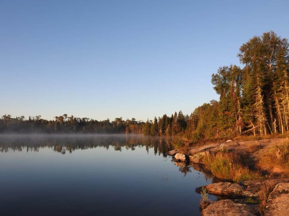
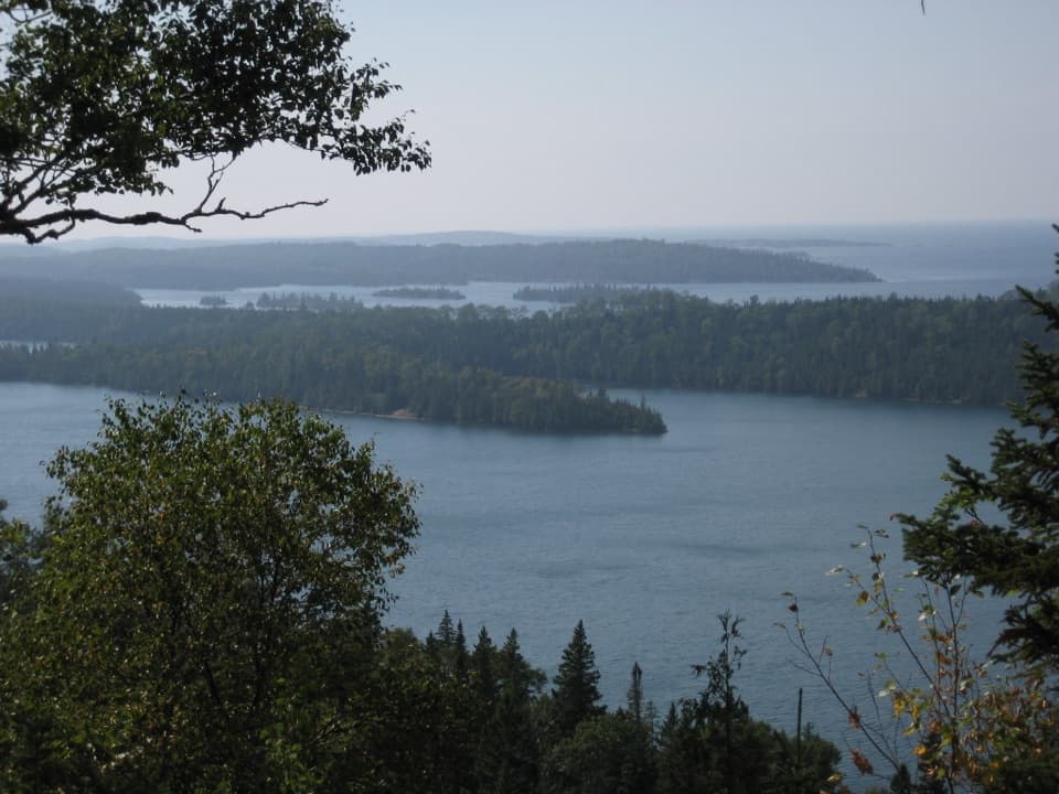
A broad Lake Superior view, if you're up for the rocky mile.

Photo: Flickr
Type
Sight
Nearest trail
0.6 mi
Audio stories
8 nearby
  • Scenic viewpoint

Hear the audio tour

The Lava Beneath the Ridges

Overview

About Lookout Louise

Why stop

  • Wide, layered views across Duncan Bay and Lake Superior.

Heads up

  • Remote boat access and a rocky, uneven hike from Hidden Lake.

Map

Where it is

Loading the Isle Royale map
Full map
SightLookout Louise48.16433, -88.48267
Keep this map with you offline in the Parkwolf app

Plan your stop

Before you go

A big view that takes planning

Lookout Louise is a wooded overlook on Isle Royale’s east end, above Duncan Bay. It looks across the bay and Lake Superior toward Thunder Bay, Ontario. This is worth lining up if you can get to Hidden Lake; the wide view earns the effort, but it isn’t a quick stop.

8 active Isle Royale alerts

  • ClosureSeasonal park closure begins November 1Isle Royale closes to public use November 1–April 15 because extreme winter weather threatens visitor safety; the closure extends 4.5 miles into Lake Superior from the island.Official details
  • ClosureCamping closures at east-end campgrounds and Zone 9Camping restrictions are in effect at four east-end campgrounds and Off-trail Camping Zones 9–13 and 30–38 because of increased human-wildlife interactions and food-storage concerns.Official details
See all 8 alerts
A park ranger sits on a dash-mounted phone, talking, as Parkwolf’s Tour Guide plays “Army Cutworm Moths: A Grizzly Bear Buffet” on Grand Loop Road below Dunraven Pass in Yellowstone
Parkwolf Tour GuideThe highest, rockiest slopes around here are a summer buffet for grizzly bears.

Isle Royale Tour Guide

Your drive to Lookout Louise, narrated.

Parkwolf is a GPS audio tour guide for Isle Royale National Park. As you drive, it chimes in with what’s ahead: hidden gems, upcoming stops, history, geology, and wildlife, right through your car’s speakers.

Recorded for this area

The Lava Beneath the Ridges
0:00 / 0:34
“Isle Royale's long ridges began as layers of lava. About one point one billion years ago, North America started pulling apart, and molten rock poured out through the cracks.”

Plays on the road 1.2 mi from Lookout Louise in the Parkwolf Isle Royale Tour Guide.

More stories near here in the app

  • A Western Plant on Superior
  • The Living Color on the Rocks
  • The Fish That Changed the Catch
  • Copper Before the Mine Shafts
  • 17 audio storiesacross Isle Royale’s roads, triggered by GPS as you drive
  • Wildlife heatmapsfor Moose, Wolf, Bald Eagle, and 13 more
  • Works offlinemaps, 39 trails, 83 places, and audio download before you lose signal
  • CarPlay readysimple controls built for the drive
★★★★★
“Fantastic app with many points of information… It’s great to just turn on while you’re driving and it gives you an audio tour of the national Park. We love it!!!!”
JMJamesApp Store review
Download Parkwolf on the App StoreGet Parkwolf on Google Play

4.7 from 8,600+ ratings

Guide

More about Lookout Louise

The boat comes before the hikeThe approach is about a mile from Hidden Lake on a narrow path, roughly 18 inches wide, over…

The approach is about a mile from Hidden Lake on a narrow path, roughly 18 inches wide, over rocks and roots, with steep spots. You can reach Hidden Lake by private boat, water taxi, or the MV Sandy tour, so arrange your drop-off in advance. If you continue toward Mount Franklin, that remote, exposed Greenstone section has no water access; plan before setting out. Pets aren’t allowed on this trail section.

Look for the layersDuncan Bay fills the foreground, with Lake Superior reaching toward Thunder Bay beyond it.

Duncan Bay fills the foreground, with Lake Superior reaching toward Thunder Bay beyond it. On clear days, look for Pie Island, Sibley Peninsula, and Edward Island. For a photo, keep some of the wooded edge and bay in the frame; the layers of trees, islands, and open water show the scale better than aiming straight at the horizon.

Find the old mining townBring binoculars and look toward Sibley Cove.

Bring binoculars and look toward Sibley Cove. Buildings dot the site of a silver-mining town developed in the 1870s, a piece of mainland history you can pick out from this island overlook.

Who Louise wasThe lookout is named for Louise Savage of Saint Paul, Minnesota.

The lookout is named for Louise Savage of Saint Paul, Minnesota. Before Isle Royale became a national park, her family owned one of the islands near Tobin Harbor. There are benches at the viewpoint, but no food service is listed, so bring what you need before arranging the boat trip.

Wildlife

Wildlife in Isle Royale

All Isle Royale wildlife maps

Sighting maps show where each species has been reported across Isle Royale. Wildlife moves, so no sighting is guaranteed.

Keep exploring

Near Lookout Louise

See it all on the map

Trails nearby

More stops nearby

Parkwolf’s Isle Royale ranking

Top sights in Isle Royale

All 83 places
  1. 1Rock Harbor LighthouseSight
  2. 2Scoville PointSight
  3. 4Edisen FisherySight
  4. 5Mount FranklinSight
  5. 6Ojibway TowerSight
  6. 7Suzy's CaveSight

Take Parkwolf to Isle Royale.

The audio tour guide for the drive, plus offline maps, trails, and wildlife heatmaps for when the signal drops.

4.7 from 8,600+ ratings

Download Parkwolf on the App StoreGet Parkwolf on Google Play