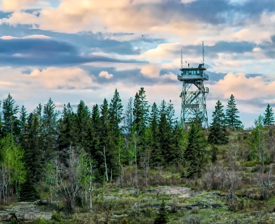
Ojibway Tower in Isle Royale National Park

#6 of 36 sights in Isle Royale

Sight · Isle Royale National Park

Ojibway Tower

A historic lookout crowns Greenstone Ridge above its interior lakes.

Photo: National Park Service
Type
Sight
Nearest trail
1.1 mi
  • Scenic viewpoint
Parkwolf audio tour17 stories across Isle Royale’s roads

Overview

About Ojibway Tower

Why stop

  • A historic fire tower with views over the island’s interior lakes.

Heads up

  • The tower room is closed, and reaching it takes a substantial hike.
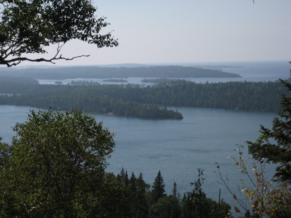
Ojibway Tower is a former fire lookout on Greenstone Ridge, above Isle Royale’s eastern end. It now supports park communications. The tower room is closed, but visitors may climb partway up the stairs for an elevated look over the island’s interior lakes and bays. It makes a rewarding destination on a longer hike, not a roadside stop.
Parkwolf’s verdictA landmark worth the hike

Map

Where it is

Loading the Isle Royale map
Full map
SightOjibway Tower48.10853, -88.60724
Keep this map with you offline in the Parkwolf app

Plan your stop

Before you go

8 active Isle Royale alerts

  • ClosureSeasonal park closure begins November 1Isle Royale closes to public use November 1–April 15 because extreme winter weather threatens visitor safety; the closure extends 4.5 miles into Lake Superior from the island.Official details
  • ClosureCamping closures at east-end campgrounds and Zone 9Camping restrictions are in effect at four east-end campgrounds and Off-trail Camping Zones 9–13 and 30–38 because of increased human-wildlife interactions and food-storage concerns.Official details

See all 8 alerts
A park ranger sits on a dash-mounted phone, talking, as Parkwolf’s Tour Guide plays “Army Cutworm Moths: A Grizzly Bear Buffet” on Grand Loop Road below Dunraven Pass in Yellowstone
Parkwolf Tour GuideThe highest, rockiest slopes around here are a summer buffet for grizzly bears.

Isle Royale Tour Guide

Your drive to Ojibway Tower, narrated.

Parkwolf is a GPS audio tour guide for Isle Royale National Park. As you drive, it chimes in with what’s ahead: hidden gems, upcoming stops, history, geology, and wildlife, right through your car’s speakers.

  • 17 audio storiesacross Isle Royale’s roads, triggered by GPS as you drive
  • Wildlife heatmapsfor Moose, Wolf, Bald Eagle, and 13 more
  • Works offlinemaps, 39 trails, 83 places, and audio download before you lose signal
  • CarPlay readysimple controls built for the drive
★★★★★
“Fantastic app with many points of information… It’s great to just turn on while you’re driving and it gives you an audio tour of the national Park. We love it!!!!”
JMJamesApp Store review
Download Parkwolf on the App StoreGet Parkwolf on Google Play

4.7 from 8,600+ ratings

Guide

More about Ojibway Tower

Make it a proper day hikeThe Daisy Farm Triangle covers about 5.

The Daisy Farm Triangle covers about 5.1 miles over Daisy Farm Trail, Mount Ojibway Trail, and a stretch of Greenstone Ridge Trail, passing the tower on the ridge. The Mount Ojibway climb is steep, so budget real day-hiking effort. You can reach Daisy Farm Dock by boat, but the rest of the way is on foot. Carry day-hiking essentials and leave enough energy for the return.

Take in the viewClimb as far as visitors are allowed and look across the interior lakes and bays; clear weather…

Climb as far as visitors are allowed and look across the interior lakes and bays; clear weather helps the view open up. The steel stairways and framework make a strong foreground from the clearing, while the landing gives you the island’s water and forest from above.

A lookout with a second jobThe Civilian Conservation Corps built the first tower in 1939, after a 1936 fire.

The Civilian Conservation Corps built the first tower in 1939, after a 1936 fire. That timber structure fell into disrepair and was replaced on the same spot in 1964. Isle Royale’s towers were no longer staffed by fire lookouts by 1980; rangers and trail crews used them as temporary shelters for a few more years. Ojibway Tower now serves park communications and joined the National Register of Historic Places in 2021 with the island’s two other fire towers.

The volcanic ridge underfootGreenstone Ridge is formed by the Greenstone Flow, a unit of ancient Portage Lake Volcanics…

Greenstone Ridge is formed by the Greenstone Flow, a unit of ancient Portage Lake Volcanics nearly 790 feet thick. Glaciers later scoured the island into long ridges and drowned valleys, the landscape spread out below the tower. The same volcanic and sedimentary rocks hold native copper, which shaped human presence on Isle Royale for thousands of years.

Wildlife

Wildlife in Isle Royale

All Isle Royale wildlife maps

Sighting maps show where each species has been reported across Isle Royale. Wildlife moves, so no sighting is guaranteed.

Keep exploring

Near Ojibway Tower

See it all on the map

Trails nearby

More stops nearby

Parkwolf’s Isle Royale ranking

Top sights in Isle Royale

All 83 places
  1. 1Rock Harbor LighthouseSight
  2. 2Scoville PointSight
  3. 3Lookout LouiseSight
  4. 4Edisen FisherySight
  5. 5Mount FranklinSight
  6. 7Suzy's CaveSight

Take Parkwolf to Isle Royale.

The audio tour guide for the drive, plus offline maps, trails, and wildlife heatmaps for when the signal drops.

4.7 from 8,600+ ratings

Download Parkwolf on the App StoreGet Parkwolf on Google Play