Roche Miette

Flat-topped limestone icon with a stout scramble and huge views
Roche Miette, Jasper National Park
InsideJasper National Park

Why go

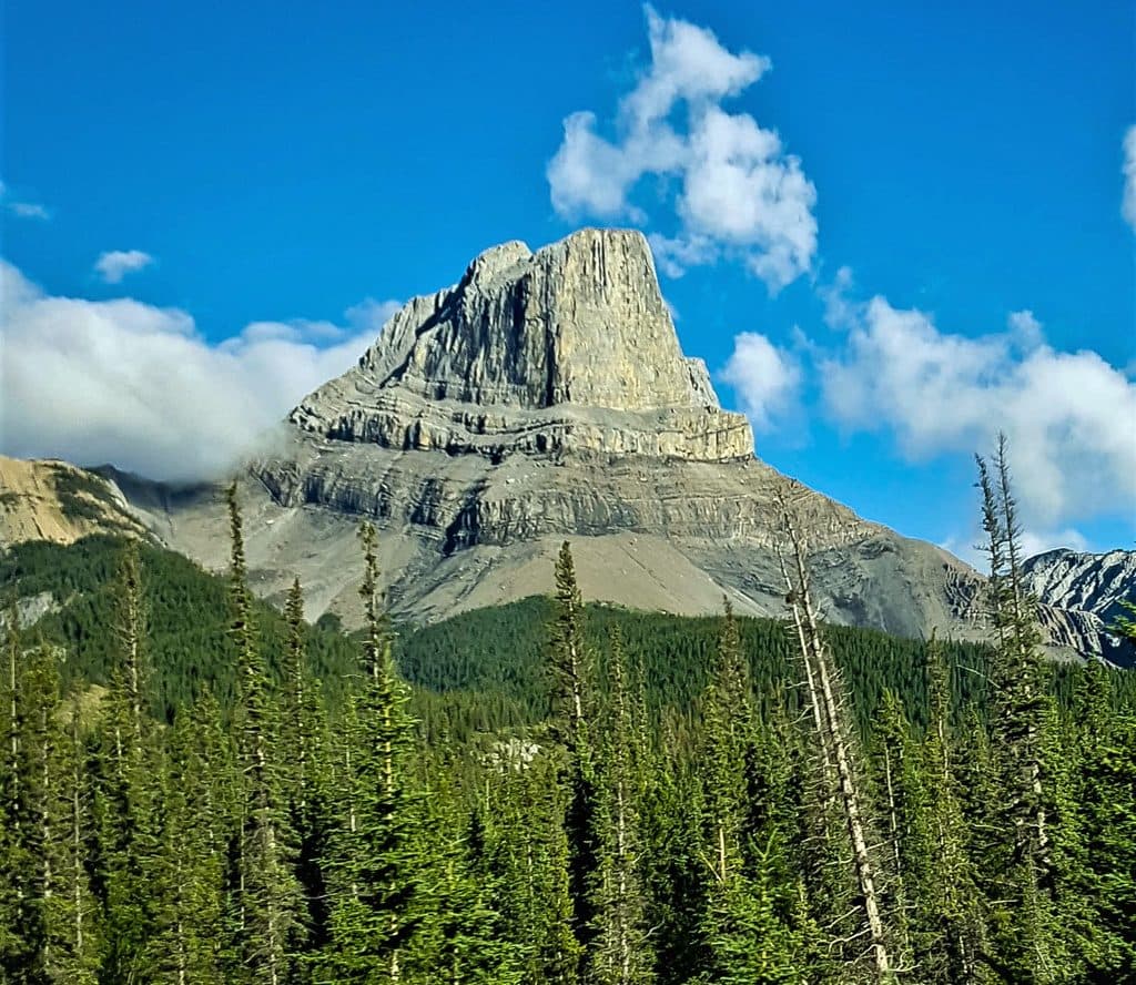
Roche Miette is that bold, flat-topped limestone landmark you see from Highway 16—sheer on its north face, broad and fortress-like up top. It’s one of Jasper’s classic scrambles, rewarding the work with huge Athabasca Valley views and a dramatic summit plateau.

The route at a glance

  • Distance and gain: roughly 10–12.8 km round trip with about 1,000–1,331 m of elevation gain.
  • Typical line: from a small roadside pullout/parking by a gate, follow a forestry/fire road to pick up the path toward the Northeast col, then scramble the final sections to the summit.
  • Terrain: steep, rocky, and occasionally exposed near the shoulder; expect a real workout and a hands-on finish.
  • Variations: a second path heads into a canyon and can link with the fire-road route for a loop when conditions allow.

What to expect

  • Navigation: multiple unmarked side paths can cause confusion—bring a map/GPS and pay attention at junctions.
  • Conditions: it’s often windy and cold near the top; weather shifts fast, especially in the afternoon.
  • Atmosphere: you’ll feel the mountain’s scale in the vertical walls as you climb, and the summit views are the payoff.

Wildlife

Mountain sheep are sometimes encountered right on the route and have been known to block the trail. Give them space and be patient; this is their turf.

Season and access

Access hinges on the Miette Hot Springs Road schedule—Parks Canada typically opens it in late May and closes it in mid‑October, and area trails are usually clear by late May. Outside those dates, assume access and conditions are not reliable.


History and geology

The name translates from French as “Crumb Rock,” and the peak has been a noted landmark for explorers since the 19th century. Folklore credits a voyageur named Bonhomme Miette with the first ascent. Geologically, it’s classic Rockies limestone: sheer cliffs on the north, with a broad, erosion‑sculpted summit plateau.

What to bring

  • Sturdy boots, warm layers, and wind protection (the summit can bite)
  • Plenty of water and high‑energy food
  • Map/GPS (route-finding matters here)
  • Bear spray as standard backcountry kit; optional poles and a camera

Best time to visit

Late May through mid‑October, aligned with the Miette Road opening. Start early to secure limited parking, avoid afternoon storms, and leave ample daylight for the descent.

Pros

  • Panoramic summit views over the Athabasca Valley
  • Classic Jasper scramble with a broad, flat-topped limestone summit

Cons

  • Steep, strenuous route with confusing side trails and some exposure
  • Very limited parking at a small pullout
  • No facilities and spotty cell service

Tips

  • Start early to beat afternoon storms and leave time for the steep descent.
  • Carry a map or GPS—unmarked side trails make navigation tricky.
  • Pack layers; it’s often windy and cold near the summit.
  • Bring all water and supplies—there are no facilities at the pullout or on route.
  • Check Miette Hot Springs Road’s seasonal opening before you go.
The Parkwolf tour guide sitting on a phone mounted in a car

Parkwolf Tour Guide

Like a tour guide in your car.

Save the places you found around Jasper, then let Parkwolf guide the drive between them.Download Parkwolf on the App Store