Challenging

Snake Indian Falls Trail

Remote ride-or-hike to Jasper’s thundering Snake Indian Falls.
Snake Indian Falls Trail, Jasper National Park
Distance37 mi
Typical time5 hr
DifficultyChallenging
PetsAllowed

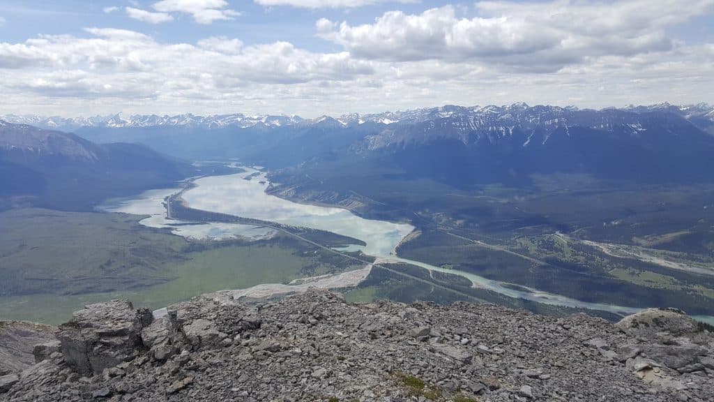
This is Jasper’s big, quiet waterfall mission—remote, long, and absolutely worth it if you like your rewards hard-earned. The route follows the historic North Boundary Trail to Snake Indian Falls, a thundering cascade often cited as one of the largest by volume in the Canadian Rockies. Expect solitude, forested travel, and a dramatic finale at the brink of the Snake Indian River.

Distance is the deal-breaker or the selling point: it’s about 30 km (18.6 mi) one way—roughly 60 km (37 mi) total out-and-back—with around 1,055 m of cumulative elevation gain. The trail begins at the North Boundary/Celestine Lake trailhead and immediately crosses a Bailey Bridge over the Snake Indian River. A steep climb follows and the first half trends mostly uphill to roughly the 14 km mark before rolling and descending toward Shalebanks Campground en route to the falls. The old fire road has grown in; much of it rides/hikes like singletrack with potholes, rough patches, and natural hazards.

Scenery is understated until the end. You’ll spend long stretches under dense forest with limited views, and many sections face south, soaking up sun. Bring more water than you think—you’ll feel the exposure on hot summer days. Wildlife is very much a factor here; bears frequent the corridor, so travel in a group if you can, carry bear spray, and make noise.

Mountain bikers often tackle the full out-and-back in about 5 hours thanks to the smoother grades and long approach. Strong hikers could attempt a massive day, but most people should treat this as a backpacking trip. Designated backcountry campgrounds (like Shalebanks and Willow Creek) break the distance into manageable chunks; you’ll need a Parks Canada backcountry permit to stay overnight.

Access is half the adventure: Celestine Lake Road is rough, narrow, and controlled by strict one-way time windows. Plan your drive carefully so you’re not stuck waiting at the gate or racing the outbound window. Once on trail, navigation is straightforward if you stay on the main North Boundary corridor and ignore the Celestine Lake spur.

Best time to go is summer into early fall, when the road is snow-free and the trail has dried out. Start early to beat heat on those exposed stretches, and aim to reach the falls with softer afternoon light for photos. If you want a quick front-country waterfall fix, look elsewhere. If you want a true backcountry objective with a roaring payoff, this one delivers.

Pros

  • One of the park’s biggest waterfalls by volume at the end of a quiet approach
  • Can be efficiently done by bike, turning a slog into a rewarding ride

Cons

  • Celestine Lake Road’s strict one-way schedule complicates timing
  • Long, often sun-exposed approach with limited views until the finale

Parking

Park at the North Boundary/Celestine Lake trailhead at the end of Celestine Lake Road (timed one-way access). The route starts by crossing the Bailey Bridge over the Snake Indian River.

Caution

Rough, long backcountry approach with potholes and natural hazards; significant sun exposure; bears frequent the area; and access via Celestine Lake Road is narrow and strictly timed one-way—confirm schedules and carry ample water and bear spray.

The Parkwolf tour guide sitting on a phone mounted in a car

Parkwolf Tour Guide

Like a tour guide in your car.

Bring Jasper trail research into the car, with offline maps and stories that play as you drive.Download Parkwolf on the App Store