Pros & cons
PROS
- Immediate canyon footbridge payoff before the climbing begins
- Wide, bike‑friendly corridor that’s great for hauling overnight gear
- Glorious aspen color show in fall along the route
CONS
- Rough access road with fixed one‑way windows can bottleneck your day
- Mosquitoes are intense in summer—linger at your own itch risk
- Signage is only average if you continue past the lake
Trailhead parking at the end of Celestine Road (shared with the North Boundary corridor). The access road is rough and operated on scheduled one‑way windows—arrive during an inbound window or be prepared to wait.
Plan around the one‑way access road schedule; the dirt road is rough. Treat or boil all water. Expect heavy mosquitoes in summer. Carry bear spray and secure food. Verify current road/bridge conditions and campground details before you go.
Why go
If you want a mellow backcountry taste of Jasper without a brutal grind, this one’s a sleeper hit. Celestine starts with a dramatic footbridge over the Snake Indian River canyon, then settles into a steady climb on an old fire road to a tranquil lake and rustic campground. It’s wide, bike‑friendly, and great for families with older kids who can handle the distance.
The hike, at a glance
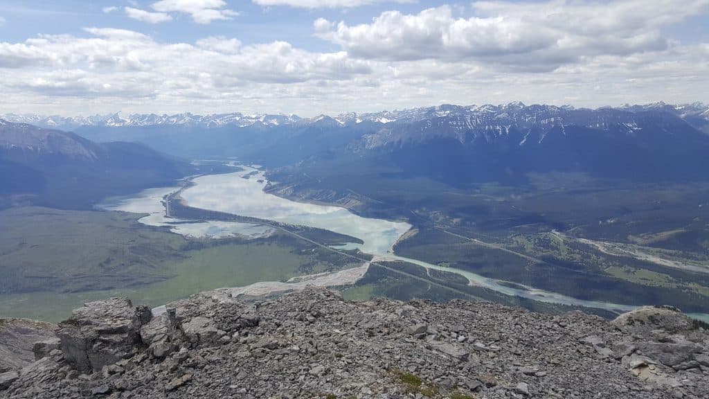
It’s an out-and-back of about 13.7 km/8.5 miles total to Celestine Lake and back, with roughly 423 m/1,388 ft of gain—most of it after the bridge up to a high bench above the river. Around 2 km in you’ll pass the Moosehorn junction, and near 5 km you reach an old parking area where you turn toward Princess Lake (on your left) and then continue to Celestine Lake. Expect forested stretches with old-growth Douglas fir, open views back down the valley, and a calm, forest-rimmed lakeshore that invites a long lunch—or an overnight if you’ve got a permit.
Camp, bikes, and bugs
The Celestine Lake Campground has about eight tent sites plus a fire pit, and there’s a water pump—treat or boil all water. The corridor is open to bikes, and the wide tread even makes bike trailers feasible for those hauling kid gear or overnight kits. Summer mosquitoes can be fierce; bring serious repellent and long sleeves.
Logistics you need to know
Getting there is the crux. The rough Celestine Road has scheduled one‑way traffic windows past a certain kilometer marker. Miss a window and you’ll wait—build extra time into your day and check the current schedule before you go. Trail signage is decent to the lake; if you plan to continue to Devona Lookout or farther, bring a map or GPS.
Seasonal notes and scenery
June through September is the sweet spot for snow-free tread and reasonable river levels. Fall is especially pretty—there’s an aspen stretch that turns into a sea of gold. Shoulder seasons can work, but conditions vary; confirm road and trail status before committing.
Who will love it (and who won’t)
It’s ideal for newcomers to Jasper’s backcountry, families with trail legs, and anyone who appreciates a quieter lake destination. If you’re craving dramatic alpine passes, look elsewhere. But for a low-drama day with a canyon bridge, forest, and a peaceful picnic-worthy lake, this is an underrated choice. Side trips exist (like Devona Lookout), but Snake Indian Falls is a very long push from here for a day.
Permits and safety
Overnight stays require a backcountry permit via Parks Canada. Carry bear spray, store food properly, and treat all water. Dogs should be leashed.
Wildlife on this trail
Near Celestine Lake Trail
All places →All trails →
Maligne LakeGlacier-blue lake with cruises to photogenic Spirit IslandTrailhead · Parking
Mount Edith CavellAngel Glacier views and wildflower meadows on Jasper’s signature peakTrailhead · Restroom
Spirit IslandIconic island view on turquoise Maligne Lake, reached only by boat
Athabasca FallsRoaring glacier-fed falls squeezed into a narrow quartzite canyonTrailhead · Pullout
Skyline TrailCanadas premier alpine traverse with 25 km above treeline.Challenging · 27.4 mi · 16 hr
Maligne CanyonJasper’s classic gorge walk with bridges, waterfalls, and karst springsModerate · 2.3 mi · 1.5 hr
Cavell MeadowsWildflowers and glaciers with a steep, rewarding ridge loopModerate · 4.6 mi · 4 hr
Sulphur SkylineSteep climb to a 360-degree ridge, then a hot-springs soak belowChallenging · 5.3 mi · 4.5 hr