Boole Tree Trail in Kings Canyon National Park

Kings Canyon National Park, CA

Boole Tree Trail

A giant sequoia thought spared by loggers anchors this forest loop.

Photo: National Park Service
Length
2.3mi
Time
2hr
Elev. change
587ft
Difficulty
Moderate
  • Loop
  • Dogs allowed
  • High point 6,841 ft
  • #28 of 77 in Kings Canyon

Hear the audio tour

Boole Tree and Stump Meadow Access

Overview

About Boole Tree Trail

Why go

  • A rare chance to visit the exceptionally large Boole Tree.
  • High Sierra and Kings River gorge views break up the forest climb.

Heads up

  • The short hike begins with a sustained climb.
  • The rough forest road makes access a bigger commitment than the mileage suggests.

Map & elevation

The route

Loading the Kings Canyon map
Full map
Elevation6,253–6,841 ft
TrailheadBoole Tree Trailhead parking area, Forest Route 13S5536.82219, -118.96074
Keep this map with you offline in the Parkwolf app

Plan your hike

Before you go

Parking

Start at the Boole Tree Trailhead parking area at the end of Forest Route 13S55 (Boole Tree Road). From Highway 180, turn onto the forest road and continue to its end. The Forest Service advises high-clearance vehicles and recommends four-wheel drive; low-clearance vehicles are not recommended. Parking and a vault toilet are available; no potable water is provided.

Safety

Forest Route 13S55 is a rough dirt road and is not recommended for low-clearance vehicles; high clearance and four-wheel drive are advised. The trail starts with an uphill climb and has some narrow, uneven tread. Bring water because none is available at the trailhead.

8 active Kings Canyon alerts

  • CautionStage 1 fire restrictionsStage 1 fire restrictions are active because high fire danger raises the risk of accidental human-caused fires that could threaten visitors and employees.Official details
  • ClosureGrant Grove trails and areas closed for prescribed fireSome trails and areas around Grant Grove and the General Grant Tree are closed during an active prescribed burn; stay out until crews clear hazards and reopen them.Official details
See all 8 alerts
A park ranger sits on a dash-mounted phone, talking, as Parkwolf’s Tour Guide plays “Army Cutworm Moths: A Grizzly Bear Buffet” on Grand Loop Road below Dunraven Pass in Yellowstone
Parkwolf Tour GuideThe highest, rockiest slopes around here are a summer buffet for grizzly bears.

Kings Canyon Tour Guide

Your drive to Boole Tree Trail, narrated.

Parkwolf is a GPS audio tour guide for Kings Canyon National Park. As you drive, it chimes in with what’s ahead: hidden gems, upcoming stops, history, geology, and wildlife, right through your car’s speakers.

See the Kings Canyon audio tour

Recorded for this trailhead

Boole Tree and Stump Meadow Access
0:00 / 0:25
“You're coming up on the Converse Basin access road for Boole Tree and Stump Meadow. The rough dirt road calls for high clearance and four-wheel drive; I'd skip this detour in a low car.”

Plays as you drive up to this trailhead in the Parkwolf Kings Canyon Tour Guide.

More stories near here in the app

  • The Insect That Skates on Water
  • The Foot-Long Cones
  • The Squirrel Behind the Cone Pile
  • Photographs in Congress
  • 55 audio storiesacross Kings Canyon’s roads, triggered by GPS as you drive
  • Wildlife heatmapsfor Black Bear, Mule Deer, Marmot, and 13 more
  • Works offlinemaps, 77 trails, 61 places, and audio download before you lose signal
  • CarPlay readysimple controls built for the drive
★★★★★
“…The kids and my husband and I all agree that the narration really added to our experience driving through the parks. We learned so much about the history and the flora & fauna.”
JessestblondeApp Store review
Download Parkwolf on the App StoreGet Parkwolf on Google Play

4.7 from 8,600+ ratings

Trail guide

Hiking Boole Tree Trail

A loop to a giant sequoiaBoole Tree Trail is a moderate 2.

Boole Tree Trail is a moderate 2.25-mile loop in Converse Basin, within Sequoia National Forest and Giant Sequoia National Monument, outside Kings Canyon National Park. It begins with a steady climb through mixed pine forest, reaches a T-junction, then descends to the Boole Tree before returning by the other leg. Plan about two hours. Published loop figures range from 2.25 to 2.5 miles, so allow a little extra room. The tree and views toward the Kings River gorge and high Sierra are the payoff for a sustained uphill start.

Plan for the access roadThe trail starts at the end of Forest Route 13S55, also called Boole Tree Road.

The trail starts at the end of Forest Route 13S55, also called Boole Tree Road. From Highway 180, follow the forest road to the trailhead parking area. The unpaved access road is rough; the Forest Service recommends high clearance and four-wheel drive and does not recommend low-clearance vehicles. Check road conditions before setting out. Parking and a vault toilet are at the trailhead, but there is no potable water. Dogs are allowed on leashes up to six feet.

What the walk is likeThe route climbs through lodgepole, western white, Jeffrey and sugar pines before the loop's…

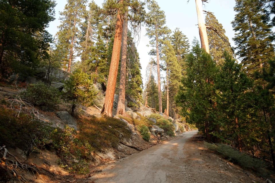
The route climbs through lodgepole, western white, Jeffrey and sugar pines before the loop's final descent toward the tree. The forest opens to views of the Kings River gorge and high Sierra Nevada. Hikers describe some narrow single-track with uneven footing and brush, so plan for a real trail underfoot. The Forest Service rates the hike moderate; the climb is concentrated early, with the return leg mostly downhill.

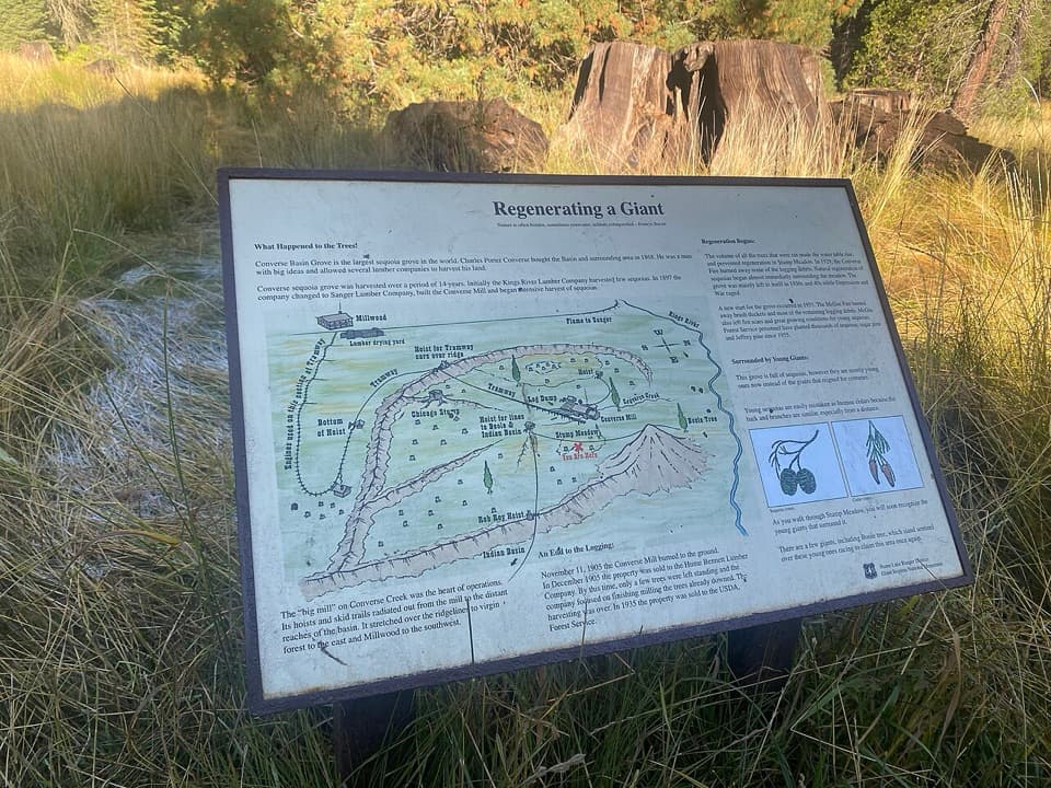
The tree and its settingConverse Basin was heavily logged from 1892 to 1918.

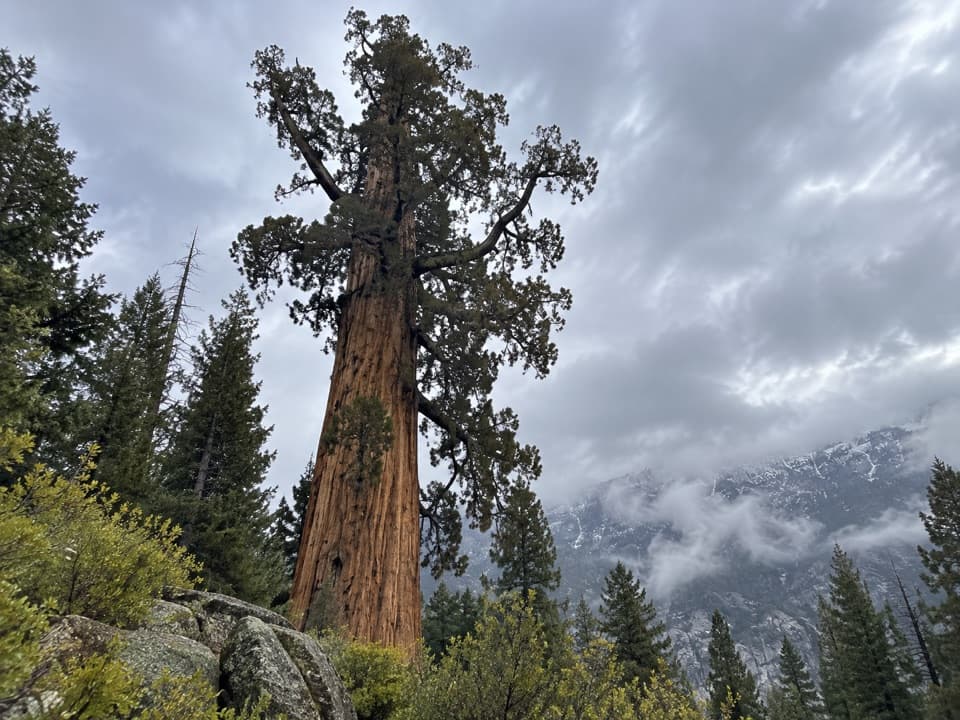
Converse Basin was heavily logged from 1892 to 1918. The grove's remaining large sequoias are a small fraction of what once stood here, and the Boole Tree is thought to have been spared because of its size. Around 1895, it was named for Franklin A. Boole, a supervisor in the logging operation. The Forest Service's descriptions differ on its exact rank among the world's largest sequoias, so the useful fact is its scale: this is one of the great survivors of the grove. For a photo, keep some of the surrounding forest beside the trunk to show its size.

Stump Meadow is a separate roadside stop along the approach, not part of the walking loop. Its old logging stumps sit among younger sequoias, and the tree rings have helped researchers study past weather, fires and droughts.

Wildlife

Wildlife in Kings Canyon

All Kings Canyon wildlife maps

Sighting maps show where each species has been reported across Kings Canyon. Wildlife moves, so no sighting is guaranteed.

Keep exploring

Near Boole Tree Trail

See it all on the map

Trails that start nearby

Places near the trailhead

Parkwolf’s Kings Canyon ranking

Top-rated trails in Kings Canyon

All 77 trails
  1. 1Rae Lakes LoopChallenging · 41.4 mi
  2. 2Mist Falls TrailModerate · 8 mi
  3. 3Zumwalt Meadow TrailEasy · 1.5 mi
  4. 4Roaring River Falls TrailEasy · 0.3 mi
  5. 5Panoramic Point TrailEasy · 0.5 mi
  6. 6Big Stump Loop TrailEasy · 1.6 mi

Take Parkwolf to Kings Canyon.

The audio tour guide for the drive, plus offline maps, trails, and wildlife heatmaps for when the signal drops.

4.7 from 8,600+ ratings

Download Parkwolf on the App StoreGet Parkwolf on Google Play