Parking
Use the Highway 180 turnout about 2 miles east of Cedar Grove Village. Auto parking is available at the cabin site; the mapped walking start is beside the turnout access.
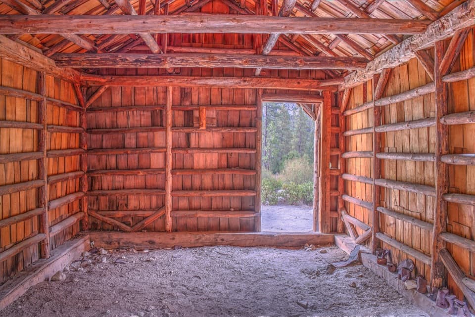
Kings Canyon National Park, CA
A tiny cabin stop with a surprisingly big canyon view
Overview
Knapp’s Cabin Trail is a very short out-and-back, about 0.1 mile round trip, from the Highway 180 access area to a historic cabin above the canyon floor. The mapped footpath is roughly 80 yards each way; the total shifts a little with where you park. Allow about 10–15 minutes to walk and look around. It’s a quick leg-stretcher, not a workout—the cabin and canyon view are the payoff.
 Parkwolf’s verdictIs this the walk for you?
Map & elevation
Plan your hike

The highest, rockiest slopes around here are a summer buffet for grizzly bears.
Kings Canyon Tour Guide
Parkwolf is a GPS audio tour guide for Kings Canyon National Park. As you drive, it chimes in with what’s ahead: hidden gems, upcoming stops, history, geology, and wildlife, right through your car’s speakers.
See the Kings Canyon audio tourRecorded for this trailhead
Knapp’s Cabin“Knapp's Cabin is coming up, a small wooden building with a canyon view that makes this a good ten-to-fifteen-minute stop. It's a short walk from the turnout.”
Plays as you drive up to this trailhead in the Parkwolf Kings Canyon Tour Guide.
More stories near here in the app
“…The kids and my husband and I all agree that the narration really added to our experience driving through the parks. We learned so much about the history and the flora & fauna.”


Trail guide
The turnout is on Highway 180 about 2 miles east of Cedar Grove Village. The cabin is a short walk from the parking area, though the exact parking edge is not marked. Cedar Grove road access is usually open from May through early to mid-November, with dates shifting according to weather. Pets aren’t allowed on park trails.
George O. Knapp had the cabin built in 1925 to store gear for his fishing and camping trips with guests. It was added to the National Register of Historic Places in 1978. The small, plain structure makes more sense once you know it was a practical base for those trips, not a lodge.
The cabin sits on a glacial moraine, a mound of rocky debris raised above the canyon floor. From here, look across at the horizontal scars on the granite walls: rocks frozen into the glacier scraped those lines as the ice moved downhill thousands of years ago. The cabin and its setting make a good paired view—wood and history in front, the larger glacial landscape beyond.
Wildlife
 227 sightingsBlack BearMost seen around 7 PMSighting map
 385 sightingsMule DeerMost seen around 7 PMSighting map
 188 sightingsMarmotMost seen around 8 AMSighting map
 118 sightingsPikaMost seen around 7 AMSighting map
 14 sightingsGolden TroutMost seen around 7 PMSighting map
 32 sightingsRainbow TroutMost seen around 7 PMSighting map
Sighting maps show where each species has been reported across Kings Canyon. Wildlife moves, so no sighting is guaranteed.
Keep exploring
 EasyRoaring River Falls Trail0.3 mi · 18 min · 0.8 mi awayA short paved walk ends at a granite-chute waterfall.EasyKings Canyon River Trail2.8 mi · 1.8 hr · 0.8 mi awayA largely level river walk from Roaring River Falls to Road's End.
 ChallengingCedar Grove Overlook via Hotel Creek Trail4.4 mi · 3.5 hr · 1.9 mi awayA steep 4.4-mile out-and-back to Kings Canyon views
 ModerateHotel Creek–Lewis Creek Loop8 mi · 5 hr · 1.9 mi awayCedar Grove loop with a canyon view and quiet pine stretch.
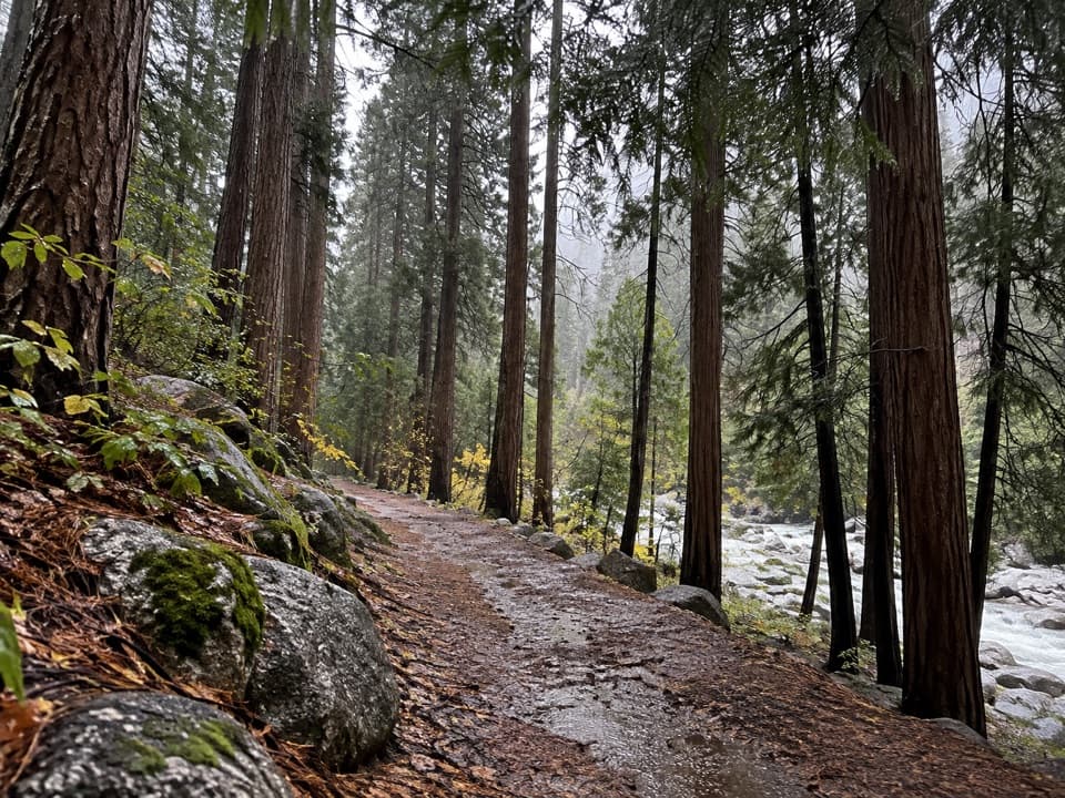 EasyCedar Grove River Road Walk6.6 mi · 2.5 hr · 1.9 mi awayA flat riverside road walk beneath granite cliffs.
 ModerateSheep Creek Cascade Trail2 mi · 1.5 hr · 2 mi awayA short climb to small falls in a shady Cedar Grove ravine.
 ChallengingLookout Peak via Don Cecil Trail11 mi · 8 hr · 2 mi awayA long historic climb opens over the whole canyon.
 EasyZumwalt Meadow Trail1.5 mi · 1 hr · 2.2 mi awayCross the river for a meadow view framed by granite cliffs.
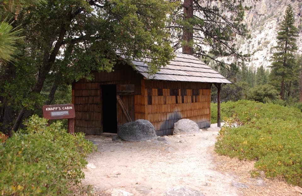 Sight · At the trailheadKnapp's CabinA 1925 fishing cabin with canyon views from a glacial moraine.Sight · 0.8 mi awayRoaring River FallsA 40-foot waterfall, reached by a short but steep paved path.
 Campground · 1.4 mi awayMoraine CampgroundA riverfront base for Cedar Grove's hikes.
 Sight · 1.6 mi awayCedar Grove Pack StationHorseback rides follow the river through Cedar Grove.
 Campground · 1.6 mi awayCanyon View Group CampgroundGroup camping beside the South Fork beneath granite canyon walls.
 1.8 mi awayCedar Grove Showers and LaundryA practical wash-up and laundry stop in Cedar Grove.
 Lodging · 1.8 mi awayCedar Grove Lodge and MarketSeasonal rooms, riverside dining and supplies in the canyon
 Sight · 2 mi awayCedar Grove AmphitheaterA forest theater for ranger talks when Cedar Grove's program is on.
Parkwolf’s Kings Canyon ranking
The audio tour guide for the drive, plus offline maps, trails, and wildlife heatmaps for when the signal drops.



