Stanley Ghyll in Lake District National Park

Sight · Lake District National Park

Stanley Ghyll

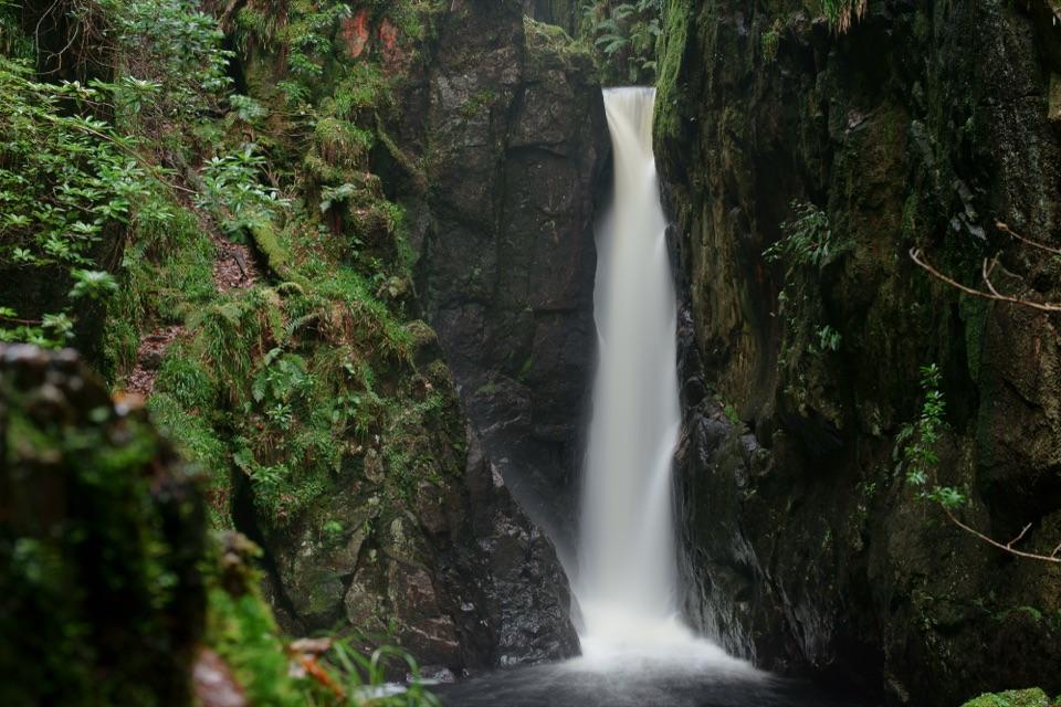
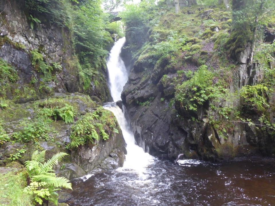
A fern-filled ravine and a waterfall viewed from high above

Photo: Wikimedia Commons

Type
Sight
Nearest trail
1.2 km
Audio stories
4 nearby
  • Parking
  • Scenic viewpoint

Hear the audio tour

Dalegarth: Stanley Ghyll from Above
Download Parkwolf on the App StoreGet Parkwolf on Google Play

4.7 from 8,600+ ratings

Overview

About Stanley Ghyll

Why stop

  • Fern-lined gorge feels wild even on a short walk
  • The waterfall swells dramatically after rain

Heads up

  • Steep, muddy steps and uneven stones
  • The viewing platform is exposed if heights unsettle you

Map

Where it is

Loading the Lake District map
Full map
SightStanley Ghyll54.38444, -3.27303
Keep this map with you offline in the Parkwolf app

Plan your stop

Before you go

8 active Lake District alerts

  • ClosureStanley Ghyll Lower Falls path closed after rockfallMentions this placeFootpath 408037 towards Stanley Ghyll Lower Falls is closed from its junction with Footpath 408087 to the path’s end because rockfall severely damaged and destabilised it, with further rockfall still…Official details
  • ClosureAnglers’ Crag path closes intermittently for repairsFootpath 407024 and the adjoining unrecorded way over Anglers’ Crag on Ennerdale Water’s southern shore close intermittently for repairs; follow signs to check whether the path is open.Official details
See all 8 alerts
A park ranger sits on a dash-mounted phone, talking, as Parkwolf’s Tour Guide plays “Army Cutworm Moths: A Grizzly Bear Buffet” on Grand Loop Road below Dunraven Pass in Yellowstone
Parkwolf Tour GuideThe highest, rockiest slopes around here are a summer buffet for grizzly bears.

Lake District Tour Guide

Your drive to Stanley Ghyll, narrated.

Parkwolf is a GPS audio tour guide for Lake District National Park. As you drive, it chimes in with what’s ahead: hidden gems, upcoming stops, history, geology, and wildlife, right through your car’s speakers.

See the Lake District audio tour

Recorded for this place

Dalegarth: Stanley Ghyll from Above
0:00 / 0:33
“You're approaching Dalegarth Station, a starting point for Stanley Ghyll's sixty-foot waterfall.”

Plays as you drive up to Stanley Ghyll in the Parkwolf Lake District Tour Guide.

More stories near here in the app

  • Boot: Eskdale Mill and the Beck
  • Birker Fell: Green Crag’s Rough Fell Walk
  • Slight Side from Wha House
  • Wood Ants: A Sweet Deal in the Trees
  • 298 audio storiesacross Lake District’s roads, triggered by GPS as you drive
  • Wildlife heatmapsfor Red Deer, Eurasian Otter, Osprey, and 13 more
  • Works offlinemaps, 265 trails, 90 places, and audio download before you lose signal
  • CarPlay readysimple controls built for the drive
★★★★★
“Fantastic app with many points of information… It’s great to just turn on while you’re driving and it gives you an audio tour of the national Park. We love it!!!!”
JMJamesApp Store review
Download Parkwolf on the App StoreGet Parkwolf on Google Play

4.7 from 8,600+ ratings

Guide

More about Stanley Ghyll

A waterfall in a deep woodland gorgeStanley Ghyll is a 60-foot waterfall in a narrow Eskdale ravine, surrounded by mossy rock and…

Stanley Ghyll is a 60-foot waterfall in a narrow Eskdale ravine, surrounded by mossy rock and ferns. The dramatic view is from a cantilevered platform above the gorge: you look down towards the falls and out across upper Eskdale. If heights unsettle you, the platform and its drop are worth considering before you make the climb.

Make the walk workYou can start at Dalegarth Station, on the Ravenglass & Eskdale Railway, or use the nearer…

You can start at Dalegarth Station, on the Ravenglass & Eskdale Railway, or use the nearer parking for the waterfalls. Follow the signed paths through the woodland towards the upper viewing platform and check the current access notices before setting out. The final climb has steep steps, uneven stones and roots, and can be muddy after rain; it isn't a pushchair-friendly stroll.

A circular walk from Dalegarth is a longer outing than the direct approach from nearby parking. Allow time for the climb and descent, and keep children and dogs close where paths run near steep drops or water. Stay on the signed paths and respect barriers.

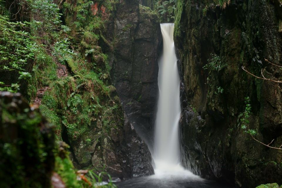
A sheltered habitatThe gorge is a protected nature site, its damp, sheltered walls supporting mosses, liverworts,…

The gorge is a protected nature site, its damp, sheltered walls supporting mosses, liverworts, lichens and unusual ferns. Look closely without leaving the path: the same conditions that support the plants also make the rocks slippery.

Rhododendrons were planted here in the Victorian era and spread densely through the ravine. Conservation work removed large areas of the invasive growth, allowing native vegetation and views of the falls to return.

From the platformThe platform projects over a 150-foot ravine and looks towards the upper, middle and lower…

The platform projects over a 150-foot ravine and looks towards the upper, middle and lower cascades. For a photograph, use the gorge walls to frame the water rather than trying to get closer to the edge. Rain can make the falls more powerful, but it makes the path and rocks more slippery too.

Wildlife

Wildlife in Lake District

All Lake District wildlife maps

Sighting maps show where each species has been reported across Lake District. Wildlife moves, so no sighting is guaranteed.

Keep exploring

Near Stanley Ghyll

See it all on the map

Trails nearby

More stops nearby

Parkwolf’s Lake District ranking

Top sights in Lake District

All 90 places
  1. 1WindermereSight
  2. 2Scafell PikeSight
  3. 3UllswaterSight
  4. 4DerwentwaterSight
  5. 5Wast WaterSight
  6. 6Aira ForceSight

Take Parkwolf to Lake District.

The audio tour guide for the drive, plus offline maps, trails, and wildlife heatmaps for when the signal drops.

4.7 from 8,600+ ratings

Download Parkwolf on the App StoreGet Parkwolf on Google Play