Loughrigg Tarn Circuit in Lake District National Park

Lake District National Park, EN

Loughrigg Tarn Circuit

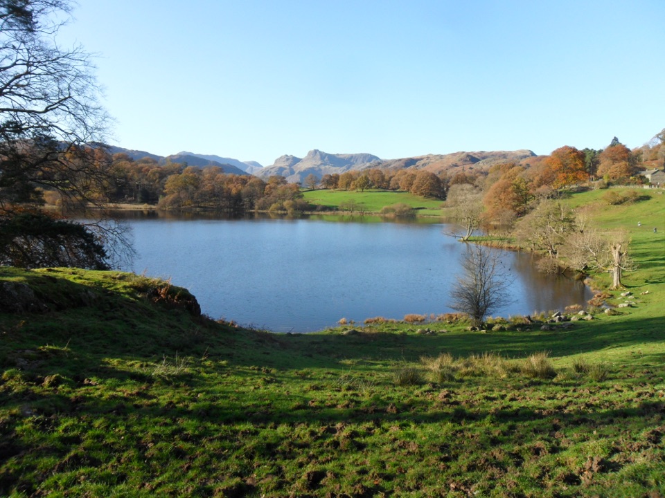
A gentle glacial tarn loop under the Langdale Pikes

Photo: Wikimedia Commons
Length
2.8km
Time
1hr
Elev. change
47m
Difficulty
Easy
  • Loop
  • Dogs allowed
  • High point 141 m
  • #57 of 265 in Lake District

Hear the audio tour

Loughrigg Tarn: A One-Hour Circuit

Overview

About Loughrigg Tarn Circuit

Why go

  • Short loop with a strong tarn and mountain payoff
  • Newly surfaced bridleway and two benches beside the tarn
  • Easy access from Ambleside

Heads up

  • Unpavemented road return requires care around traffic
  • Informal parking is limited

Map & elevation

The route

Loading the Lake District map
Full map
Elevation94–141 m
TrailheadTarn Foot lay-by54.42636, -3.01108
Keep this map with you offline in the Parkwolf app

Plan your hike

Before you go

Parking

Use the lay-by car park at Tarn Foot, postcode LA22 9HF, grid NY 345039. From Ambleside, take the A593 toward Coniston for about 2.5 km, then turn right onto the minor road uphill to the junction and parking. There is no public transport or facility at the start; café and pub toilets are available at Skelwith Bridge about 0.5 km away.


Best time to go

Late spring through early autumn gives the most reliable footing, and high summer is when the lilies are at their best. Wet spells soften the grass and unsurfaced ground, and short winter daylight makes the unpaved road return less comfortable. Morning and late afternoon side light suits the tarn and the fell behind it best, with the Langdale skyline strongest when the sun is low.

Safety

The opening climb is short but steep, and the road return has no pavement with short sections around a 1 in 7 gradient. Watch for traffic, walkers, and cyclists, and expect softer or boggy ground after prolonged rain. Keep dogs under close control or on a short lead near livestock. The informal lay-by cannot be reserved for disabled parking; class 2 or 3 mobility scooters are the only suitable scooter types for this route.

8 active Lake District alerts

  • ClosureChapel Stile footpath closed for retaining-wall riskPart of Footpath 543030 between Chapel Stile and Baysbrown campsite is closed because a retaining wall beside the path could collapse and material it supports could fall across the footpath.Official details
  • ClosureStanley Ghyll Lower Falls footpath closed for rockfallThe section of Footpath 408037 leading towards Stanley Ghyll Lower Falls is closed because severe rockfall damage has made the path unstable and further rockfall remains a danger.Official details
See all 8 alerts
A park ranger sits on a dash-mounted phone, talking, as Parkwolf’s Tour Guide plays “Army Cutworm Moths: A Grizzly Bear Buffet” on Grand Loop Road below Dunraven Pass in Yellowstone
Parkwolf Tour GuideThe highest, rockiest slopes around here are a summer buffet for grizzly bears.

Lake District Tour Guide

Your drive to Loughrigg Tarn Circuit, narrated.

Parkwolf is a GPS audio tour guide for Lake District National Park. As you drive, it chimes in with what’s ahead: hidden gems, upcoming stops, history, geology, and wildlife, right through your car’s speakers.

Recorded for this trailhead

Loughrigg Tarn: A One-Hour Circuit
0:00 / 0:54
“You're coming up on the access road for Loughrigg Tarn, a little lake with a walk that fits into about an hour.”

Plays as you drive up to this trailhead in the Parkwolf Lake District Tour Guide.

More stories near here in the app

  • Elterwater: Lakeshore to Skelwith Bridge
  • Clappersgate: The Walk to Wray
  • Rydal Water and Cave from White Moss
  • Ambleside Roman Fort: Reading the Ruins
  • 298 audio storiesacross Lake District’s roads, triggered by GPS as you drive
  • Wildlife heatmapsfor Red Deer, Eurasian Otter, Osprey, and 13 more
  • Works offlinemaps, 265 trails, 89 places, and audio download before you lose signal
  • CarPlay readysimple controls built for the drive
★★★★★
“Fantastic app with many points of information… It’s great to just turn on while you’re driving and it gives you an audio tour of the national Park. We love it!!!!”
JMJamesApp Store review
Download Parkwolf on the App StoreGet Parkwolf on Google Play

4.7 from 8,600+ ratings

Trail guide

Hiking Loughrigg Tarn Circuit

Route and distanceThis is a circular loop of 2.75 km (1.

This is a circular loop of 2.75 km (1.71 miles), measured as the full loop back to the start, and most walkers finish in about an hour. Relief is low, with the route sitting roughly between 94 and 141 m, though a few short steep pitches break up the easy going.

How the walk unfoldsFrom the lay-by at Tarn Foot, a signposted bridleway leads up between houses, bears right at…

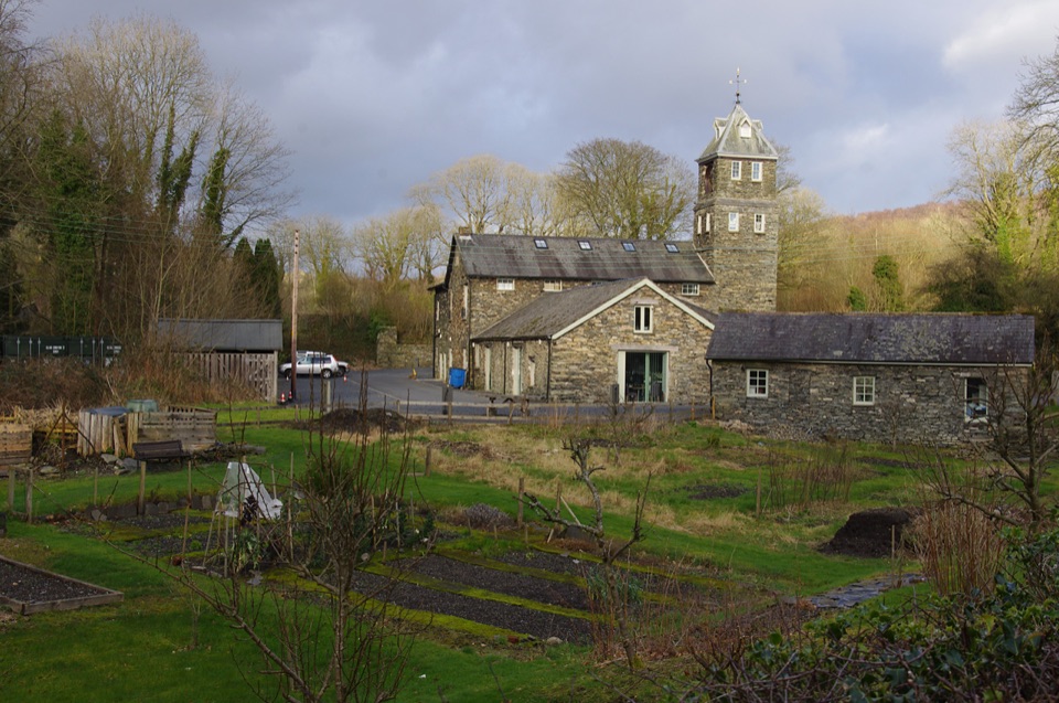
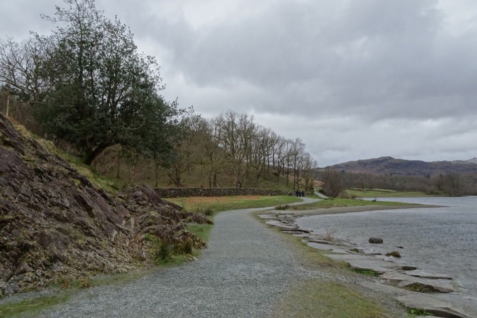
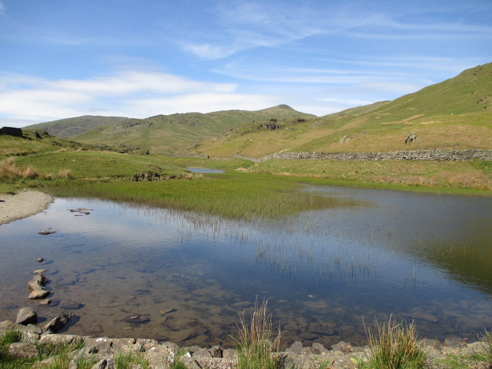
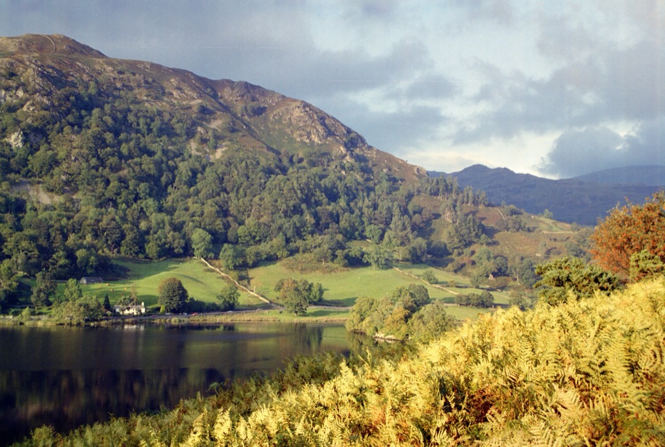
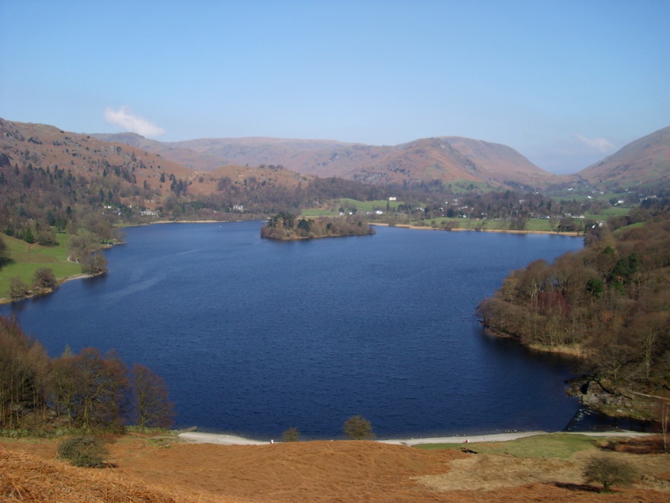
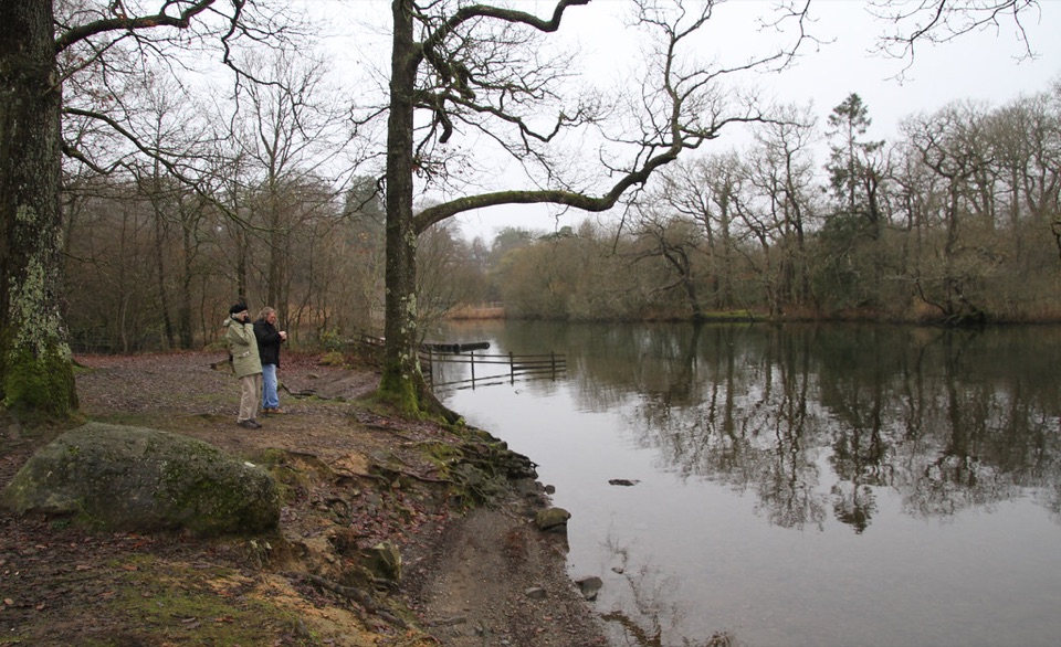
From the lay-by at Tarn Foot, a signposted bridleway leads up between houses, bears right at the fork and passes through a gate. The newly surfaced bridleway then curves around and above Loughrigg Tarn, which is the payoff: open water set below wooded fell, with the Langdale Pikes rising beyond and water lilies carpeting the surface in summer. The path climbs past The How to a minor tarmac road, where a left turn brings you back to the parking area. Two benches beside the tarn make natural pauses.

Difficulty and footingThe opening pull is the steepest part of the walk at around 1 in 10, after which the surfaced…

The opening pull is the steepest part of the walk at around 1 in 10, after which the surfaced bridleway is straightforward, with occasional grass and rock underfoot. The tarmac lane on the return is good walking but includes short sections at about 1 in 7. Unpaved stretches can soften and turn boggy after prolonged rain. The route carries an accessible-route grading described as suitable for many, and only class 2 or 3 mobility scooters are appropriate.

Exposure and sharing the wayThe loop is short and never remote, but the road section has no pavement, so walk facing…

The loop is short and never remote, but the road section has no pavement, so walk facing traffic and keep children and dogs close. The bridleway is used by cyclists as well as walkers, and sheep are often grazing beside the route, so expect to give way and step aside on the narrower stretches.

Access and parkingFrom Ambleside, follow the A593 toward Coniston for about 2.

From Ambleside, follow the A593 toward Coniston for about 2.5 km, then turn right onto the minor road that climbs to the junction and lay-by parking at Tarn Foot (LA22 9HF, grid NY 345039). Spaces are limited and informal, and the lay-by cannot be reserved for disabled parking. There is no public transport or facility at the start, though café and pub toilets can be found at Skelwith Bridge about 0.5 km away. The walk follows public rights of way, so no permit is required.

DogsDogs are welcome on the rights of way that make up the loop.

Dogs are welcome on the rights of way that make up the loop. Keep them under close control or on a short lead wherever livestock are grazing, and note that seasonal short-lead guidance applies on rights of way.

Wildlife

Wildlife in Lake District

All Lake District wildlife maps

Sighting maps show where each species has been reported across Lake District. Wildlife moves, so no sighting is guaranteed.

Keep exploring

Near Loughrigg Tarn Circuit

See it all on the map

Trails that start nearby

Places near the trailhead

Parkwolf’s Lake District ranking

Top-rated trails in Lake District

All 265 trails
  1. 1Scafell Pike via Hollow Stones from WasdaleChallenging · 9 km
  2. 2Helvellyn via Striding Edge and Swirral EdgeChallenging · 12.4 km
  3. 3CatbellsModerate · 6.6 km
  4. 4The Old Man of ConistonChallenging · 9 km
  5. 5Buttermere CircularEasy · 7.6 km
  6. 6The Fairfield HorseshoeChallenging · 17.2 km

Take Parkwolf to Lake District.

The audio tour guide for the drive, plus offline maps, trails, and wildlife heatmaps for when the signal drops.

4.7 from 8,600+ ratings

Download Parkwolf on the App StoreGet Parkwolf on Google Play