Ambleside Roman Fort in Lake District National Park

Sight · Lake District National Park

Ambleside Roman Fort

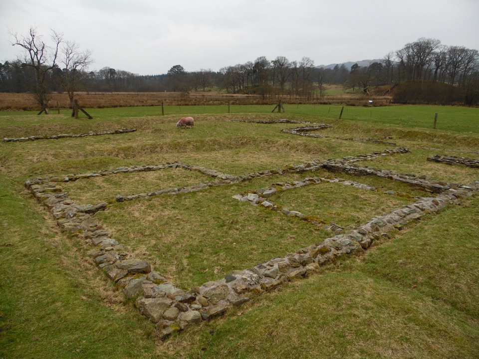
Low stone foundations make a Roman garrison surprisingly legible

Photo: Wikimedia Commons
Type
Sight
Nearest trail
0.6 km
Audio stories
10 nearby
  • Exhibit
  • Scenic viewpoint

Hear the audio tour

Ambleside Roman Fort: Reading the Ruins

Overview

About Ambleside Roman Fort

Why stop

  • The stone layout is unusually easy to reconstruct
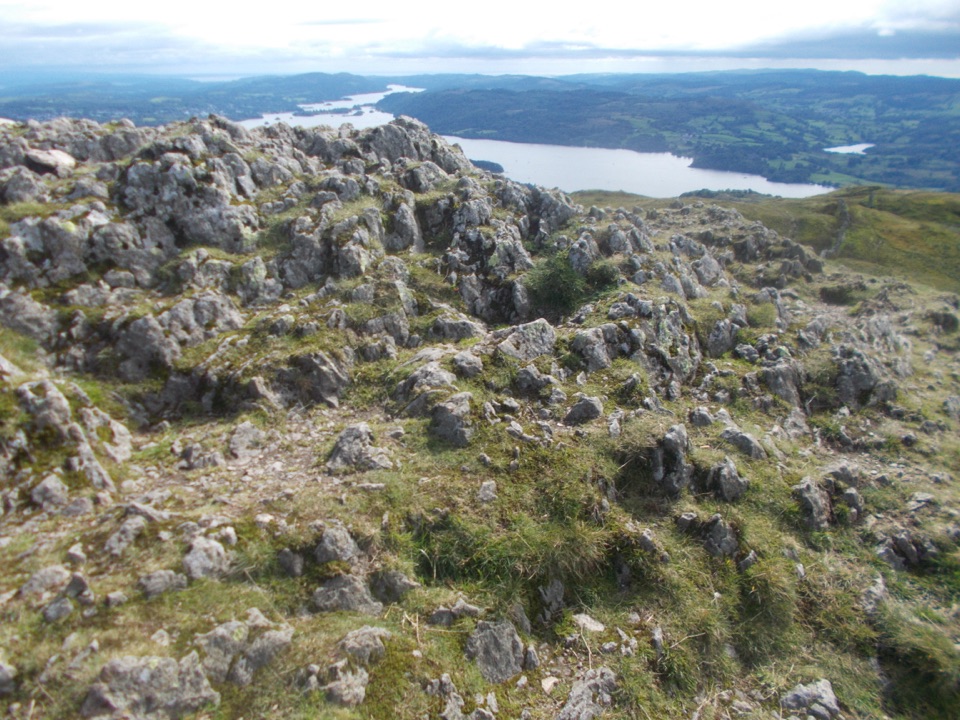
  • Windermere and fell views give the ruins a memorable setting

Heads up

  • Low foundations can feel slight if you expect standing walls
  • Uneven ground and wooden stiles restrict access in places
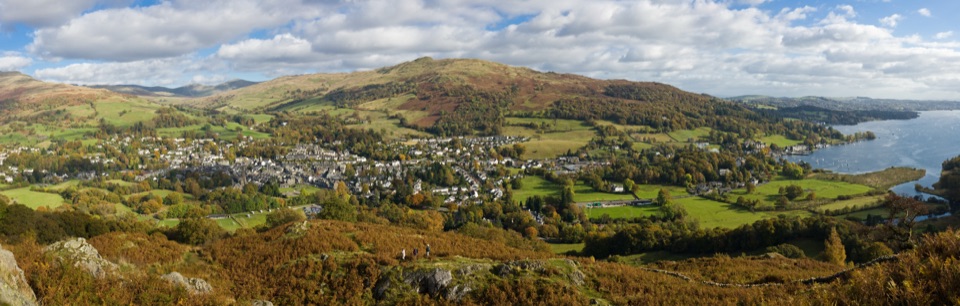
Ambleside Roman Fort is a quiet, open-air look at the Roman military presence at the head of Windermere. The remains are low, but the plan is unusually readable: you can still trace the eastern and southern gates, corner towers, headquarters, commander’s house, granaries, and strongroom. It is the kind of place that rewards a few minutes of close looking rather than a quick glance from the entrance.
Parkwolf’s verdictWhy stop

Map

Where it is

Loading the Lake District map
Full map
SightAmbleside Roman Fort54.42232, -2.96850
Keep this map with you offline in the Parkwolf app

Plan your stop

Before you go

Best time to go

Early morning or late afternoon is the best balance of quieter paths, softer light, and enough time to read the boards. Dawn and dusk can make the low walls stand out in raking light, while a bright, busy day is less atmospheric. After wet weather, allow extra care on the grass and around the excavated stonework.

Bring a waterproof layer and give the site more attention than its modest remains first suggest. It works especially well as part of a Waterhead or lakeshore walk, but visitors looking for dramatic intact walls may find it too slight to justify a special journey on its own.


Arrival and access

The fort is in Borrans Field beside the A5075, on Ambleside’s south-western edge. It is best treated as a walk from Waterhead or Ambleside, rather than a drive-up attraction. Borrans Park sits next to the ruins and makes a useful pause, with benches and open views over Windermere.

The ground inside the field is uneven and can be soft or muddy after rain. Wooden stiles restrict access to some areas, so the site is not fully accessible even though the main approach is fairly level once you are in the field. Wear shoes with grip. Keep dogs on leads, and expect farm livestock in the surrounding fields. Do not use barbecues or naked flames.

8 active Lake District alerts

  • ClosureChapel Stile footpath closed for retaining-wall riskPart of Footpath 543030 between Chapel Stile and Baysbrown campsite is closed because a retaining wall beside the path could collapse and material it supports could fall across the footpath.Official details
  • ClosureStanley Ghyll Lower Falls footpath closed for rockfallThe section of Footpath 408037 leading towards Stanley Ghyll Lower Falls is closed because severe rockfall damage has made the path unstable and further rockfall remains a danger.Official details
See all 8 alerts
A park ranger sits on a dash-mounted phone, talking, as Parkwolf’s Tour Guide plays “Army Cutworm Moths: A Grizzly Bear Buffet” on Grand Loop Road below Dunraven Pass in Yellowstone
Parkwolf Tour GuideThe highest, rockiest slopes around here are a summer buffet for grizzly bears.

Lake District Tour Guide

Your drive to Ambleside Roman Fort, narrated.

Parkwolf is a GPS audio tour guide for Lake District National Park. As you drive, it chimes in with what’s ahead: hidden gems, upcoming stops, history, geology, and wildlife, right through your car’s speakers.

Recorded for this place

Ambleside Roman Fort: Reading the Ruins
0:00 / 0:56
“You're approaching Ambleside Roman Fort, where a quiet field beside the head of Windermere holds the outline of a Roman military base.”

Plays as you drive up to Ambleside Roman Fort in the Parkwolf Lake District Tour Guide.

More stories near here in the app

  • Clappersgate: The Walk to Wray
  • Stagshaw: The Champion Tree Trail
  • Ambleside and Stock Ghyll Force
  • Ambleside: Fairfield or Loughrigg
  • 298 audio storiesacross Lake District’s roads, triggered by GPS as you drive
  • Wildlife heatmapsfor Red Deer, Eurasian Otter, Osprey, and 13 more
  • Works offlinemaps, 265 trails, 89 places, and audio download before you lose signal
  • CarPlay readysimple controls built for the drive
★★★★★
“Fantastic app with many points of information… It’s great to just turn on while you’re driving and it gives you an audio tour of the national Park. We love it!!!!”
JMJamesApp Store review
Download Parkwolf on the App StoreGet Parkwolf on Google Play

4.7 from 8,600+ ratings

Guide

More about Ambleside Roman Fort

The Roman storyThe stone fort was built in the AD 120s during the reign of Hadrian, on the site of an earlier…

The stone fort was built in the AD 120s during the reign of Hadrian, on the site of an earlier timber fort. It housed roughly 500 soldiers and remained in use for close to three centuries, into the 4th century AD. Its position linked land and water routes through the Lake District, and the unusually large granaries suggest that it may have served as a supply base for other garrisons as well as its own.

The Roman name is not certain. Galava is the traditional identification, but more recent research has also proposed Clanoventa or Glannoventa. Treat those names as part of the historical mystery, not as a settled fact. Look especially for the main eastern gateway and the long granary foundations, where the fort’s practical military design is easiest to understand.

Why stopSet expectations correctly.

Set expectations correctly. This is a grassy field with stone foundations and earthworks, not a standing-walls monument. The payoff is being able to reconstruct the fort in your head while looking across the same lake-and-fell landscape that made this location useful. The information boards help turn scattered masonry into a coherent Roman layout.

Wildlife

Wildlife in Lake District

All Lake District wildlife maps

Sighting maps show where each species has been reported across Lake District. Wildlife moves, so no sighting is guaranteed.

Keep exploring

Near Ambleside Roman Fort

See it all on the map

Trails nearby

More stops nearby

Parkwolf’s Lake District ranking

Top sights in Lake District

All 89 places
  1. 1WindermereSight
  2. 2Scafell PikeSight
  3. 3UllswaterSight
  4. 4DerwentwaterSight
  5. 5Wast WaterSight
  6. 6Aira ForceSight

Take Parkwolf to Lake District.

The audio tour guide for the drive, plus offline maps, trails, and wildlife heatmaps for when the signal drops.

4.7 from 8,600+ ratings

Download Parkwolf on the App StoreGet Parkwolf on Google Play