Uncas Falls via Terzian Woodlot in Lake George NY

Lake George NY, NY

Uncas Falls via Terzian Woodlot

Two brook crossings reward the climb with a wooded waterfall.

Length
2.2mi
Time
2hr
Elev. change
276ft
Difficulty
Moderate
  • Dogs allowed
  • High point 896 ft

Hear the audio tour

The Trees That Shade the Streams

Overview

About Uncas Falls via Terzian Woodlot

Why go

  • A small woodland waterfall rewards the gradual climb.
  • Two brook crossings add variety to the wooded route.

Heads up

  • The roadside entry and kiosk are easy to confuse; the kiosk is a walk in.
  • The available mapped line is shorter than the preserve-map distance.

Map & elevation

The route

Loading the Lake George map
Full map
Elevation620–896 ft
TrailheadLGLC Terzian Woodlot kiosk43.67555, -73.51692
Keep this map with you offline in the Parkwolf app

Plan your hike

Before you go

Parking

The dirt-road entry is about 75 feet beyond Carney Point Drive; from the north, it is shortly past 7876 Lake Shore Drive. The kiosk is roughly 0.3 mile farther on foot, according to a preserve visitor report. No formal lot, parking capacity or fee was confirmed.

Safety

The route has two stream crossings, including a rock-hop and a bridge. Stay on the orange-marked public route; the Silver Bay trails beyond Uncas Falls are restricted to YMCA members. Timber rattlesnakes are protected: leave them undisturbed and do not share sighting locations. Permit hunting occurs; wear bright colors and hike in groups during hunting season.

2 active Lake George alerts

  • ClosureFishbrook Pond North Lean-to site closedThe entire Fishbrook Pond North Lean-to site is closed because the lean-to burned down. - No camping or campfires are allowed at the site until further notice.Official details
  • CautionNo Parking Zones enforced along River RoadDo not park in the No Parking Zones along River Road in the Hudson River Special Management Area in the Towns of Lake Luzerne and Warrensburg; DEC is enforcing the restriction.Official details
Lake George alerts
A park ranger sits on a dash-mounted phone, talking, as Parkwolf’s Tour Guide plays “Army Cutworm Moths: A Grizzly Bear Buffet” on Grand Loop Road below Dunraven Pass in Yellowstone
Parkwolf Tour GuideThe highest, rockiest slopes around here are a summer buffet for grizzly bears.

Lake George Tour Guide

Your drive to Uncas Falls via Terzian Woodlot, narrated.

Parkwolf is a GPS audio tour guide for Lake George NY. As you drive, it chimes in with what’s ahead: hidden gems, upcoming stops, history, geology, and wildlife, right through your car’s speakers.

See the Lake George audio tour

Recorded for this area

The Trees That Shade the Streams
0:00 / 0:30
“On a woodland walk, look for an evergreen with short, flat needles and tiny cones hanging from its twigs. That may be an eastern hemlock, one of the trees helping keep Lake George's streams cool.”

Plays on the road 0.6 mi from the trailhead in the Parkwolf Lake George Tour Guide.

More stories near here in the app

  • The Insect in the Pebble Tube
  • What Forever Wild Protects
  • Where Autumn Colors Come From
  • Deer Leap Overlook Trail
  • 113 audio storiesacross Lake George’s roads, triggered by GPS as you drive
  • Wildlife heatmapsfor White-tailed Deer, Timber Rattlesnake, Osprey, and 13 more
  • Works offlinemaps, 67 trails, 64 places, and audio download before you lose signal
  • CarPlay readysimple controls built for the drive
★★★★★
“Fantastic app with many points of information… It’s great to just turn on while you’re driving and it gives you an audio tour of the national Park. We love it!!!!”
JMJamesApp Store review
Download Parkwolf on the App StoreGet Parkwolf on Google Play

4.7 from 8,600+ ratings

Trail guide

Hiking Uncas Falls via Terzian Woodlot

A small waterfall at the endUncas Falls via Terzian Woodlot is a 2.

Uncas Falls via Terzian Woodlot is a 2.2-mile out-and-back from the preserve kiosk, through hardwood woods and along a brook to a small waterfall. The preserve map lists the orange route at 1.1 miles; that is treated as the one-way kiosk-to-falls distance because its directions put the yellow-spur junction a mile from the kiosk, with the falls farther on. Allow about two hours. The available mapped trail line covers only about 0.76 mile, so the stored line is shorter than the map-based distance; use the orange markers and a current preserve map rather than treating the line as a GPS track. If you begin at the roadside access instead of the kiosk, reports put the walk in at about 0.3 mile each way; that approach is not included in 2.2 miles.

Follow the orange trail to the brookFrom the kiosk, the trail climbs gradually to a knoll, drops to a small stream, rises over…

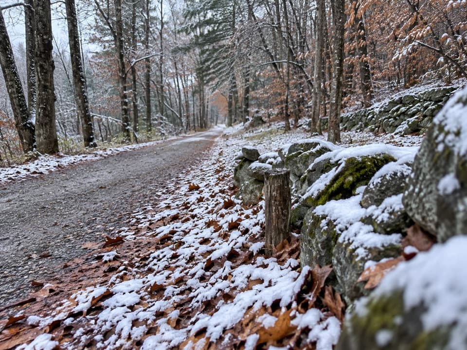
From the kiosk, the trail climbs gradually to a knoll, drops to a small stream, rises over another knoll, then descends to a larger brook. It follows the water briefly before a sharp turn and a short straight stretch to an old logging road. Turn left for a longer, gradual climb across the ridge and then descend to the falls. Orange markers begin at the kiosk. The first crossing may mean hopping rocks; a bridge spans the larger brook, and a short steeper pitch interrupts the otherwise rolling walk.

Falls and the separate cliff spurThe public orange route ends at a small waterfall tucked into the woods.

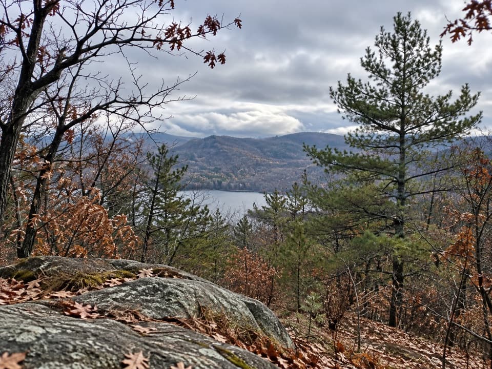
The public orange route ends at a small waterfall tucked into the woods. The yellow Uncas Cliff spur is a separate branch, not part of the 2.2-mile Falls route; it reaches an open rock ledge with a broad Lake George view and a bench. Beyond Uncas Falls, the Silver Bay trail system is for YMCA members, so turn back at the falls if you are hiking the public route.

Preserve access and wildlifePublic foot access reaches the preserve across State Forest Preserve land, and the kiosk marks…

Public foot access reaches the preserve across State Forest Preserve land, and the kiosk marks the beginning of the LGLC trail. The preserve is open from dawn to dusk year-round; dogs must be leashed. Neighbors helped secure the Terzian family parcel for conservation in 2014, protecting forest, a tributary and habitat used by timber rattlesnakes. They are protected under state law: give them space and do not publicize sighting locations. Hunting is by permit; during hunting season, wear bright colors and hike in a group.

Wildlife

Wildlife in Lake George

All Lake George wildlife maps

Sighting maps show where each species has been reported across Lake George. Wildlife moves, so no sighting is guaranteed.

Keep exploring

Near Uncas Falls via Terzian Woodlot

See it all on the map

Trails that start nearby

Places near the trailhead

Parkwolf’s Lake George ranking

Top-rated trails in Lake George

All 67 trails
  1. 1Sleeping Beauty Mountain LoopModerate · 4 mi
  2. 2Buck Mountain Trail from Pilot KnobChallenging · 6.6 mi
  3. 3Black Mountain Summit TrailModerate · 5 mi
  4. 4Cat Mountain Trail from Valley Woods RoadModerate · 6.8 mi
  5. 5Prospect Mountain TrailChallenging · 3 mi
  6. 6Red Trail to The PinnacleModerate · 2.2 mi

Take Parkwolf to Lake George.

The audio tour guide for the drive, plus offline maps, trails, and wildlife heatmaps for when the signal drops.

4.7 from 8,600+ ratings

Download Parkwolf on the App StoreGet Parkwolf on Google Play