Parking
Use the preserve parking area on Valley Woods Road. The preserve map allows roadside parking if the lot is full; do not block neighboring driveways.

#4 of 67 trails in Lake George
Lake George NY, NY
A long forest road gives way to a rocky Lake George summit.
Overview
Cat Mountain from Valley Woods Road is a 6.8-mile round-trip out-and-back to a rocky summit above Lake George. The mapped walk is about 3.4 miles each way; allow around four hours and treat it as a half-day hike. This is the easier approach from Valley Woods, with a long road walk before the final climb. I’d choose it if you want the summit panorama and don’t mind earning it over several miles.
 Parkwolf’s verdictIs this the hike for you?
Map & elevation
Plan your hike

The highest, rockiest slopes around here are a summer buffet for grizzly bears.
Lake George Tour Guide
Parkwolf is a GPS audio tour guide for Lake George NY. As you drive, it chimes in with what’s ahead: hidden gems, upcoming stops, history, geology, and wildlife, right through your car’s speakers.
See the Lake George audio tourRecorded for this trailhead
Cat and Thomas Mountains from Valley Woods Road“You're nearing the Valley Woods Road trailhead for Cat and Thomas Mountains. Cat gives you the wider sweep of Lake George and the Adirondacks, but allow about four hours for the six point eight mile round trip.”
Plays as you drive up to this trailhead in the Parkwolf Lake George Tour Guide.
More stories near here in the app
“Fantastic app with many points of information… It’s great to just turn on while you’re driving and it gives you an audio tour of the national Park. We love it!!!!”


Trail guide
Start on the blue-marked dirt road from the Valley Woods Road parking area. After about 0.7 mile, yellow turns toward Thomas Mountain; stay with the Cat Mountain route. Roughly two-thirds of the direct walk follows a logging road, so the first stretch has small rises and steady, uncomplicated footing. Old logging roads cross the marked trails in this preserve. Follow the destination signs at junctions, especially if the blaze colors on the ground don’t match the older map.
The road gives way to a narrower, rougher woods trail for the final third. That’s where the climb steepens and rocks make the pace slower. The return is the same way, so those rocky sections are downhill too; they can be slippery. It’s a long walk but the hard footing is concentrated near the top, rather than spread across the whole route.
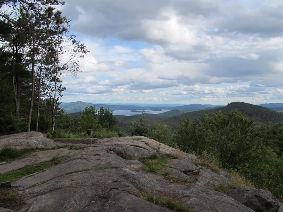
Cat Mountain ends at open rocky ledges with a 270-degree view of Lake George and the Adirondacks. The lake and the long mountain ridges make a proper pause worthwhile after the wooded approach. For a photo, include some of the summit rock in the foreground; a frame filled only with distant hills loses the sense of being on the open ledge.
If you want less road walking, the separate route from Edgecomb Pond follows the red trail and then blue to the same summit, listed at about 1.9 miles each way. It’s a more direct approach, but it starts at a different trailhead and is not the Valley Woods route described here. Don’t use the shorter mileage for this outing.
The Cat and Thomas preserve covers 1,909 acres. The Lake George Land Conservancy acquired this parcel in 2003 and sold it to New York State in 2013 for the Adirondack Forest Preserve. Keeping this large tract intact protects part of the Lake George watershed as well as the hiking route.
Wildlife
 34 sightingsWhite-tailed DeerMost seen around 5 PMSighting map
 26 sightingsTimber RattlesnakeMost seen around 6 PMSighting map
 22 sightingsOspreyMost seen around 7 AMSighting map
 60 sightingsLoonMost seen around 6 AMSighting map
 33 sightingsPorcupineMost seen around 7 PMSighting map
 84 sightingsGreat Blue HeronMost seen around 6 AMSighting map
Sighting maps show where each species has been reported across Lake George. Wildlife moves, so no sighting is guaranteed.
Keep exploring
 ChallengingCat and Thomas Mountains Loop7.2 mi · 5 hr · At the trailheadTwo summits, a Lake George panorama, and a rough ridge between them.
 ModerateThomas Mountain Trail3 mi · 2 hr · At the trailheadA broad forest road leads to a rocky Lake George overlook.
 ModerateCat Mountain Trail from Edgecomb Pond4.5 mi · 3.5 hr · 2 mi awayA pond-side climb to open rock and broad Lake George views
 EasyUp Yonda Farm Base Loop Trail0.5 mi · 25 min · 2.6 mi awayA half-mile farm loop with a self-guided nature focus.
 ModerateUp Yonda Farm Field Traverse Trail0.5 mi · 30 min · 2.7 mi awayA short grassy climb to an open view of Lake George's Narrows.
 EasyUp Yonda Farm Sugar Trail0.3 mi · 15 min · 2.7 mi awayA short sugarbush walk links the Sugar House and seasonal StoryWalk.
 ModerateUp Yonda Farm Upper Loop1.3 mi · 1.5 hr · 2.7 mi awayA grassy climb to a Lake George Narrows view
 ModerateGodwin Preserve Yellow Trail1.2 mi · 45 min · 2.8 mi awayA short climb to wetlands, forested ridges and a Lake George glimpse.
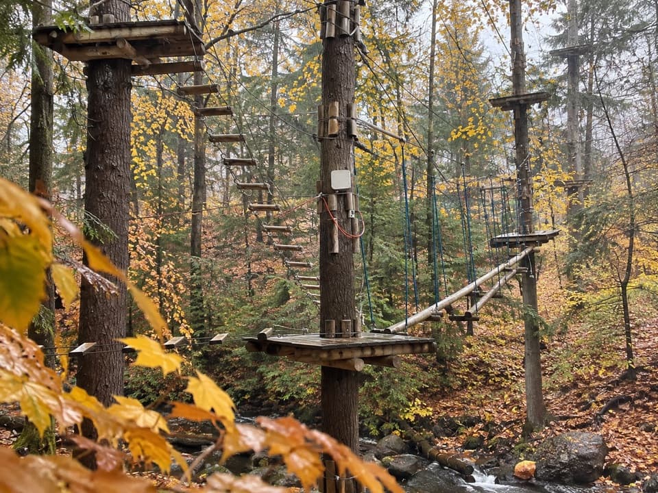 Sight · 1.6 mi awayAdirondack Extreme Adventure CourseClimb, swing, and zip through a forest full of obstacles.
 Visitor center · 2.7 mi awayUp Yonda Farm Environmental Education CenterHands-on nature exhibits pair with a short climb to a lake view.
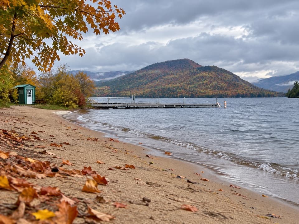 Beach · 3.5 mi awayVeteran’s Memorial Park BeachA compact beach pairs mountain views with easy family play.
 Sight · 3.9 mi awayThe Bolton MuseumA former church traces the story of a classic Adirondack resort
 Beach · 3.9 mi awayRogers Memorial Park and BeachLake George swimming, picnic space, and a pier in the village.
 Lodging · 4.1 mi awayThe Sagamore ResortA historic hotel on a private island reached by causeway.
 Restaurant · 4.2 mi awayThe Algonquin RestaurantDockside dining pairs the Fish Point with wide lake views.
 Sight · 4.3 mi awayThe SembrichOpera history inside a soprano’s former teaching studio.
Parkwolf’s Lake George ranking
 Sleeping Beauty Mountain LoopModerate · 4 mi
 Buck Mountain Trail from Pilot KnobChallenging · 6.6 mi
 Black Mountain Summit TrailModerate · 5 mi
 Prospect Mountain TrailChallenging · 3 mi
 Red Trail to The PinnacleModerate · 2.2 mi
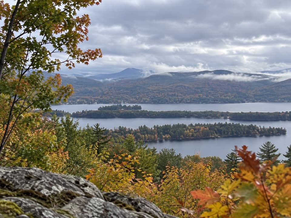 Schumann Preserve at Pilot Knob Orange Trail to GazeboModerate · 1.4 mi
The audio tour guide for the drive, plus offline maps, trails, and wildlife heatmaps for when the signal drops.