Parking
Use the Mile 18.2 pullout on Northshore Road. The route starts from the west end of the parking area and crosses the highway into Cottonwood Wash.
#8 of 42 trails in Lake Mead
Lake Mead National Recreation Area, AZ · NV
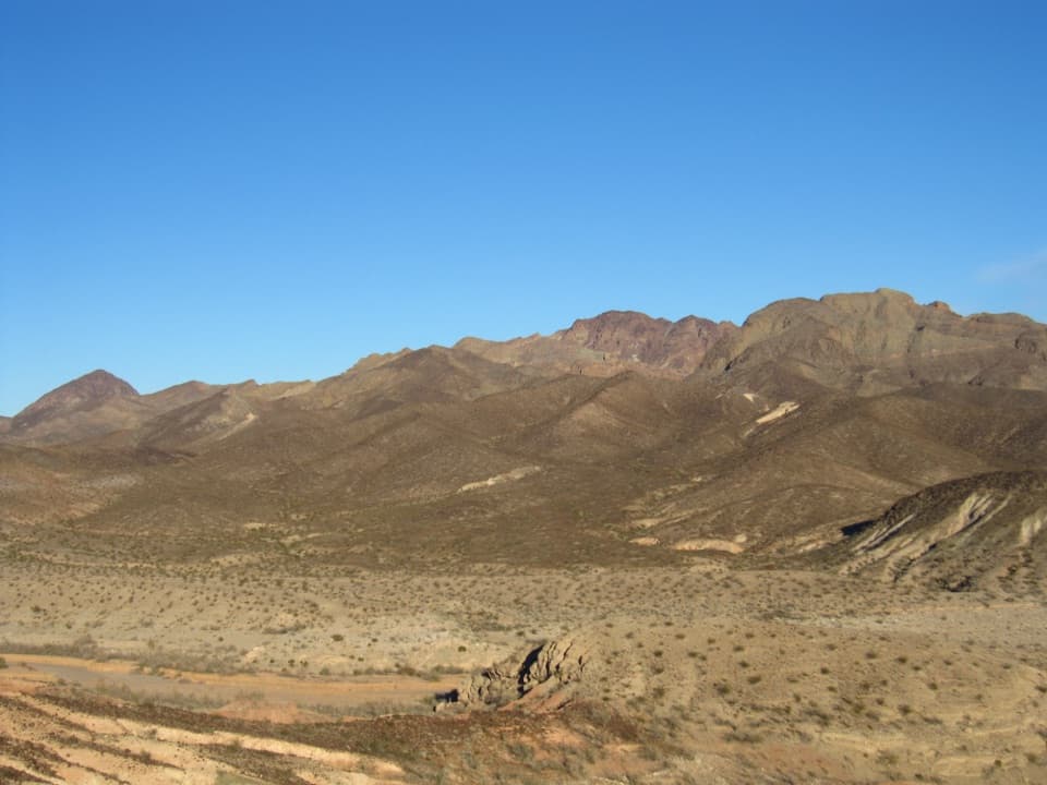
A rugged wash climb to a volcanic summit above Lake Mead.
Overview
Map & elevation
Plan your hike

The highest, rockiest slopes around here are a summer buffet for grizzly bears.
Lake Mead Tour Guide
Parkwolf is a GPS audio tour guide for Lake Mead National Recreation Area. As you drive, it chimes in with what’s ahead: hidden gems, upcoming stops, history, geology, and wildlife, right through your car’s speakers.
See the Lake Mead audio tourRecorded for this trailhead
Mile 18.2: Hamblin Mountain“You're nearing the Mile eighteen point two trailhead on Northshore Road, the start for Hamblin Mountain.”
Plays as you drive up to this trailhead in the Parkwolf Lake Mead Tour Guide.
More stories near here in the app
“Fantastic app with many points of information… It’s great to just turn on while you’re driving and it gives you an audio tour of the national Park. We love it!!!!”


Trail guide
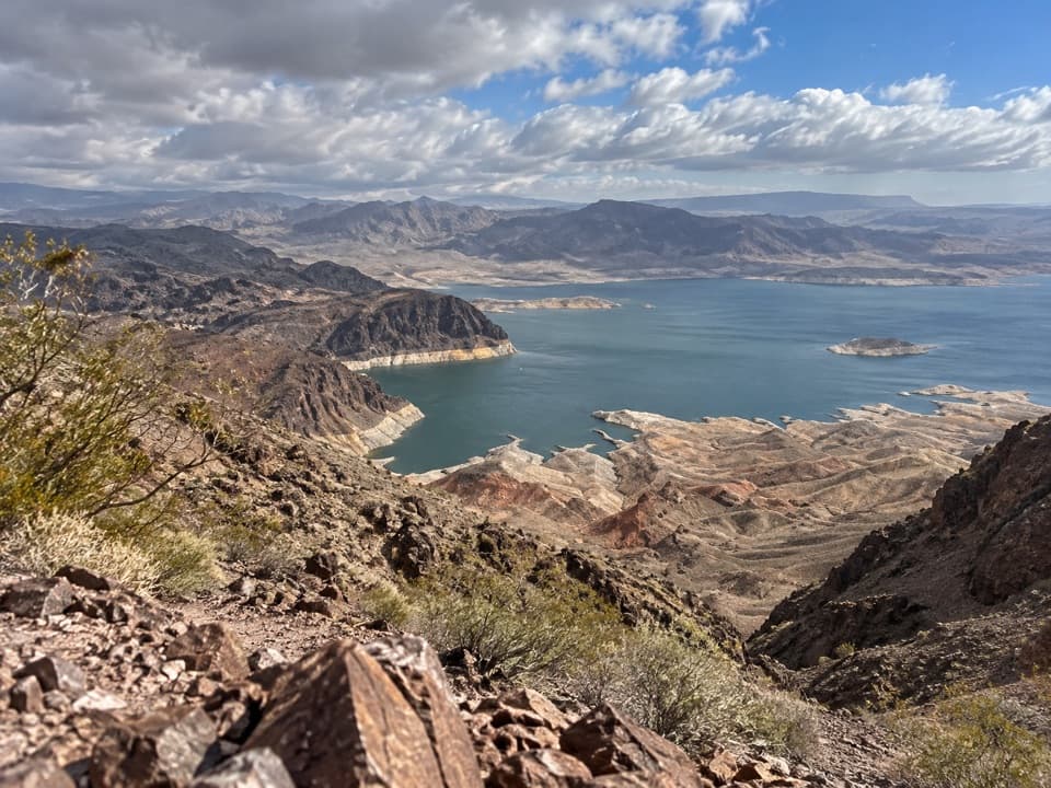
Hamblin Mountain Trail is a remote out-and-back from the Mile 18.2 pullout on Northshore Road to a narrow volcanic summit ridge. The established route follows Cottonwood Wash and side canyons before climbing steeply to the crest, then returns the same way. It is about 7.2 miles round trip with roughly 1,300 feet of net climb; set aside about five to six hours for a steady outing with short stops. The payoff is a broad view across Lake Mead and the surrounding ranges.
This is a hard hike despite the relatively modest summit height. The start is faint, wash junctions need attention, and two low Class 3 pour-overs require some hands-on footing. The final ridge is narrow, rocky and edged by steep slopes. Carry your own water, a route map and the rest of your essentials; cell service is unreliable. Turn around before the ridge if the scrambling or exposure feels uncomfortable.
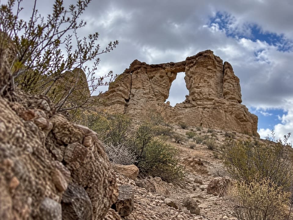
From the west end of the Mile 18.2 pullout, a faint path crosses Northshore Road and drops into Cottonwood Wash after about 0.2 mile. Cross carefully: visibility at the highway crossing is limited. Follow the main wash upstream. At about 1.1 miles from the start, two cottonwood trees stand against a cliff at Cottonwood Spring. They are a useful landmark, not a water plan. A low Class 3 pour-over sits behind the trees; it can be bypassed far to the right on the old Arrowhead Highway alignment.
About half a mile above the spring, Razorback Wash North joins from the east; stay right in the main canyon. At the white mudstone wall, around 1.9 miles from the start, the wash splits at a T. Take the right-hand fork toward Hamblin Mountain. The other fork follows the old Arrowhead Highway into Pinto Valley.
The Hamblin branch runs beneath a chocolate-brown conglomerate ridge. A deep erosion ditch often makes the wash easy to follow, but keep checking the line at side forks. Pass a cluster of dark boulders, then a broad red-dirt bowl; stay left through the bowl and right at the low red bluff beyond it. A well-used footpath becomes clearer as it climbs steeply to a low saddle.
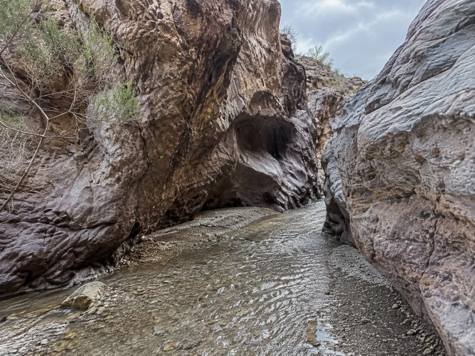
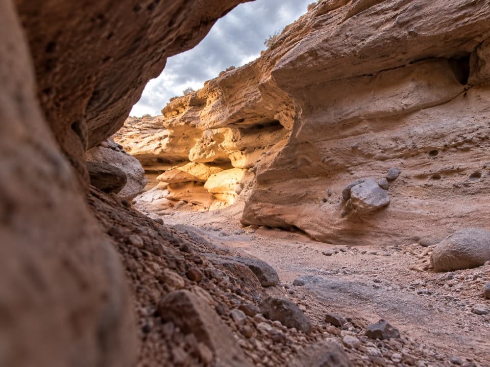
Past the saddle, the route bends around the head of a deep gully and descends into a wide gravel wash. After roughly a third of a mile, the wash narrows into a shallow box canyon. The second low Class 3 move is a roughly five-foot pour-over on the right side. Bighorn sheep may use the shaded canyon to rest, so move quietly and give wildlife room.
Above the pour-over, the wash tightens and becomes steeper and rockier, while the footpath grows more distinct. About 80 yards below the summit ridge, several tracks leave the wash and head uphill. Use the lowest, main trail rather than spreading onto the slopes. It reaches a saddle with an open Lake Mead view, then follows the ridge, swings across the south-facing slope around a knob and climbs back onto the crest. Near a cliff, the route turns left onto a steep side slope for the final rise.
The summit is an unmarked, narrow southwest-to-northeast ridge scattered with jagged volcanic rock. The path winds among the rocks, with steep drops on both sides, so take care and stop where the footing is comfortable. A USGS benchmark marked “Pinto,” set in 1948, and two reference marks lie just beyond the summit. From the ridge, clear-day views reach across the lake and toward mountain ranges in Nevada, Utah, Arizona and California. The jagged crest makes a strong foreground for a wide lake-and-range photograph.
The colorful walls along the route are part of an old volcanic landscape: red sandstone, limestone, dark conglomerate and multicolored mudstone appear in close succession. Ripple marks and fossils in the mudstone record ancient lake beds. Hamblin Mountain is one separated section of the Hamblin-Cleopatra stratovolcano, which formed about 13 million years ago and was divided by fault movement. The Cleopatra lobe now lies about 12 miles away.
Gypsum-rich red-and-white mud hills along Cottonwood Canyon support Silverleaf Sunray and California Bearpaw Poppies, both considered species of concern in Nevada. Stay on established tread and avoid walking across the soft hills. Bighorn sheep use the box canyon’s shade; sightings are never guaranteed, and wildlife should be observed from a distance.
The trail lies in Lake Mead National Recreation Area and enters Pinto Valley Wilderness. The route is remote, with no dependable cell signal and no developed water stop documented along the hike. Desert heat and flash flooding are the main environmental concerns; carry enough water for the whole outing and avoid narrow washes when storms threaten. Dogs are allowed on park hiking trails but must stay on a leash no longer than six feet; bring water for them as well. There is no need to continue onto the separate West Peak scramble to reach this trail’s summit.
After descending from the summit, a northern route from the greenish knob crosses low saddles and rejoins Cottonwood Wash, making a shorter, easier partial loop. It is described as less scenic and less interesting than retracing the main route. The mapped experience here uses the standard out-and-back and excludes that alternate return.
Wildlife
 525 sightingsBighorn SheepMost seen around 5 PMSighting map
 116 sightingsBurroMost seen around 7 PMSighting map
 18 sightingsBald EagleMost seen around 4 PMSighting map
 99 sightingsWhite PelicanMost seen around 7 AMSighting map
 145 sightingsGreat Blue HeronMost seen around 7 AMSighting map
 106 sightingsTurkey VultureMost seen around noonSighting map
Sighting maps show where each species has been reported across Lake Mead. Wildlife moves, so no sighting is guaranteed.
Keep exploring
 ModerateBowl of Fire Trail4.6 mi · 3.5 hr · At the trailheadA faint desert route enters a maze of fire-red sandstone.
 EasyCottonwood Spring Trail2.1 mi · 1.3 hr · At the trailheadFossil ripples and a desert spring reward an easy wash walk.
 ModerateAnniversary Narrows Trail5.8 mi · 3.5 hr · 2 mi awayA twisting, colorful slot canyon on a sun-baked 5.8-mile loop.
 ChallengingAnniversary Peak Trail9.9 mi · 7 hr · 2 mi awaySculpted narrows give way to a long, exposed summit ridge
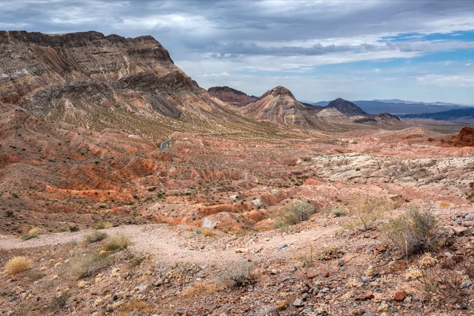 ModerateNorthshore Summit Trail0.6 mi · 1 hr · 2.3 mi awayA short loop climbs to banded desert views over Bowl of Fire.
 ChallengingNorthshore Peak East Ridge Route2.6 mi · 3 hr · 2.3 mi awayA short, exposed ridge scramble to fossil coral and lake views.
 ModerateRazorback Wash North Trail5.4 mi · 3.5 hr · 3.4 mi awayA 5.4-mile wash traverse with a short climb and car shuttle.
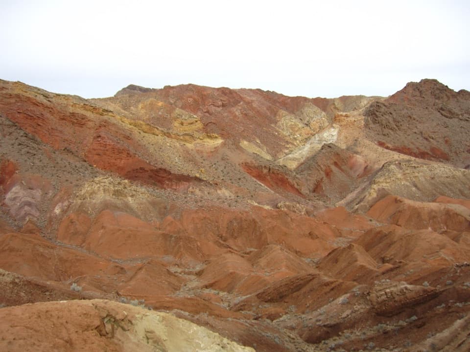 ModerateRazorback Wash South Trail6.3 mi · 5 hr · 4.1 mi awayA remote traverse through red, yellow and green mud hills.
 Sight · 5.9 mi awayCallville Bay MarinaBoat rentals open a day on the lake beneath red-rock cliffs.
 Campground · 6 mi awayCallville Bay RV ParkFive full-hookup spaces in a marina's tiny RV village.
 Picnic area · 6.2 mi awayCallville Bay Picnic AreaEight shaded tables, grills and drinking water make lunch easy.
 Campground · 6.4 mi awayCallville Bay CampgroundA quiet desert camp base with a marina and food nearby.
 Picnic area · 8.1 mi awayRedstone Picnic AreaA picnic among 140-million-year-old red sandstone outcrops.
Parkwolf’s Lake Mead ranking

The audio tour guide for the drive, plus offline maps, trails, and wildlife heatmaps for when the signal drops.